HOPEDALE TOWNSHIP RESOLUTION
WHEREAS, Tazewell County Landfill, Inc. ("TCL") is the owner and operator of
Indian Creek Landfill located in Hopedale Township, Tazewell County, Illinois;
WHEREAS, on October 1, 2003, TCL and the County of Tazewell entered into a
Host Community Agreement which was amended by a First Amendment to Host
Community Agreement effective September 27, 2006 ("Host Community Agreement");
WHEREAS, on September 12, 2006, TCL and Hopedale Township entered into a
Host Township Agreement ("Host Township Agreement");
WHEREAS, on March 28, 2007, the County of Tazewell granted local siting
approval for an approximate 10,000,000 ton expansion of Indian Creek Landfill;
WHEREAS, in accordance with the procedures set forth in Section 32 of the Host
Community Agreement, on May 30, 2007, the County of Tazewell authorized TCL to
accept for disposal at Indian Creek Landfill De-Listed and De-Characterized Stabilized
Residues from the Waste Stabilization Facility owned and operated by Peoria Disposal
Company ("PDC"), an affiliate of TCL, located in Peoria County, Illinois;
WHEREAS, on April 25, 2008, PDC filed with the Illinois Pollution Control Board
("Board") a RCRA Delisting Adjusted Standard Petition petitioning for an upfront and
conditional delisting for the stabilized residues generated by PDC from the treatment of
K061 electric arc furnace dust generated by steel mills that produce steel using electric
arc furnaces ("Treated K061 Residues");
WHEREAS, PDC would like to dispose of the Treated K061 Residues in Indian
Creek Landfill;
WHEREAS, other than the County of Tazewell, Hopedale Township is the only
local governmental entity having jurisdiction over Indian Creek Landfill;
RESOLVED, that Hopedale Township supports the RCRA Delisting Adjusted
Standard Petition filed by PDC with the Board petitioning for an upfront and conditional
delisting for the Treated K061 Residues;
FURTHER RESOLVED, that Hopedale Township supports the disposal of the
Treated K061 Residues by TCL at Indian Creek Landfill.
ADOPTED on August 12, 2008.
sec26?
de-td,Q
z
D
Q_6 s
o_eeex
,
_?
By:
?
cC/
Its:
8-1607
(Ti^c-t_s
-
re t_
HOPEDALE TOWNSHIP
Jerry & Carol Van II
9731
W
Lamplighter Lane
Hanna City, IL 61536
309.565.7870 /
vancitilAvahoo.com
August 18, 2008
Re: Illinois Pollution Control Board Hearing
August 18, 2008
Peoria Public Library
To Whom it May Concern:
Before a hazardous waste is sent to municipal landfills as 'safe', a study should be done (not just a
few 'testings') to ensure the long term viability of a new treatment process.
Some of the treated material should be put in the conditions of a municipal landfill and over the
course of several years the runoff, the condition of the treated material, and the safety of that
material (did it break down? Did toxins leach from the treated material?) - we should do this to
be safe before placing material in a municipal landfill; especially when that landfill is over an
aquifer, and we are dealing with (the untreated) waste that will be hazardous for a long, long,
time.
Another area of concern to me regarding this request; I understand the governing bodies
controlling landfills in Tazewell County have given their agreement to have this waste put in their
municipal landfills. PDC wants to landfill in their locations. If that is what Tazewell wants - so
be it. But...does the permit application specify that PDC would NOT be able to place this
material in our municipal landfill in Peoria County? PDC made a strong statement at the hearing
that was their intent. We in Peoria County - from the Citizens to rulings by the County Board -
have indicated very strongly we do NOT want an expansion of the hazardous landfill - and, quite
frankly, are extremely suspicious that this is just another end run by PDC to accomplish their goal
of staying in operation and land filling hazardous waste - regardless of what the County wants.
And that this 'secret process' has not been tested sufficiently to determine whether it will stand the
test of time.
Because of these concerns, I urge you to consider two things:
•
One, testing the process over a period of at least a year to determine if it will stand up to
conditions prevalent in a landfill - not just a test in a laboratory
•
Two, requiring the waste - regardless of what it is eventually classified - not allowed to
be put in a Peoria County landfill of any type.
I understand this has been a long and rigorous process for the Illinois Pollution Control Board,
and I really do appreciate the response of the agency to the concerns of the citizens of Peoria
County. We have never had so many people so involved in 'the process' on an issue. I think that
speaks volumes, in and of itself.
Sincerely,
4'
V
4
-4■) 11/1-1/1
Ca o anWin le
7ri
Keystone Consolidated Industries, Inc.
Keystone Steel & Wire — Peoria, Illinois
Keystone Wire Products — Sherman, Texas
7000 S.W. Adams Street • Peoria, IL
61641
309/697-7020 Phone • 309/697-7487 Fax
www.redbrand.com • www.keystonesteel.com
August 18, 2008
Illinois Pollution Control Board
James R. Thompson Center
100 W. Randolph
Suite 11-500
Chicago, Illinois 60601
Re: Keystone Steel & Wire Co.
Statement of Support
PDC K061 Delisting
Case Number AS 2008-010
Dear Illinois Pollution Control Board:
My name is Chad Erdmann. I am the Environmental Engineering Manager at Keystone
Steel & Wire Company ("Keystone") located in Bartonville, Illinois. Keystone currently
employs over 900 people. Even though Keystone is one of the largest recyclers in the
area, we, like any other large industrial facility, have some process byproducts that must
be handled as hazardous wastes under current environmental regulations. PDC has a
strong history of environmental compliance, which is very important to Keystone. For
many years these wastes have been transported, treated, and disposed of by PDC in an
environmentally safe manner while still being convenient and cost effective.
If PDC would no longer have the capability to treat and landfill K061, Electric Arc
Furance Dust, in the near future, Keystone's cost for waste disposal will increase
significantly because of high transportation costs to the next nearest facility capable of
receiving K061 hazardous waste. It is a short trip from Keystone's facility to the PDC
waste stabilization plant and Indian Creek Landfill. Currently, at PDC's facilities the
wastes are stabilized and treated as necessary to meet stringent land ban requirements
before being placed in the landfill cell.
PDC is a valuable supplier in Keystone's business plan moving forward. Keystone has
followed PDC's K061 Delisting Petition Application and supports Illinois EPA's
"Response to RCRA Delisting Adjusted Standard Petition" submitted on June 12, 2008 to
the Illinois Pollution Control Board.
Keystone holds PDC's environmental stewardship in high regards and supports this K061
Delisting Petition Application.
Sincerely,
Chad Erdmann
Manager, Energy & Environmental Engineering
On behalf of Keystone Steel & Wire Co.
Pey--?
a/te(
John (Jack) R. Skelley
Corporate Environmental Affairs Manager
Gerdau Ameristeel Wilton
Gerdau Ameristeel Comments in Support
Of the PDC K061 Delisting Petition
Public Hearing, Monday Aug. 18, 2008
GERDAU AMERISTEEL:
WILTON
GERDAU
AMERISTEEL
ntl. THE IDEA
Monday, August 18, 2008
Good afternoon; My name is Jack Skelley and I am here today on behalf of Gerdau Ameristeel to offer
our support for the Peoria Disposal Company Delisting Petition Application. My current position is
serving as a Corporate Environmental Affairs Manager for Gerdau Ameristeel based at the Wilton, IA
Steel Mill.
Gerdau Ameristeel l
is first and foremost a recycling company. Our preference is to recycle, but in the
case of EAF dust, there is not enough capacity to recycle the annual North American production of
800,000-1,100,000 tons. Secure, well-run treatment and landfill operations like PDC No. 1 are critical
to the steel industry until such time as there is sufficient capacity to recycle all the EAF Dust produced
annually. There are a number of recycling projects being conducted worldwide to solve the EAF dust
recycling challenge, however it will be a number of years before enough commercial recycling capacity
is available. Therefore, PDC's K061 delisting petition is crucial to meet the EAF dust capacity
requirements in the interim.
Peoria Disposal Company is one of Gerdau Ameristeel's approved strategic regional suppliers in our
MRO purchasing program for our Wilton, IA, St. Paul, MN, and Jackson, TN mills. As an approved
supplier, Gerdau Ameristeel has monitored the delisting petition application process, as PDC's
continued service is a key component to our environmental program.
Gerdau Ameristeel supports the conclusions of the Illinois EPA in the "RESPONSE TO RCRA
DELISTING ADJUSTED STANDARD PETITION" submitted by William D. Ingersoll-Manager,
Enforcement Programs-IEPA to the Illinois Pollution Control Board on June 12, 2008. PDC has shown
with thorough, objective, scientific data that the treated K061 is environmentally stable and safe. In
addition the Indian Creek Landfill exceeds the design requirements for a subtitle D landfill and will be
an environmentally sound facility to store the treated K061.
PDC's environmental performance record is unmatched in the landfill industry, which is well known
and highly respected in the steel industry. Gerdau Ameristeel, as a current customer, has great
confidence in PDC and their future. We therefore respectfully urge you to support the K061 Delisting
Petition application.
THANK YOU
Gerdau Ameristeel is the fourth largest overall steel company and the second largest minimill steel producer in
North America. Our company has the capacity to manufacture over 12 million tons of mill finished steel products
annually. Gerdau Ameristeel serves customers throughout North America through an integrated network of
minimills, steel scrap recycling facilities, and downstream operations.
Page 1 of
1
Sinc ely,
Rudy Habb
3732 N. Monroe
Peoria Heights, IL 61616
August 18, 2008
To: The Illinois Pollution Control Board
Regarding: Case Number AS 2008-10
Peoria Disposal Company Filing
to Delist Electric Arc Furnace Dust Waste
Comments for the Public Hearing in Peoria:
My name is Rudy Habben. I reside at 3732 North Monroe, Peoria Heights, IL 61616.
I am currently Vice Chairman of the Heart of Illinois Group Sierra Club and I wish to
state my great concerns about this delisting.
I am concerned that the Illinois Environmental Protection Agency only says in its June 12th,
2008, comment letter:
"... that PDC's request... will likely meet the required level of
justification with some additional information
?
I respectfully wish to point out that " will likely " is a very open-ended way to consider a
regulation that could impact municipal waste landfills and area water resources across Illinois
for years, and years, and years to come.
This delisting should be denied. PDC should not be allowed to send treated Electric Arc
Furnace Dust Waste to any Subtitle D Municipal Waste landfill in Illinois. I also think
PDC should not be allowed to delay reaching capacity of their Hazardous Waste Landfill
at Peoria until 2018, and that it should be closed next year.
Because this delisting could impact municipal waste landfills across Illinois, I think
a second hearing must be held. I request that the Illinois Pollution Control Board hold
a public hearing in Clinton.
Thank you for the opportunity to comment at this hearing.
0
i
1
p
J2
01 /,
To: Illinois Pollution Control Board, public hearing
August 18, 2008
Re: Case No. AS 08-10
Peoria Disposal Co. (PDC) request to delist EAF dust as "hazardous waste."
V
From: Tom Edwards, 902 W. Moss Ave, Peoria,IL 61606
I request that Peoria Disposal Co.'s appeal to the IPCB to uphold delisting electric arc
furnace dust (EAF) as a K061 hazardous waste after going through secret "proprietary
stabilization technology," be summa it rejected because of PDC's denial of any public
disclosure of the process itself, an. +ro: of a
pp
tshort or longterm effectiveness and
safety.
The public's ri ht of due process is,therefore, being violated because it has no
o
bv,i
way to consider let alone respond to the PDC request for exemption from the hazardous
waste classification.
DC wants to have the highly hazardous electric arc furnace wastes from, so far,at least
0 71"1('
10 steel manufacturers from throughout the Midwest brought to its hazardous waste
landfi 1 adjoining Peoria's west side to go through this secret processing to, theoretically,
"reduce" its toxicity by, at least temporarily, immobilizing (but not removing) the bevy
of toxic materials in the waste to qualify it as a non-hazardous. It could then be re-
shipped, PDC says, to local municipal waste dumps.
Since this steel mill furnace dust is loose and fluffy, it is now also mixed with soil or non-
hardening cement to hold it stable, i.e., keep it from blowing away. But this "dilution" of
toxic waste with regular soils is
not
now peimitted to be considered as a reduction of the
toxic hazard of the original chemical waste. PDC would have the law changed to permit
this, too. This is termed "solution by dilution."
There are many contaminants listed in the steel mill wastes, both metals and chemicals,
including very toxic lead and mercury, which will also volatilize into the air.
Under its proposed permit change PDC would be allowed to truck in 95_,_000subic ward
P
such waste per year for so-called "treatment" at the PDC landfill adjoining Peoria (at
?Ats-toV;rn). After this treatment, if it proves effective, the waste would be reloaded onto
trucks and taken to one or more other local landfills for non-hazardous municipal waste.
If 95,000 cubic yards were stacked vertically yard by yard, it would be a tower 54 miles
high. At a 5-yard per load truck trip, it would be 19,000 trips into PDC's Peoria dump
site, then probably re-trucked 30 miles to PDC's regular landfill in Tazewell County.
_
L
4
4,/pv-t-
PDC's landfill for hazar/ous toxic wastes is one of only 16 such commercial landfills still
operating in the nation; and the only one in the top half of the nation from 50 miles this
side of Indianapolis to the Rocky Mts. The Indiana one is closer to Chicago and
Milwaukee and the entire east side of Illinois, and is centrally located for Indiana, Ohio,
Michigan, and the bulk of Kentucky and Tennessee.
Torn Edwards
Sincerely,
ce Blumenshine
olunteer, Heart of Illinois Sierra
2419 E. Reservoir
Peoria, IL 61614-8029
SIERRA
CLUB
FOUNDED 1892
Heart of Illinois Group
?
P.O. Box 3593, Peoria, IL 61614
August 18, 2008
TO: Illinois Pollution Control Board
100 W. Randolph Street, Suitell-500
Chicago, IL 60601
RE: List of Exhibits & Exhibits /HOI Sierra /Blumenshine
for the August 18, 2008, IPCB Public Hearing in Peoria
Case No. As 08-10
Hearing Officer Webb and Members of the Illinois Pollution Control Board,
Attached to this cover page are exhibit documents presented by Joyce Blumenshine
at the August 18
th
hearing.
LIST OF EXHIBITS:
1.
US Army Corps of Engineers Public Notice CEMVR-OD-P-2006-801, June 5, 2007
2.
"Wetland" from Wikipedia, the free encyclopedia Internet source
3.
United Nations World Health Association "Dioxins and their effects on human health" Internet
Source
4.
email from Charles Norris, IL Professional Geologist, Lic 196.001082vet
-
4-0
a
-5
-
2i
-->
friAr
This purpose of this public notice is to solicit comments on the proposed project.
?
POC: Wayne Hannel, Telephone: 309/794-5378
US Army Corps
PUBLIC NOTICE
of Engineers
Rock Island District
Applicant: Tazewell County Landfill
CEMVR-OD-P-2006-801
Date: June 5, 2007
Expires: July 4, 2007
Section: 404
Joint Public Notice
US Army
Corps of Engineers
Illinois Environmental Protection Agency
Illinois Department of
Natural Resources I Office
of Water Resources
1. Applicant.
Tazewell
County Landfill, Post Office Box 9071, Peoria, Illinois.
2.
Project Location.
-
Sections 20, 29, Township 23 North, Range 3 West; approximately 2 miles west of Hopedale, Tazewell County, Illinois;
wetland area and an unnamed tributary to Indian Creek.
-
Datum NAD-83. UTM Zone 16, Northing 4 477 017, Easting 290 820.
–
Latitude: 040.4175. Longitude: -089.4655.
3. Project
Description.
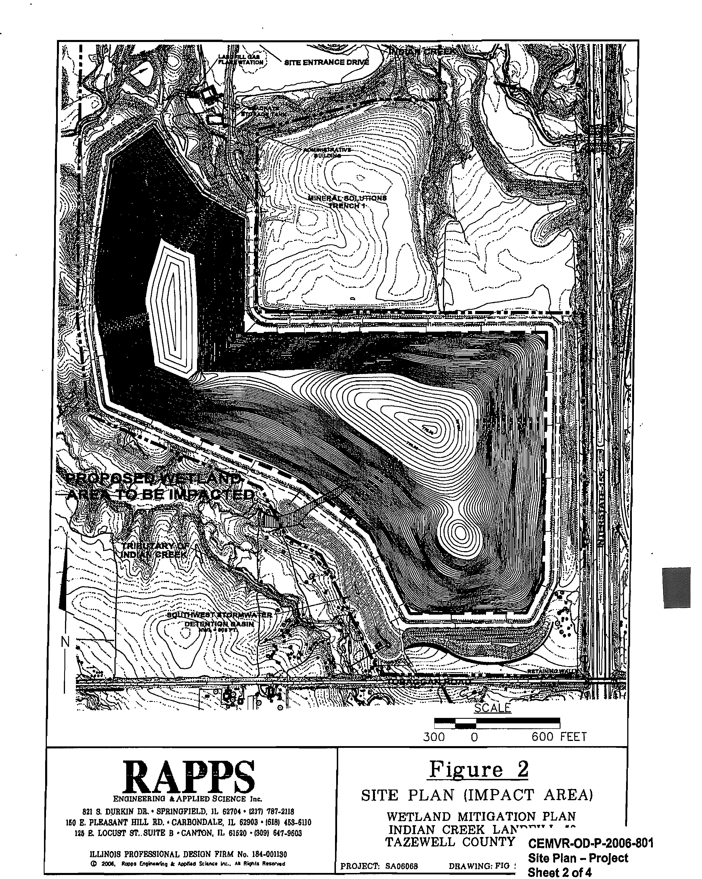
Tazewell County Landfill, Inc. proposes to expand the current landfill operations at Indian Creek Landfill #2
by an additional 140 acres. The additional area measures approximately 140 acres, including perimeter buffer areas, retaining
walls, and sediment basin. Approximately 0.89 acres of emergent wetland on the property will be filled by the expansion.
Mitig
ation. The proposed mitigation area is located approximately 200 feet to the south of the impact site. The mitigation area will
comprise 1.3 acres, which is a mitigation ratio of 1.5:1. The site is a grassy pasture. Approximately 2 to 3 feet of material will be
excavated to contact the groundwater table. Excavated soil will be removed from the site but will be stockpiled within the boundary
of the property. The applicant intends to allow vegetation in the mitigation site to establish naturally through wind, water, and wildlife
dissemination of plant seeds. The only planting planned is a cover crop of wheat or annual ryegrass on all bare soil surfaces to
reduce soil erosion. The mitigation area will be monitored and maintained to keep Invasive species such as
Lythrum salicaria
(purple loosestrife),
Typha
species (cattails), and
Phalaris arundinacea
(reed canary grass) from overtaking the site.
4.
Agency Review.
a.
Dep
artment of the Arm
y
. Corp
s of Engineers. The Department of the Army application is being processed under the
provisions of Section 404 of the Clean Water Act (33 U.S.C. 1344).
b. State of Illinois.
(1)
The applicant has applied to the Illinois Environmental Protection Agency (IEPA) for water quality certification, or waiver
thereof, for the proposed activity in accordance with Section 401 of the Clean Water Act. Certification or waiver indicates that IEPA
believes the activity will not violate applicable water quality standards. The review by the IEPA is conducted in accordance with the
Illinois water quality standards under 35 Illinois Administrative Code Subtitle C. The water quality standards provide for the IEPA to
review individual projects by providing an antidegradation assessment, which includes an evaluation of alternatives to any proposed
increase in pollutant loading that may result from this activity. The "Fact Sheer containing the antidegradation assessment for this
proposed project may be found on the IEPA's web site, at www.epa.state.ii.us/public-notices/. In the event that the IEPA is unable to
publish the "Fact Sheer corresponding to the timeframe of this Joint Public Notice, a separate public notice and "Fact Sheet" will be
published by the IEPA at the web site identified above. You may also obtain a copy of the "Fact Sheet" by contacting the IEPA at the
address or telephone number shown below. Written comments specifically concerning possible Impacts to water Quality should
be
addressed to: Illinois Environmental Protection Agency, Bureau of Water, Watershed Management Section, 1021 N. Grand Avenue
East, P.O. Box 19276. Springfield, Illinois 62794-9276. A copy of the written comments should be provided to the Corps of
Engineers. If you have any questions, please contact IEPA at (217) 782-3362.
CEMVR-OD-P-2006-801 –
Tazewell
County Landfill, Inc,
(2) The Illinois Department of Natural Resources, Office of Natural Resources (IDNR/OWR), application is being processed
pursuant to an Act In Relation to the Regulation of the Rivers, Lakes and Streams of the State of Illinois, Chapter 615, ILCS 5 (Illinois
Compiled Statutes (1994)). Comments concerning the IDNR/OWR permit should be addressed to the Illinois Department of Natural
Resources, Office of Water Resources, One Natural Resources Way, Springfield, Illinois 62702-1271, with a copy provided to the
Corps of Engineers (see paragraph 11. of this public notice for address). Mr. Mike Diedrichsen, IDNR/OWR (217/782-3863), may be
contacted for additional information.
5.
Historical/Archaeological. The Corps of Engineers did not consult with the District geographic information systems (GIS)
archeological site and survey databases. The Corps reviewed the report dated 27 February 2006 entitled Phase I Archaeological
Reconnaissance Surve
y of a Prop
osed Landfill Ex
p
ansion in Tazewell Count
y
. Illinois (PSAP Project No. 05-396) authored by Brian
Adams of the Public Service Archaeology Program, Department of Anthropology, University of Illinois, Urbana-Champaign. The
Corps concurs that only sites 11T492, 117496 and 11T500 are potentially eligible for inclusion in the National Register of Historic
Places (NRHP). The Corps also reviewed the report dated 20 July 2006 entitled National Re
g
ister of Historic Places Evaluation of
111498 and 11T500 In Tazewell Count
y
, Illinois (PSAP Project No. 06-166) also authored by Brian Adams. Based on the findings in
this report the Corps concurs that sites 11T496 and 11T500 are not eligible for inclusion in the NRHP. The Corps will require
additional investigations to evaluate 11T492 for NRHP eligibility.
6.
Endangered Species. District staff have performed a preliminary review of this application for the potential Impact on
threatened or endangered species pursuant to Section 7 of the Endangered Species Act as amended. The following threatened
or endangered species are listed by the United States Fish and Wildlife Service as occurring in Tazewell County, Illinois:
Indiana bat. The endangered Indiana bat (Myotis sodalis) is considered to potentially occur in any area with forested
habitat in any county in Illinois. Since there is no forested habitat to be affected by the project (mostly row crop), there
should be no effect on the Indiana bat.
-
Prairie Bush Clover. The prairie bush clover
(Lespedeza leptostachya)
is considered to potentially occur statewide based
on historical habitat and could potentially be found in any Illinois county. It occupies dry to mesic prairies with gravelly soil.
There is no critical habitat designated for this species. Since there Is no dry to mesic prairies with gravelly soil to be
affected by the project, there should be no effect on the prairie bush clover.
-
Eastern Prairie Frin
g
ed Orchid. The eastern prairie fringed orchid
(Platanthera /eucophaea) may
potentially be found in
any Illinois county. It occupies wet prairie remnant habitat. There is no critical habitat designated for this species. Since
there Is no wet prairie remnant habitat to be affected by the project, there should be no effect-on the eastern prairie fringed
orchid.
Bald Eagle. The threatened bald eagle
(Hallaeetus leucocephalus)
is listed as wintering along large rivers, lakes and
reservoirs. Since the project is not located near a large river, lake, or reservoir, there will be no impacts to bald eagles.
-
Lakeside Daisy. The lakeside daisy
(Hymenoxys herbacea)
is listed as threatened in Tazewell County, Illinois, where it
has been introduced. Since the project area consists of agricultural cropland, there should be no effect on the lakeside
daisy.
-
Decurrent False Aster. The decurrent false aster
(Boltonla decurrens)
is listed as threatened and known to occur in
Tazewell County, Illinois (Illinois River floodplain). Since the project area is over 10 miles from the Illinois River, there
should be no effect on the decurrent false aster.
The proposed project is being coordinated with the United States Fish and Wildlife Service. Any comments it may have concerning
Federally-listed threatened or endangered species or their critical habitat will be considered in the final assessment of the proposed
project. Accordingly, our preliminary determination is subject to change should further information become available.
7.
Dredge/Fill Material Guidelines. The evaluation of the impact of the proposed activity on the public interest will also include
application of the guidelines promulgated by the Administrator of the United States Environmental Protection Agency under authority
of Section 404(b) of the Clean Water Act (40 CFR Part 230).
8.
Public Interest Review.
The decision whether to issue the Corps permit will be based on an evaluation of the probable impact
including cumulative impacts of the proposed activity on the public Interest. That decision will reflect the national concern for both
protection and utilization of important resources. The benefit which reasonably may be expected to accrue from the proposal must
be balanced against its reasonably foreseeable detriments. All factors which may be relevant to the proposal will be considered
including the cumulative effects thereof; among those are conservation, economics, aesthetics, general environmental concerns,
wetlands, cultural values, fish and wildlife values, flood hazards, floodplain values, land use, navigation, shoreline erosion and
accretion, recreation, water supply and conservation, water quality, energy needs, safety, food production and, in general, the needs
and welfare of the people.
2
CEMVR-01)43
-2006
-
801
–
Tazewell County Landfill, Inc.
9.
Who Should
Reply. The Corps of Engineers is soliciting comments from the public; Federal, state, and local agencies and
officials; Indian Tribes; and other interested parties in order to consider and evaluate the Impacts of this proposed activity. Any
comments received will be considered by the Corps of Engineers to determine whether to issue, modify, condition or deny a permit
for this proposal. To make this decision, comments are used to assess impacts on endangered species, historic properties, water
quality, general environmental effects, and the other public Interest factors listed above. Comments are used in the preparation of
an Environmental Assessment and/or an Environmental Impact Statement pursuant to the National Environmental Policy Act.
Comments are also used to determine the need for a public hearing and to determine the overall public interest of the proposed
activity. These statements should be submitted on or before the expiration date specified at the top of page 1. These statements
should bear upon the adequacy of plans and suitability of locations and should, if appropriate, suggest any changes considered
desirable.
10.
Public Hearing
Requests.
Any person may request, in writing, within the comment period specified in this notice, that a public
hearing be held to consider this application. Requests for public hearings shall state, with particularity, the reasons for holding a
public hearing. A request may be denied if substantive reasons for holding a hearing are not provided.
11.
Reply to the Corps of
Engineers. Comments concerning the Corps permit should be addressed to the District Engineer,
U. S. Army Corps of Engineers, Rock Island District, ATTN: OD-P (Wayne Hannel), Clock Tower Building - Post Office Box 2004,
Rock Island, Illinois 61204-2004.
Mr. Wayne Hannel (309/794-5378)
may be contacted for additional information.
Attach?
Wayne Hannel
Plan
?
Project Manager
Regulatory Branch
REQUEST TO POSTMASTERS:
Please post this notice
?
NOTICE TO EDITORS: This notice is provided as background
conspicuously and continuously until the expiration date
?
information for your use in formatting news stories.
specified at the top of page 1.
?
This notice is not a contract for classified display advertising.
3
000
000
LANDFILL
750
0
1500 FEET
EXPANSION AREA
SCA
L
E
ACTIVE LANDFILL OPERATIONS/
STORMWATER DETENTION
BASIN PREVIOUSLY APPROVED
RAPPS
SITE LOCATION MAP
SING •APPLIED MI
MI lie.
SE
a
DOWN DE. • SPRINGFIELD. WOO I17) 987-11111
1150 E. PLEASANT BILL
RD.
•
GARDONDALE. IL MOS
•
010 4104110
11. LOCUST ff. SUM B
•
CANTON, IL 61610
.
000) 647-0608
UMW PEOPESSIONAL DESIGN HEM Ne. 11144:01110
0
aoal.
lispp•
Iral••rlas MON
Nona bo.. w ItIghb lissorod
LANDFILL EXPANSION
INDIAN CREEK LAN]
CEMVR-OD-1
3-Z
2
TAZEWELL COUNTY, r Vicinity Map
rumor: SAMOS?
DRAWING: BLM
Sheet 1-
of 4
006.801
•
p000000000000000-o
•
000000000000000-oo.ao
0000000000000Opo
.0
.
0
•
o
?
•oo
p
o
otto.00
00:00
:00
0Aggg:Tingggg:g:;"
0,
00000
oo
000
?
'p0000000,o
000000000
00 OA 00 004
0,
Iiot
0017'0,
op.op000t-w00000
Aoo
opo
•
?
000
ooroq000-oloo
.6 0
,
00000000loo
000
00000000
0
p
000
tp
000
0000
000
0.•.:
001
•
300
?
0?
600 FEET
Figure 2
SITE PLAN (IMPACT AREA)
WETLAND MITIGATION PLAN
INDIAN CREEK LAN--"
TAZEWELL COUNTY
CEMVR-OD-P-200
PROJECT: SA06068
DRAWING:
FIG :
Site Plan -
Projec
Sheet 2 of 4
6-801
ENGINEERING
RAPPS
&APPLIED SCIENCE Inc.
821 a DURKIN DR. • SPRINGFIELD, IL 62704 • 12171 787-2118
150 E. PLEASANT BILL RD. • CARBONDALE, IL 62903 • 16181 458-6U0
125 E. LOCUST ST.. SUITE B • CANTON, IL 61620 • (3091 647-9603
ILLINOIS PROFESSIONAL DESIGN FIRM No. 184-001130
0
2004. Rags Enetnearing
k
Appitta Wince Inc.
All
RION
Reserved
500 0
1000 FEET
RNOINEEPING
RAPPS
*APPLIED
sonnies Is&
an a
DUREN DI. •
811UNCIPIILD, IL UM • (SD 7894218
IN
a
MADAN? BILL RD.
•
coutsommaa,
IL 11908 • $18) 468-8)10
196E LOCUST fit RITE B • CANTON. IL I= • (109) 8474E8
mum
PROPRBOONAL DEEM
Pau xw 184-E01110
0?
Nom Enilmate & WWI Woos
Imk.
M Kyhte lissowd
Figure 3
SITE LOCATION MAP
(MITIGATION AREA)
WETLAND
MITIGATIC" '"
INDIAN CREEK LANI
TAZEWELL COUNTY,
PROJECD 8A08008
6.801
tion
CEMVR-0D•P-20
Location – Mitiga
DRAWING:
FICI
8
Sheet 3 of 4
i
j
i
:
:
?
?
:
;
?
!?
'
?
,,''.
?
.?
..
?
'::;•,.
4 ?\
••■•:,
/?
_
?
..'
:
?
i I?
,/
?
.?
.-.?
1, '
,?
)''''
•?
s%
.
\
\*1?
.?
,
,
'.
,
'?
:-
../,,
•
—,?
•
\\?
\
..Pla 4N
.
*...
.
%
?
' . , : : -77.
;"..F=Z:ii,
,u,,,,,,NN.
.:'
.
?.—,.,:,
'
?
...
• -/, '''
?
,:gf:L.- - ...
?
N . .., • \
?
'..,
......
?
''•
?
\ ....
\.-.'
.?
...-
,./".
\
..,d
?
'e
7
,?
?
..
?
•
A
\
•
?
?
\
\
%
?
•:::\.\.
.
' \\•
\
,
.
, 'Z....,-
'?
.
's,,
•
•
,
N .
?
.
\ \?
' \?
\
.,?
■?
\?
.
\
s ?\
•?
?
.?
...
-,..
i?
:
?
i?
i
?
.
;
1
,'
?
,
!
?
i?
.
.?
•
?
.
\?
':?'?
i
.;'
,,,,...
.;•
.,
..::,.
.
‘••■•••\.,
‘?
.
I . . 'Ss .:
y
,
./..,,,
?, ?
--..
-,
f\---.Ar--,?
—.
?
'
?
''..-...,,....,....,,,,
i
I
.
-, \
-..... s... •..?
.?
.-\,..\\\?
'?.
..,..,..:.
?
,
?
.?s‘:
.--
?
s.
?
s \?
\ \
''•?
\
?
\
?
\ % .,
\
?
„?
........_ ..,
.?
.
\\\-:
?
: .
....?
.--•..._.
s•••?
....••?
'.•
N
,
?
;
?
,
?
S?
,
N."
,,'
.
.
'''
''s
S.
.•
\\\?
I
N ‘••?
\‘‘ • ..\ . 7. .,
?
'
‘'.
,'!;1;.:
.'■••
.
'160..........:•::....„
„?
•?
.•
'. ..,..
•-• •?
?
.
‘., ,
...". ..-•••••••
?
‘
s
?
\ \?
\ \
?
s,
?
,
\
•
S
?
s
S
\
?\
.
?
\
?
\?
..,,
?
\?
•?
\?
••
'
,.
s.
\
...?
,..
•
?
,
\
?
,
s?
I
?
I
/
\?
\
‘‘...\
. S N
\•?
•
'••\\\> ::::::....
•?
..
...:.
.
•?
\
‘.?
\?
\
?
\?
\?
\ \ '
'
N..'
I?
■?
.. ..
?''''-',
...
.,,
\ \.:,..
?
Z...
Z.
.
•
\ •••"17...$;;Z:,
?
0 i t :.?
'
•?
:
-•--.."'
?
;
?
•?
••
?
.•'•-•
\
\
?
\
\
s
\
s
?
\
.
?
?
N,
\
\ \?
:\
..,
' .,..,
?
\
\
s, ..,?\
',
?
•..
?
..,?
...•
?
N
\
\\.•
• \
••
\`• . \ \
?
\\ , \
\?
V
•?
'
'?
N
.
\\
•
?
?
S.
?
•''
,.
?
\?
?
N.
."7t,•1:
.•
?
\•••
`'•Z:\
\\:,‘,...
?
,
\?
V.:::•;:
,;-(-.7.:,,,
?
,.,4,,,
t.,
.'
•?
.?
...
:?
•?
:
•':
.1
?
.?
:
3
,
.•
'
,
?
- • -
•
,
\:`,.%%-'' "--
•
'
.,
'
.;
i
s 's?
,
s".'
'.,
_
.‘
?
s...
•
?
..-•-'-'
?
ii.: .
3
.j
.'•
'
•'
?
N's•-■....._...
.
.?
'
,,,
?
\ :
,,..
?
,
\?
:
i
?
?
i,
:
?1
?
':
?
i
?
f
I t
k\':',;3•::...,
4?
-,.
'"•-.
?
•,..
?
..
•
......?
•••
?
•?..."..
.
"S
••?
•?
.?
.
'?
f•:.•':'.:.:'...•
?
''''..!'::'::•••■
?
.■‘
..\
.
...
?
....-•'-
?
.•'•
?
...
" \
N.
\
\
'?
.?
N./
'
/
e'''.":••• ' •
?
'''?
•••■•.• .... \
?
'''' ' 4
...■-•""s•..S.„ss
.
.?
s
.
••••'•••
•••'
?
•?
‘.*•••'.\\.
,,?....s
"
'
••?
I ‘•
:
.....
."?
.,
?
?
.....--.
?
.....
?
..............•
..
.......................,
.....„..,
ss?
.s
N,,
?
.
s. s,
..
,
..
...
.?
?
............,....
... ,...‘s,
?
\
.•
.......
?
-?
...-
...
?
„.
....
?
?
...
-el
d•?
Vile
.. •
..,.
"
1
i
?
•
.,
..........
‘?
•
S
?' \ C
.
'
•?
-•
?
.?
\?
N
•
\
•
•?
.
-?
•?
..
,
•?
N.\
N
•?
• ...............
• , N
•?
.........
?
....
•
?
,, ,
?
* Ns?
,,,
,
••
?
\?
N
.,
\
.^...,,,.
?
........
.
?
..,....
?
.
?
\
„
\
N.,
•
?
.
?
,
., •
?
\
?
'`.
•••.........
?
•?
••••••••••••...
................-....*.%
\ \
?
•
N
•
\
.
?
•
"?
-
.
\?•.,?
......?
..,„.......*.......-....-,
.
,S.-?
, \
\•:...
?
r••■■•••
•
.
....__?
•••••
1
;?
/?
:.' „?
,.. ■
?
'
?
\.
.?
,
J.,
\?
.
'.--' ....
.......k
.
,
-•...........
._......•........
.._..„..,.
?
.,
:
\
.?
.
..,.?
‘.....
..
•
...
\
.,
\
•?
.
.?
/-......_
.
..,.
?
?
...
?
.
.
... ..,.
,
:
.........,
:?
!?
i?
.. /
.:.
.,,
?
-
//
f
/
/7.1).;:i''' ,
//?
..‹.....''
,•
7
.
:,...„.E..,,
:,.
?
..
'?
\'1:1•1-':...'r,?
..'.
...•?
•?
.•
?
'?
-.
.
.....7.
..._.......„..._.
?
. .„,..„...,...
,..?
.
„:„.
....?
........„
_.,
.s,
SCALE
EMI:NELL=
RAPPS
*APPLIED =MR hr.
Figure 9
mt
i
$21S. DURKIN DX • EPPERWILLE IL UM - DID MEW
PROPOSED
WETLAND MITIGATION
SITE DESIGN
40
?
0
80 FEET
ED *OX BE • CARBONDALE. IL UM • ISM 31:147711
US X LOCU%T St ME II
• CANTOX IL OLEO -NOE ilT4408
INDIAN CREEK LANDFILL *2
TAZEWELL COUNTY, ILLINOIS
MUMS IIMIUSIONAL =ON PAW Ire. 111491114
'
?
". ..." " ' ...." ..*"" ..." ' "." ."...".
narEcr:
SAM=
?
DRAWING: FIG I?
DATE WM/
CEMVR-OD-P-2006-801
Site Plan – Mitigation
Sheet 4 of 4
k„
A
SIERRA
ILLINOIS CHAPTER
CLUB
70 East Lake Street • Suite 1500 • Chicago. IL. 60601
FOUNDED 1892
tel: 312.251.1680
fax:312.251.1780
web: illinois.sierraclub.org
July 4, 2007
Sent via regular mail and fax to 309-794-5190 and 217-785-1225
District Engineer
US Army Corps of Engineers
Rock Island District
ATTN: OD-P (Wayne Hannel)
Clock Tower Building
Post Office Box 2004
Rock Island, Illinois 61204-2004
Illinois Environmental Protection Agency
Bureau of Water
Watershed Management Section
ATTN: Mr. Bruce Yurdin
1021 N. Grand Avenue East
P.O. Box 19276
Springfield, Illinois 62794-9276
Re: CEMVR-OD-P-2006-801, Tazewell County Landfill, Tazewell County, Illinois
Dear Messrs. Hannel and Yurdin:
The Illinois Chapter of the Sierra Club objects to the issuance of a 404 permit and a 401 certification to
Tazewell County Landfill for impacts to 0.89 acres of wetland associated with expansion of Indian Creek
Landfill #2 west of the town of Hopedale in Tazewell County, Illinois. Members of our group live in the
Mackinaw River watershed and depend on clean waters in the watershed's streams and wetlands for
recreational activities including fishing, birdwatching and other wildlife viewing. The landfill site lies
close to a tributary to Indian Creek and over the Mahomet Aquifer, the water supply for many of our
group's members and thousands of other citizens of Tazewell County. We are not only concerned with
the proposed wetland fill; we are also concerned with potential impacts on Indian Creek and the
underlying aquifer.
OBJECTIONS
Impacts to Aquatic Functions and Services
1.
The proposed landfill site lies in an area subject to high water tables, since the public notice states
that the proposed wetland mitigation 200 feet south of the landfill expansion will only require 2-3
feet to contact groundwater. There is potential for stream contamination to occur as the result of
landfill leachate reaching the groundwater that likely feeds the Indian Creek tributary which runs
along the SW edge of the proposed landfill expansion. There is also potential for runoff from the
landfill site to contaminate the creek. We are concerned about the long-term impacts on the water
quality of the Indian Creek tributary based on its close proximity to the proposed landfill site. 40
CFR 230.11(h) requires that long-term, secondary effects on aquatic ecosystems such as leachate
and runoff from a sanitary landfill' be determined.
2.
The public notice provides no information on alternatives. 40 CFR 10(a) requires that practicable
alternatives which would have less adverse impact on the aquatic environment be employed. Siting
of the landfill expansion to avoid the impacted wetland would also increase the buffer area for the
Indian Creek tributary.
CEMVR-OD-P-2006-801, Tazewell County Landfill
page 2
3. No information is provided in the public notice that describes the functions and values of the
wetland which proposed to be filled. A functional assessment needs to be done and all functions
need to be mitigated.
Cumulative Impacts on the Public Interest
Besides our concerns about the potential impacts of landfill leachate on Indian Creek waterways, we ask
that the Army Corps of Engineers and Illinois EPA also address the potential for this landfill, which will
accept special waste, to contaminate groundwater, the water supply for residents of Tazewell County.
According to the Illinois State Geological Survey (in
Water International,
Vol. 28, No. 2, pages 170-180,
June 2003), the Mahomet aquifer is unconfined at its western end in Mason, Menard and Tazewell
counties increasing the vulnerability to contamination of this water resource, the major sand and gravel
aquifer of East-Central Illinois.Thank you for the opportunity to review the public notice and provide our
comments on the proposed 404 permit and 401 certification. You can reach me at 815-675-2594,
cindv.skrulcrud@sierraclub.org
or via mail to: 4209 W Solon Rd, Richmond, IL 60071
Sincerely,
Cynthia L Skrukrud, Ph.D.
Clean Water Advocate
marine
salt marsh
intertidal
estuary
lagoon
deep sea
benthos
habitats
freshwater
lakes
rivers
wetlands
fisheries
Wetland - Wikipedia, the free encyclopedia
Page 1 of 8
Wetland
Your continued donations keep Wikipedia running!
From Wikipedia, the free encyclopedia
For the 2008 novel by Charlotte Roche, see its German title,
Feuchtgebiete.
A
wetland
is an area of land consisting of soil that is saturated with moisture, such as a swamp, marsh, or bog.
As defined in terms of physical geography, a wetland is an environment "at the interface between truly
terrestrial ecosystems and aquatic systems making them inherently different from each other yet highly
dependent on both"
[1]
. In essence, wetlands are ecotones. Wetlands often host considerable biodiversity and
endemism. In many locations such as the United Kingdom and United States they are the subject of
conservation efforts and Biodiversity Action Plans.
The United States Army Corps of Engineers and the United States Environmental Protection Agency jointly
define wetlands as "those areas that are inundated or saturated by surface or ground water at a frequency and
duration sufficient to support, and that under normal circumstances do support, a prevalence of vegetations
typically adapted for life in saturated soils. Wetlands generally include swamps, marshes, bogs, and similar
areas."[21[3]
Contents
■
1 Characteristics
■
1.1 Soils
■
1.2 Vegetation
■
1.3 Hydrology
■
1.4 Topography
■
2 Classification
■
2.1 Hydrogeomorphic classes
■
2.2 Wetlands in drylands
■
2.3 Intertidal wetlands
■
3 Functions
■
3.1 Hydrologic
■
3.2 Biogeochemical
■
3.3 Habitat
■
3.4 Value to humans
■
4 Protection and rehabilitation
■
4.1 United States
■
5 See also
■
6 References
■
7 Further reading
A subtropical wetland in Florida,
USA, with an endangered
American Crocodile.
http://en.wikipedia.org/wilci/Wetland
Q/1 Q /111/1Q
Wetland - Wikipedia, the free encyclopedia?
Page 2 of
8
■ 8 External links
Characteristics
Soils
Wetlands are found under a wide range of hydrological conditions, but at least some of the time water saturates the soil. The result is a hydric soil, one characterized
by an absence of free oxygen some or all of the time, and therefore called a "reducing environment."
Vegetation
Plants (called hydrophytes or just wetland plants) specifically adapted to the reducing conditions presented by such soils can survive in wetlands, whereas species
intolerant of the absence of soil oxygen (called "upland" plants) cannot survive. Adaptations to low soil oxygen characterize many wetland species.
There are many types of vegetation in wetlands. There are plants such
as
cattails, bulrushes, sedges, arrowhead, water lilies, blue flag, arid floaters like common
duckweed. Pondweed is also another type of plant that grows in wetlands, but it is not easily seen. Peatland can be dominated by red maple, silver maple, and elm
trees. Some types of trees in peatland can exhibit lower trunks and roots that have adapted to the wet surroundings by forming buttresses,like the cypress, enlarged root
bases to better support the trees in the mucky soil. Trees can also form knees, raised roots that allow for gas exchange. Swamps can also have whitecedar, [[Tamarack
Larchltamarack, and white pine. Below the canopy, there are often limited amounts of shrubs such as speckled alder, Winterberry, and sweet gale.
Mangroves are a species of plant which typically thrive in coastal wetlands (called marine or estuarine environments). They are a special tree taxon that can survive in
salty wetland water. Mangroves also provide the base for the wetland food chain. They are the producers in the wetland environment. Because mangroves add sulfur to
the wetlands, it makes the water more acidic, therefore allowing decomposed matter in the water to biodegrade faster than it normally would, which in turn, provides
more food for the organisms in the wetland ecosystem.
Hydrology
Generally, the hydrology of a wetland is such that the area is permanently or periodically inundated or saturated at the soil surface for a period of time during the
growing season. The presence (or absence) of water is not necessarily a good method for identifying wetlands because the amount of water generally fluctuates
depending on such things as rainfall patterns, snow melt, dry seasons, longer droughts, and tidal patterns. Often the same wetland can appear to be an open body of
water sometimes and a dry field at other times because of significant fluctuations in water levels. The three water sources that contribute to wetlands are:
■
precipitation falling within the wetland
■
groundwater moving up or out from the subsurface of the wetland
■
surface flow from the surrounding watershed or nearby water bodies (lakes, streams, oceans, etc.)
Location determines which of these sources will be contributing water to a wetland.
Topography
Generally, wetlands are located within topographic features that are lower in elevation that the surrounding landscape such as depressions, valleys, and flat areas.
http://en.wikipedia.org/wikilWetland
?
Q/1 Q
/'111114
fifth AltErya
Dasin
19515.1993
USGS-NWRC
Time lapsed animation of
basin from 1956 to 1993.
Wetland - Wikipedia, the free encyclopedia
Page 3 of 8
Topography plays an important role in determining the size and shape of a wetland by controlling where the water goes and how long it stays there.
Classification
Below are terms used for various types of wetlands:
• A bog or muskeg is acidic peat land (peat bog).
■
A moor was originally the same as a bog but has come to be associated with this soil type on hill-tops.
• A moss is a raised bog in Scotland
■
A fen is a freshwater peat land with chemically basic (which roughly means alkaline) ground water. This means that it contains a
moderate or high proportion of hydroxyl ions (pH value greater than 7).
■
A carr is a fen which has developed to the point where it supports trees. It is a European term, mainly applied in the north of the
UK.
•
A freshwater marsh's main feature is its openness, with only low-growing or "emergent" plants. It may feature grasses, rushes,
reeds, typhas, sedges, and other herbaceous plants (possibly with low-growing woody plants) in a context of shallow water. It is an
open form of fen.
■
A vernal pool ( or ephemeral) is a shallow, freshwater pond that is seasonal, having water during rainy months and drying up
completely during the remainder of the year. One distinctive characteristic is the lack of fish species in the pool.
■
A coastal salt marsh may be associated with estuaries and along waterways between coastal barrier islands and the inner coast. The
plants may extend from reed in mildly brackish water to salicornia on otherwise bare marine mud. It may be converted to human use as pasture (salting) or for
salt production (saltern).
■
A swamp is wetland with more open water surface and deeper water than a marsh. In North America, it is used for wetlands dominated by trees and woody
bushes rather than grasses and low herbs, but this distinction does not necessarily apply in other areas, for instance in Africa where swamps may be dominated
by papyrus.
■
A dambo is a shallow, grass-covered depression of the central and southern African plateau which is waterlogged in the rainy season and usually forms the
headwaters of a stream or river. It is marshy at the edges and at the headwater but maybe swampy in the centre and downstream.
■
A mangrove swamp or mangal is a salt or brackish water environment dominated by the mangrove species of tree, such as
Sonneratia.
■
A paperbark wetland is a fresh or brackish water environment dominated by the Melaleuca tree.
■
A bayou or slough is a southern United States terms for a creek amongst swamp. In an Indian mangrove swamp, it would be called a creek.
■
A constructed wetland is artificially contrived wetland, intended to absorb flash floods, clean sewage, enhance wildlife or for some other human reason.
■
A pocosin is a bog-like wetland dominated by fire-adapted shrubs and trees, found mainly in the southeastern United States on the Atlantic Coastal Plain.
■
Seasonally flooded basins or flats.
■
Inland fresh meadows.
■
Inland shallow fresh water.
The U.S. Fish and Wildlife Service's National Wetlands Inventory (NWI) produces and provides information on the characteristics, extent, and status of U.S. wetlands
and deepwater habitats and other wildlife habitats. The NWI also produces periodic reports on the status and trends of wetlands in the conterminous U.S. The NWI
website includes a Wetlands Mapper.
Hydrogeomorphic classes
The Hydrogeomorphic (HGM) Approach is a system developed by the United States Army Corps of Engineers to classify all wetlands based on three factors that
influence how they function: position in the landscape (geomorphic setting), water source (hydrology), and the flow and fluctuation of the water once in the wetland
http://en.wikipedia.org/wiki/Wetland
/1 /111(14
Wetland - Wikipedia, the free encyclopedia
Page 4 of 8
(hydrodynamics). There are seven classes (types) of wetlands in this system:
■
riverine
■
depressional
■
slope
■
mineral soil flats
■
organic soil flats
■
estuarine fringe
■
lacustrine fringe
This approach also intends to develop subclasses of wetlands to account for specific conditions of various regions.
Marsh in Point Pelee, Ontario, Canada
Wetlands in drylands
In contrast to wetlands in other biomes (usually permanent and fresh water), wetlands in drylands are more diverse in their composition, depending on the local climate
and other particularities of the surroundings. They can be fresh or saline, permanent, seasonal or temporary, filling intermittently or regularly.
Wetlands in drylands can be attributed all values and uses of wetlands found in other biomes. However, given the stark contrast to their dry surroundings, many of
these values are enhanced. This applies to the water balance where gradual release and storage of rainwater by wetlands amid drylands is crucial because of the
unpredictability and incalculability of rain. During dry seasons, wetlands in drylands are also pivotal as refugia for wildlife, livestock and people. Moreover,
biodiversity levels are higher than in wetlands in other major biomes, in particular because of the accessibility of water amid an otherwise very dry environment.
Intertidal wetlands
In intertidal wetlands the majority of natural stress comes from salinity and tidal movements. The intertidal wetlands must be able to survive extreme conditions of
mainly salt water at high tide, fresh water at low tide and times of flood and brackish water at other times. The saline water is a very difficult condition for plants to
survive in. The grey mangrove accomplishes this by excluding salt in the root system, salt glands in the leaf, and waxy leaves to minimize water loss. However it is
vulnerable to changes in salinity levels. Changes to tidal movements through increased run-off or altered drainage can cause the roots of mangroves to be inundated for
longer than normal periods affecting their pneumatophones. It can also be pushed past its threshold level if water quality is changed. Thus even healthy ecosystems are
vulnerable to change. Some species such as oysters and mollusks have been used as indicator species, with any decline in their numbers indicating the ecosystem is
http://en.wildpedia.org/wiki/Wetland
4/1 Q/'>1.1110
Home of water birds in
wetland near Tuchlovice,
Czech Rep.
Wetland - Wikipedia, the free encyclopedia
?
Page 5 of 8
under stress. A change in nutrient levels may also affect primary productivity and thus bring about change.
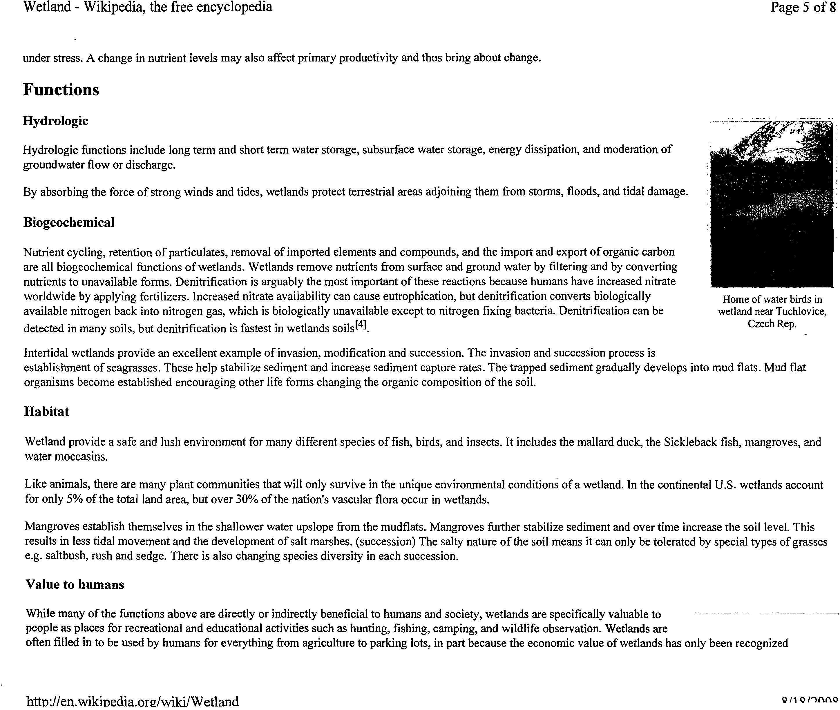
Functions
Hydrologic
Hydrologic functions include long term and short term water storage, subsurface water storage, energy dissipation, and moderation of
groundwater flow or discharge.
By absorbing the force of strong winds and tides, wetlands protect terrestrial areas adjoining them from storms, floods, and tidal damage.
Biogeochemical
Nutrient cycling, retention of particulates, removal of imported elements and compounds, and the import and export of organic carbon
are all biogeochemical functions of wetlands. Wetlands remove nutrients from surface and ground water by filtering and by converting
nutrients to unavailable forms. Denitrification is arguably the most important of these reactions because humans have increased nitrate
worldwide by applying fertilizers. Increased nitrate availability can cause eutrophication, but denitrification converts biologically
available nitrogen back into nitrogen gas, which is biologically unavailable except to nitrogen fixing bacteria. Denitrification can be
detected in many soils, but denitrification is fastest in wetlands soils[4].
Intertidal wetlands provide an excellent example of invasion, modification and succession. The invasion and succession process is
establishment of seagrasses. These help stabilize sediment and increase sediment capture rates. The trapped sediment gradually develops into mud flats. Mud flat
organisms become established encouraging other life forms changing the organic composition of the soil.
Habitat
Wetland provide a safe and lush environment for many different species of fish, birds, and insects. It includes the mallard duck, the Sickleback fish, mangroves, and
water moccasins.
Like animals, there are many plant communities that will only survive in the unique environmental conditions of a wetland. In the continental U.S. wetlands account
for only 5% of the total land area, but over 30% of the nation's vascular flora occur in wetlands.
Mangroves establish themselves in the shallower water upslope from the mudflats. Mangroves further stabilize sediment and over time increase the soil level. This
results in less tidal movement and the development of salt marshes. (succession) The salty nature of the soil means it can only be tolerated by special types of grasses
e.g. saltbush, rush and sedge. There is also changing species diversity in each succession.
Value to humans
While many of the functions above are directly or indirectly beneficial to humans and society, wetlands are specifically valuable to
people as places for recreational and educational activities such as hunting, fishing, camping, and wildlife observation. Wetlands are
often filled in to be used by humans for everything from agriculture to parking lots, in part because the economic value of wetlands has only been recognized
htto://en.wildoedia.org/wild/Wetland
C
s
/1 o
Wetland - Wikipedia, the free encyclopedia
Page 6 of 8
recently: the shrimp and fish that breed in salt water marshes are generally harvested in deeper water, for example. Humans can
maximize the area of healthy, functioning wetlands by minimizing their impacts and by developing management strategies that
protect, and where possible rehabilitate those ecosystems at risk.
Wetlands are sometimes deliberately created to help with water reclamation. One example is Green Cay Wetlands in Boynton Beach,
Florida, in the United States.
Protection and rehabilitation
Historically, humans have made large-scale efforts to drain wetlands for development or to flood them for use as recreational lakes.
Since the 1970s, more focus has been put on preserving wetlands for their natural function—sometimes also at great expense. One
example is the project by the U.S. Army Corps of Engineers to control flooding and enhance development by taming the Everglades,
a project which has now been reversed to restore much of the wetlands as a natural habitat and method of flood control.
The creation of the treaty known
as
the Ramsar Convention (1971), or more properly "The Convention on Wetlands of International
Importance, especially as Waterfowl Habitat", demonstrates the global concern regarding wetland loss and degradation. The primary
purposes of the treaty are to list wetlands of international importance and to promote their wise use, with the ultimate goal of
preserving the world's wetlands.
A temperate wetland in
Britain, with shallow open
water and reedbeds.
Small wetland in Marshall
County, Indiana in the United
States.
Exclusion
Those responsible for the management of wetland areas often facilitate public access to a small, designated area while
restricting access to other areas. Provision of defined boardwalks and walkways is a management strategy used to restrict access
to vulnerable areas, as is the issuing of permits whilst visiting.
Education
In the past, wetlands were regarded as wastelands. Education campaigns have helped to change public perceptions and foster public support for the wetlands.
Because of their location in the catchment area, education programs need to teach about total catchment management programs. Educational programs include
guided tours for the general public, school visits, media liaison, and information centers.
United States
In the United States, some wetlands are regulated by the federal government under the Clean Water Act. Determining the
boundary between regulated wetlands and non-regulated lands therefore can be contentious. In reality, there is no natural boundary
between the classes that humans define on these gradients (wetland/upland), and this issue is highlighted by the U.S. Fish and
Wildlife Service's definition from Classification of Wetlands and Deepwater Habitats of the United States, which defines wetlands
as "lands transitional between terrestrial and aquatic systems." Regulations to protect water quality and highway safety require that
we create arbitrary boundaries within those gradients, but these boundaries are scientifically definable, and consist of areas where
three criterion of the presence of hydric soils, the presence of wetland vegetation, and the presence of appropriate hydrology. Such
regulations must be predictable, reproducible, and enforced. Otherwise, we will sacrifice clean water for development in the case
of wetlands regulation (or vice versa), or sacrifice safe travel for quick travel (or vice versa) in the case of speed limits.
Determining which wetlands are regulated under section 404 of the clean water act
[5]
or section 10 of the rivers and harbors act is
termed "jurisdictional determination". Determining the boundary of wetland, whether jurisdictional under sections 404 or 10, or
not jurisdictional but still meeting the technical definition of a wetland, that is having the soils, vegetation and hydrology criterion
among the Salt Marsh Nature
Center, in Brooklyn, NY
http://en.wikipedia.org/wilci/Wetland
42/1Q/1(111Q
72
Wetlands protected by steel fence,
San Francisco, CA
Wetland - Wikipedia, the free encyclopedia
Page 7 of 8
met is called a "wetland delineation", and generally is performed by college graduates with natural science or biology degrees
working for engineering firms or environmental consulting firms who are familiar with the 1987 U.S. Army Corps of Engineers Wetland delineation manual.
Defining a boundary depends upon soil and vegetation characteristics; it is easier to do where the slope of the land is steeper.
Deciding if a wetland is a regulated wetland depends on classifying the water in it as "water of the United States" or not.
Classifying water as "of the U.S." or "not of the U.S." for purposes of enforcing the Clean Water Act suggests a natural boundary
that probably does not exist in nature, and one that was not created regarding air for purposes of enforcing the Clean Air Act.
Indiana Wetlands are the focus of the U.S. National Wetlands Coalition, which in turn has become the focus of some controversy
over "false fronts," a form of political camouflage.
See also: National Wetlands Research Center and Wetlands Reserve Program
See also
■
Asmat Swamp (in Indonesia)
■
Bog
■
Cardiff Bay Wetlands Reserve (in Wales UK)
■
Flooded grasslands and savannas
■
Freshwater swamp forest
■
Marsh
■
Peat swamp forest
■
Salt marsh
■
Slough
■
Swamp
References
1. A
Mitsch, William J.; James G. Gosselink (2007-08-24). "?",
Wetlands,
4th edition, New York: John Wiley & Sons, p. ?. ISBN 978-0471699675.
2.
" Definition from Corps of Engineers, Wetlands Delineation Manual, by Environmental Laboratory, U.S. Army Corps of Engineers, Waterways Experiment Station, 3909 Halls
Ferry Road, Vicksburg, MS 39180-6199
3.
A
42 Federal Register 37125-26, 37128-29. 1977-07-19. via Gingras, Glenn (2006-08-21). "VTrans Proposal" (PDF). Retrieved on 2008-01-19.
4. A
Ullaha, Sarni; S.P. Faulkner (2006-11-30). "Denitrification potential of different land-use types in an agricultural watershed, lower Mississippi valley".
Ecological Engineering
28 (2): 131-140. Elsevier. doi:10.1016/j.ecoleng.2006.05.007. ISSN 0925-8574. Retrieved on 2008-01-19. "Low-elevation clay soils in wetlands exhibited 6.3 and 2.5 times
greater DP compared to high-elevation silt loam and low-elevation clay soils in croplands, respectively."
5.
A
"Section 404 of the Clean Water Act: How Wetlands are Defined and Identified".
Wetlands fact sheet.
EPA (2006-02-22). Retrieved on 2008-01-19.
Further reading
▪
Ghabo, A. A. (2007) Wetlands Characterization; Use by Local Communities and Role in Supporting Biodiversity in the Semiarid Ijara District, Kenya. Terra
Nuova East Africa. Wetlands in drylands.
■
1987 U.S. Army Corps of Engineers Wetland delineation manual
http://en.wilcipedia.org/wiki/Wetland
4/14n/111Q
Wetland - Wikipedia, the free encyclopedia ?
Page 8 of 8
External links
■
Wetlands: The Ecological Effect of Loss (Research article)
■
Marshlands of Ibera (in English and Spanish)
■
Federal Register (1996-08-16). "National Action Plan to Develop the Hydrogeomorphic Approach to Assessing Wetland Functions
■
National Wetland Inventory (USA)
■
Brinson, M. M., Hauer, F. R., Lee, L. C., Nutter, W. L., Rheinhardt, R. D., Smith, R. D., and Whigham, D. (1995). "A guidebook for application of
hydrogeomorphic assessments to riverine wetlands" Technical Report WRP-DE-11, U.S. Army Engineer Waterways Experiment Station, Vicksburg, MS. NTIS
No. AD A308 365.
■
Rutgers University Wetland Delineation and Wetland Education Courses
■
Wetlands
in Te Ara - the Encyclopedia of New Zealand
Retrieved from "http://en.wikipedia.org/wiki/Wetland"
Categories: Wetlands
Hidden categories: Semi-protected I Articles with limited geographic scope
■
This page was last modified on 9 August 2008, at 14:05.
■
All text is available under the terms of the GNU Free Documentation License. (See
Copyrights
for details.)
Wikipedia® is a registered trademark of the Wikimedia Foundation, Inc., a U.S. registered 501(c)(3) tax-deductible nonprofit charity.
httn://en.wikinedia.or2/wiki/Wetl and
?
Q!1 OP-MAO
WHO1 Dioxins and their effects on human health
Page 1 of 4
Francais I
Pycext4a
4.) All WHO?
This site only
Espanol
Home
About WHO
Countries
Health topics
Publications
Data and statistics
Programmes and
projects
Media centre
News
Events
Fact sheets
Multimedia
Contacts
Media centre
WHO > Programmes and projects > Media centre > Fact sheets
0
printable version
Fact sheet N°225
November 2007
Dioxins and their effects on human health
Background
Dioxins are environmental pollutants. They have the dubious distinction of belonging to the "dirty dozen"
- a group of dangerous chemicals known as persistent organic pollutants. Dioxins are of concern because
of their highly toxic potential. Experiments have shown they affect a number of organs and systems.
Once dioxins have entered the body, they endure a long time because of their chemical stability and
their ability to be absorbed by fat tissue, where they are then stored in the body. Their half-life in the
body is estimated to be seven to eleven years. In the environment, dioxins tend to accumulate in the
food chain. The higher in the animal food chain one goes, the higher is the concentration of dioxins.
The chemical name for dioxin is:
2,3,7,8- tetrachlorodibenzo para dioxin (TCDD).
The name 'dioxins' is
often used for the family of structurally and chemically related
polychlorinated dibenzo para dioxins
(PCDDs)
and
polychlorinated dibenzofurans (PCDFs).
Certain dioxin-like
polychlorinated biphenyls
(PCBs)
with similar toxic properties are also included under the term "dioxins". Some 419 types of
dioxin-related compounds have been identified but only about 30 of these are considered to have
significant toxicity, with TCDD being the most toxic.
Sources of dioxin contamination
Dioxins are mainly by products of industrial processes but can also result from natural processes, such
as volcanic eruptions and forest fires. Dioxins are unwanted by products of a wide range of
manufacturing processes including smelting, chlorine bleaching of paper pulp and the manufacturing of
some herbicides and pesticides. In terms of dioxin release into the environment, waste incinerators
(solid waste and hospital waste) are often the worst culprits, due to incomplete burning.
Although formation of dioxins is local, environmental distribution is global. Dioxins are found throughout
the world in practically all media. The highest levels of these compounds are found in some soils,
sediments and food, especially dairy products, meat, fish and shellfish. Very low levels are found in
plants, water and air.
Extensive stores of PCB-based waste industrial oils, many with high levels of PCDFs, exist throughout
the world. Long-term storage and improper disposal of this material may result in dioxin release into the
environment and the contamination of human and animal food supplies. PCB-based waste is not easily
disposed of without contamination of the environment and human populations. Such material needs to
be treated as hazardous waste and is best destroyed by high temperature incineration.
Dioxin contamination incidents
Many countries monitor their food supply for dioxins. This has led to early detection of contamination
and has often prevented impact on a larger scale. One example is the detection of increased dioxin
levels in milk in 2004 in the Netherlands, traced to a clay used in the production of the animal feed. In
another incident, elevated dioxin levels were detected in animal feed in the Netherlands in 2006 and the
source was identified as contaminated fat used in the production of the feed.
Some dioxin contamination events have been more significant, with broader implications in many
countries.
In July 2007, the European Commission issued a health warning to its Member States after high levels of
dioxins were detected in a food additive - guar gum - used as thickener in small quantities in meat,
dairy, dessert or delicatessen products. The source was traced to guar gum from India that was
contaminated with pentachlorophenol (PCP), a pesticide no longer in use. PCP contains dioxins as
contamination.
http://www.who.int/mediacentre/factsheets/fs225/en/
8/18/2008
WHO I Dioxins and their effects on human health
Page 2 of 4
animal feed exported from Brazil. The investigation resulted in a ban on all citrus pulp imports to the EU
from Brazil.
Another case of dioxin contamination of food occurred in the United States of America in 1997.
Chickens, eggs, and catfish were contaminated with dioxins when a tainted ingredient (bentonite clay,
sometimes called "ball clay") was used in the manufacture of animal feed. The contaminated clay was
traced to a bentonite mine. As there was no evidence that hazardous waste was buried at the mine,
investigators speculate that the source of dioxins may be natural, perhaps due to a prehistoric forest
fire.
Large amounts of dioxins were released in a serious accident at a chemical factory in Seveso, Italy, in
1976. A cloud of toxic chemicals, including 2,3,7,8-Tetrachlorodibenzo-p-dioxin, or TCDD, was released
into the air and eventually contaminated an area of 15 square kilometres where 37 000 people lived.
Extensive studies in the affected population are continuing to determine the long-term human health
effects from this incident. These investigations, however, are hampered by the lack of appropriate
exposure assessments. A minor increase in certain cancers and effects on reproduction have been
detected and are being further investigated. Possible effects on the children of exposed people are
currently being studied.
TCDD has also been extensively studied for health effects linked to its presence as a contaminant in
some batches of the herbicide Agent Orange, which was used as a defoliant during the Vietnam War. A
link to certain types of cancers and also to diabetes is still being investigated.
Earlier incidents of food contamination have been reported in other parts of the world. Although all
countries can be affected, most contamination cases have been reported in industrialized countries
where adequate food contamination monitoring, greater awareness of the hazard and better regulatory
controls are available for the detection of dioxin problems.
A few cases of intentional human poisoning have also been reported. The most notable incident is the
2004 case of Viktor Yushchenko, President of the Ukraine, whose face was disfigured by chloracne.
Effects of dioxins on human health
Short-term exposure of humans to high levels of dioxins may result in skin lesions, such as chloracne
and patchy darkening of the skin, and altered liver function. Long-term exposure is linked to impairment
of the immune system, the developing nervous system, the endocrine system and reproductive
functions. Chronic exposure of animals to dioxins has resulted in several types of cancer. TCDD was
evaluated by the WHO's International Agency for Research on Cancer (IARC) in 1997. Based on animal
data and on human epidemiology data, TCDD was classified by IARC as a "known human carcinogen".
However, TCDD does not affect genetic material and there is a level of exposure below which cancer risk
would be negligible.
Due to the omnipresence of dioxins, all people have background exposure and a certain level of dioxins
in the body, leading to the so-called body burden. Current normal background exposure is not expected
to affect human health on average. However, due to the high toxic potential of this class of compounds,
efforts need to be undertaken to reduce current background exposure.
Sensitive subgroups
The developing fetus is most sensitive to dioxin exposure. The newborn, with rapidly developing organ
systems, may also be more vulnerable to certain effects. Some individuals or groups of individuals may
be exposed to higher levels of dioxins because of their diets (e.g., high consumers of fish in certain parts
of the world) or their occupations (e.g., workers in the pulp and paper industry, in incineration plants
and at hazardous waste sites, to name just a few).
Prevention and control of dioxin exposure
Proper incineration of contaminated material is the best available method of preventing and controlling
exposure to dioxins. It can also destroy PCB-based waste oils. The incineration process requires high
temperatures, over 850°C. For the destruction of large amounts of contaminated material, even higher
temperatures - 1000°C or more - are required.
Prevention or reduction of human exposure is best done via source-directed measures, i.e. strict control
http://wvvw.who.int/mediacentre/factsheets/fs225/en/
8/18/2008
'WHO I Dioxins and their effects on human health
Page 3 of 4
More than 90% of human exposure to dioxins is through the food supply, mainly meat and dairy
products, fish and shellfish. Consequently, protecting the food supply is critical. One approach includes,
as mentioned above, source-directed measures to reduce dioxin emissions. Secondary contamination of
the food supply needs to be avoided throughout the food-chain. Good controls and practices during
primary production, processing, distribution and sale are all essential to the production of safe food.
Food contamination monitoring systems must be in place to ensure that tolerance levels are not
exceeded. It is the role of national governments to monitor the safety of food supply and to take action
to protect public health. When incidents of contamination are suspected, countries should have
contingency plans to identify, detain and dispose of contaminated feed and food. The exposed
population should be examined in terms of exposure (e.g. measuring the contaminants in blood or
human milk) and effects (e.g. clinical surveillance to detect signs of ill health).
What should consumers do to reduce their risk of exposure?
Trimming fat from meat and consuming low fat dairy products may decrease the exposure to dioxin
compounds. Also, a balanced diet (including adequate amounts of fruits, vegetables and cereals) will
help to avoid excessive exposure from a single source. This is a long-term strategy to reduce body
burdens and is probably most relevant for girls and young women to reduce exposure of the developing
fetus and when breastfeeding infants later on in life. However, the possibility for consumers to reduce
their own exposure is somewhat limited.
What does it take to identify and measure dioxins in the environment and food?
The quantitative chemical analysis of dioxins requires sophisticated methods that are available only in a
limited number of laboratories around the world. These are mostly in industrialized countries. The
analysis costs are very high and vary according to the type of sample, but range from over US$ 1700 for
the analysis of a single biological sample to several thousand US dollars for the comprehensive
assessment of release from a waste incinerator.
Increasingly, biological (cell- or antibody) -based screening methods are being developed. The use of
such methods for food samples is not yet sufficiently validated. Nevertheless, such screening methods
will allow more analyses at lower cost. In case of a positive screening test, confirmation of results must
be carried out via more complex chemical analysis.
WHO activities related to dioxins
Reducing dioxin exposure is an important public health goal for disease reduction, also with respect to
sustainable development. In order to give guidance on acceptable levels of exposure, WHO has held a
series of expert meetings to determine a tolerable intake of dioxins to which a human can be exposed
throughout life without harm.
In the latest of such expert meetings held in 2001, the Joint FAO/WHO Expert Committee on Food
Additives (JECFA) performed an updated comprehensive risk assessment of PCDDs, PCDFs, and "dioxin-
like" PCBs. The experts concluded that a tolerable intake could be established for dioxins on the basis of
the assumption that there is a threshold for all effects, including cancer. The long half-lives of PCDDs,
PCDFs and "dioxin-like" PCBs mean that each daily ingestion has a small or even a negligible effect on
overall intake. In order to assess long- or short-term risks to health due to these substances, total or
average intake should be assessed over months, and the tolerable intake should be assessed over a
period of at least one month. The experts established a provisional tolerable monthly intake (PTMI) of 70
picogram/kg per month. This level is the amount of dioxins that can be ingested over lifetime without
detectable health effects.
WHO, in collaboration with the Food and Agriculture Organization (FAO), through the joint FAO/WHO
Codex Alimentarius Commission, has established a 'Code of Practice for the Prevention and Reduction of
Dioxin and Dioxin-like PCB Contamination in Foods and Feed'. This document gives guidance to national
and regional authorities on preventive measures. The establishment of Codex guideline levels for dioxins
in foods is under consideration.
Since 1976 WHO has been responsible for the Global Environment Monitoring System's Food
Contamination Monitoring and Assessment Programme. Commonly known as GEMS/Food, the
programme provides information on levels and trends of contaminants in food through its network of
participating laboratories in over 70 countries around the world. Dioxins are included in this monitoring
programme.
http://www.who.int/mediacentreifactsheets/fs225/en/
8/18/2008
-
WHO I Dioxins and their effects on human health
Page 4 of 4
WHO is now working with the United Nations Environmental Programme (UNEP) on the implementation
of the 'Stockholm Convention', an international agreement to reduce emissions of certain persistent
organic pollutants (POPs), including dioxins. A number of actions are being considered internationally to
reduce the production of dioxins during incineration and manufacturing processes. In responding to the
needs of the Stockholm Convention on POPs, the WHO GEMS/Food has developed a new protocol for a
Global Survey of Human Milk for POPs in order to meet the health, food safety and environmental
objectives of WHO, UNEP and their member countries. This protocol will assist national and regional
authorities to collect and analyse representative samples in order to assess the current state of
background exposure and in the future to assess the effectiveness of measures taken to reduce
exposure.
Dioxins occur as a complex mixture in the environment and in food. In order to assess the potential risk
of the whole mixture, the concept of toxic equivalence has been applied to this group of contaminants.
TCDD, the most toxic member of the family, is used as reference compound, and all other dioxins are
assigned a toxic potency relative to TCDD, based on experimental studies. During the last 15 years,
WHO, through the International Programme on Chemical Safety (IPCS), has established and regularly
re-evaluated toxic equivalency factors (TEFs) for dioxins and related compounds through expert
consultations. WHO-TEF values have been established which apply to humans, mammals, birds and fish.
The last such consultation was held in 2005 to update human and mammalian TEFs. These international
TEFs have been devebped for application in risk assessment and management, and have been adopted
formally by a number of countries and regional bodies, including Canada, Japan, the United States and
the European Union.
RELATED LINKS
- WHO programme on food safety, zoonoses and foodborne disease
- International Programme on Chemical Safety
- Technical report: Evaluation of Certain Food Additives and Contaminants [pdf 911 kb]
For more information contact:
WHO Media centre
Telephone: +41 22 791 2222
E-mail: mediainquiries(@who.int
Contacts I E-mail scams I Employment I FAQs I Feedback I Privacy I 118aie_edS
C) WHO 2008
http://www.who.int/mediacentre/factsheets/fs225/en/
8/18/2008
Print
Page 1 of 2
From:
Joyce Blumenshine (joblumen@yahoo.com)
To: Charles Norris
Date:
Monday, August 18, 2008 10:49:13 AM
Cc: Dave Wentworth
Subject:
Re: IL Pollution Control Board Hearing
Thank you for your letter Chuck.
I will read this at the hearing.
Joyce
Original Message ----
From: Charles Norris <cnorris geo-hydro.com>
To: Joyce Blumenshine <joblumen@yahoo.com>
Sent: Sunday, August 17, 2008 4:29:34 PM
Subject: IL Pollution Control Board Hearing
Joyce,
Thank you for your contact regarding the possibility of my
reviewing and offering comments on the proposal by PDC to delist EAF
wastes after processing, for eventual disposal in municipal landfills.
I have completed a preliminary review of the proposal and related
Agency, Board and PDC materials. Based upon that review and my
education, training, and experience, I believe your concerns well founded.
As we discussed earlier, my existing obligations to other clients make
it impossible to attend the public meeting in person to offer
sworn testimony. I am sorry for that, because I do believe personal
testimony, with the opportunity for cross examination, the most
effective way present technical issues.
However, in lieu of that, I can provide written comments to you and the
Board for its and its technical staffs consideration. I will try to
have my comments ready for submittal by August 21. By filing early, I
hope to generate a dialog before the Board with the Applicant during the
public comment period, instead of simply providing crossing statements
at the end of the comment period. It isn't the same as testimony with
cross, but it is the best I can do this time.
At present, my principle concerns are the modeling performed by the
applicant, the environment(s) targeted for disposal, the reliance upon
problematic test protocols, and the poor performance record of
lime-enhanced coal combustion waste as a stabilizing agent for other
waste streams. I will likely comment upon some or all of these, and I
may address other issues that arise.
Chuck
http://us.mg2.mail.yahoo.com/dc/launch?.rand
=
cuu10r9lhd8b9
8/18/2008
Print
Page 2 of 2
Charles H. Norris
(IL Professional Geologist, Lic 196.001082, exp. 31Mar09)
Geo-Hydro, Inc.
1928 E 14th Avenue
Denver CO 80206
(303) 322-3171
http://us.mg2.mail.yahoo.com/dc/launch?.rand
–
cuu10r9lhd8b9
8/18/2008