SIERRA
CLUB
n
p
Ficru
cic
r
E
s
FvFl
E
ce
ti
1-; (
?
L
FOUNDED 1893
MAY 0 7 2008
Heart of Illinois Group
P.O. Box 3593, Peoria, 1L 61614
STATE OF
IL
2419 E. Reservoir
Pollution
Control
L INOIS
Board
Peoria, IL 61614-8029
May 7, 2008
Illinois
Pollution Control Board
RE: PCB 08-42
100 W. Randolph St., Suitell-500
Chicago, IL 60601
To the Illinois Pollution Control Board Regarding Case PCB 08-42:
This letter is being sent on behalf of Heart of Illinois Group Sierra Club (HOD, which has nearly
900 members in central Illinois and approximately 600 members in the Peoria metropolitan
area. Our members drink Peoria water and breathe Peoria air. We want a safe environment for our
families and for our future, and we contend that the currently issued IEPA Operating Permit for PDC is
lacking in critical factors to protect the public health and safety and that the issue of this landfill
capacity must be reviewed.
On behalf of HOL I supplied comments and questions at the IEPA Public Hearing, February 28, 2007,
in
Peoria,
as
did other HOI members who spoke regarding the Operating Permit for Peoria Disposal
Company Hazardous Waste Landfill. HOE has concerns related to petitioner Tom Edward's issues
regarding this hazardous waste landfill and the currently issued operating permit.
We ask the Illinois Pollution Control Board to review the following:
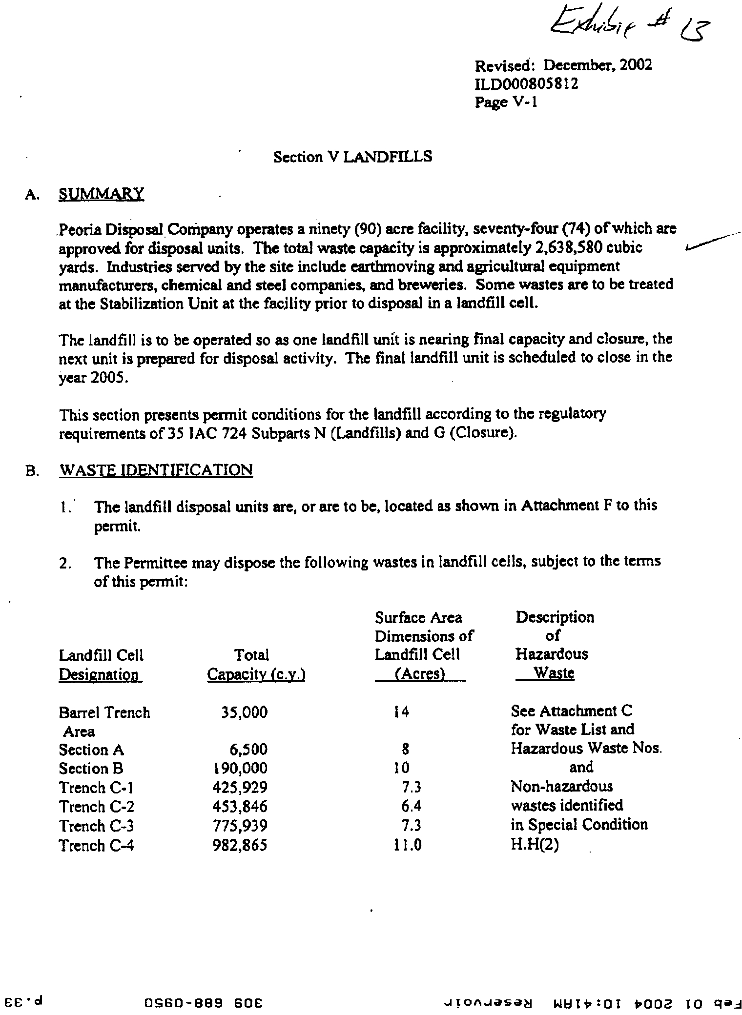
I. Landfill Canacity
We question the capacity of
this
landfill and how PDC obtained an increase in total landfill
capacity from the 1,847,200 cubic yards printed on Page V-1, Section V Landfills, of the1987 permit',
to the capacity of 2,638,580 cubic yards currently listed as capacity on Page V-1, Revised October 2007
of the permit application.
In a December 16, 2002, IEPA Bureau of Land File Memorandum', the following is stated:
"The new total capacity is calculated to be 2,638,580 cubic yards. This is less than
current calculations of the previously permitted total capacity of 2,638,983 cubic yards.
The capacitie previously listed in the permit is incorrect because of calculation errors
made in the original permit application. This issue had been raised previously,
but the
actual number in the permit had never been revised to reflect the accurate volume.
I Exhibit I, page V-1, Section V Landfills, 1987 permit
2 Exhibit 2, page
V- I, Revised October 2007, permit renewal application
3 Exhibit 3, December 16, 2002, IEPA Bureau of Land File Memorandum
I 'd
?
0660-8139 60E
?
JIOAJOSaa
WUS2:01
bon?
in
Page 2
[bold added/ROI] This error has been corrected in the modified permit. The
submittal does not contain a breakdown of the new capacities of Cells C-1
through C-4. I have contacted Ron Welk of PLC to obtain these values,
which will be included in the modified permit."
The modified permit being referred to is the Class 2 Permit Modification Dated December 18, 2002.
We specifically ask the IPCB to look at the Agency (IEPA) public notice regarding this specific year
2002 permit modification', which gives this Description of Project':
"1. Use municipal wastewater treatment plant sludge as part of the final cover
topsoil component.
2. Reconfigure landfill units
with no increase in capacity."
[bold added/H01]
Without significant investigation studying the permits, the public could not know that in this permit
modification the Agency changed the printed permitted capacity of the PDC Hazardous Waste Landfill
from 1,847,200 cubic yards to 2,638,580 cubic yards (in the year 2002 permit modification). This
change should have at least merited an accurate mention in the public notice wording. We question if
this should not also have required a public hearing.
Please also note the comment from above that "The submittal does not contain a breakdown of the new
capacities of Cells C-1 through C-4,"' yet the recalculation of permitted cubic yards in total is accepted.
The recalculation, "... is done by adjusting final contours of Cells C-1 through C-4. Calculations
showing that the units will be able to support the additional loading are included in the appendicies of
the application."'
HOI asks the IPCB to review the "calculated redesign" of the landfill height, weight, and slopes over
Cell CI in particular, and over Cells C2-C4 to verify that the additional load and increased slopes are
protective of the public health and safety The steepest slopes with 4 to 1 raise are at the south edge of
the landfill closest to Pottstown, and in proximity above the Peoria Dog Obedience Training Club on
Southport Road.
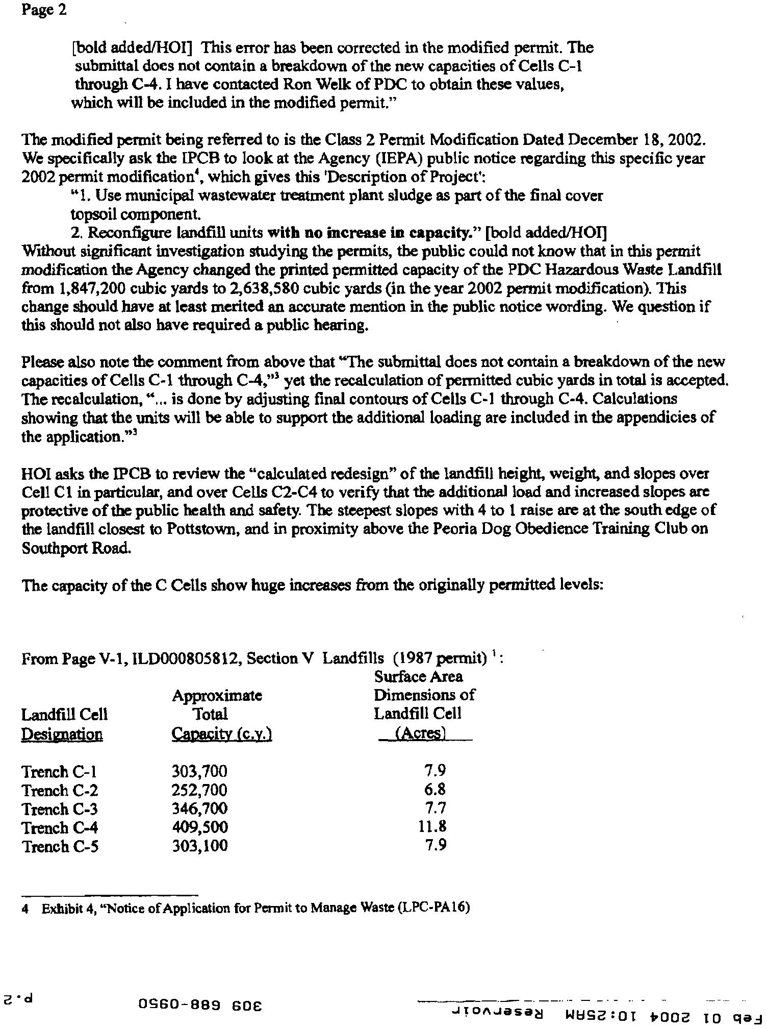
The capacity of the C Cells show huge increases from the originally permitted levels:
From Page V-1, ILD000805812, Section V Landfills (1987 permit) 1:
Surface Area
Approximate
?
Dimensions of
Landfill Cell
?
Total
?
Landfill Cell
Designation
?
Capacity (c.Y.1
?
(Acres)
Trench C-1
?303,700
?
7.9
Trench C-2?
252,700
?
6.8
Trench C-3?
346,700
?
7.7
Trench C-4
?
409,500?
11.8
Trench C-5?
303,100
?
7.9
4 Exhibit 4, "Notice of Application for Permit to Manage Waste (LPC-PA16)
a •
d
?
OGG0-8139 SOC
?
JiciAJased WEIG2
r
OT 4002 TO clad
Page 3
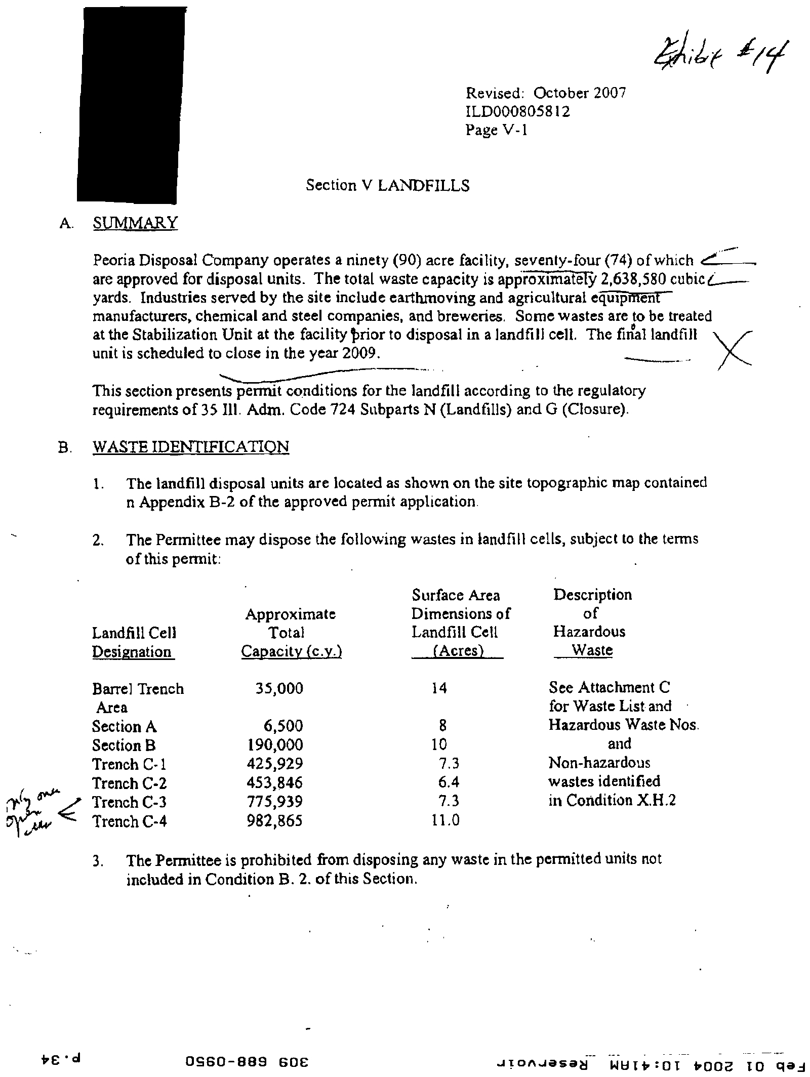
From Page V-1, ILD00085812, Section V Landfills Revised: October 2007':
Surface Area
Approximate
Dimensions of
Landfill Cell
Total
Landfill Cell
Dgnation
?
Capacity (c.v.)
(Acres)
Trench C-1
425,929
7.3
Trench C-2
453,846
6.4
Trench C-3
775,939
7.3
Trench C-4
982,865
11.0
The changing capacity figures are one reason HOI views the capacity of this site with complete
discomfiture. The wording of the Agency public notice for the Class 2 Permit Modification of 2002,
stated "no increase in capacity" yet the capacity change of total cubic yards from 1.8 million to 2.6
million was in this document. This is another reason we sincerely request the IPCB review capacity
issues with this site.
We question if this landfill should not already be considered at capacity, and we request that a date
certain for closure of March, 2009, be required in the Operating Permit
While we respect that the Agency has a great many important duties and demands, the fact that this
operating permit was for ten years from 1987 to 1997, and the ten year renewal was actually issued by
the Agency in 2007, ten years after the renewal date, does not help in the public perception of the
priority, level of attention, and scrutiny being given to this hazardous waste landfill. It also seems to
indicate that perhaps due to lack of staff, or other issues, that timely evaluation and issuing of this
RCRA operating permit was delayed ten years, which gives those of us in Peoria great cause for
concerns with the Agency ability to give adequate oversight to the huge details of this facility.
Monitorin g
Should Not
Be
Reduced
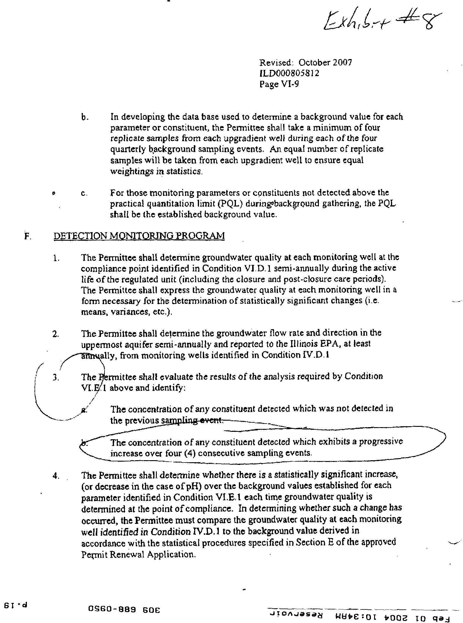
On Page VI-5, Revised October 2007 of the RCRA Part B Permit, letter E, Monitoring
Parameters,' the newly issued operating permit allows a change to semi-annual detection monitoring of
up-gradient and point of compliance wells. This is not protective of public health and safety. We ask
that monitoring be required quarterly, as in the previous operating permit.
Page 3
Aquifer level sands below the PDC waste site link to the Sankoty aquifer, which supplies water
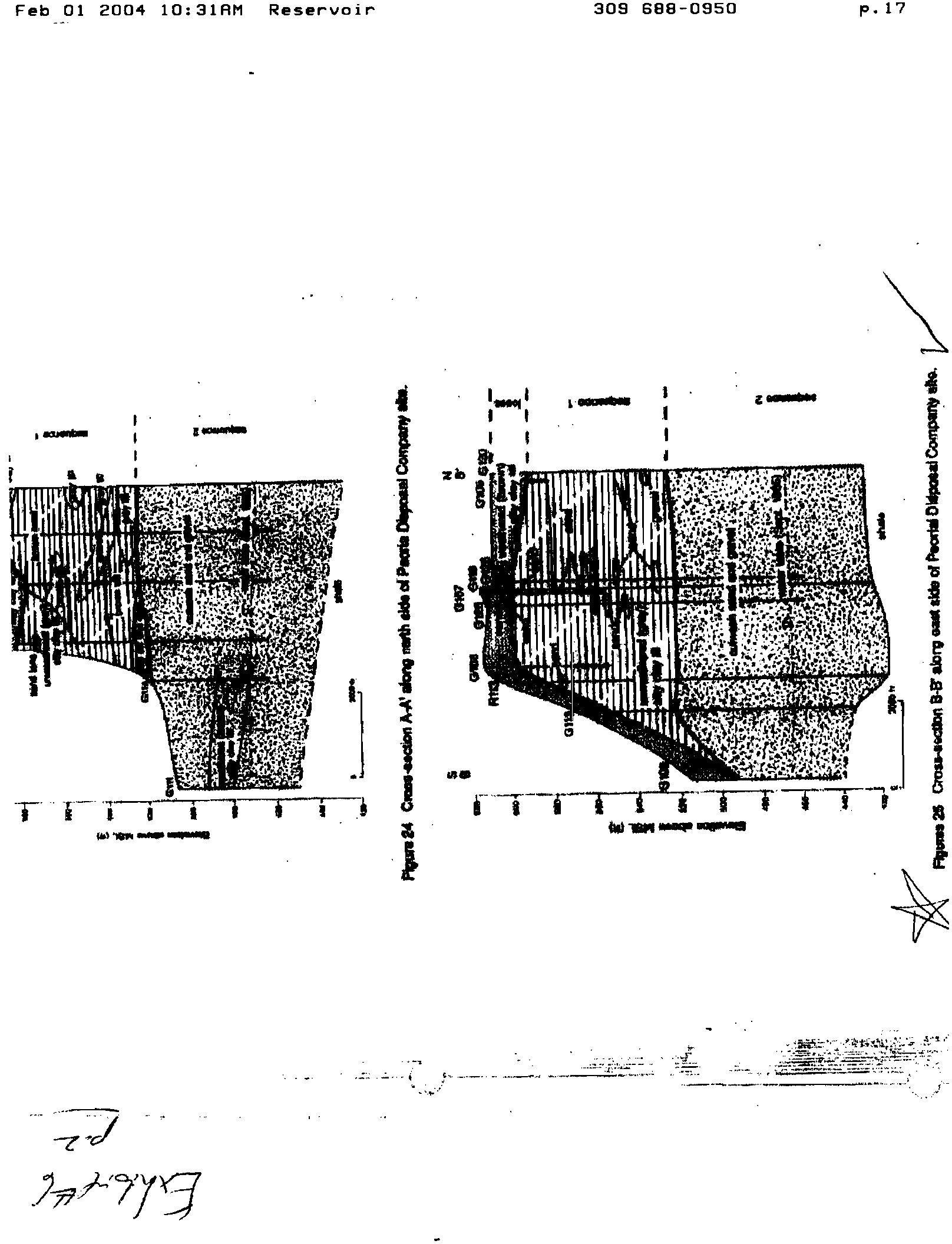
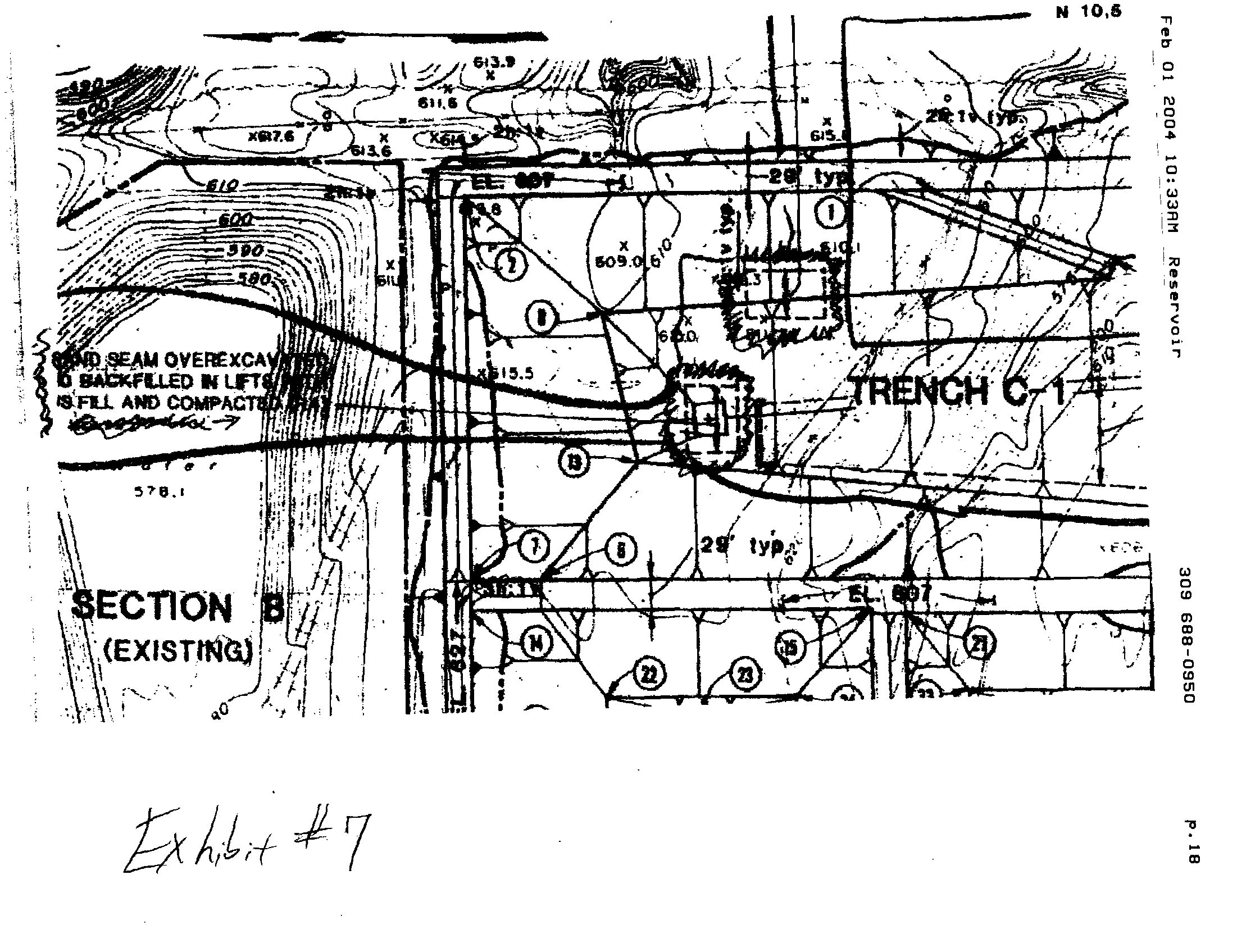
for Peoria and outlying communities. It is well documented that sand lenses occur on the east side of
the landfill.', and that two large sand lenses were encountered in the excavation of Cell C-1.7
The change to semi-annual monitoring is particularly of concern because of the time it would
then take for any constituent detected which exhibits a progressive increase over four consecutive
sampling events. Those must be identified (in letter b. below F. Detection Monitoring on page VI – 9 of
5 Exhibit 5,
page
VI- 5,
Revised: October
2007, MD000805812
6
Exhibit 6, Herzog et all, Evaluation of Groundwater Monitoring Programs at Hazardous Waste Disposal Facilities in
Illinois (1988),
Figure
25,
"Cross-section
B-B'
along east side
of
Peoria Disposal Company site"
7
Exhibit
7,
Trench
C-1,
"Sand Scam Overexcavated ..." trench drawing
' al
?
0960-6139 606
?
JI"JaSad
14892:01 4002
to
clad
Page 4
the pennitt and it appears to indicate that two years would elapse before a progressive increase would
be given critical consideration, and that is only if there were four consecutive increases.
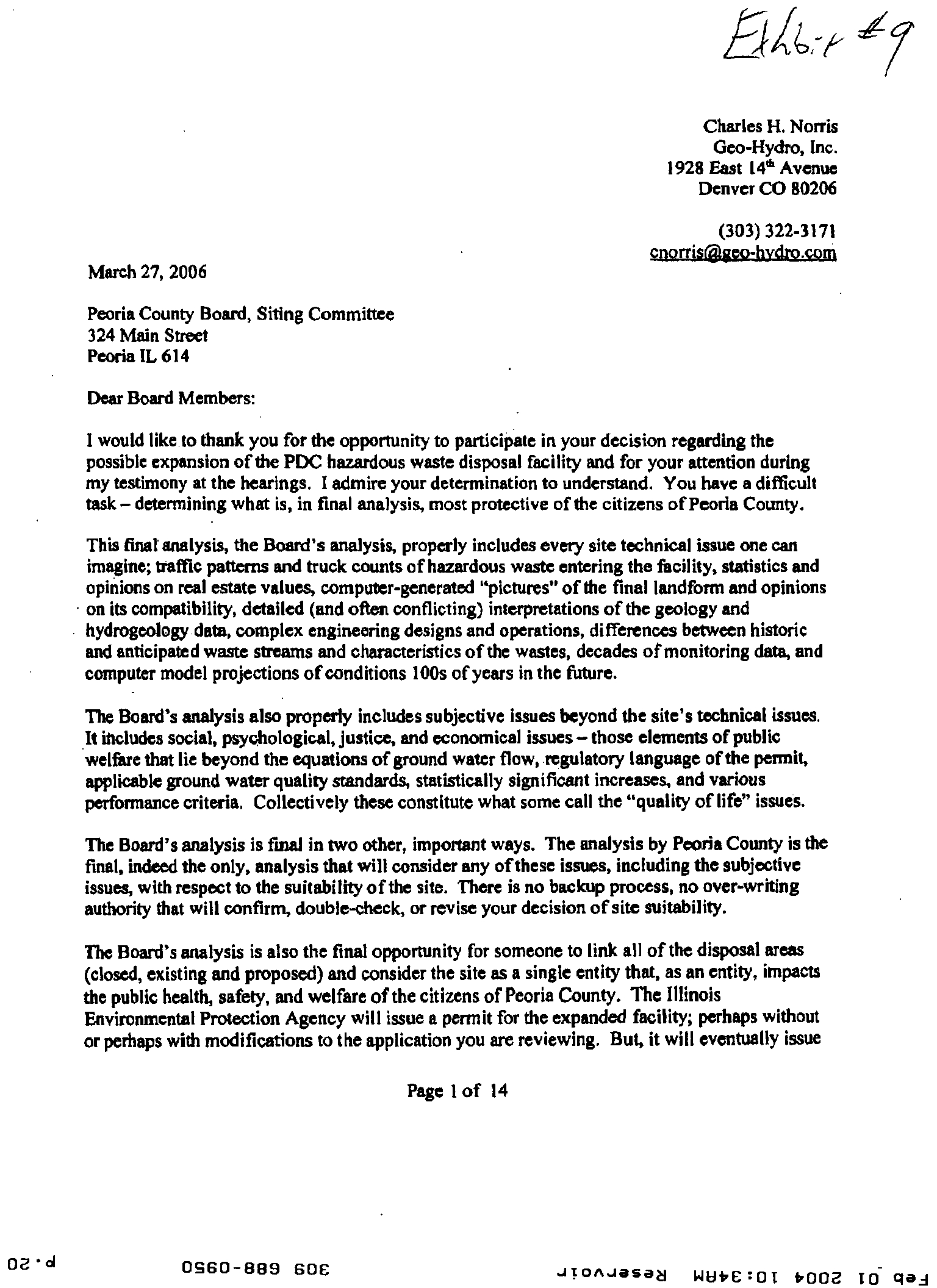
There are known problems with the Cell C liners. In his letter to the Peoria County Board, dated
March 27, 2006 , Charles Norris, Geo-Hydro, Inc., has an entire section regarding "Leaking from the
Liner Systems Under Section C,"" where he states:
"The operating record and the monitoring data for leachate production from
Section C demonstrates that the primary basal liners of trenches Cl through
C4 leak, and that the primary basal liner of trench C-1 shows the worst
leakage. Further, the data from trench CI shows that the secondary liner
also leaks."
Mr. Norris goes on to provide supporting details for his conclusion, including the following:
"By 1988 it was recognized that the integrity of the basal liner for trench Cl
was compromised. The leak detection system was producing fluid far in excess
of what could be expected from an intact liner and the chemistry of the fluid
was similar to the leachate from trench Cl with respect to the constituents
present and their relative concentrations. Effective 21-Sep-88, a new permit
condition required PDC to document production rates from the leak
detection system daily, analyze the composition of the fluid from the leak
detection system twice monthly, and report that documentation toe IEPA
monthly (reduced to annual reporting in 1993)."
Mr. Norris goes on with his discussion that there is thready contamination under the PDC waste
disposal complex.'
"It is undisputed that the water under and adjacent to the PDC waste disposal
complex is contaminated with synthetic chemicals. It is undisputed that inorganic
contaminants such as chloride are anomalously high and, in many cases, are known to
have risen above original base line levels. PDC's consultants hold that none of the
contamination that is found under the site is from the PDC waste disposal complex or
the result of PDC operations. In every case, the water beneath the PDC waste
disposal complex has been the victim of migration from some off-site source
or migration upward from the earth beneath the site. Unknown, unproven, and
speculative off-site sources are rationalized as the cause of all on-site contamination.
Simple, downward migration front historic and current waste disposal units and
operations are rejected as possible causes."
A specific example of contamination that HOI asks the IPCB to review, is the nickel
exceedances in five monitoring wells, allowed by the Agency to be due to leaching of nickel from the
monitoring well stainless steel screens. In October, 1993, the Agency accepted PDC 's April, 1993,
explanation of nickel exceedances in wells R121, Al26, R128, R129, and G136 to leaching of nickel in
the stainless steel screens in the monitoring wells.
w
This exemption appears to be continued in the
newly issued operating permit. HOI asks the IPCB to consider our dismay that since 1993, five
monitoring wells have been exempted from nickel exceedances and that there is no evidence that the
Agency has required new monitoring wells for these locations, PVC, or other corrections to the existing
S
Exhibit 8, page V1-9, Revised:
October
2007, ILD000805812
9 Exhibit 9,
Norris,
Charles, March 27, 2006, letter to the Peoria
County
Board
Siting
Committee,
page s 14
10 Exhibit 10, Vol. 14, Section 3, Page 6, 1997 permit
application
draft
0980-889 SCE
--•
JICIAJOSaS
141:1S2:01 b002
to
clad
Page 5
wells to insure that adequate and responsible monitoring for nickel, as required and regulated, is being
done. This is not in the interests of public health and safety and what would appear to be the
requirements of the regulations.
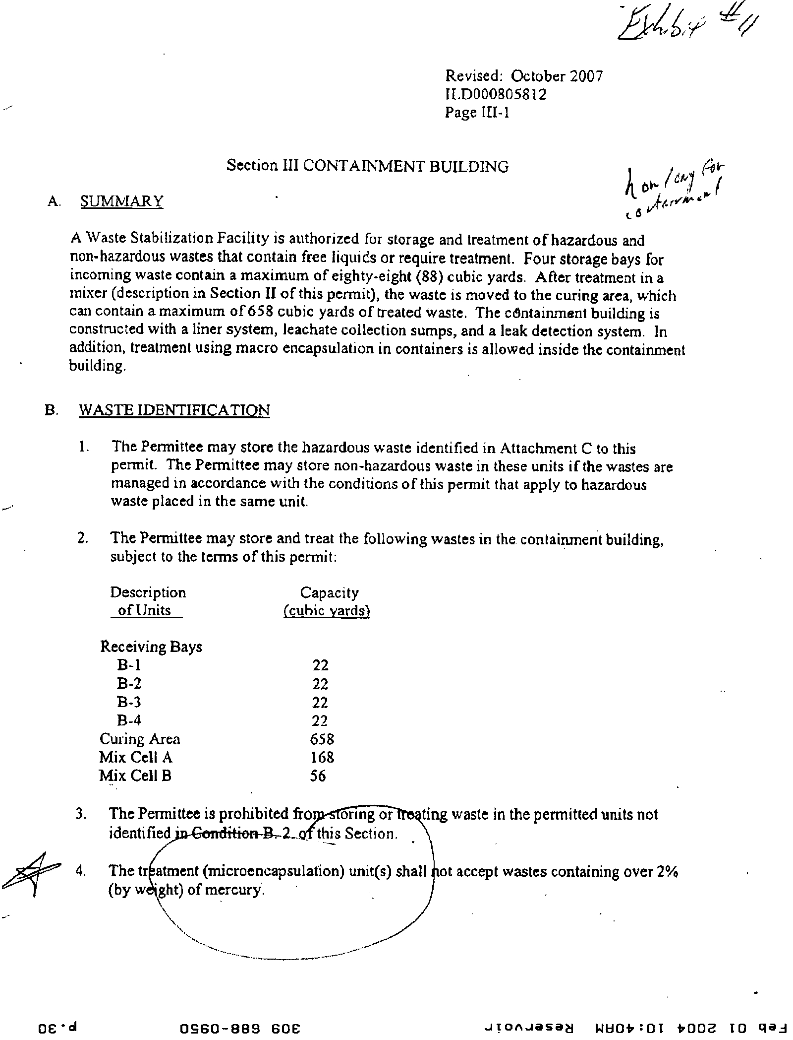
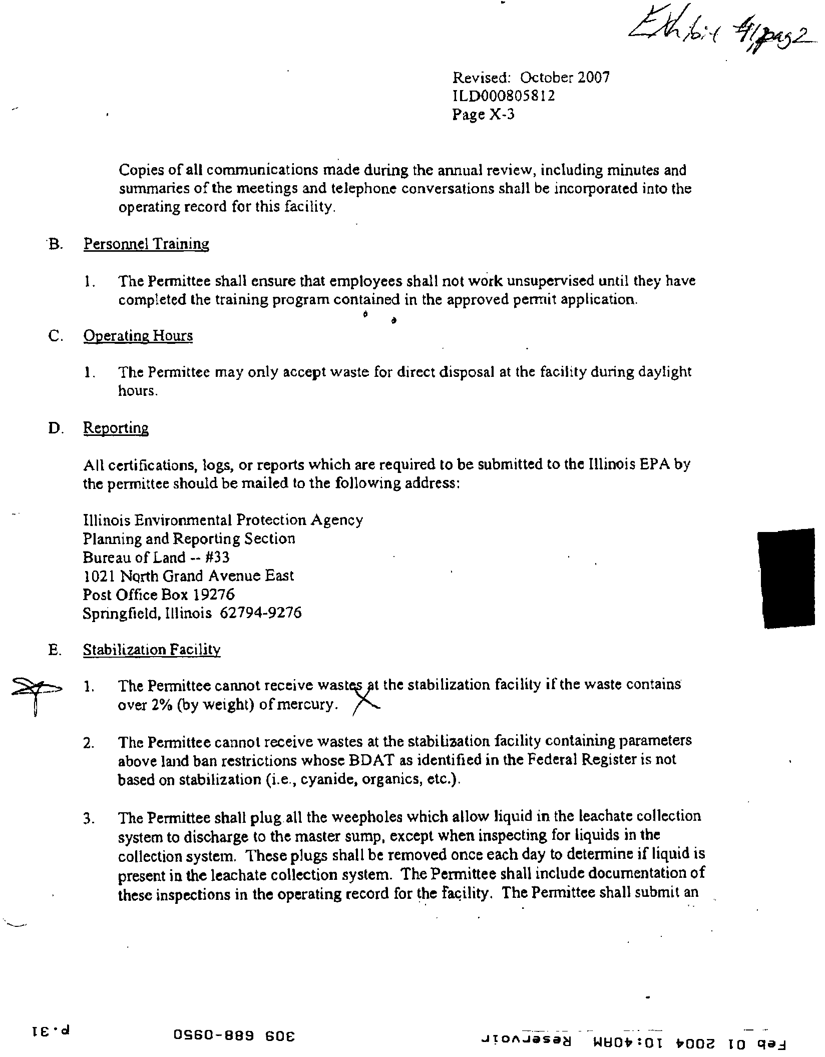
III. Testing for Mercury Should Be Required
HOI asks specifically, as Mr. Edwards does, that monitoring and testing for mercury pollution
be required. The current Operating Permit states in several locations" that wastes cannot be accepted
with over 2% of mercury by weight, yet there is no monitoring well testing for mercury. Considering
that up to 2% of weight of wastes can be mercury, testing should be required. The lack of mercury
testing seems to be a distinct disconnect between hazardous waste going into the landfill, and adequate
monitoring to protect the public health and safety.
IV.
Additional Down-
Gradient Monitoring Wells Should be Re
q
uired for Older Parts of,Land^l
While five upgradient monitoring wells exist for the Barrel Trench Area, and older parts
of the landfill outside the C-Cells, there are not adequate downgradient monitoring wells for
for the older parts of the landfill. HOI is concerned that the Agency has not required as many
downgradient monitoring wells for the older sections as up gradient monitoring wells.
Additional downgradient test wells should be required to monitor the Barrel Trench, Part A, Part B,
and the additional pre-regulation waste area on the west side of the site.
V.
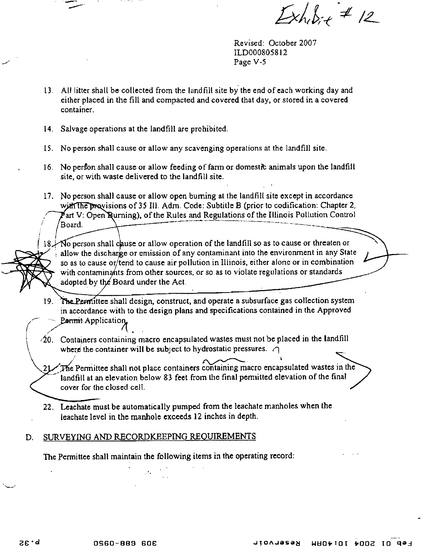
Air Monitoring for this Site Is Not Adequate and Permit Provisions Me Not Monitored
Page V– 5 of the RCRA Permit Revised October 2007 states at #18
12
that:
"No person shall cause or allow operation of the landfill so as to cause or
threaten or allow discharge or emission of any contaminant into the
environment in any state so as to cause or tend to cause air pollution in
Illinois, either done or in combination with contaminants from other
sources, or so violate regulations or standards adopted by the Board
under the Act."
In spite of this permit directive, there is no air monitoring for this hazardous waste landfill except
for the Waste Stabilization Plant baghouse processes. This landfill permit does not have restrictions on
landfill operations regarding wind speeds or direction. The landfill is upwind of the preponderance of
the city of Peoria, with residences within less than 300 feet from the landfill boundary. Prevailing south
westerly winds go over the landfill to the city of Peoria, with over 53,000 people within 3 miles of the
landfill site. Fine particulates, P.M. 2.5 can travel miles. About 113,000 people live in Peoria, and
having an active hazardous waste landfill immediately next to a large city population without ambient
air monitoring at the perimeter of the landfill and in adjacent neighborhoods is not protective of the
public health and safety. Low-income housing, senior citizen residences, private homes, and children's
playgrounds are all within close proximity to the landfill and are subject to prevailing winds. The fact
that the landfill has been granted a reconfiguration of the site, adding height over the previous plans,
adds to our concerns regarding wind carrying pollutants to adjacent residential areas. Some parts
11 Exhibit 11 #1: Letter B. Waste Identification, #4., Page III-1, Section III Containment Building, Revised: October 2007,
ILD000805812, Hazardous Waste Management RCRA Permit Pan B (effective January 1, 2008);
#2: Letter Letter E: Stabilization Facility, #1., Page X-3, Section X Additional Special Conditions, Revised:
October 2007, ILD000805812, Hazardous Waste
Management
RCRA Permit Part B (effective January 1, 2008)
12 Exhibit 12, Page V-5, C. Design and operating requirements, #18, Revised: October 2007, ILD000805812, Hazardous
Waste Management RCRA Pennit Part B (effective January I, 2008)
s
ci
?
0S60-889 60E
JT0AJesa8
WEI92
: 01
.
000E TO
(BA
Page 6
of the landfill will be an additional ten to twenty feet higher for the open landfill face, than in the
original permit.
HOI requests, as does Mr. Edwards, that the IPCB direct the Agency to require additional air
monitoring. We ask that air monitoring be done at the perimeter of the landfill, and in adjacent
neighborhoods. We would like to see regular reporting, and constant monitoring during winds. We ask
that restrictions on dumping during high wind conditions be added. Without additional air monitoring
beyond the baghouse testing, the provision of the current permit quoted above has no means of being
adequately monitored and is actually not being monitored.
VI. Hazardous
inith=mLargeldnniejpalityangCharAgnifer
The 2002 Permit Revisions for this landfill stated that the expected date for landfill closure was
in 2005". The current permit states that the anticipated landfill closure is to be in March, 2009.
The current permit application has a table with closure plans and post-closure plans (Section I,
"Closure Plans, Post-Closure Plans and Financial Requirements," Table I-1, in Application Volume 17,
Revised November 2006)" for other units of the landfill, including the Waste Stabilization Building
and Waste Storage Silos and Tanks, however, there is nothing required by the Agency that appears to
trigger closure of the Waste Stabilization Plant and related waste silos and storage areas. PDC owns
numerous municipal waste landfills and trucking, and has been sending lead and PCB wastes to their
Indian Creek Municipal Waste Landfill near Hopedale, in Tazewell County, since 2007 (that we know
of). The citizens of Peoria are faced with the continued trucking of toxic wastes into PDC #1 with the
processing and handling of the wastes upwind of family residences, senior citizen homes, playgrounds,
and public streets.
We ask the Illinois Pollution Control Board's consideration for stronger protections for our
community and our aquifer, and that the Agency be required to set a date certain for closure of the
Waste Stabilization Plant, waste storage silos, and other temporary storage areas, within two years after
the final landfill waste cell closure.
The current permit has sections allowing the construction of a solids storage building with nine
hazardous waste storage tanks, construction of two proposed storage silos and concrete vault, and the
option for storing up to ten roll-off containers in the container storage/staging area (page iv, of the
permit and I-1) remain in the permit. Since this landfill is expected and requested to close in March,
2009, there is no need for these additional features to be in the newly issued Operating Permit and we
ask that the Agency be directed to remove permission for any additional facilities not currently in
operation. It is obviously our concern that these facilities will be added to expand the Waste
Stabilization Plant operations, which could mean more hazardous waste trucks traveling in and out of
the site and over our county roadways and highways. We think it is essential that the permit be clarified
that the Waste Stabilization Plant is part of the RCRA landfill, and that it must close in connection to
the closure of the landfill.
Closing
Comment;
PDC attempted a site expansion, which was soundly turned down by the Peoria County Board
vote of 12 to 6, in May, 2006. In 2007, the Agency denied PDC's attempt for a Class 3 Operating
Permit expansion. Both of these denials were affirmed by the Illinois Pollution Control Board .
While the explanation is given that the capacity is not yet at the allowable limit, and the
maximum height limit is still met by the "landfill reconfiguration", HOI
asks the
IPCB:
13 Page V-I, Section V Landfills, Part A Summary, Revised: December, 2002, ILD000805812, Permit Modification
14 Page V-1, Section V Landfills, Part A Summary, Revised: October, 2007, 11.D 000805812, Hazardous Waste
Management RCRA Permit Part
B
(effective January
1, 2008)
9•d
?
0960-089 606
?
JI0A-JasaN WEI92
: 01
t
.
002 TO clai
Page 7
How much hazardous waste should be allowed to be squeezed in effect, on the existing cells? The
additional height will be added over cells with compromised liners. The waste will be added at higher
levels, putting the adjacent neighborhoods at greater risk from air-born particulates that are transported
by the prevailing winds from the southwest going over the landfill toward residential areas. The
working areas of the landfill are not covered during the day when work is underway. The landfill is in
operation on days with strong winds. Children play outside in neighborhood playgrounds within easy
view of the landfill. There is a popular dog obedience training school below the edge of the landfill
property at Pottstown on Southport Road, and their facility and parking lot is in easy view of a raw dirt
edge looming above in close proximity. There is no air monitoring at the perimeter or in the adjacent
neighborhoods. There are known sand lenses, in particular on the east side of the landfill, where Cell
C-1 is located.
We are concerned that the continued operation of this landfill further compromises the functional
capabilities of the C — Cells and means greater pollution risks for our community and the Sankoty
Aquifer. We do not want Peoria and the people of our community treated as a sacrifice zone for the
continued operations of this privately owned and for-profit hazardous waste landfill.
We question how the capacity limit of 2,638,586 cubic yards was determined by PDC, and how
the 1987 originally permitted capacity was changed. PDC has made it clear that they will push the
limits in their every attempt to expand their landfill. We believe they are pushing the limits of the
existing site, and that a date certain for closure of March, 2009, must be required.
On Page VIII —I of the Permit, the statement #1. Effect of Permit reads":
Issuance of this permit does not authorize any injury to persons or property or
invasion of other private rights, or infringement of state or local law or
regulations.
HOI contends that the Peoria community and Peoria County has had enough toxic
waste
on
behalf of Illinois and thel 5 outside states with locations sending hazardous waste to this site.
The continued operations of this site affect the the public health and safety of our community and for
many individuals, our private rights to peace of mind have been invaded by this hazardous waste
landfill.
Sincerely,
yce Blumenshine
volunteer Heart of IL Group Sierra Club
I5 Page
V111-1, ILD 000805812, Hazardous
Waste Management RCRA Permit Part B (effective
January 1, 2008)
Z. • d
?
OSGO-889 GOE
?
JIOAJOSad
W8t2:Ot
bona
TO
gad
ILLINOIS ENVIRONMENTAL PROTECTION AGENCY
1021 NORTH GRAND AVENUE EAST, P.O. Box 19276, SPRINGFIELD, ILLINOIS 62794-9276 - ( 217) 782-3397
JAWS R. THOMPSON CENTER, 100 WEST RANDOLPH, SUITE 11 -3 00, CHICAGO, IL 60601 - (312) 814 -6026
ROD R. BLAGOIEVICN, GOVERNOR?DOUGLAS P. SCOTT,
DIRECTOR
April 28, 2008
Heart of
IL Group Sierra Club
Attn: Ms. Joyce Blumenshine
2419 E Reservoir
Peoria, IL 61614-8029
Re: Freedom of Information Act
Dear Ms. Blumenshine:
Phone: 217/782-9878
Fax: 217/782-9290
www.epa.state.il.us/foia
The FOIA Sector, Bureau of Land, has processed your request dated April 17, 2008 and
received on April 17, 2008 for public records pursuant to the Freedom of Information Act
(FOIA) (5 ILCS 140/1 et. seq.). The information you requested from the below listed
Site is enclosed.
Bureau of Laud Site?
bunged Documents No. of Images
?
Inches
of
Paper?
Pages
of
Microfiche
1431120003 PEORIA DISPOSAL CO INC
4349 504.:7HPOrr RD, PEORIA?
0?
0
?
0.10?
0
Total imsgursge
Cowles:?
0
?
0
?
3
? 0
In order to obtain more detailed information, you would need to review the permit application at
our office here in Springfield. Please contact me by telephone at 217/557-2482 or by email at
Jan.Oaderi@illinois.gov
to schedule a file review if you are interested.
Sincerely,
Jan Ogden, FOIA Coordinator
Records Management Unit
Bureau of Land
53067
ROCICEORD-
4302
North
Main Street, Rockford, IL 61103 -
(815) 987-7760 • DES
PLAINS - 9511 W.
Harrison SI., Des Plaines, IL
60016- (847) 294-4000
ELGIN -595 South State,
Elgin,
IL 60121 - (847) 608-31
31 • PEORIA - 5415 N.
University St.,
Peoria, IL
61 614 -
1309) 693-5463
BVREAU Of LAND - PEORIA - 7620
N. University St., Peoria,
IL 61614 -1309) 693-5462 • CHAMPAIGN -
2125 Soulh First
Street. Champaign,
8.61820 -
(2171 278-5800
SPRINGFIELD- 45005.
Shah Street
Rd.,
Springfield,
IL 62706 - (217) 786-6892 • Cotur8V4.1.E - 2009
Mall Street, Collinsville,
11. 62234-
(618) 346-5120
MARION - 2309 W. Main St., Suite
116, Marion, IL
62959 - I6181993-7100
PRINTED ON RECYCLED PAPER
a
• d
0960-889 606
JIDAJ
asea
waaa:ot vooa
TO clad
•
ILD000805812
Page V-1
Section V LANDFILLS
A.
SUMMARY
Peoria Disposal Company operates a ninety (90) acre facility, seventy-four
(74) of which are approved for disposal units. The total waste capacity
is approximatel 1,847,200 cubic yards. Industries served by the site
c u•e earthmov ng an ag?equ pment manufacturers, chemical and
steel companies, and breweries. Some wastes are to be treated at the
Stabilization Unit at the facility prior to disposal in a landfill cell.
The landfill is to be operated so as one landfill unit is nearing final
capacity and closure, the next unit is prepared for disposal activity.
The final landfill unit is scheduled to close in the year 2005.
This section presents permit conditions for the landfill according to the
regulatory requirements of 35 IAC 724 Subparts N (Landfills) and G
(Closure).
B.
HASTE IDENTIFICATION
1. The landfill disposal units are, or are to be, located as shown in
Attachment F to this permit.
2. The Permittee may dispose the following wastes in landfill cells,
subject to the terms of this permit:
Landfill?
Cell
Desi
g nation
Capacity (c.y.)
Surface Area
Dimensions of
Landfill Cell
Description
of
?Hazardous
Waste?
Waste No.
Barrel Trench
Area
35,000
14
See Attachment C
for Waste List and
Section A
6,500
8
Hazardous Waste Mos.
Section 8
190,000
10
and
Trench C-1
303,700
7.9
Non-hazardous
Trench C-2
252,700
6.8
waste approved
Trench C-3
346,700
7.7
by IEPA
Trench C-4
409,500
11.8
special waste
Trench C-5
303,100
7.9
stream permit
3.
The Permittee is prohibited from disposing any waste 1n the permitted
units not included in Condition 8. 2. of this Section.
6•d
0960-869 60C
JI0AJ
ased
w882:01 tro
p
e
ID
ciaA
•
TOPSOIL
FETES
—
CILTE11 IAATENIAL
con*
TEL
sonnvious pi.
&IV/ / 7,0
ORAN NOT
z
N
I
O
SRA
IA
POITITHYLENE PIPS.
FILLED WITH
TinterTiON STONE
API.
• IONA
FILTER !Age
11116LWI26"11.11111
leftet SEAL (WIN 010.
GOVI101 DIAL
WIN mATIINIL
RANDOM FILL.
IYAMMA
cle11111111141------
is eithill/m
OAS SENT 010014
• AC•IIILLID WITH •. • •
D
RAIN MATN11/4„
•
,
WASTE
•
•
•
?
• MATERIAL
.?
.?
•?
-Thp•
,
COVER SYSTEM TYPICAL SECTION
SON! 0
I
MT
LA-1J
10.000
L.A
I
T I
•
•
500
11LS
NI.1111FINING
▪
ONASSCOVIIII
..--11A10011
ea
S.
II
74100
,
100
Nk
pIRM
/DO-
00)
EANOt OP I II
NCK
FINAL COVER GEOMETRY
2011/
efassi nu
Lemma
2E1
11.111
12.1/1
120
202
10.110
12.175
NS
I.411
11.A55
NO
704
10.1N
MO
'OS
10.454
10.174
?
NO
TN
111.04
11.015
NS
20?
10.n?
11.441
PIO
204
11.143
11.1
510
Nil
11.141
12.111
NO
71F
10.510
11.450
151
711
10.411
11.410
547
712
211
1
0
11
.4111
M
1I
11.4211
541
11.111
214
10.545
11.M
147
215
10.10
11.110
5E7
LEGEND:
•
OAS VINT
00.
•••••
OAS TINT
DITCH
!AGITATION
woe
nu
?
COVVI CONTOURS
CLITNLE ANINOSIANS
(Fla)
DAMN
NIT
FILM Pete
NANNOLS Gee
NOTES:
I. TOPOCIIIAPNV TARN. FROM MAPPING PII►UMO POE mall.
emoomemoNo
CO_ NG. ET aniDeTtioG ENINNEERINO NG.
DATE OP FOIDORAINT: 5450151.
S. 1.1111AL NONIOANIES.STFRIGNINES.
IMO
ALL ExPLONATION 10Th
NITA". AND
•11101112
THE LISTS M 1NiS omen An reek
11114e0 MIMI
It.
S. 0014
FERIMITIE
GOONONATtil• Ueda DETAILS, AND
MANHOLE
DETAILS
NI
INIANTel 151n1 05.
IIIrti
04,
AND 151711 OA
PIESPEGTIVIl•
4. VENT INTENIS 040%/7 NOT
DI
MIT
CLOSSA THAN It TO
TIC
TOP
Of
Till ay
. SLOPS AEON TN
43412485
SOILS 0
100
TOO FILET
1110117 AS NOTED
PEORIA DISPOSAL COMPANY
PEON,
ILLINOIS
DEVELOPMENT PERMIT APPLICATION' AREA C
01110014 FILL
NOM SMITE MI
•
•
•
•
•
WAITS.
•
IINTENAL
SECTION A-A (TYP)
NOT
TO KALI
DOAN MAMMAL
DACE
IN I'
Him
OAS
cousenow
EXCAVATION
24:
MA.
•flett •••i
Ava
See
TO 15MM OA
AM
FINAL COVER
PLAN
RZA ENVIRO
?
VICES. INC.
00110,110
One0.11.0001
C
i
?
161714 06
V
tt
NIt
AMARA of NIHON%
?
ST
Owe Alto
OT 'd
OcBO-899 60€
JI0A-lasam
wuez:ot frocia
TO
qaj
Revised: October 2007
IL D000805812
Page V-1
Section V LANDFILLS
A. SUMMARY
Peoria Disposal Company operates a ninety (90) acre facility, seventy-four (74) of which
are approved for disposal units. The total waste capacity is approximate 2,638,580 cubicLe.
yards. Industries served by the site include earthmoving and agricultural equipment
manufacturers, chemical and steel companies, and breweries. Some wastes are to be treated
at the Stabilization Unit at the facility prior to disposal in a landfill cell. The final landfill
unit is scheduled to close in the year 2009.
This section presents permit conditions for the landfill according to the regulatory
requirements of 35?
Adm. Code 724 Subparts N (Landfills) and G (Closure).
B.
WASTE IDENTIFICATION
1.
The landfill disposal units are located as shown on the site topographic map contained
n Appendix B-2 of the approved permit application.
2.
The Permittee may dispose the following wastes in landfill cells, subject to the terms
of this permit:
Landfill Cell
Designation
Approximate
Total
Capacity (c.v.)
Surface Area
Dimensions of
Landfill Cell
(Acres)
Description
of
Hazardous
Waste
Barrel Trench
Area
35,000
14
See Attachment C
for Waste List and
Section A
6,500
8
Hazardous Waste Nos.
Section B
190,000
10
and
Trench C-1
425,929
7.3
Non-hazardous
Trench C-2
453,846
6.4
wastes identified
Trench C-3
775,939
7.3
in Condition X.H.2
Trench C-4
982,865
11.0
3. The Permittee is prohibited from disposing any waste in the permitted units not
included in Condition B. 2. of this Section.
•
cl
?
OS60-13139 608
?
JP3AJasaa WEI62
: 0T
4002
TO clad
MEMORANDUM
Date: December 16, 2002
To: BOL File
Aft
From:
Mark
Mark
L. Critei, RCRA Permits
Re:
Class 2 Permit Modification - Reconfiguration of Landfill Cells
1438120003 -
Peoria County
ILD000805812
Log No. 13-24-M-56
Discussion
In this submittal,
2
modifications are requested to the Part B Permit for the above -
referenced facility. These modifications are discussed below:
1.
Allow the use of municipal wastewater treatment plant sludge as a soil amendment in
final cover soils.
According to Inuan Sayed, of the Solid Waste unit, this is currently done in solid waste
landfill permits. The main concern is that the sludge be applied at agronomic rates (20
tons per acre per year) so
that a state permit is not required. I have incorporated language
used by the Solid Waste unit in permits where MWTPS is used as a soil amendment. The
specific language I have used is drawn crom the permit for Harbor View landfill (Permit
No. 1995-0600LFM). A copy of the page containing the applicable condition is attached.
2.
Reconfigure the existing landfill units to eliminate the proposed Cell C-5, and increase
capacity in cells C-1 through C-4 without increasing overall capacity, or final permitted
elevations.
This is done by adjusting final contours of Cells C-1 through C-4. Calculations showing
s-?
t at the units will be able to support the additional loading are inclunsthespendicie,i
f the application. The new total capacity is calculated to be 2,638,
?
cu is yards!
1?
This is less than current calculations of the previously permitted total capacity of
2,638,983
cubic yards. The capacitie previously listed in the permit is incorrect because
of calculation errors made in the original permit application. This issue had been raised
previously, but the actual number in the permit had never been revised to reflect the
accurate volume. This error has been corrected in the modified permit. The submittal
— does not contain a breakdown of the new capacities of Cells C-1 through C-4. I have
contacted Ron Welk of PDC to obtain these values, which will be included in the
modified permit.
2 • d
O
S60-889
60E
?
JIOAJOSO8
W1162
:
0I
booa
To
gad
ILLINOIS ENVIRONMENTAL PROTECTION AGENCY
1021
NORTH GRAND AVENUE EAST,
P.O. Box 19276,
SPRINGFIELD, ILLINOIS
62794.9276
THOMAS
.
V. SKINNER, DIRECTOR
NOTICE OF APPLICATION FOR PERMIT TO MANAGE WASTE (LPC-PA16)
Dale
August 13, 2002
To Elected Officiah and Concerned Citizens:
The prima of dal
DoSesSmintem
you
that a palit applation has been
euhmitied
to the IEPA, Bureau orLand, fora solid waste project described
below.
You are not obligated to respond bs this notice, hoverer, if you have any
COMM%
please
submit them In writing to the address below, or call the Parrs*
Section at 217/5243300, within twenty-one
(21) days.
Peoria Journal Star
Illinois Environment& Protection
Agency
News Room
?
B
aran ottand, 'emit Section (133)
1 News Plaza
1021 North
Spfingfield,
Orand Avenue
Illinois
Rest,
62794-9276
Post
Office Box
19276
Peoria, IL 61643
The
permit application, Mitch is identified below, is for a prefect described at the bottom of this page.
SITE IDENTIFICATION
Site Name,
IMOr ia Disposal Company
Address:
4349 Southport' Road
City.
Peoria
r
YPT. PERMIT
suawassiort
?
TYPE FACITITY;
New Landfill
Landfill •
LandfillExpansion
Land Treatment
First Sipsificent
Modikadon
Transfer Station'
Significant Modifieafion
to OperateTreatmet&Faciity
Other SigniGoint
Modification
Stomp
Renewal of Landfill
Incinerator
Development
Composting
Operating
Recyclinp/Rcelamation
Supplemental
Other
Transfer
•
Name Change
amic
f
G
liltA Part B
?
S_-
DESCRIPTION OF
PROthler
•■■••••■■
zoo (awn
14 3 8 12 0003
County:
Peoria
TYPE
WASTE;
General Municipal Refuse
SPerial
(Non-lirmitrdous)
Chemical
Only (exec. putrescibk)
Inert Only Oman &tern. do putrcsoibk)
Used
01
Solvents
Icandscape/Yard Waste
Other (Specify
I. Use municipal wastewater treatment plant sludge as part of the final cover
tzz
k7
topsoil component.
2. Reconfigure landfill units with no increase in capacity.
RECEIVED
Ail6
2 0_2002
Please retain copy for your
own use.
PEKR/T SECTION
I
151,532A0R3441av
CI-d
0560-089 608
Ann-C10
JTOAJOSed
WUOC:OT 4002 TO gad
Revised: October 2007
ILD000805812
Page VI-5
4.
Should any well become consistently dry or unserviceable; a replacement well
shall be provided within ten (10) feet of the existing well. This well shall monitor
the same geologic zone as the existing well and be constructed in accordance with
the current Illinois EPA groundwater monitoring well construction standards at
the time that the well is replaced. A replacement well which is more than ten (10)
feet from the existing well or does not monitor the same geologic zone
must be
approved by the Illinois EPA and designated as a new well.
6
5.
The Permittee shall submit boring logs, construction diagrams and data sheets
from installation and development of a new or replacement well
to
the Illinois
EPA at the address below with thirty (30) days of the date that installation of the
well is completed. In addition, the Permittee shall submit certification that
plugging and abandonment of
a
well was carried out in accordance with the
approved procedures to the Illinois EPA at the address below within thirty (30)
days of the date that the well is plugged and abandoned. All information should
be submitted to the appropriate State Agencies.
Illinois Environmental Protection Agency
Bureau of Land - #33
Permit Section
1021 North Grand Avenue East
Post Office Box 19276.
Springfield, Illinois 62794-9276
6.
All wells/piezometers shall be equipped with protective caps and locks.
Monitoring wells or piezometers located in high traffic areas must protected with
bumper guards.
7.
All groundwater monitoring wells and piezometers not utilized in the groundwater
monitoring system, but retained by the facility, must be constructed and
maintained in accordance wit
dm. Code 920 regulations. Monitoring
wells
and piezometers thrare improper constructed
must be abandoned in
accordance with Conditions VI.D.3.
E. MONITORING PARAMETERS •
1.
The Permittee shall determine groundwate
l
r quality at groundwater monitoring
ells identified in Condition IV.D.1, arboth the upgradient and point of
ompliance locations, semi-annuallyduring the active life (including closure and
ost-closure care period) of the„Ifindfill. Samples collected during the semi-
--.
/2
OSGO-889 BOE
?
JTonaasaH WUOE
:
OT
frooa
TO clad
gs-
ae.2-
Revised: October 2007
1LD0008058 12
Page VI-6
annual events of each year shall be analyzed for the field parameters and
hazardous waste constituents below.
List 01 – Semi-Annual_Groundwater Sampling
Storet
?
Reporting
Field Parameters
?
Number
?
Units
a
?
8
pH?
00400
Specific Conductance
?
00094
?
micromos/cm
Temperature of Water Sample
?
00011
?
(°F)
Turbidity
?
45626
?
Ntus
Depth to Water (below land surface)?
72019
?
Feet
Depth to Water (below measuring
point)?
72109
?
Feet
Elevation of Bottom of Went,
?
72020
?
Ft-MSL
Elevation of Groundwater Surface
?
71993
?
Ft-MSL
Elevation of Measuring Point (top of casing)#N
?
72110
?
Ft-MSL
Shall be determined during the second sampling event each year.
##?
Shall be surveyed once every five (5) years, or at the request of the 111inois EPA, or
whenever the elevation changes
as
required by Condition VI.G 2.
Storet?
Reporting
Hazardous Waste Constituents
?
Number?
_ nits
Inorganics
Barium, Ba (dissolved)
?
01005
?
ug/l
Cadmium, Cd (dissolved)
?
01025
?
ugh
Chromium (dissolved)
?
01030?
ug/1
Iron, Fe (dissolved)
?
01046?
ug/I
Lead, Pb (dissolved)
?
01049?
ugh
Manganese, Mn (dissolved)
?
01056?
ug/1
Nickel, Ni (dissolved)
?
01065
?
ug/1
Zinc, Zn (dissolved)
?
01090
?
ugh
Calcium, Ca (dissolved)
?
00915?
mg/1
Chloride, CI (dissolved)
?
00941
?
mg/I
Cyanide, CN (total)
?
00720?
ugh
Sodium, Na (dissolved)
?
00930?
mg/1
Sulfate, SO4
(dissolved)
?
00946
?
mg/1
S I • cl
0960-889 606
•?
•-
-
1I0A
-
Ja
seN
WUTE
:
OT 1,002 TO clad
Feb 01 2004 10:31RM Reservoir
?
309 688-0950?p.16
awe
70001030 3LV1S MOWN
saamoSsij titioN P
us
MAW W Os848,080
Bet SALON AS01030
laN311,44013AN3
uee
t
ele? ma
gg
i Pee laiteirld Leer
lawmen papa
t
aeuern imam( tavern Marne
SIONITII NI 63111-110Vd
1V8OdSICI 3ISVA1 snoauvzvm IV SOVVIMOISci
ON11101INOW 1:131VMONnOlie NOUVIIIVA3
M03
goviitaio
1194RBOWb
Feb 01 2004 10:31AM Reservoir
?
309 688-0950
?p.17
„air ac----tensa
m
i
r°
i
MParmiallaanni
4
, 1
*
0
IIPLW
4
t
I
?
,
?
a
4
r
PAili
ria
-a
CO
Revised: October 2007
ILD0008058I 2
Page VI-9
b.?
In developing the data base used to determine a background value for each
parameter or constituent, the Permittee shall take a minimum of four
replicate
samples
from each upgradient well during each of the
four
quarterly background sampling events. An equal number of replicate
samples will be taken from each upgradient well to ensure equal
weightings in statistics,
0?
For those monitoring parameters or constituents not detected above the
practical quantitation limit (PQL) duringebackground gathering, the PQL
shall be the established background value.
DETECTION MONITORING PROGRAM
1.
The Permittee shall determine groundwater quality at each monitoring well at the
compliance point identified in Condition VID.1 semi-annually during the active
life of the regulated unit (including the closure and post-closure care periods).
The Permittee shall express the groundwater quality at each monitoring well in a
form necessary for the determination of statistically significant changes (i.e.
means, variances,
etc.).
2.
The Permitted shall determine the groundwater flow rate and direction in the
uppermost aquifer semi-annually and reported to the Illinois EPA, at least
ally, from monitoring wells identified in Condition IV.D. I
The rmittee shall evaluate the results of the analysis required by Condition
VI. I above and identify:
The concentration of any constituent detected which was not detected in
the previous s. ,
?
-
The concentration of any constituent detected which exhibits a progressive
increase over four (4) consecutive sampling events.
4.?
The Permittee shalt determine whether there
is
a statistically significant increase,
(or decrease in the case of pH) over the background values established for each
parameter identified in Condition VI.E.1 each time groundwater quality is
determined at the point of compliance. In determining whether such a change has
occurred, the Permittee must compare the groundwater quality at each monitoring
well identified
in Condition
IV.D.1 to the background value derived in
accordance with the statistical procedures specified in Section E of the approved
Permit Renewal Application.
ST •
d
?
OS60-9139 SUE
?
-IT
°
mas
a?' Widt
•
E
:
OT 4002 TO clad
Charles H. Norris
Geo-Hydro, Inc.
1928
East
1.4
m
Avenue
Denver
CO 80206
(303) 322-3171
cnorris@geo-hvdro.com
March 27, 2006
Peoria County Board, Siting Committee
324 Main Street
Peoria IL 614
Dear Board Members:
I would like to thank you for the opportunity to participate in your decision regarding the
possible expansion of the PDC hazardous waste disposal facility and for your attention during
my testimony at the hearings. I admire your determination to understand. You have a difficult
task – determining what is, in final analysis, most protective of the citizens of Peoria County.
This final analysis, the Board's analysis, properly includes every site technical issue one can
imagine; traffic patterns and truck counts of hazardous waste entering the facility, statistics and
opinions on real estate values, computer-generated "pictures" of the final landform and opinions
on its compatibility, detailed (and often conflicting) interpretations of the geology and
hydrogeology data, complex engineering designs and operations, differences between historic
and anticipated waste streams and characteristics of the wastes, decades of monitoring data, and
computer model projections of conditions 100s of years in the future.
The Board's analysis also properly includes subjective issues beyond the site's technical issues.
It includes social, psychological, Justice, and economical issues – those elements of public
welfare that lie beyond the equations of ground water flow, regulatory language of the permit,
applicable ground water quality standards, statistically significant increases, and various
performance criteria. Collectively these constitute what some call the "quality of life" issues.
The Board's analysis is final in two other, important ways. The analysis by Peoria County is the
final, indeed the only, analysis that will consider any of these issues, including the subjective
issues, with respect to the suitability of the site. There is no backup process, no over-writing
authority that will confirm, double-check, or revise your decision of site suitability.
The Board's analysis is also the final opportunity for someone to link all of the disposal areas
(closed, existing and proposed) and consider the site as a single entity that, as an entity, impacts
the public health, safety, and welfare of the citizens of Peoria County. The Illinois
Environmental Protection Agency will issue a permit for the expanded facility; perhaps without
or perhaps with modifications to the application you are reviewing. But, it will eventually issue
Page 1 of 14
02 •cl
0960-889 SOE
JTotwasad WIrlt
r
E
:
OT 4
.
002
16
clad
a permit if you find the site suitable for hazardous waste disposal. That permit will consider the
proposed expansion as a facility that is independent of the existing closed units at the PDC waste
disposal complex. There will be no integration or linkage of the proposed expansion to the
remediation of, or risk reduction from, the barrel trench, Section A, Section B, or the old
municipal solid waste unit. That linkage can only come from Peoria County.
Your task is unquestionably made more difficult by the narrow circle of experts upon whom you
must rely. Landfill design and siting hearings almost constitute a cottage industry. At one
proposed site, Company A designs the landfill for an applicant and Company B reviews the
design on behalf of the siting authority. Company B's fees may be paid by Company A. At
another proposed site, Company B designs the landfill for the applicant and Company A reviews
the design on behalf of the siting authority. Lawyer X may represent intervenors in some cases,
but Corporation Z for its applications. Lawyer X may also represent the siting authority in other
cases and serve as the hearing officer in yet others. Consultant R may work only for intervenors,
but in doing so may be working with or opposing the nine limited set of lawyers and
consultants. Consultant S, representing an applicant, may have previously been the Regulator
passing judgement on that same applicant's facilities. In this musical chairs of consultants,
corporations, lawyers, and roles, it is difficult to avoid a vague feeling of something between
potential conflicts of interest and outright chicanery.
The above observations and comments are made personally, as a citizen who has observed and
participated in many of these siting hearings. They are non-expert in nature and are offered
without reliance on any professional or scientific training or expertise 1 may hold.
Below are a number of observations that I offer to supplement my expert testimony. They are
technical and scientific in nature and do rely on my professional expertise. To the extent that
these comments fall within the rubric and scope of the Illinois professional practices statutes and
regulations, I mention that I hold a license in Illinois as a Professional Geologist. My license
number is 196-001082 and it will expire March 31, 2007. I personally developed these
comments and interpretations, they are made, as the lawyers would say, "to a reasonable degree
of scientific certainty", and I
impress my seal
upon them.
Copies of figures
shown during testimony
Attachment 1 to this letter contains 4 figures which I showed and discussed during my
testimony.
Leaking from
the
liner systems under Section
C
In the four weeks since I testified, I have continued to review the materials filed by PDC with the
County, specifically the scanned data from the 43 boxes that represent the operating record,
Exhibit A. As a result of that continued review, I must modify the opinions I expressed in
Page 2 of 14
T2 •d
?
OS60-889 60E
?
JtoAJasaa
WUfre
:
OT
frooz
TO clad
testimony.
I am no longer confident that wastes disposed in Section C are significantly more isolated by
virtue of the double liner technology than the wastes in the older disposal areas. The further
review of the operating system shows that at least the primary basal liners in Section C leak.
The review also shows that the secondary basal liner of trench CI also leaks. The evidence for
the leaking, and its implications for ability of the most modern units to isolate the wastes in
Section C, are discussed below.
In my testimony, I stated that the continuing and most immediate threat to the aquifer under the
site comes from the older disposal facilities at the site; the municipal solid waste unit, the barrel
trench disposal area, Section A and Section B. I expressed the opinion that wastes disposed in
the various Section C units, due to the modem technology and construction techniques for these
areas, would likely be isolated effectively for some time to come. I testified that wastes in the
older units, without the benefit of the double composite liners were more likely to leak in the
near future and more likely to contaminate the underlying aquifer. I further testified that
contamination of the aquifer with chlorinated organic compounds,
Le.,
man-made compounds,
had already occurred and was ongoing. When I testified, I considered the likeliest source for this
contamination to be the older facilities and operations at the site, even though some of the
contamination was observed adjacent to parts of Section C. I no longer believe that solely to be
the case.
The operating record and the monitoring data for leachate production from Section C
demonstrates that the primary basal liners of trenches Cl through C4 leak, and that the primary
basal liner of trench C-1 shows the worst leakage. Further, the data from trench Cl shows that
the secondary liner also leaks. It is unclear why this information was not specifically discussed
and made explicitly clear to the Board by PDC when the double composite liner systems were
being discussed in testimony.
As discussed in testimony on behalf of PDC, the primary basal liner system is designed to
contain the leachate that is or may be produced from waste disposed in a particular cell.
Leachate that forms sinks to the primary basal liner and flows along that liner to a sump, where it
is
pumped from the landfill cell to keep it from building up. Unlike a municipal landfill in
Illinois, the PDC hazardous waste landfill has a second composite basal liner, as a back-up to the
first. Between the two liners is a permeable layer that flows to its own sumps, a leak detection
layer. If the primary liner is built to the level of integrity specified in this application, the leak
detection system remains virtually dry.
(The qualifier "virtually" is necessary because there are times and conditions under which some
fluid that is not related to leaking leachate may be produced and some leaking is expected.
These production rates are small and dominantly occur early in the history of a cell. For this
facility, built in unsaturated sediments, the principle non-leachate source of water is
consolidation water that is pressed out of the clay liner during and shortly after disposal, as the
weight of waste is added on the liner. Once the liner has fully compacted, discharge from
Page 3 of 14
0S60-889 60E
?
-non-lases
WUSE:OT
bona
TO
qsj
a
• cl
consolidation stops. In addition, some leachate leakage is expected. It is recognized that a
perfect liner is not possible, and there is a rate leachate leaking that is accepted into the design.
According to documents developed by PDC consultants that are in the operating record (Exhibit
A), the production rate for consolidation water from a young clay liner would be around 3-6
gallons per acre per day (gpad), and the expected rate of leachate leaking from a properly
constructed liner would be up to I gpad. For a landfill cell of 5 acres, roughly comparable to
trench CI, this represents an initial rate of production from the leak detection system of 20 to 35
gallons per day (gpd), and an eventual rate of 5 gpd, so long as leachate is produced from the
overlying waste. More details can be reviewed by going to the operating record and reading
"Response Action Plan for Landfill Trenches C-3, C-4, and C-5" developed by GeoSyntec. It
can be found beginning on page 513 of file
B
15 PERMIT MODIFICATIONS-CLASS I ('90-1996) PEORIA DISOSA.pdf
of scanned the documents from the operating record found on the disk oi
•
in the directory
412 05 0044 Box 2 of 3.)
A quantity of the fluid from the leak detection system that exceeds what is expected by liner
consolidation and design-accepted leaking suggests that the integrity of the.primary basal liner
system has been compromised. A quality of the fluid from the leak detection system that is
similar to, or characteristic of, the leachate of the overlying cell similarly suggests that the
integrity of the primary basal liner system has been compromised.
By 1988 it was recognized that the integrity of the basal liner for trench CI was compromised.
The leak detection system was producing fluid far in excess of what could be expected from an
intact liner and the chemistry of that fluid was similar to the leachate from trench CI with
respect to the constituents present and their relative concentrations. Effective 21-Sep-88, a new
permit condition required PDC to document production rates from the leak detection system
daily, analyze the corimosition of the fluid from the leak detection system twice monthly, and
report that documentation to 1EPA monthly (reduced to annual reporting in 1993). Many of the
reports from 1991-93 are contained in
B 12 SECIX-CONDITION E RESPONSES "91) PEORIA DISPOSAL COM.pdf
found in
412 05 0044
Box
2 of 3.
These reports provide Board members an opportunity to review directly the quantity and quality
of the fluid from the leak detection system.
During the early 1990s, before the top liner was installed, over 40,000 gallons of leachate was
pumped some months from the leak detection system for trench C I. In May and June, 1991,
84,648 gallons were reported to have been pulled from the leak detection system. Some of this
pumpage, 40,250 gallons, was taken from accumulated storage in the leak detection layer. The
total net leakage during these months was 44,398 gallons or 728 gpd, a rate that is more than 145
times the design-excepted leak rate. It is important to note that this is a net rate of leaking. That
is, it
represents the rate of leachate leaking through the primary liner minus leachate leaking
through the secondary liner.
Page 4 of 14
E2'
4
?0660-889 60E
?
JTOAJ8SaN
WH9E
: OT
frond
TO clad
There is no direct way to measure the rate of leachate leakage through the lower liner, since there
is no leak detection system below it to intercept it. However, one can investigate the integrity of
the lower liner qualitatively by considering the rates withdrawn from the leak detection system
under the variety of conditions that are observed over the years of record. For example, during
the May and June,1991, the period above, when there was declining storage (and declining heads
across the bottom liner) in the leak detection system, the net production rate for that system
(pumped leachate less leachate withdrawn from storage) was 728 gpd. During the previous five
months (December, 1990, through April, 1991), with a higher level of storage in the leak
detection layer (and, therefore, a higher head across the bottom liner), the average daily net
production from the leak detection layer was 614 gpd. The difference of 114 gpd represents an
increase in (but, not total of) leaking across the lower liner due
to
leachate build-up within the
leak collection layer.
During a 71 day period within the December, 1990, through April, 1991, interval, when there
was a higher and constant storage volume of leachate of 50,000 gallons within the leak detection
system, the net production rate was only 325 gpd, with the balance of 403 gpd leaking through
the secondary liner system. Further, for periods with no extraction from the leak detection layer,
there was no increase in storage, indicating that everything leaking through the upper liner into
the leak detection system was also leaking from the leak detection system through the lower liner
and into the subsurface environment. The data indicate that, unless leachate is continually
pumped from the landfill and from the leak detection system, the integrity of the lower liner is no
better than that of the upper liner once 50,000 gallons or more of leachate is allowed to build up
in the leak detection system. 1.
e.,
everything leaking through the primary liner is also leaking
past
the secondary liner.
The quantity of water produced from the leak detection system for CI has declined substantially
from the rates that were produced during the early 1990s, but the quality still reflects leaking
leachate from the cell above. The reduced flow does not represent "healing" of the compromised
liners. Rather, it represents a reduction in the rate of leachate produced from the waste in the cell
as a result of the installation of the top liner closing the cell and preventing new water from
entering the cell. During 1995, after installation of the top liner, the average daily amount
pumped from the leak detection system had declined to 19 gpd, only about 4 times the design-
accepted rate for a leaking liner. Lower current rates of leachate production generate lower
current rates of leaking leachate. The trend of the downgradient wells toward lower chloride
contamination probably reflects the current reduced leachate production. As the top liners
degrade, or are removed as part of the expansion, the leaking of leachate, and associated
contamination, can be expected to increase again.
The leaking that is documented through the primary bottom liners for trenches C2, C3, and C4 is
very convincing from a standpoint of the water quality pumped from the leak detection systems;
in each case there is a match even to minor constituents with the composition of the leachate of
that cell. The data that have been reviewed to date shed less information on the quantity of the
leachate that is leaking, however. In 1995, after at least partial installation of the top liner, the
average fluid removed from the leak detection system for C2 was about 8 gpd, and for C3 was
Page 5 of 14
fra
OS60-8139 60E
?
JT0A-Jasa8 WU
jE
:
OT *002 TO clad
about 5 gpd. These rates could represent consolidation water from the clay liner. However, for
each of
the
cells, there is a strong correlation between the leachate water quality from the
leachate collection system and the fluid pumped from the respective leak collection systems.
Sufficient data have been reviewed for trenches C2 and C3 to suggest that the potential
magnitude of leaking through the C2 and C3 primary bottom liners are probably less than that of
the CI primary bottom liner. In none of the other cases have the necessary data been identified
to evaluate leakage through the secondary bottom liners.
Contamination Under the PDC Waste
Disposal Complex
It is undisputed that the water under and adjacent to the PDC waste disposal complex is
contaminated with synthetic chemicals. It is undisputed that inorganic contaminants such as
chloride are anomalously high and, in many cases, are known to have risen above original base
line levels. PDC's consultants hold that none of the contamination that is found under the site is
from the PDC waste disposal complex or the result of PDC operations. In every case, the water
beneath the PDC waste disposal complex has been the victim of migration from some off-site
source or migration upward from the earth beneath the site. Unknown, unproven, and
speculative off-site sources are rationalized as the cause of all on-site contamination. Simple,
downward migration from historic and current waste disposal units and operations are rejected as
possible causes.
Ockham's Razor is a scientific premise that states the explanation of a phenomenon should make
as few assumptions as possible. The multitude of assumptions that are necessary to explain
away all of the contamination under the PDC waste disposal complex definitely does not
conform with that maxim. The presence of some contaminants are speculated as being the result
of vapor-phase transport front unknown sources. Other contaminants are speculated as the result
of surface water flows from unknown sources to topographically low areas where the aquifer is
near the surface of the land, infiltration into the aquifer, and lateral migration in the aquifer to a
location beneath the facilities. A given contaminant may need multiple sources to rationalize its
distribution across the site. Such hypothetical complexities are not consistent with Ockham's
Razor.
Chloride
Chloride is a contaminant that has received considerable discussion by PDC consultants in an
attempt to conclude that the PDC waste disposal complex is not responsible for the increases and
variations in chloride concentrations under the site. Off-site sources are postulated as a result of
apparent inconsistencies within monitoring data that are perceived as precluding site sources.
The chloride increases and variations are independent of sulfate concentrations, precluding
leachate as a source since it contains both chloride and sulfate. Road salt contamination was one
speculation Migration upward from the underlying shale bedrock was another speculation.
Each of these speculative off-site sources can be easily eliminated, and there is no inconsistency
between chloride and sulfate patterns with respect to a leachate source.
Page 6 of 14
sa •
d
?
0960-8139 60E
?
JI0A-Jasad WULE Ot
frooa
TO clai
Road salt began being generally used in Illinois around 1960 (PDC (Liss) 22-Mar-06 submittal
reference: Panno,
et at.,
Ground Water, 2005.). The application indicates that the physical
migration rate of water under the site, generally from northwest to southeast, is approximately 8
feet per day. Significant chloride contamination occurred in some wells as early as 1990. At the
migration rate specified in the application, road salt, once it got into the aquifer, could have
moved only 240 feet (30 years x 8 feet/year). There simply are no off-site sources of road salt
that exist within 240 feet northwest of the each of the impacted wells. For the chloride-impacted
wells along the east side of the PDC waste disposal complex, however, migration from 240 feet
northwest of the wells does imply source locations in Sections A, B, and C. Further, as
acknowledged by Liss in his testimony, there is a lack of similarity between sodium
concentrations and variations and chloride concentrations and variations. Such similarity would
be expected if road salt, predominantly sodium chloride, were the contamination source.
The bedrock underlying the site aquifer is Pennsylvanian-aged shale. This unit is described in
the application as an aquitard, a unit that does not readily transmit water. In the site model, it is
numerically considered a no-flow bottom to the aquifer. Although wells completed in sands or
coals in the shale do have higher chloride, sodium, sulfate, and iron concentrations typically than
do glacial sediments, the site description says that in the area of the PDC facility, there are no
aquifers in the shale. If one accepts the contamination premise of upward flow froth the
underlying shale instead of the modeling premise of no-flow from the shale, one finds that the
chloride contamination cannot be explained with that premise. As with dissolved road salt, such
flow contains relatively high concentrations of sodium, yet sodium does not rise or vary with the
chloride concentration. The speculation of water from shale as a source would also have to
explain why such flow has increased over the last two decades, why such flow has varied greatly
from season to season, year to year, and location to location, and why, at some wells, such flow
has seemingly decreased in recent years. Finally, were the chloride contamination due to water
from the shale, there would be corresponding increases and variations in sulfate as in chloride.
The lack of these corresponding changes is the argument used by PDC for chloride not coming
from leachate leaks. Although the argument is invalid for the issue of a leachate source, as
discussed below, it is an appropriate argument against flow from the shale as a source of the
chloride.
The dismissal of leachate as a possible source of chloride contamination on the basis of the lack
of correspondence between sulfate and chloride, both of which are in the leachate of at least the
C-area trenches, is inappropriate. First, with respect to wells east of Sections B and C
(e. g.,
wells G,R125, 6,R,Al26, G,R138) the chloride Increases begin during the period when areas B
and C were not yet capped and at least C-1 was known to be leaking. Subsequent to capping of
these
areas,
the chloride levels in these down gradient wells stabilized and/or declined.
Second, for many of the wells, including "upgradient" wells, the chloride levels dropped to near
nothing during the drought of 1989-90. Were the chloride from some off-site source at distance
from the wells, there would not be a decline in chloride contamination contemporaneous with a
dramatic drop in current precipitation and infiltration; the chloride at the wells would have been
introduced to the aquifer years prior to the drought. The coincident drop in multiple wells at
Page 7 of 14
92'
d
?0S80-889 GOE
?
JTOAJaSaa
WEIBE
: 0I-
4002 TO iieJ
widely varying locations reflects an event that is contemporaneous with on-site conditions.
Chloride/Bromide Ratios
PDC provided in 22-Mar-06 supplemental public comments a discussion of a "special" one-time
sampling event to determine chloride/bromide ratios, in a attempt to further identify or eliminate
potential sources of chloride contamination. Data were reported for the leachate collection
system and the leak detection system of trench C-1 and for 8 of the monitoring wells. It was not
reported whether these 8 wells and single source of leachate constituted the entirety of the
"special" sampling event, or a subset. The underlying laboratory data and chains of custody
were also not provided, so it is unknown when the sampling occurred, when the samples were
analyzed, by whom the data were analyzed, or whether other analyses were performed that were
not reported.
The chloride/bromide ratios at the level of the aquifer were largely similar across the site and had
a ratio that the referenced literature indicates is within the range that is typical of municipal
landfill leachates. The ratio that was measured for the CI leachate was dissimilar from the ratios
observed in the aquifer and showed a much higher bromide component than would be
characteristic of a typical municipal landfill.
One reasonably-drawn conclusion from this data is that, in a 2006 (perhaps late 2005) sampling
of water from the site aquifer, there is not evidence of a significant component of leachate from
trench CI . This is to be expected since leaking from this trench has, for now, largely been
controlled with the installation of the top liner a dozen years ago. The "special" sampling event
provides no insight with respect to the chloride/bromide ratios that would have existed when
trench Cl was actively leaking.
Mother reasonably-drawn conclusion from this data is that the municipal solid waste unit, the
original disposal area of the PDC waste disposal complex, is a likely source of much of the
chloride contamination across the site. The chloride/bromide concentrations are consistent with
leachates from a municipal landfill and the waste disposed in oldest unit on site probably is the
closest to a traditional municipal solid waste landfill. Analyses of the leachate from several
areas of this old unit would allow testing of this conclusion and could shed considerable light on
other contaminant concentrations and distributions related to the PDC waste disposal complex as
a whole.
Of the wells for which analyses are reported, well R129 has the lowest chloride/bromide
concentration and one of the lower increases in chloride concentration. This is consistent with
its being the closest to pristine conditions of the wells reported in the chloride/bromide study.
Well RI29 is also positioned off the south end of the municipal solid waste unit geographically
and with respect to potentiometic map on Sheet 1 of the 22-Mar-06 supplemental comments. It
is also the furthest removed from older disposal units Area 1, Sections A and B, and trench Cl.
Tritium Data
Page 8 of 14
a2-01
?
OS60-889 60C?
JICIAJaSaN
WIAGC : OT 4002 TO clad
6i21#/31
bromine, or iodine) associated with dissolved organic substances. TOX does not measure
specific compounds, and water quality standards have not been established for TOX. False
positive TOX results are possible if the sample contains sediment, chloride, or inorganic halides
such
as
common laboratory and industrial solvents. ASTM
Method D 4744,
Standard Test
Method for Organic Halides in Water by Carbon Adsorption-Microcoulometric Detection,
notes
the possibility of interference with the chloride ion during the TOX analysis. If the inorganic
halide concentration is greater than 20,000 times the concentration of organic halides, the TOX
result may be affected significantly. The monitoring results of the facility groundwater program
over the permitted life of the facility reflect these variations.
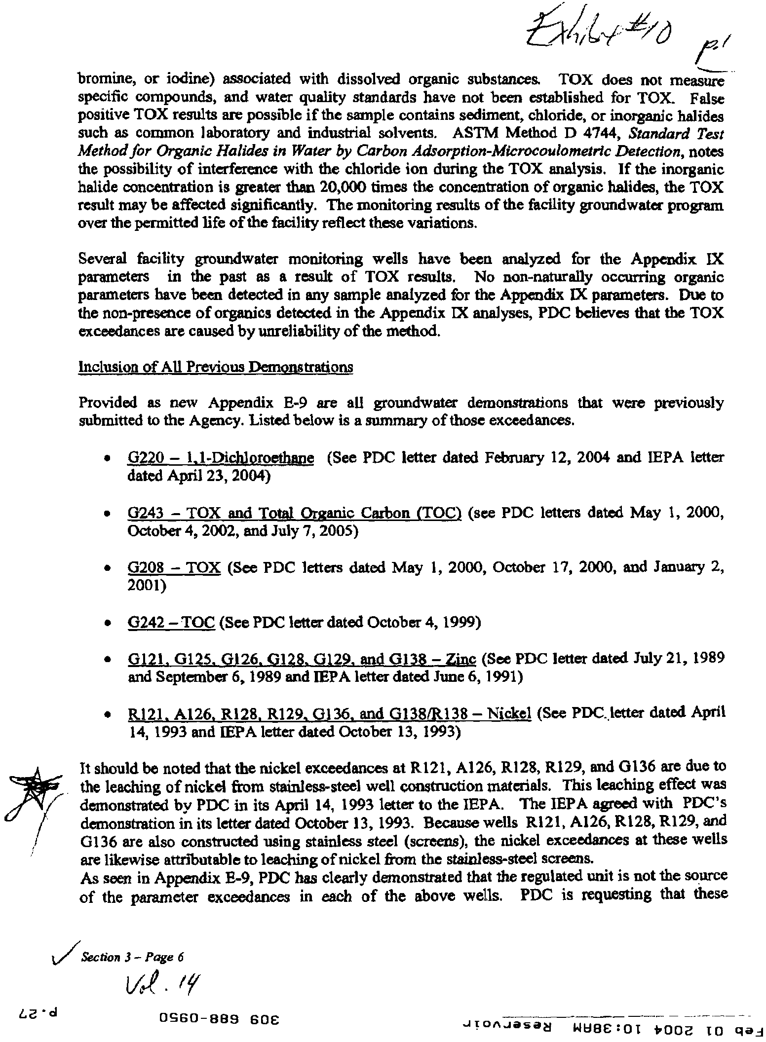
Several facility groundwater monitoring wells have been analyzed for the Appendix IX
parameters in the past as a result of TOX results. No non-naturally occurring organic
parameters have been detected in any sample analyzed for the Appendix IX parameters. Due to
the non-presence of organics detected in the Appendix IX analyses, PDC believes that the TOX
exceedances are caused by unreliability of the method.
Inclusion of All Previous Demonstrations
Provided as new Appendix E-9 are all groundwater demonstrations that
were
previously
submitted to the Agency. Listed below is a stunmary of those exceedances.
•
glanunsbaSn
i
ro?
(See PDC letter dated February 12, 2004 and IEPA letter
dated April 23, 2004)
•
0243 – TOX and Total Or
g
anic Carbon (TOG) (see PDC letters dated May 1, 2000,
October 4, 2002, and July 7, 2005)
•
G208 – TOX (See PDC letters dated May 1, 2000, October 17, 2000, and January 2,
2001)
•
0242 – TOC (See PDC letter dated October 4, 1999)
• G121. G125 e126
G128. G129 and GI38 – Zinc (See PDC letter dated July 21, 1989
and September 6, 1989 and IEPA letter dated June 6, 1991)
•
R121. Al26. R128. R129. 0136. and G138/R138 – Nickel (See PDC.Ietter dated April
14, 1993 and IEPA letter dated October 13, 1993)
It should be noted that the nickel exceedances at R121, Al26, R128, R129, and 0136 are due to
the leaching of nickel from stainless-steel well construction materials. This leaching effect was
demonstrated by PDC in its April 14, 1993 letter to the IEPA. The IEPA agreed with PDC's
demonstration in its letter dated October 13, 1993. Ber•i
g
e wells R121, Al26, R128, R129, and
0136 are also constructed using stainless steel (screens), the nickel
exceedances
at these wells
are likewise attributable to leaching of nickel from the stainless-steel screens.
As seen in Appendix E-9, PDC has clearly demonstrated that the regulated unit is not the source
of the parameter exceedances in each of the above wells. PDC is requesting that these
u/7.5ection3-Page6
/v
LE 'd
OS60-889 60E
JTDAJasas
WEIBE
:
OT tro
p
e
TO clad
demonstrations be included in the Part B Permit for the facility.
Re
q
uest for Semi-Annual Monitoring
PDC proposed in the March 1997 Part B Permit Application to collect four quarters of
background data in order to re-establish background groundwater quality at the facility.
Furthermore, once background groundwater quality was re-established, PDC proposed in the
March 1997 Part B Permit Application to sample the facility monitoring wells on a semi-annual
basis (twice a year). No text has been changed since this was originally proposed in the March
1997 Part B Permit Application. However, PDC requests that the Part B Permit be modified to
specify semi-annual detection monitoring.
Re
q
uest to
?
Monitoring Well G141
Groundwater monitoring well 0141 was intended to be a downgradient well for Trench C-5.
Since Trench C-5 will not be constructed due to the site reconfiguration approved in
Modification No. 56 (December 18, 2002), monitoring well G141 is no longer required. As seen
on revised Table E-9 provided in this submittal, G141 is removed from the list of wells.
Re
q
uest for Revised Monitoring of Wells G139 and 0140
As discussed in the November 7, 2005 meeting, monitoring wells G139 and G140 are located
near the center of the facility and are not compliance point wells. Therefore, PDC is requesting
that monitoring data from these wells not be subject to either comparisons to the facility
background, Groundwater Quality Standard or a PQL.
Well Numbering Amendments
The following monitoring wells should
be
added to the Part B permit:
Well G142 was added to the groundwater monitoring program in July 1997. In addition,
shallow monitoring well G242 was also installed within 10 feet of well G142 in July
1997. The soil boring log and well construction for these wells were previously
submitted to the Agency.
Monitoring well 0135 was installed at the facility on October 3, 2005. The soil boring
log and well construction report are provided as new Appendix E-2-A. No shallow well
was installed near the well due to no water-bearing unit being encountered during drilling
of well G135.
The following mothering well should be re-designated in the Part B permit:
Shallow monitoring well G243 is incorrectly designated in the Part B as monitoring well
G143. Since the well is a shallow monitoring well, it should be designated as well G243.
The following monitoring wells should be deleted in the Part B permit:
Section 3 – Page
7
sa'd
0660-889 606
JT0A-lasa6
WW6C
:
OI
fr002 I0 clad
Revised: October 2007
ILD000805812
Page III-1
A. SUMMARY
Section III CONTAINMENT BUILDING
k
bw
761
t 6 )40'4'4'
A Waste Stabilization Facility is authorized for storage and treatment of hazardous and
non-hazardous wastes that contain free liquids or require treatment. Four storage bays for
incoming waste contain a maximum of eighty-eight
(88)
cubic yards. After treatment in a
mixer (description in Section II of this permit), the waste is moved to the curing area, which
can contain a maximum of
658
cubic yards of treated waste. The containment building is
constructed with a liner system, leachate collection sumps, and a leak detection system. In
addition, treatment using macro encapsulation in containers is allowed inside the containment
building.
B.
WASTE IDENTIFICATION
1. The Permittee may store the hazardous waste identified in Attachment C to this
permit. The Permittee may store non-hazardous waste in these units if the wastes are
managed in accordance with the conditions of this permit that apply to hazardous
waste placed in the same unit.
2. The Permittee may store and treat the following wastes in the containment building,
subject to the terms of this permit:
Description
of Units
Capacity
(cubic yards)
Receiving Bays
B-1
22
B-2
22
B-3
22
B-4
22
Curing Area
658
Mix
Cell A
168
Mix
Cell B
56
3. The Permittee is prohibited Crow-storing or
ting waste in the permitted units not
identified
2_
&this Section.
The tr atment (microencapsulation) unit(s) shall lot accept wastes containing over 2%
(by w 'ght) of mercury.
•
oc •ol
?
0960-889 60E?
moron-Aasea 1-0104
:
0T 4002 TO clad
Revised: October 2007
ILD000805812
Page X-3
Copies of all communications made during the annual review, including minutes and
summaries of the meetings and telephone conversations shall be incorporated into the
operating record for this facility.
B.
Personnel Training
I. The Permittee shall ensure that employees shall not work unsupervised until they have
completed the training program contained in the approved permit application.
a
C.
Operating Hours
1. The Permittee may only accept waste for direct disposal at the facility during daylight
hours.
D.
Reporting
All certifications, logs, or reports which are required to be submitted to the Illinois EPA by
the permittee should be mailed to the following address:
Illinois Environmental Protection Agency
Planning and Reporting Section
Bureau of Land -- #33
1021 North Grand Avenue East
Post Office Box 19276
Springfield, Illinois 62794-9276
E.
Stabilization Facility
1.
The Permittee cannot receive wasted t the stabilization facility if the waste contains
over 2% (by weight) of mercury.
2.
The Permittee cannot receive wastes at the stabilisation facility containing parameters
above land ban restrictions whose BDAT as identified in the Federal Register is not
based on stabilization (i.e., cyanide, organics, etc.).
3.
The Permittee shall plug all the weepholes which allow liquid in the leachate collection
system to discharge to the master sump, except when inspecting for liquids in the
collection system. These plugs shall be removed once each day to determine if liquid is
present in the leachate collection system. The Permittee shall include documentation of
these inspections in the operating record for the facility. The Permittee shall submit an
TE • cl
?
0960-889 60E
?
J
I
DAJasa
N
WH04
:
0I 4002 I0
dift--(-
4
it.
Revised: October 2007
ILD000805812
Page V-5
13.
All litter shall be collected from the landfill site by the end of each working day and
either placed in the fill and compacted and covered that day, or stored in a covered
container.
14. Salvage operations at the landfill are prohibited.
15. No person shall cause or allow any scavenging operations at the landfill site
16.
No person shall cause or allow feeding of farm or domestit animals upon the landfill
site, or with waste delivered to the landfill site.
17.
No person shall cause or allow open burning at the landfill site except in accordance
visions of 35 Ill. Adm. Code: Subtitle B (prior to codification: Chapter 2,
art V: Open urning), of the Rules and Regulations of the Illinois Pollution Control
Board.
_
! 18.4--No person shall lause or allow operation of the landfill so as to cause or threaten or
allow the discharge or emission of any contaminant into the environment in any State
so as to cause or/tend to cause air pollution in Illinois, either alone or in combination
with contamin its from other sources, or so as to violate regulations or standards
adopted by t1y Board under the Act.
19.
'wtlittee shall design, construct, and operate a subsurface gas collection system
in accordance with to the design plans and specifications contained in the Approved
(1 .
.
Conta
iners
containing macro encapsulated wastes must not be placed in the landfill
where the container will be subject to hydrostatic pressures. c
Cg
\\ 2
__-
Yh
i
Permittee shall not place containers LiitZlini
—
niacro encapsulated wastes in the
landfill at an elevation below 83 feet from the final pematted elevation of the final
cover for the closed cell.
22. Leachate must be automatically pumped from the leachate manholes when the
leachate level in the manhole exceeds
12 inches
in depth.
D.
SURVEYING AND RECORDKEEPING REQUIREMENTS
The Permittee shall maintain the following items in the operating record:
26 'd
?
OS60-889 606
?
JTonJasad WEI04
: 0T Hinz TO clai
Revised: December, 2002
ILD000805812
Page V-1
Section V LANDFILLS
A.
SUMMARY
Peoria Disposal Company operates a ninety (90) acre facility, seventy-four (74) of which are
approved for disposal units. The total waste capacity is approximately 2,638,580 cubic
yards. Industries served by the site include earthmoving and agricultural equipment
manufacturers, chemical and steel companies, and breweries. Some wastes are to be treated
at the Stabilization Unit at the facility prior to disposal in a landfill cell.
The landfill is to be operated so as one landfill unit is nearing final capacity and closure, the
next unit is prepared for disposal activity. The final landfill unit is scheduled to close in the
year 2005.
This section presents permit conditions for the landfill according to the regulatory
requirements of 35 IAC 724 Subparts N (Landfills) and G (Closure).
B.
WASTE IDENTIFICATION
1.
The landfill disposal units are, or are to be, located as shown in Attachment F to this
permit.
2.
The Permittee may dispose the following wastes in landfill cells, subject to the terms
of this permit:
Landfill Cell
Designation
Total
Capacity (c.y.)
Surface Area
Dimensions of
Landfill Cell
(Acres)
Barrel Trench
35,000
14
Area
Section A
6,500
8
Section B
190,000
10
Trench C-1
425,929
7.3
Trench C-2
453,846
6.4
Trench C-3
775,939
7.3
Trench C-4
982,865
11.0
Description
of
Hazardous
Waste
See Attachment C
for Waste List and
Hazardous Waste Nos.
and
Non-hazardous
wastes identified
in Special Condition
H.H(2)
6€' d
?
0960-889 606?
'ant/A-Ina?'
WUI4
:
0T sooa I0 gad
11111111
A SUMMARY
Revised: October 2007
ILD000805812
Page V-1
Section V LANDFILLS
4:11k -‘7,1
Peoria Disposal Company operates a ninety (90) acre facility, seventy-four (74) of which
are approved for disposal units. The total waste capacity is approximately 2,638,580 cubict-
yards. Industries served by the site include eartlunoving and agricultural equipment
manufacturers, chemical and steel companies, and breweries. Some wastes are to be treated
at the Stabilization Unit at the facility trior to disposal in a landfill cell. The firral landfill
unit is scheduled to close in the year 2009.
This section presents permit conditions for the landfill according to the regulatory
requirements of 35 III. Adm. Code 724 Subparts N (Landfills) and G (Closure).
B. WASTE IDENTIFICATION
1.
The landfill disposal units are located as shown on the site topographic map contained
n Appendix B-2 of the approved permit application.
2.
The Permittee may dispose the following wastes in landfill cells, subject to the terms
of this permit:
Landfill Cell
Designation
Approximate
Total
Capacity (c.v.)
Surface Area
Dimensions of
Landfill Cell
(Acres)
Description
of
Hazardous
Waste
Barrel Trench
Area
35,000
14
See Attachment C
for Waste List and
•
Section A
6,500
8
Hazardous Waste Nos.
Section B
190,000
10
and
Trench C-1
425,929
7.3
Non-hazardous
Trench C-2
453,846
6.4
wastes identified
Trench C-3
775,939
7.3
in Condition X.H.2
Trench C-4
982,865
11.0
3. The Permittee is prohibited from disposing any waste in the permitted units not
included in Condition B. 2. of this Section.
•E•d
?
OS60-889 60E
?
JTOAJeSag
-
14EIT4
: 0T
boot TO
gad
Revised: October 2007
ILD000805812
Page VIII-1
Section VIII STANDARD CONDITIONS
GENERAL REQUIREMENTS
1.
EFFECT OF PERMIT. The existence of a RCRA permit shall not consti se to
a violation of the Environni
entaLPs-oteetion-
.
Actor
.StibtiLle..G, except for:development,
modificationffleagetition without a permit. Issuance of this permit does not convey
-
rights or any exclusive privilege. Issuance of this permit does not authorize an
jury to persons or property or invasion of other private rights, or infringement of st
or local law or regulations. (35 Ill. Adm. Code 702.181)
2.
PE FF-AC-TIONST
-
Thii permit may be modified,
reissued or
revoked for cause as
specified in 35 Ill. Adm. Code 703.270 through 703.273 and Section 702.186. The filing
of a request by the Permittee for a permit modification or revocation, or a notification of
planned changes or anticipated noncompliance on the part of the Permittee does not stay
the applicability or enforceability of any permit condition. (35 III. Adm. Code 702.146)
V
e"
3.
SEVERABILITY. The provisions of this permit are severable, and if any provision of
this permit, or the application of any provision of this permit to any circumstance is held
invalid, the application of such provision to other circumstances and the remainder of this
permit shall not be affected thereby. (35 III. Adm. Code 700.107)
4.
PERMIT CONDITION CONFLICT. In case of conflict between a special permit
condition and a standard condition, the special condition will prevail. (35 III. Adm. Code
702.160)
5.
DUTY TO COMPLY. The Permittee shall comply with all conditions of this permit
except for the extent and for the duration such noncompliance is authorized by an
emergency permit. Any permit noncompliance constitutes a violation of the
Environmental Protection Act and is grounds for enforcement action; permit revocation
or modification; or for denial of a permit
'
renewal application._ 05 Ill. Adm. Code
DUT
TO-
IAPPLY. If the Per
-.
m
itteewishes to continue an activity allowed by this
702.141 and 703.242)
it after the expiration date of this permit, the Permittee must apply for a new permit
least 180 days before this permit expires, unless permission for a later date has been
anted by the EPA. (35 Ill. Adm. Code 702.142 and 703.125)
7.
PE
T EXPIRATION. This permit and all conditions herein willierneirf in effect
beyond the perm'
the-Permitterhatiibinitted a timely, complete .
•%,
SE•d
?
OS60-8139 60E
?
J T
IDAJasa
a
WaTb:OI
*Doe to clad