RECREATIONAL INFORMATION PERTAINING TO
SKULLING, BOAT LAUNCHES AND OTHER
RECREATIONAL ACTIVITIES
(CORRESPONDS WITH ATTACHMENT K ATTACHED
TO THE AGENCY'S STATEMENT OF REASONS)
Lauren Placek
<Igplacek@villageo?
To:
?
Janet
Pellegrini/R5/USEPA/US@EPA
fworth.com>
?
cc:
Subject: Village of
Worth Boat Launch Revenue
10/15/02 12:11 PM
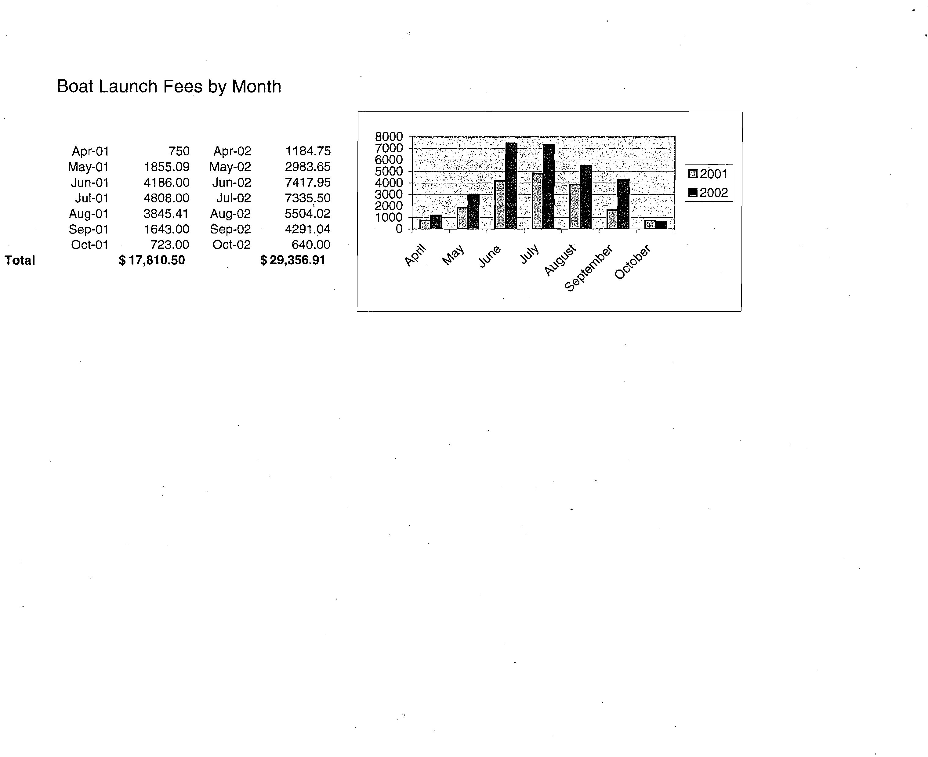
Janet—attached you will find the boat launch revenues for the years
2001 and 2002. As I mentioned last week. Our boat launch is $7 daily
or $50 season pass. The cost for just parking your car and not
launching is $2. Hope this helps.
Lauren G. Placek
Deputy Clerk
Village of Worth
7112 W.. 111th Street
Worth IL 60482
(708) 923-7505
(See attached file: Boat Launch Fees by Month.xls)
\A` 1
?
cc•
,c)&
OG
coe.Q
$ 17,810.50
$ 29,356.91
Apr-01
750
Apr-02
1184.75
May-01
1855.09
May-02
2983.65
Jun-01
4186.00
Jun-02
7417.95
Jul-01
4808.00
Jul-02
7335.50
Aug-01
3845.41
Aug-02
5504.02
Sep-01
1643.00
Sep-02
4291.04
Oct-01
723.00
Oct-02
640.00
Tota
I
8000
7000
6000
5000
4000
3000
2000
1000
0
Boat Launch Fees by Month
Tom Nagawiecki - Fwd: Re: Chicago Area Waterway UAA
?
Page 1
From:
?
Rob Sulski
To:?
Nagawiecki, Tom
Date:?
6/11/2007 10:32:38 AM
Subject:?
Fwd: Re: Chicago Area Waterway UAA
CA,
»> John Mickle <ccdphjohnmickle@yahoo.com> 10/25/2002 2:01 PM >»
Rob Sulski <EPA1512@epa.state.il.us> wrote:
I'm sorry that the Nov. 4 meeting was postponed by USEPA shortly after
my invitation to you. I will keep you posted on the matter, which I
expect is here to stay.
Rob:
I asked Steve Shemanski, from our office, for his observations of these waterway systems since he lives •
closest to the study area. His observation is for the Cal/Sag Channel. I am not certain that this is included
in in the system that is being discussed but the following is a transcript of Steve's comments:
John: As you know I live in Palos Park, a short distance from the Cal/Sag channel.
On several occasions I have observed people water skiing in the Cal/Sag. Both upright on the skis as well
as awaiting the "Towing Boat" to begin moving. That is they are, with the exception of their heads, totally
submerged.
It is my opinion that if the Cal/Sag and other waterways are to be used for such full contact purposes, then
they should meet the IDPH water Quality Standards for Bathing Beaches.
If they do not meet those standards then warning signs should be placed at all boat launching ramps and
similar points of public access that a potential health hazard exists by full body contact or ingestion.
Do you Yahoo!?
Y! Web Hosting - Let the expert host your web site
Tom Nagawiecki - Fwd: RE: Tubers, not the eating kind.
?
Page
1
24
From:?
Rob Sulski
To:?
Nagawiecki, Tom
Date:?
6/11/2007 10:35:39 AM
Subject:?
Fwd: RE: Tubers, not the eating kind.
"Laurene von Klan" <Ivonklan@chicagoriver.org> 7/18/2003 11:07 AM >>>
I took pictures and will send you an image digitally when i get it. They
were lying back in the tubes, butt in the donut hole, with feet dangling in
the water, fishing.
what a sight.
best,
Laurene von Klan
Executive Director
Friends of the Chicago River
Chicago, IL 60605
312 939-0490
312 939-0931 F
www.chicacioriver.org
Chicago River carp - not just for breakfast anymore!
?
Original Message?
From: Rob Sulski ISMTP:Rob.Sulski@epa.state.il.usl
Sent: Friday, July 18, 2003 10:52 AM
To:?
Ivonklan@chicacioriver.org
Cc:
?
frenchrd@cdm.com
Subject:?
Tubers, not the eating kind.
Hey, Laurene. Can you share any details, including photos, of last
Fridays siting of tubing activity in the North Branch at West River
Park? Thanks. Rob
Rob Sulski - Fw: Your canoe tip over
?
Page 1
From:
To:
Date:
Subject:
Hi Stephanie,
"Jayne Lilienfeld-Jones" <lilienfeld-jones@comcast.net>
<BrockSE@cdm.com>
7/21/2003 8:54:00 PM
Fw: Your canoe tip over
Here is my sorry tale...On Friday July 11 I fell into the river while
getting into a canoe and was soaked to my armpits. I was helping Friends of
the Chicago River and their contractors, the Wetlands Initiative and the
Wetlands Research,
Inc., monitoring the Lathrop Wetland that they are attempting to establish
in the turning basin just south of Diversey Avenue on the North Branch. Two
canoes were lashed together side by side to provide stability while walking
(with waders) in the wetland area. At the end of the day the canoes were
separated and two of us decided to paddle back to the storage location on
Goose Island, about 2 miles south. Having become used to the stability of
the lashed canoes, I carelessly stepped in only to have the canoe roll over
on me. The water was shallow and so nothing was hurt but my dignity!
Jayne
?
Original Message ?
From: "Rob Sulski" <Rob.Sulski@epa.state.il.us>
To: <lilienfeld-jones@comcast.net>
Cc: <BrockSE@cdm.com>
Sent: Monday, July 21, 2003 2:01 PM
Subject: Your canoe tip over
> Hey, Jayne. Please forward to Stephanie Brock at CDM, a quick note on
> your canoe tip over so we can add it to the UAA record. Thanks. Rob
CC:?
"Rob Sulski" <Rob.Sulski@epa.state.il.us>
Rob Sulski - lake cal canoe #s ?
Page 1
From:?
"Aaron Rosinski" <setfdirector@ameritech.net>
To:?
"Rob Sulski" <Rob.Sulski@epa.state.il.us>
Date:?
8/15/2003 12:21:40
PM
Subject:
?
lake cal canoe #s
per your request, the numbers of participants was limited by the city--I
know more than the 16 on the 1st trip were interested in attending.
Tomorrow is the second trip--I'm not sure what the projected numbers are
yet.
Aaron Rosinski
?
Original Message ?
From: "Nicole Kamins" <nkamins@cityofchicago.org>
To: <setfdirector@ameritech.net>
Sent: Monday, August 11, 2003 12:33 PM
Subject: canoe #s
Aaron - we had 16 on the trip in June
the trip this weekend doesn't have final numbers yet but we're looking at
around 16 again; could be more depending on how many calls I get this
weekend.
Take care.
Nicole Kamins
Chicago Department of Environment
Division of Natural Resources and Water Quality
30 N. LaSalle, 25th Floor
Chicago, IL 60602
nkamins@cityofchicago.org
(312)744-5959 phone
(312)744-5272 fax
This e-mail, and any attachments thereto, is intended only for use
by the addressee(s) named herein and may contain legally privileged
and/or confidential information. If you are not the intended recipient
of this e-mail (or the person responsible for delivering this document
to the intended recipient), you are hereby notified that any
dissemination, distribution, printing or coping of this e-mail, and any
attachment thereto, is strictly prohibited. If you have received this
e-mail in error, please respond to the individual sending the message,
and permanently delete the original and any copy of any e-mail
and printout thereof.
Tom Nagawiecki - Fwd: lake cal canoe #s
?
Page 1
From:
?
Rob Sulski
To:
?
Nagawiecki, Tom
Date:
?
6/11/2007 10:41:01 AM
Subject:
?
Fwd: lake cal canoe #s
>>> "Aaron Rosinski" <setfdirector@ameritech.net> 8/15/2003 2:45 PM >>>
per your request, the numbers of participants was limited by the city--I
know more than the 16 on the 1st trip were interested in attending.
Tomorrow is the second trip--I'm not sure what the projected numbers are
yet.
Aaron Rosinski
?
Original Message ?
From: "Nicole Kamins" <nkamins@citvofchicado.orq>
To: <setfdirector@ameritech.net>
Sent: Monday,.
A
, ,
ugust 11, 2003 12:33 PM
Subject: canoe fis
Aaron - we had 16 on the trip in June
the trip this weekend doesn't have final numbers yet but we're looking at
around 16 again; could be more depending on how many calls I get this
weekend.
Take care.
Nicole Kamins
Chicago Department of Environment
Division of Natural Resources and Water Quality
30 N. LaSalle, 25th Floor
Chicago, IL 60602
nkamins@cityofchicado.orq
(312)744-5959 phone
(312)744-5272 fax
This e-mail, and any attachments thereto, is intended only for use
by the addressee(s) named herein and may contain legally privileged
and/or confidential information. If you are not the intended recipient
of this e-mail (or the person responsible for delivering this document
to the intended recipient), you are hereby notified that any
dissemination, distribution, printing or coping of this e-mail, and any
attachment thereto, is strictly prohibited. If you have received this
e-mail in error, please respond to the individual sending the message,
and permanently delete the original and any copy of any e-mail
and printout thereof.
p
Tom Nagawiecki - Fwd: Jet Ski Photos
?
Page 1
From:
?
Rob Sulski
To:?
Nagawiecki, Tom
Date:?
6/11/2007 10:42:03 AM
Subject:?
Fwd: Jet Ski Photos
>>> "Nathan Aaberg" <naaberg@chicagoriver.org> 9/17/2003 6:50 PM >»
Dear Rob and Ron:
I just wanted to share with you photos of jet skiers who were on the South Branch during our Flatwater
Classic paddling event on 8/10/03. The photos were taken just north of Roosevelt Road. One of the jet
skiers was later pulled over by the Coast Guard for violating the no wake zone.
As the photos are rather large, I'll be sending them one at a time.
Best wishes,
Nathan Aaberg
Development Writer
Friends of the Chicago River
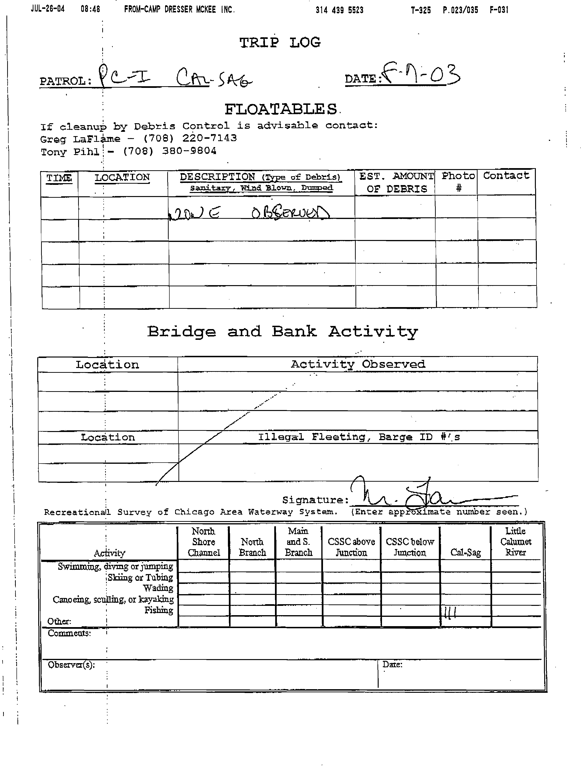
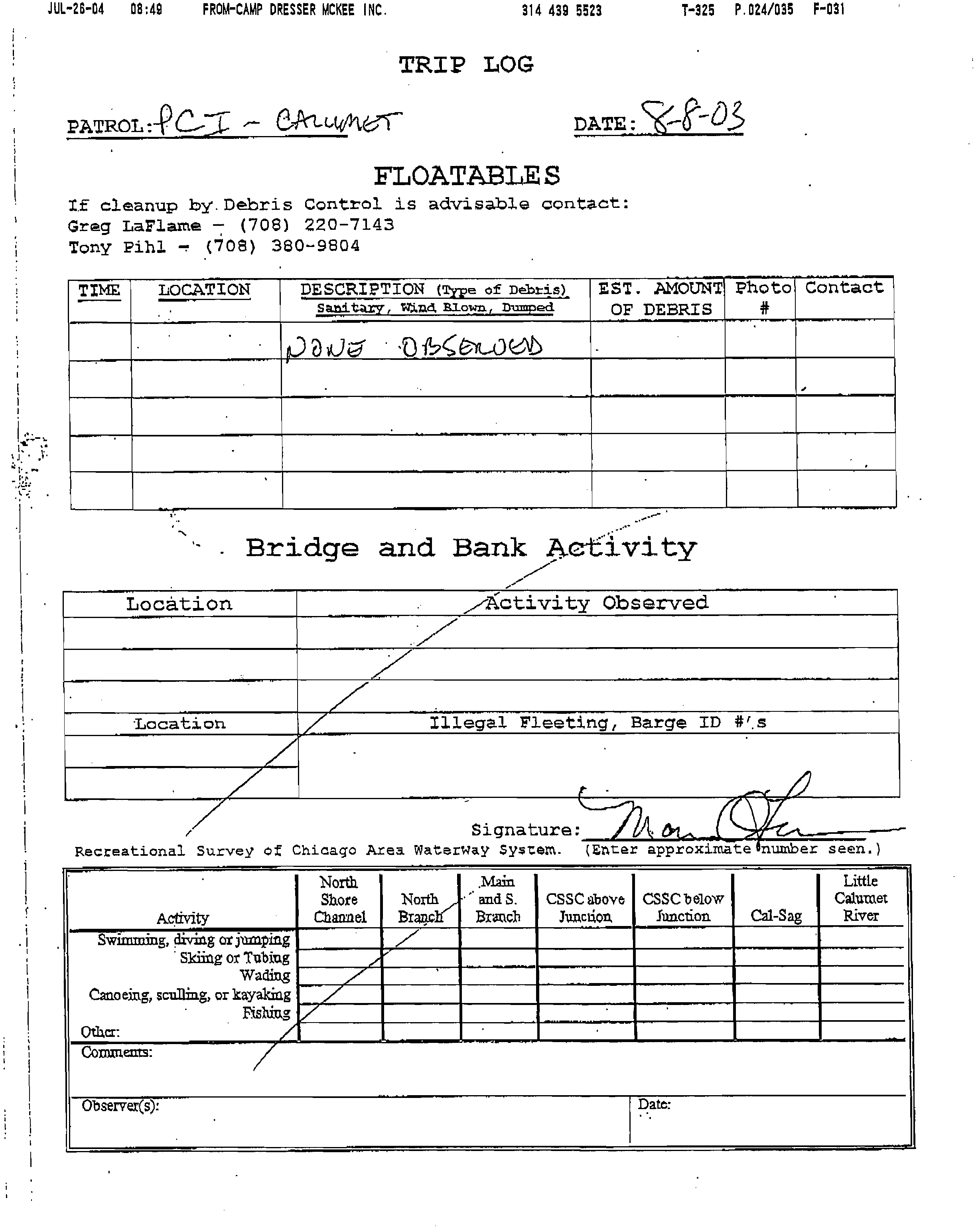
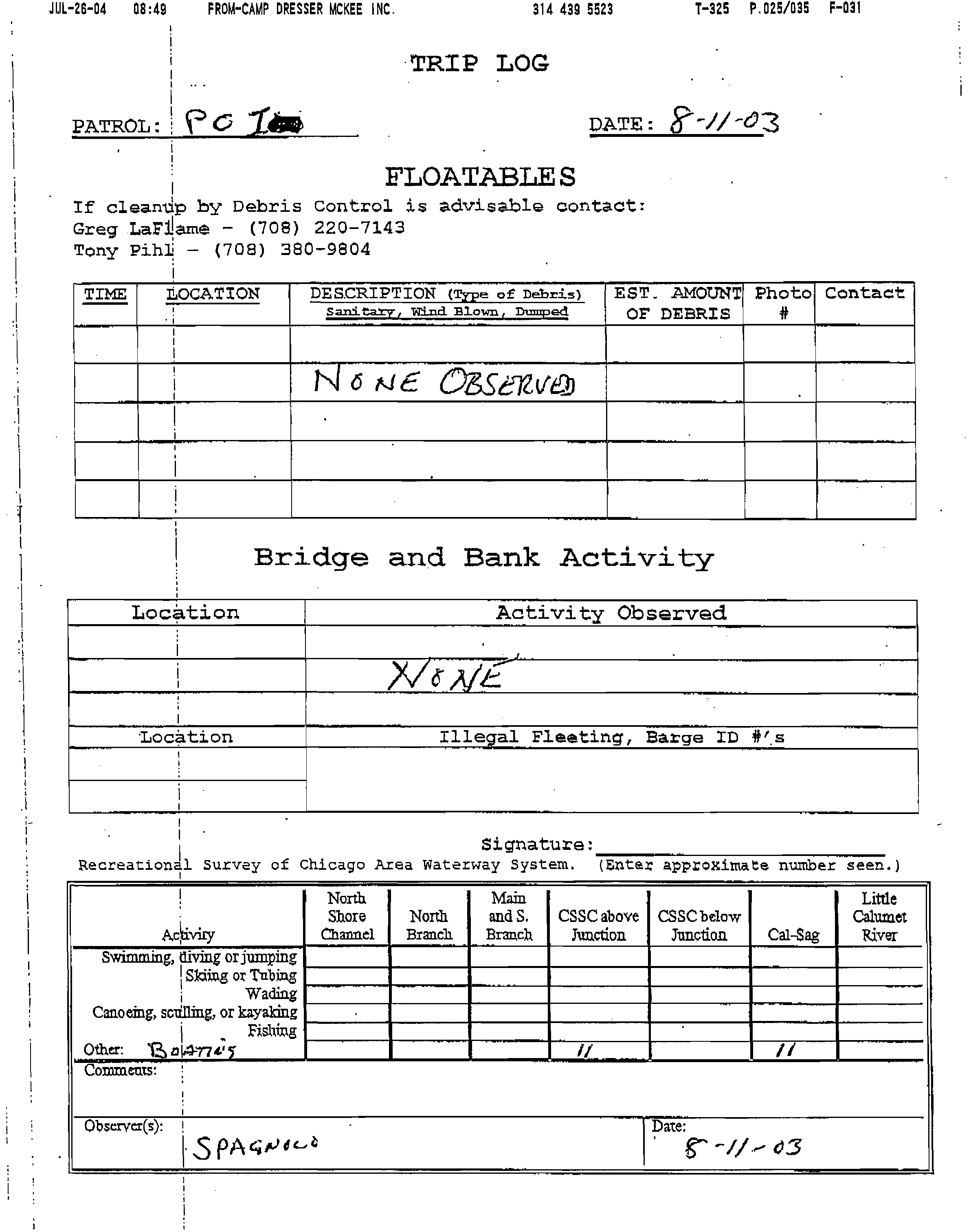
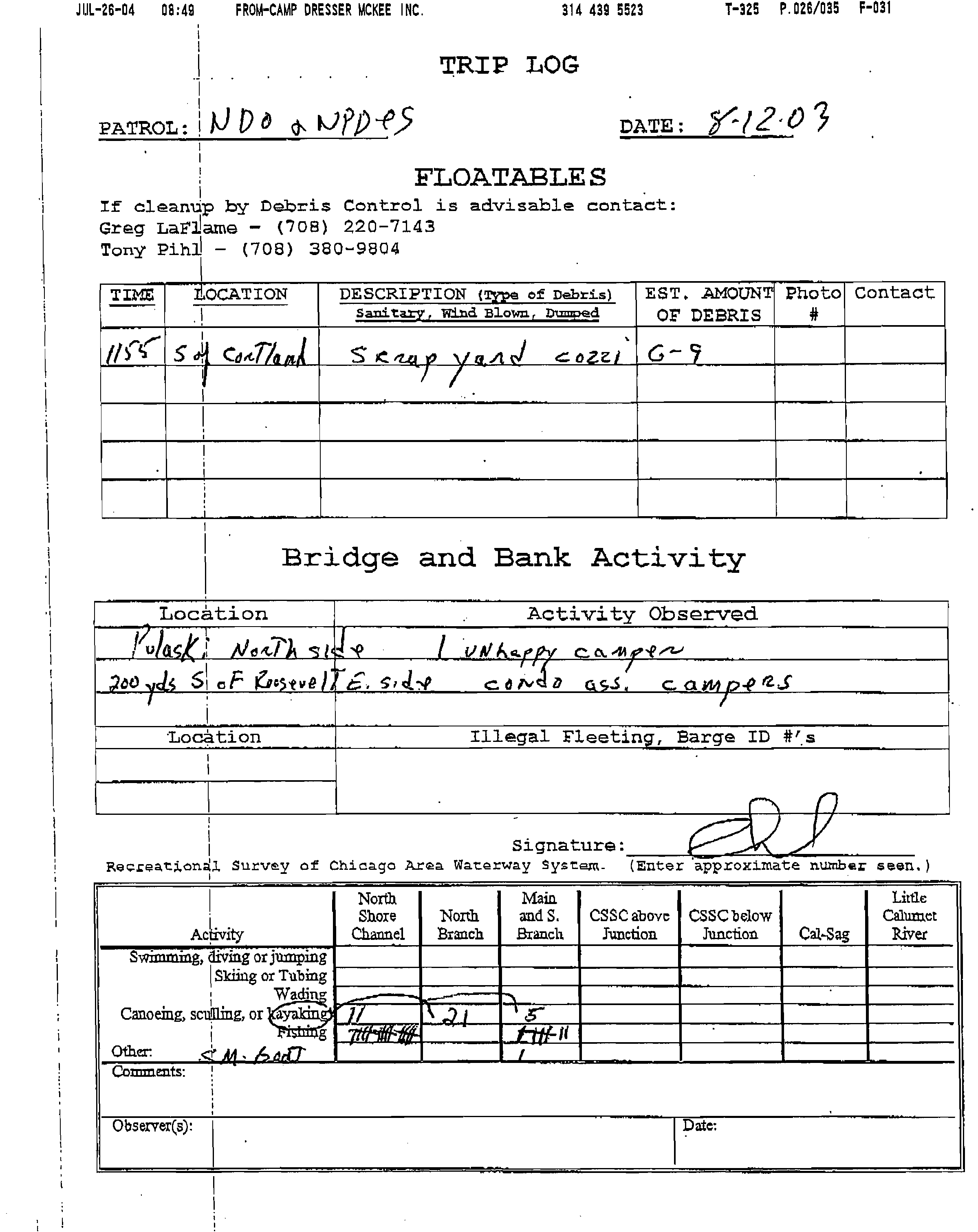
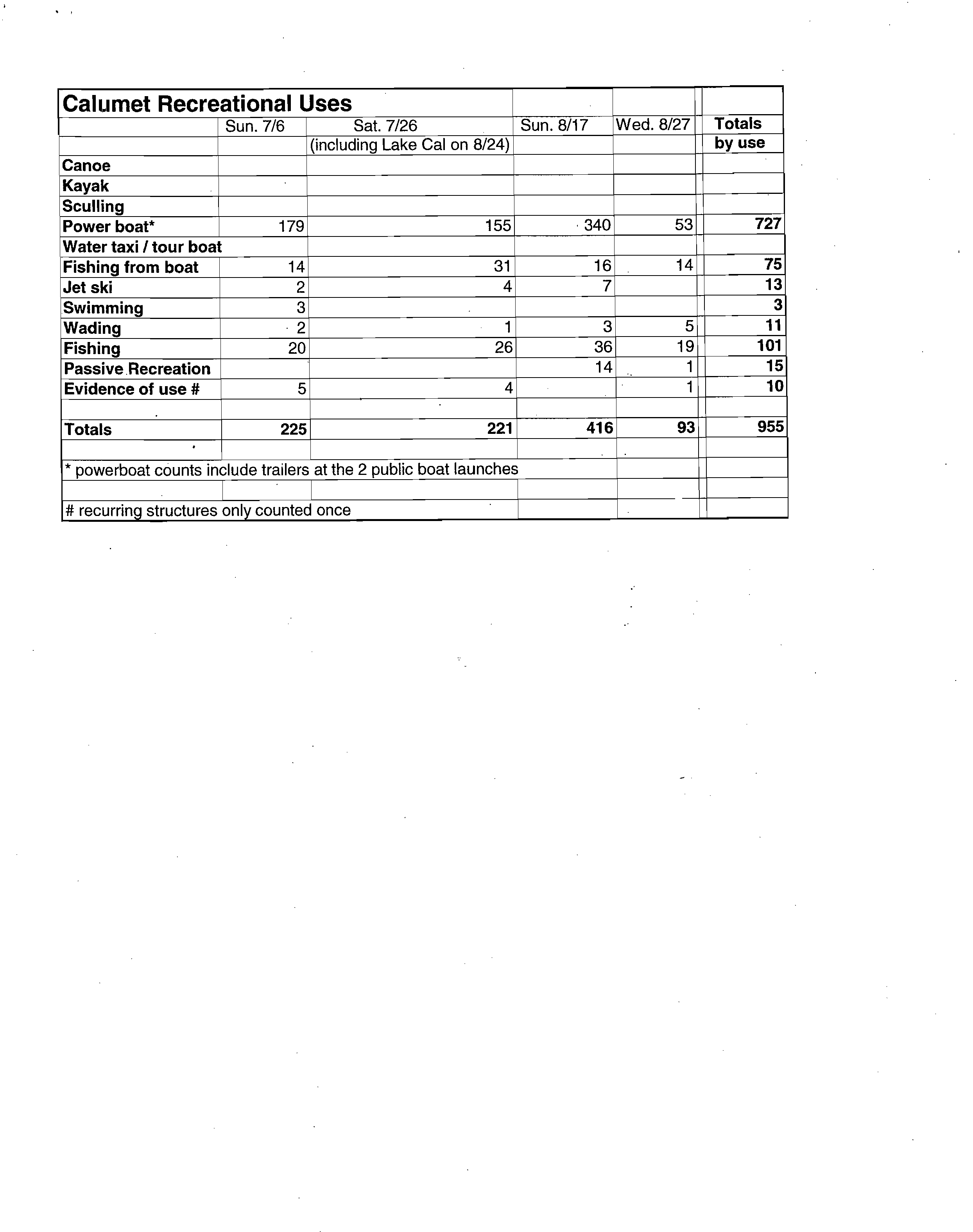
RECREATIONAL USES OBSERVED
ON THE CHICAGO AREA WATERWAYS
SUMMER 2003
Jayne Lilienfeld-Jones
3
October 2003
Background
As part of the Use Attainability Analysis currently being undertaken by the Illinois
Environmental Protection Agency, I conducted surveys of water-related recreation on the
Chicago River, Little Calumet River, Cal Sag Channel, and Lake Calumet. I made site
visits to the Chicago River on 7/13, 7/15, 7/09, the Calumet River on 7/06, 7/26, 8/17,
8/24 (Lake Calumet only), and 8/27. Observations were made from small motorboats
(john boat) with the help of the IEPA on some occasions and CDM (their contractor) on
others. Most observations were made on Saturdays or Sundays when presumably
recreational activity was at its highest.
Summary
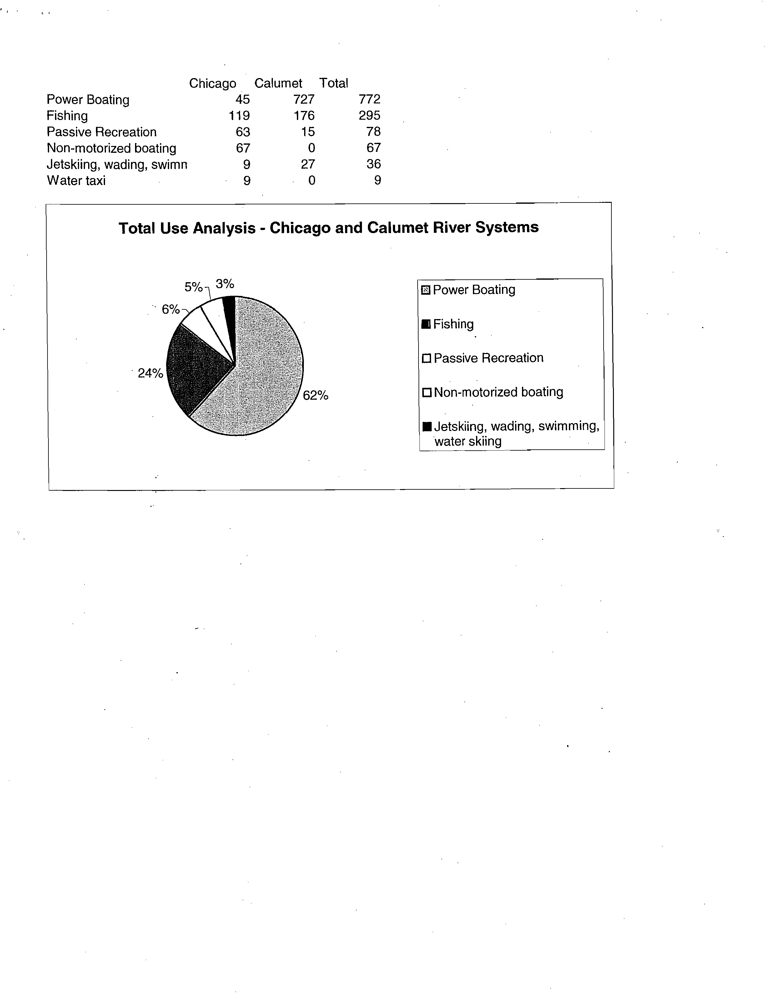
By far the majority of recreational activity was the use of powerboats for cruising (not
including fishing). On the Calumet system I counted 727 cruising power boats and 45
such boats on the Chicago River. The powerboat count on the Calumet includes vacant
trailers parked at the 2 public boat launches on the Cal Sag, so it is likely that the total
count contains some redundancy. Lake Michigan is the likely destination for a good part
of this traffic — especially on the Calumet River. I never saw any commercial traffic
going through the O'Brien Lock. On the downtown section of the Chicago River there
are tour boats and water taxis. The tour boats run most of the year and offer dining,
sightseeing and architectural tours. The water taxis mostly ferry people between the two
downtown Metra stations and Michigan Ave.
After power boating, the most popular form of recreation for both the Chicago River and
the Calumet River is fishing. Fishing from the bank was observed to be much more
common than fishing from a boat. I counted a total of 101 bank anglers on the Calumet
system, and 111 on the Chicago River. I counted only 8 boat anglers on the Chicago
River, while on the Calumet there were 75. Most of those boats were 'bass boats'
designed specifically for fishing.
I saw little commercial traffic on the Chicago River (excluding tour boats, water taxis and
MWRD cleanup boats). I observed a barge moored at Cozzi Steel on the North Branch
south of Cortland Street being loaded with scrap metal. There was also a barge being
loaded with construction materials at the Material Service Corp. yard near the southern
tip of Goose Island. Under a South Branch bridge a barge was used as a construction
platform. Of course I observed barge traffic on the Calumet. Several times we hugged
the side of Cal Sag Channel as a raft of 6 barges (which the tow operators refer to as a 6-
pack) powered by a tug passed. I was 'struck by the fact that all these barges plus the tug
create less wake than most of the powerboats we saw. We also witnessed the arrival of
an exceptionally large barge, constructed with an aftward niche for an inserted tug (I
don't know the name for this kind of arrangement) that had just come in from Lake
Michigan and was unloading at Lafarge, a slag processing facility in the Calumet River
turning basin. There were always barges moored at the junction of the Cal Sag and the
Sanitary & Ship Canal. This is most likely due to the proximity of Hannah Marine,
which operates a large fleet of tugs.
Physical description of the Chicago River
The North Shore Channel begins at Wilmette Harbor, and passes through the
municipalities of Wilmette, Evanston, Skokie, Lincolnwood, and Chicago. The channel
banks are owned primarily by the Water Reclamation District of Greater Chicago, and are
leased as public open space for the majority of the channel. The banks are sloped earth,
and are mostly densely vegetated with weedy trees. Access to the water is limited to
street ends and few other points. The Skokie Park District has recently completed a
sculling center and canoe launch at Oakton Street, immediately upstream from the
MWRD's North Side Sewage Treatment Plant at Howard Street.
The North Branch of the Chicago River coming from the northwest side of Chicago
discharges into the North Shore Channel just south of Foster Avenue, and the waterway
continues as the North Branch. Downstream from this point land uses along the banks
include residential, public open space, and small amounts of commercial land for several
miles. The banks continue to be sloped earth, but public access to the water increases, as
there are several park and new residential developments that make a point of providing
canoe landings. The new parks and residential developments have replaced weedy tree
growth with higher-value landscaping.
Beginning around North Western Avenue commercial land uses become more
predominant and begin to include more industrial land as well. This pattern continues
nearly to the Loop. Commercial and industrial land also tends to have seawalls
constructed of concrete, steel, or wood, and are not accessible by the public. Commercial
land use developed in the last decade or so in the City of Chicago will have the requisite
30-foot setback from the river, with public access along the river in almost all cases.
Landscaping in these areas excludes weedy trees in favor of ornamentals and higher-
value native species.
Near the Loop land uses include more residential as well as commercial. New
developments will include accessible banks, although most have seawalls which separate
the public from the water by six to eight vertical feet; access into the water is not likely at
such sites.
The South Branch, beginning at Wolf Point, is primarily commercial, with several
notable residential buildings. Access to the water is limited to water taxi stops. The
banks are nearly all seawalls. South of the Loop, land use is composed primarily of
industrial uses, rail yards and boat yards, and some vacant land, although developers are
buying up vacant land for mixed use ventures, to include commercial and residential
land. Ping Tom Park in Chinatown is notable as an exception to the industrial land use.
At Ping Tom Park there is easy access to the water. River City, a residential development
is also an exception to the prevailing land uses. Seawalls and weedy trees predominate.
Bubbly Creek, also referred to as the South Fork of the South Branch has primarily
vacant and industrial land uses, but there is also a relatively new and up-scale single-
family residential area which provides public access along the waterway.
Physical Description of the Calumet Waterways
Lake Calumet, constructed by draining local wetlands, is unused as a port facility. The
margins of Lake Calumet include primarily low earth banks with weedy trees and shrubs.
Because its water source is from Lake Michigan, water quality appears good. There is no
public access, although a golf course is along one shore. From Lake Calumet, the
Calumet River leads to the O'Brien Lock, passing industrial land uses with seawalls.
Downstream from the lock there are significant landfill sites, and a series of small
marinas. Banks are earth slope with some riprap. There is little public access to the
waterway. At Acme Bend, industrial land uses become more intense, and includes the
MWRD's Calumet Sewage Treatment Plant, with its outfall.
Downstream from Acme Bend, the banks become increasingly steep, due to higher soil
elevation. The banks are heavily forested here, with a portion of the left bank being
occupied by Pipe-o-Peace Woods, a facility of the Cook County Forest Preserve District.
A few residential boat docks can be found on the right bank, although residences are only
scattered. This is also where the Water Reclamation District's half dozen sidestream
elevated pool aeration (SEPA) stations are to be found; they lift water from the waterway
and let it trickle back to entrain oxygen to be dissolved into the water.
Around 86th
Avenue (at Palos Hills), the land along the Cal-Sag Channel is leased by the
Water Reclamation District to the Cook County Forest Preserve District and is heavily
forested. This area is also where bedrock is at the surface, and the waterway's banks are
composed of incised Silurian dolomite, or rock cut. Although accessible to the public,
there are no facilities for boat launching or for individuals to get near to the water:
Beyond the banks are spoil piles left from when the Cal-Sag Channel was constructed
100 years ago. This land use continues for several miles, to the junction of the Cal-Sag
with the Sanitary and Ship Canal. There is no land use except for the Forest Preserves for
this reach.
Direct contact with the water
I observed several jet skiers – 6 on the Chicago River and 13 on the Calumet system. I
interviewed John Bickness of the Worth Police Department who manned the boat launch
at Howe's Landing on 7/26. He reported 30 jet skis launched on Sunday July 13. To get a
better idea of the number of jet skiers on the Calumet, Bickness suggested that I come out
to the boat launch on a Sunday to do a count. From this I gather that I've only observed a
small sample of the actual jet skiing activity on the Calumet waterway.
I observed one teenage boy trying to water ski on a boogie board in the Cal Sag. As he
was being dragged behind the boat, I observed a considerable amount of water being
sprayed into his mouth, eyes, and nose. I think Rob Sulski (IEPA) and Ron French
(CDM) also saw some water skiing on their survey trip in July. The 3 people I observed
swimming in the Little Calumet were attempting to hitch their disabled jet ski to a boat so
it could be towed. This happened right in front of the main outfall of the Calumet Sewage
Treatment Plant.
Whenever we encountered people in direct contact with the water we warned them about
the health risks. With few exceptions, they appeared either unconcerned or
uncomprehending. (We must have seemed like the police). I didn't see any swimming in
the Chicago River but I did see 2 rope swings, one between Cortland and Ashland, the
other north of Irving in Horner Park. I also observed a rope swing on the Cal Sag near
Stony Creek. There is no indication how frequently the rope swings are used but it
indicates the likelihood of children in the water.
Most waders entered the water in the process of launching boats. On the Chicago River
two of the three waders were associated with the canoe livery at Clark Park and the other
was fishing near the waterfall. On the Calumet, I noticed boaters standing in the water up
to their thighs while trying to launch a boat from a trailer. One woman had her feet in the
water while watching her 3 dogs swim in the Little Calumet. She reported that the dogs
swam regularly and were not adversely affected. I also saw a woman dangling her feet in
the water at a SEPA station.
Powerboats
By far the vast majority of recreational traffic on both waterways is powerboats. There
are a number of marinas along the Little Calumet that serve the recreational boating
community. There are also public boat ramps at Alsip, Worth, and in the Cook County
Forest Preserves. On July 26 we observed a
poker run.
Boaters pay a fee and race
between participating marinas in an attempt to assemble a winning poker hand. Alcohol
seems a part of the process. The event seemed to attract boaters who raced around the
Little Calumet in huge cigarette boats. Cigarette boats are designed for racing and I
understand are very expensive to run (one boater told me it cost him $800 to fill his tank).
Nevertheless they seem to be popular. Even without a special event there is considerable
powerboat traffic throughout the system. The boaters seemed very friendly. They always
waved to us as they sped by, but we were left to negotiate some sizeable wakes. In
CDM's small johnboat, we were almost swamped on several occasions.
On the Chicago River I observed plenty of powerboats as well. One of the main
differences is that there are fewer marinas. Two out of the three times on the Chicago
River we put in at the South Branch Marina under the Dan Ryan Expressway. The South
Branch Marina, Crowley's, and River City were the only marinas I noticed until we got
to the Ravenswood area on the North Branch. I did observe additional docks along the
North Branch, including those at 'Slow Down' and 'Green Dolphin Street,' both
restaurant/bars near Webster. Some of the recent residential developments on the river
have put up places to moor boats. Friends of the Chicago River has addressed this
growing trend with their newly drafted dock policy.
Fishing
On the Calumet waterway fishing is a very popular form of recreation. Some fishermen
take the sport very seriously driving fancy high tech 'bass boats.' These boats have
powerful motors in the back and small trolling motors in the front. The person fishing is
perched on what looks like a bar stool and can control the trolling motor with a foot
pedal. In the recent past there was a national "Bass Masters" fishing tournament that took
place on the Calumet and other area waterways. On 8/27 we met fisherman Herb Brown,
a Chicago policeman, on Lake Calumet. He has caught shad and bass in Lake Calumet
and the Cal Sag, and reports having seen fry. I specifically asked about fry because of
the question of weather fish were reproducing in the waterway or just moving through. I
also talked with a fisherman at one of the boat launches and he reported that there was a
lot of fish habitat even in the Cal Sag with its rock cut walls. He indicated that fissures in
the rock walls, downed trees, and even debris would serve as fish habitat. I didn't see the
same kind of serious boat-based fishing on the Chicago River. I counted only eight
fishing boats as.compared to 75 in the Calumet
system.
Fishing from the shore is also a common form of recreation along both waterways. One
of the most popular spots is the waterfall at River Park along the North Branch of the
Chicago River. People fish along the wingwalls surrounding the waterfall and the
wooded bank across the river from the weir. I observed one man wading into the river
with his fishing pole, the water reaching nearly to the top of his hip boots. Ping Tom
Park on the South Branch is another popular fishing spot. People sit on the park benches
or on top of the seawall and drop their lines in the water. It seems very serene and was
sometimes difficult to determine who was fishing and who was just relaxing, Fishing at
Ping Tom is similar to what I saw at the Forest Preserve boat launch on the Little
Calumet (could be Pipe o' Peace or Beaubean Woods Forest Preserve). I observed small
groups fishing under bridges, along the overgrown banks, and on outfall structures. My
speculation is that many are from a lower socioeconomic class, or even homeless. Could
they be fishing to supplement their diet? I asked a man who was fishing with a buddy
under the Church St. Bridge on the North Shore Channel. He denied that he ate any of
the fish he caught and seemed to understand about potential toxicity. It's difficult to
know what is really going on without establishing some kind of relationship with
members of this marginalized community. I noticed that many of these people were
minorities, notably Hispanic. Most were older men but I did observe some youths from
time to time. There is a regular fishing spot in one of stormwater outfalls just north of the
North Side Treatment Plant outfall. There are gang signs painted on the wing walls, beer
cans scattered around, and remnants of a campfire. Although I only saw people fishing
there once, it looks as if the site is regularly used.
Canoes and Kayaks and Shells
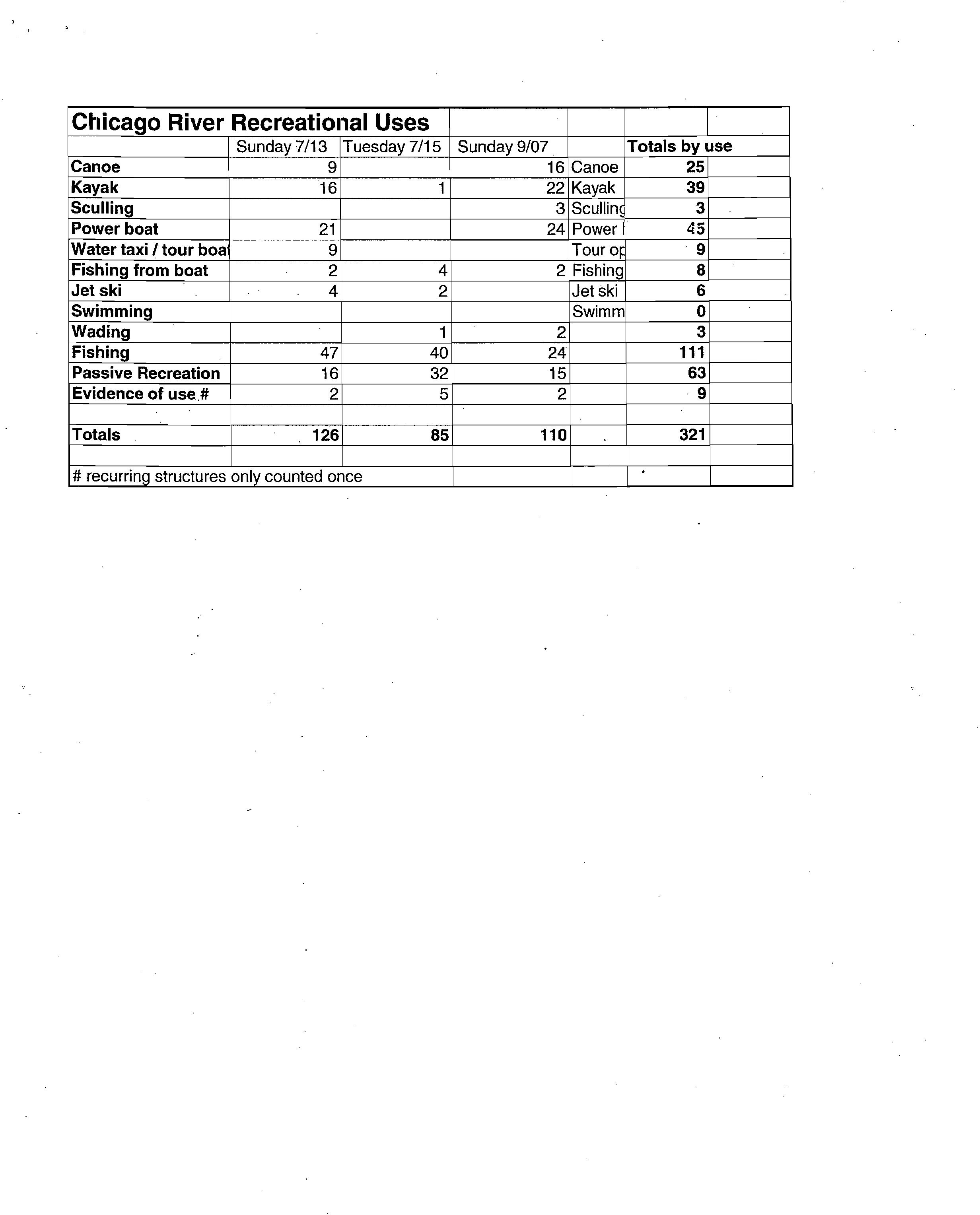
Canoes and kayaks are popular on the Chicago River. I observed a total of 25 canoes and
39 kayaks during my 3 survey trips. I suspect that most of the boats are from
Chicago
River Canoe and Kayak,
a livery located at Clark Park on the North Branch and at the
Skokie Park District boat launch at Oakton on the North Shore Channel. I also observed
canoes and kayaks stored by the sides of buildings like the East Bank Club and at
residences.
I did not observe a single canoe or kayak on the Calumet River. There are several
possible reasons: with so many powerboats and hard edges intensifying the turbulence of
boat wakes it would be treacherous for a small craft; maybe the working class population
around Calumet is not attracted to small human-powered boats; or maybe there are no
outfitters to rent them. Several years ago Friends of the River sponsored a canoe trip to
Lake Calumet area. We put in at the SEPA station next to the Torrence Ave. bridge.
Because the water was shallow it kept the motorboats away. In my opinion, if there were
better access to Lake Calumet, there would be more canoeists.
On my very last survey trip of the Chicago River I saw the Loyola Academy women's
sculling team working out on the North Shore Channel. They had 3 shells and a small
motorized johnboat. In the past I have seen races in which a number of schools compete
on the North Shore Channel. Onlookers sit on the steep bank to watch the races.
Rob Sulski - Fw: recreation survey report 7/6/03
?
Page 1
From:?
"Jayne Lilienfeld-Jones" <lilienfeld-jones@comcast.net>
To:?"Rob Sulski" <Rob.Sulski@epa.state.il.us>
Date:
?
7/16/2003 5:15:05 PM
Subject:
?
Fw: recreation survey report 7/6/03
Hi Rob,
Here is the survey information from Calumet. Hopefully our results are similar. Let me know what you
think.
Are you aware that Chicago River Canoe and Kayak (the livery at Clark Park) has special events such as
'Pub Yaws' and 'Moonlight Paddling' that bring a lot of people out on the river at odd hours. A friend told
me about this. She has gone on a couple of these events over the past few years. FOCR also has canoe
events but I don't have details.
Jayne
?
Original Message ?
From: Jayne Lilienfeld-Jones
To: Laurel O'Sullivan
Sent: Thursday, July 10, 2003 12:54 PM
Subject: recreation survey report 7/6/03
Hi Laurel,
I have attached my survey report for the Calumet waterway. Let me know what you think and what
changes should be made.
Jayne
PS; I have used maps from the Army Corps of Engineers - Charts of the Illinois Waterway.
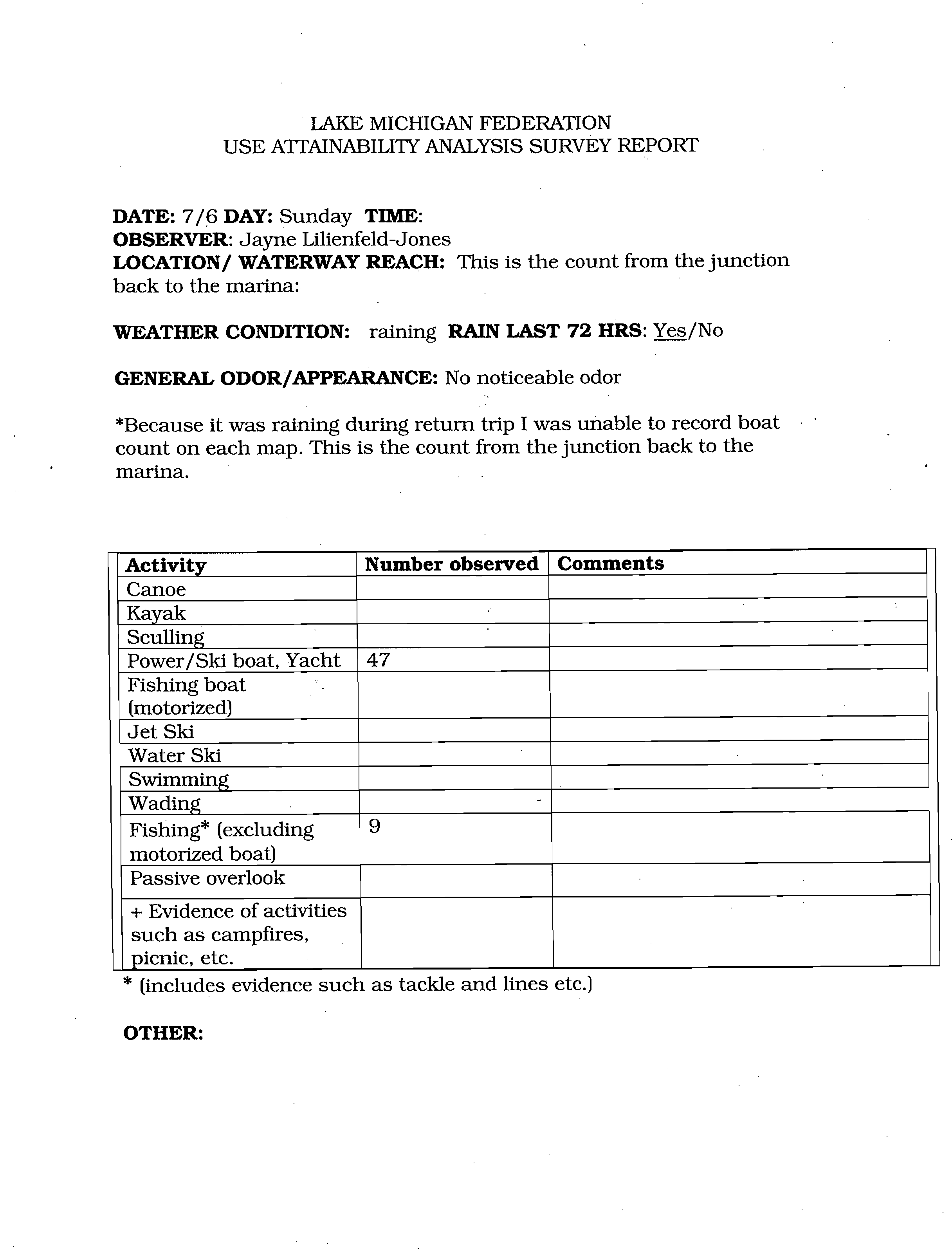
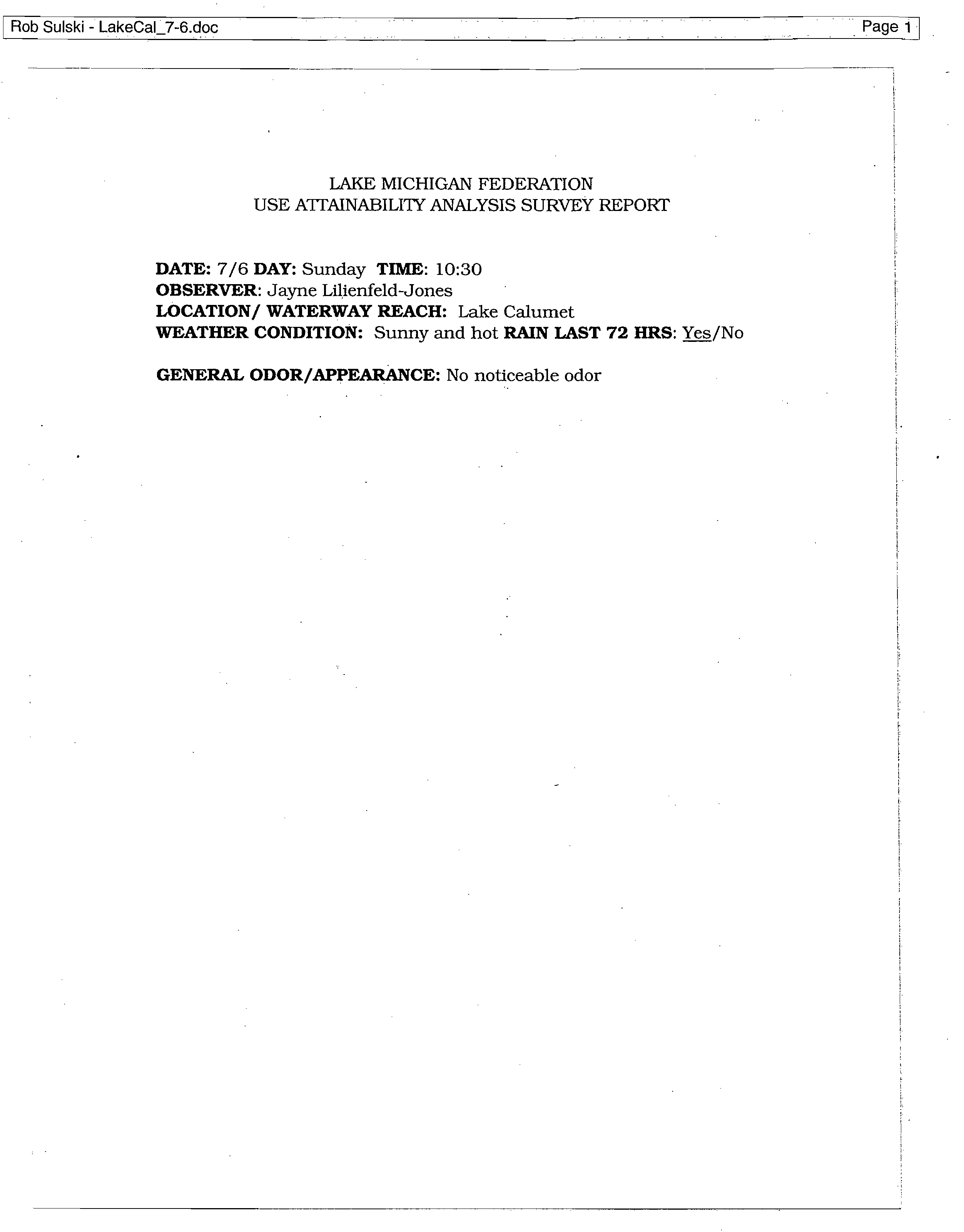
LAKE MICHIGAN FEDERATION
USE ATTAINABILITY ANALYSIS SURVEY REPORT
DATE:
7/6
DAY:
Sunday
TIME:
OBSERVER:
Jayne Lilienfeld-Jones
LOCATION/ WATERWAY
REACH:
This
is the count from the junction
back to the marina:
WEATHER CONDITION:
raining
RAIN LAST 72 HRS:
Yes/No
GENERAL ODOR/APPEARANCE:
No noticeable odor
*Because it was raining during return trip I was unable to record boat
count on each map. This is the count from the junction back to the
marina.
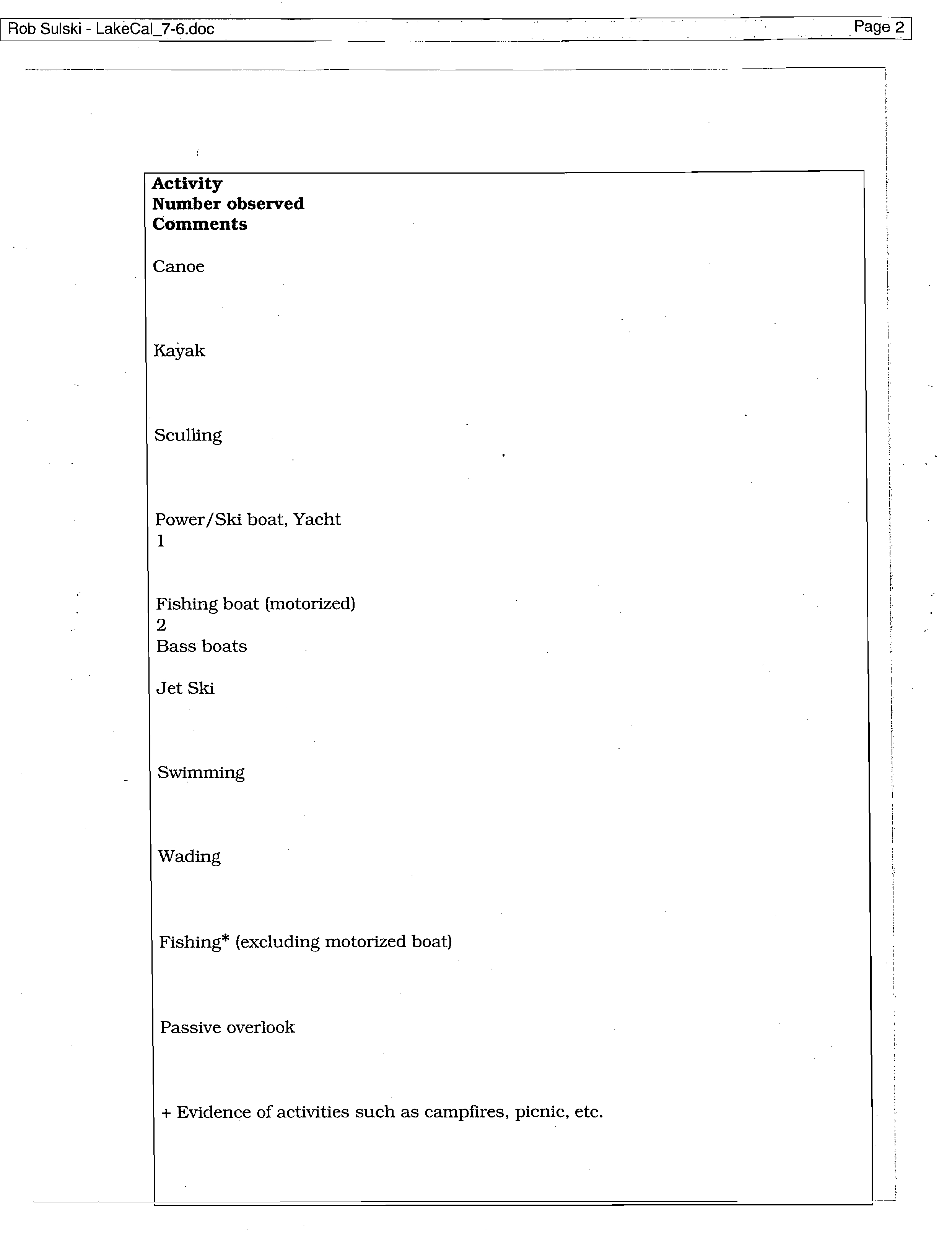
Activity
Number observed
Comments
Canoe
Kayak
Scuffing
Power/Ski boat, Yacht
47
Fishing boat
(motorized)
Jet
Ski
Water Ski
Swimming
Wading
Fishing* (excluding
motorized boat)
9
Passive overlook
+
Evidence of activities
such as campfires,
picnic, etc.
* (includes evidence such as tackle and lines etc.)
OTHER:
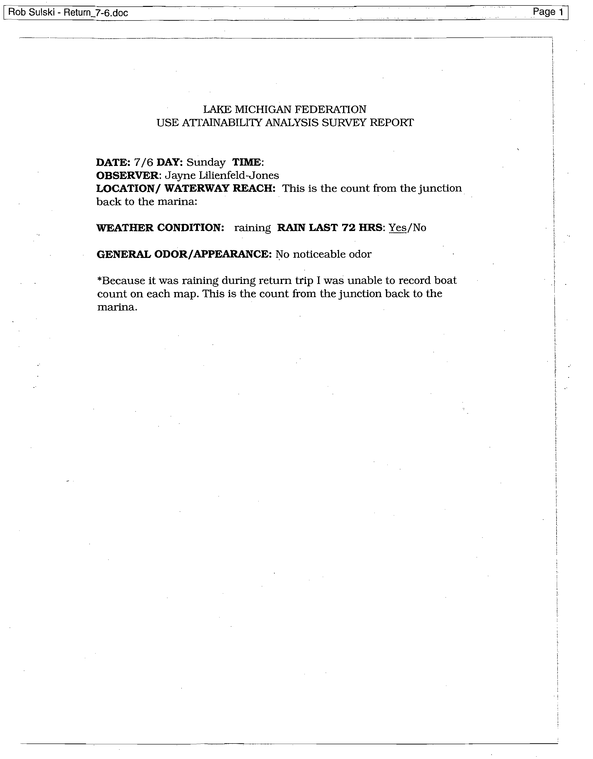
Rob Su!ski - Return_7-6.doc
?
Page 1
LAKE MICHIGAN FEDERATION
USE ATTAINABILITY ANALYSIS SURVEY REPORT
DATE:
7/6
DAY:
Sunday
TIME:
OBSERVER:
Jayne Lilienfeld-Jones
LOCATION/ WATERWAY REACH:
This is the count from the junction
back to the marina:
WEATHER CONDITION:
raining
RAIN LAST 72 HRS:
Yes/No
GENERAL ODOR/APPEARANCE:
No noticeable odor
*Because it was raining during return trip I was unable to record boat
count on each map. This is the count from the junction back to the
marina.
Rob Su!ski - Return_7-6.doc
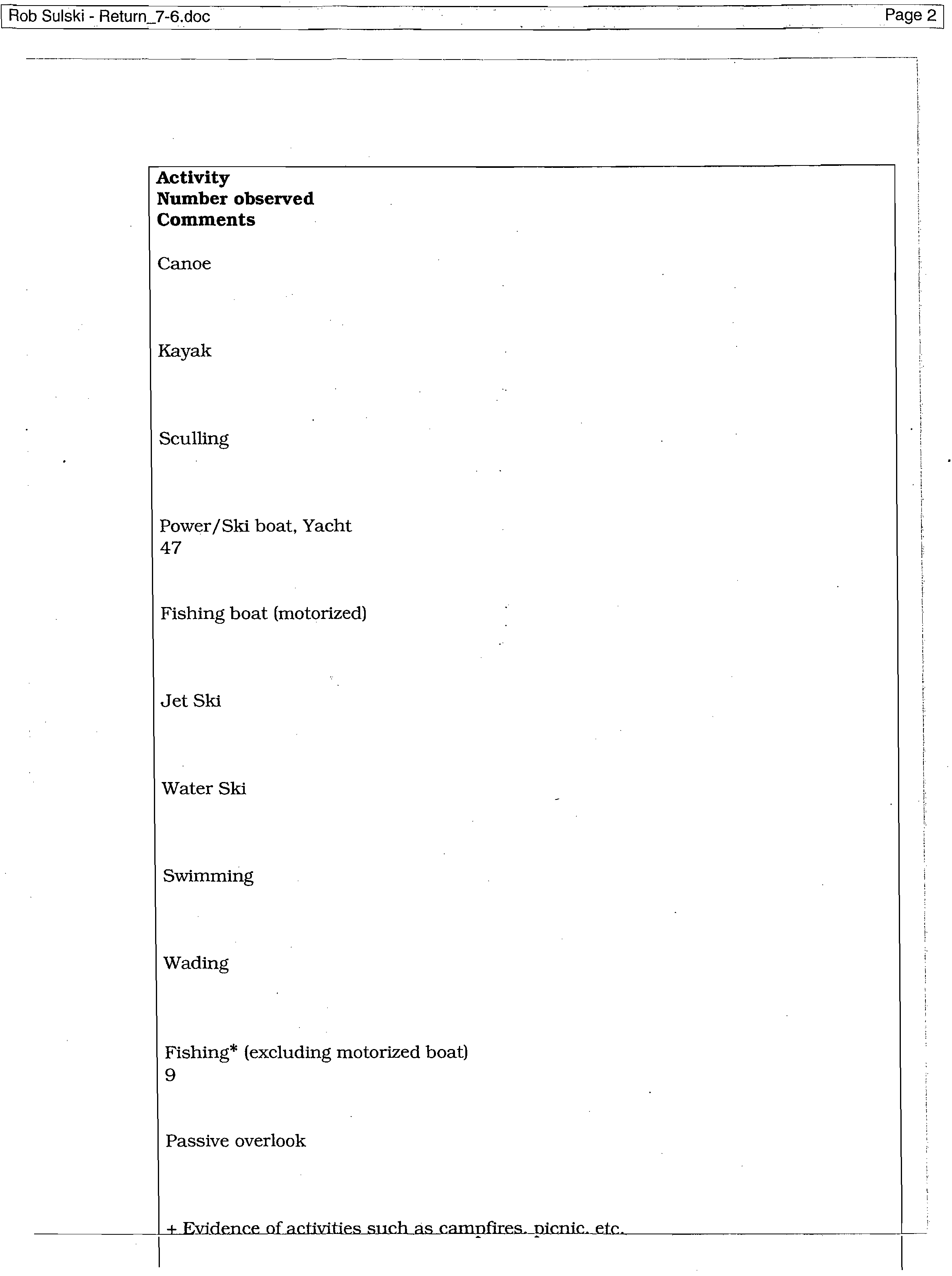
?
Page 2
Activity
Number observed
Comments
Canoe
Kayak
Sculling
Power/Ski boat, Yacht
47
Fishing boat (motorized)
Jet Ski
Water Ski
Swimming
Wading
Fishing* (excluding motorized boat)
9
Passive overlook
+ Evidence of activities such as camnfires. nianic.. etc.
?
Rob Sulski - Return_7-6.doc
?
Page 3
* (includes evidence such as tackle and lines etc.)
OTHER:
Rob Sulski - LakeCal_7-6.doc
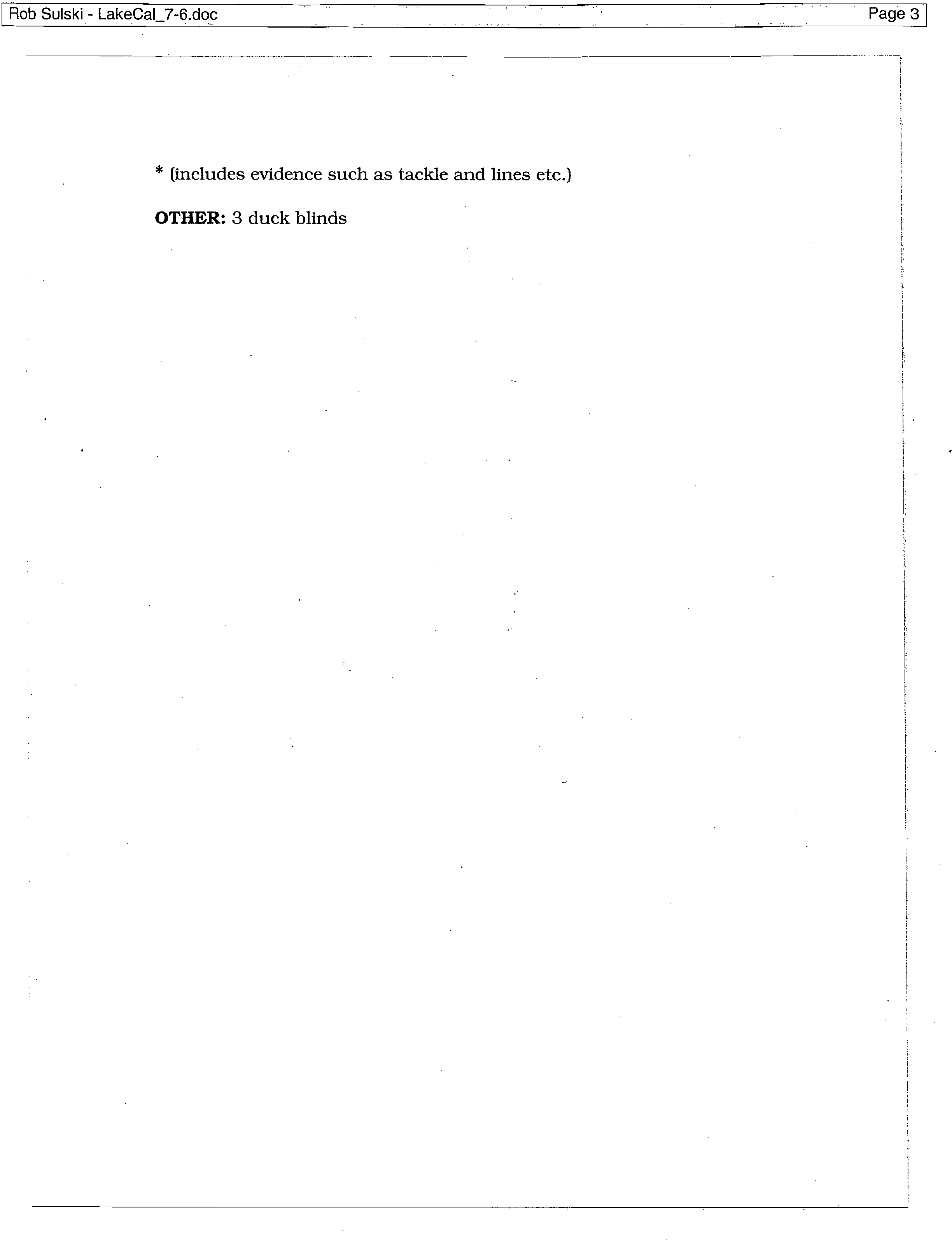
LAKE MICHIGAN FEDERATION
USE ATTAINABILITY ANALYSIS SURVEY REPORT
DATE:
7/6
DAY:
Sunday
TIME:
10:30
OBSERVER:
Jayne Lilienfeld-Jones
LOCATION/ WATERWAY REACH:
Lake Calumet
WEATHER CONDITION:
Sunny and hot
RAIN LAST 72 HRS:
Yes/No
GENERAL ODOR/APPEARANCE:
No noticeable odor
P
Rob Su[ski - LakeCal_7-6.doc
?
Page 2
Activity
Number observed
Comments
Canoe
Kayak
Sculling
Power/Ski boat, Yacht
1
Fishing boat (motorized)
2
Bass boats
Jet Ski
Swimming
Wading
Fishing* (excluding motorized boat)
Passive overlook
+ Evidence of activities such as campfires, picnic, etc.
Rob Su[ski - LakeCal_7-6.doc
?
Page 3
* (includes evidence such as tackle and lines etc.)
OTHER:
3 duck
blinds
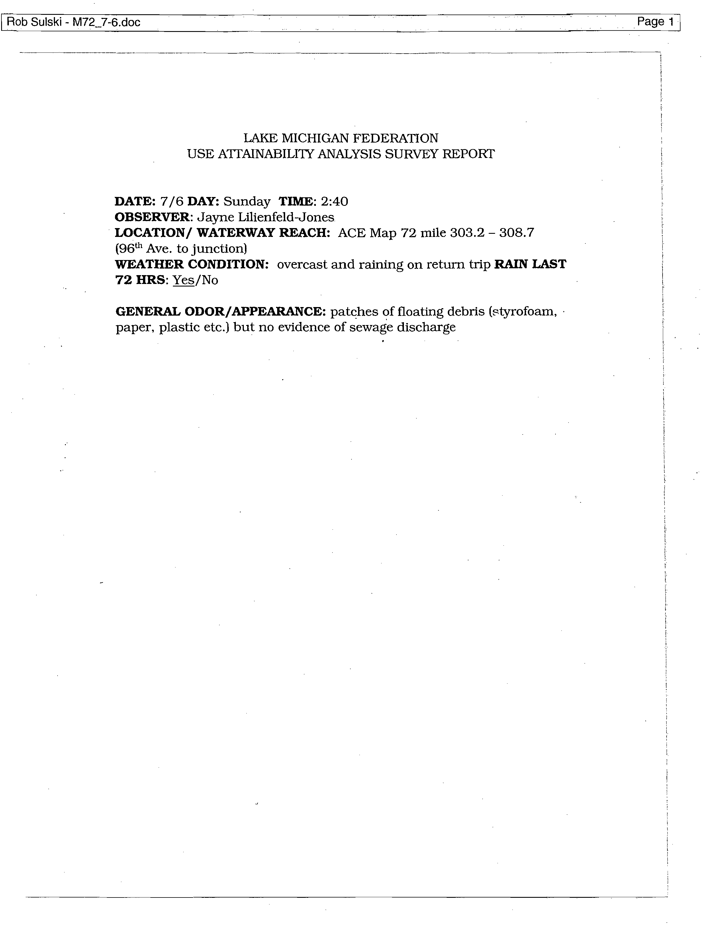
Rob Sulski - M72_7-6.doc
?
Page 1
LAKE MICHIGAN FEDERATION
USE ATTAINABILITY ANALYSIS SURVEY REPORT
DATE:
7/6
DAY:
Sunday
TIME:
2:40
OBSERVER:
Jayne Lilienfeld-Jones
LOCATION/ WATERWAY REACH:
ACE Map 72 mile 303.2 - 308.7
(96th Ave. to junction)
WEATHER CONDITION:
overcast and raining on return trip
RAIN LAST
72 HRS:
Yes/No
GENERAL ODOR/APPEARANCE:
patches of floating debris (styrofoam, •
paper, plastic etc.) but no evidence of sewage discharge
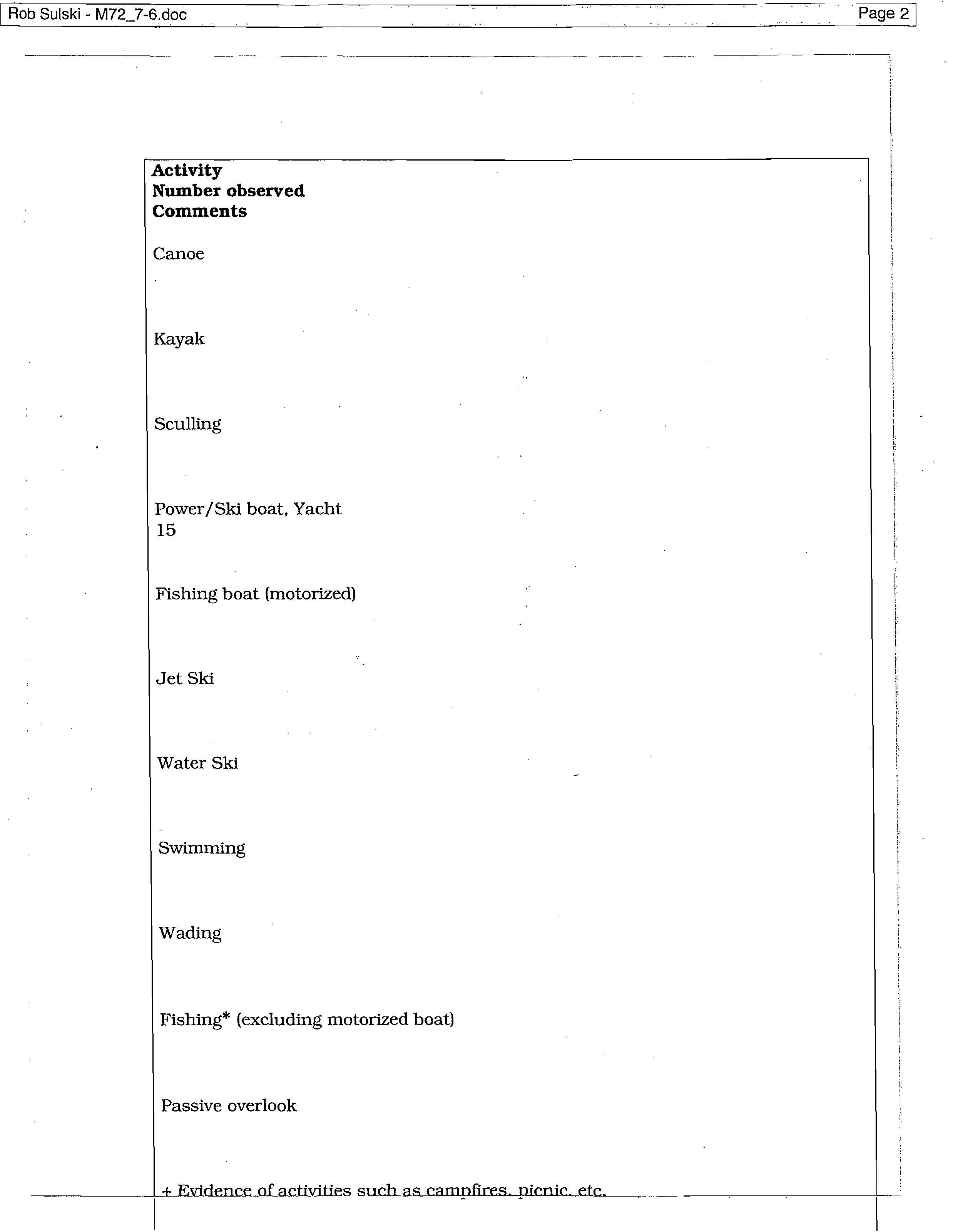
Rob Sulski - M72_7-6.doc
?
Page 2
Activity
Number observed
Comments
Canoe
Kayak
Sculling
Power/Ski boat, Yacht
15
Fishing boat (motorized)
Jet Ski
Water Ski
Swimming
Wading
Fishing* (excluding motorized boat)
Passive overlook
+ Evidence of
activities such as campfires.
nicnic_e_te._
?
Rob Su!ski - M72_7-6.doc
?
Page 3
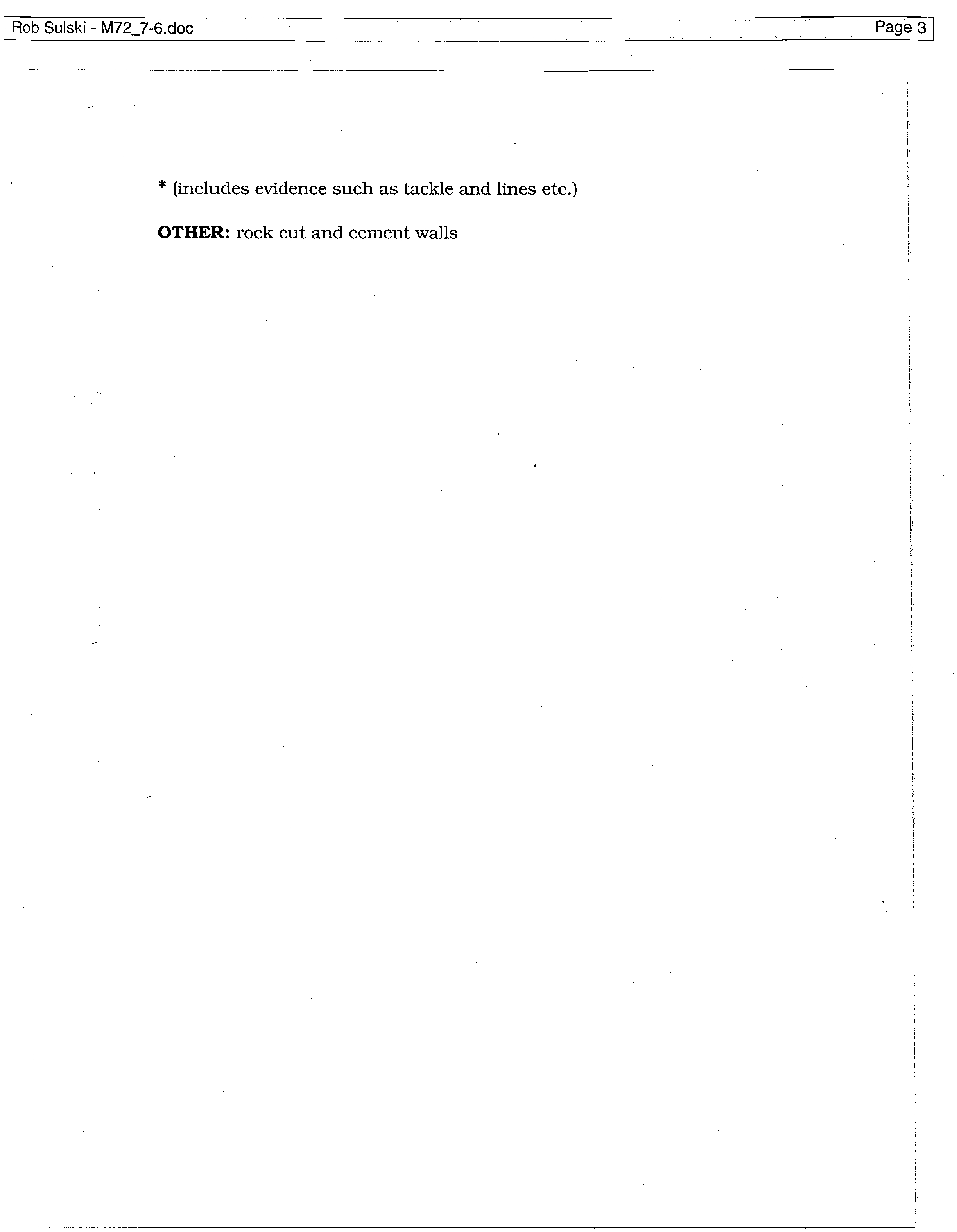
* (includes evidence such as tackle and lines etc.)
OTHER:
rock cut and cement walls
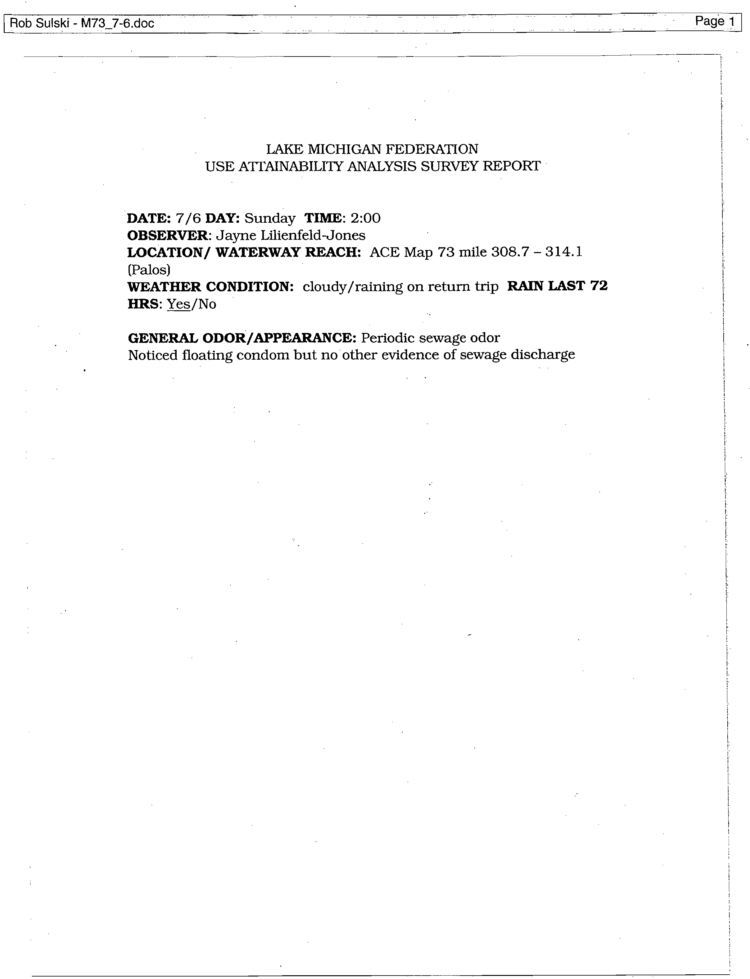
Rob Sulski - M737-6.doc
LAKE MICHIGAN FEDERATION
USE ATTAINABILITY ANALYSIS SURVEY REPORT
DATE:
7/6
DAY:
Sunday
TIME:
2:00
OBSERVER:
Jayne Lilienfeld-Jones
LOCATION/ WATERWAY REACH:
ACE Map 73 mile 308.7 - 314.1
(Palos)
WEATHER CONDITION:
cloudy/raining on return trip
RAIN LAST 72
HRS:
Yes/No
GENERAL ODOR/APPEARANCE:
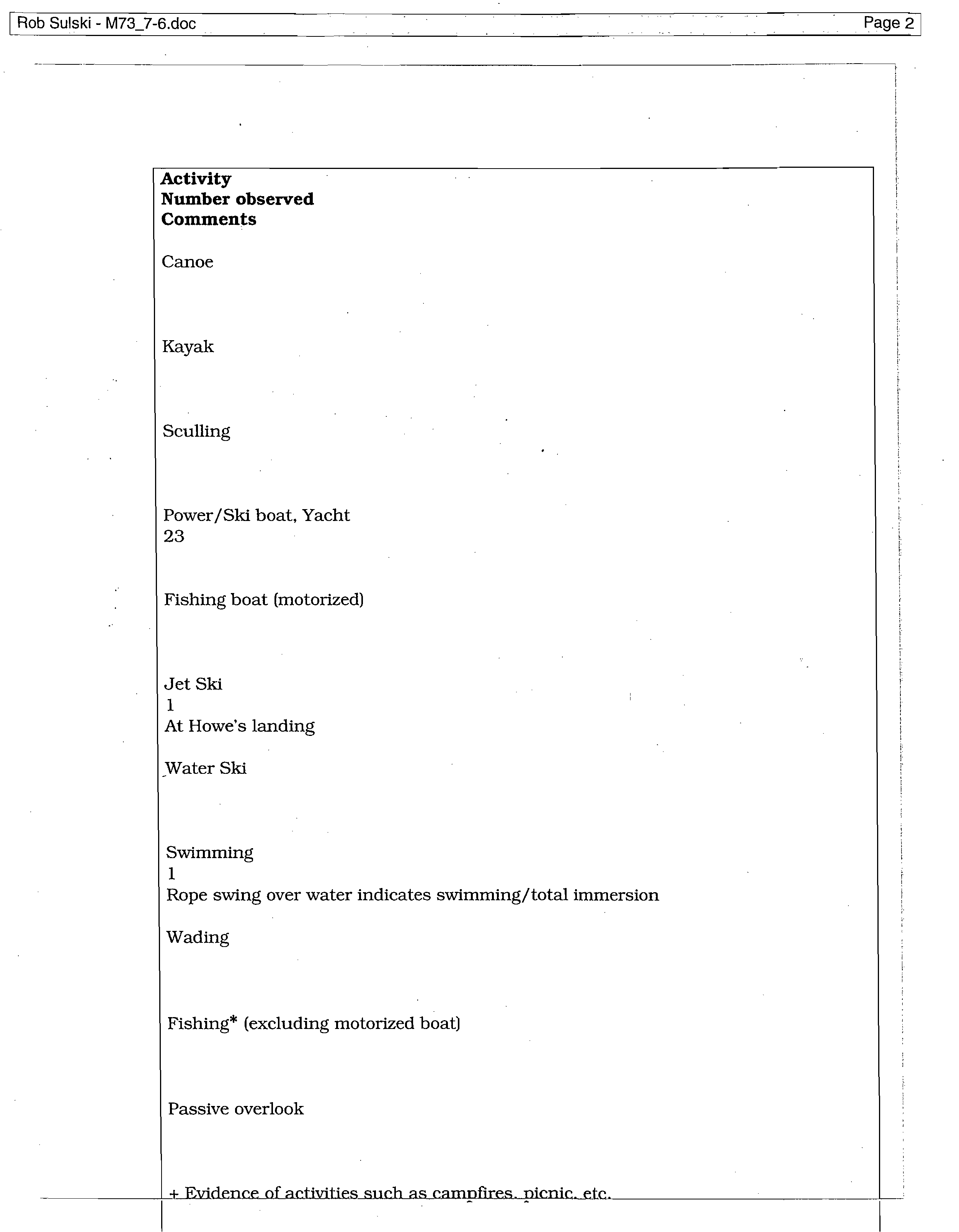
Periodic sewage odor
Noticed floating condom but no other evidence of sewage discharge
Rob Sulski - M73_7-6.doc
?
Page 2
Activity
Number observed
Comments
Canoe
Kayak
Sculling
Power/Ski boat, Yacht
23
Fishing boat (motorized)
Jet Ski
1
At Howe's landing
Water Ski
Swimming
1
Rope swing over water indicates swimming/total immersion
Wading
Fishing* (excluding motorized boat)
Passive overlook
Rob Su!ski - M73_7-6.doc
* (includes evidence such as tackle and lines etc.)
OTHER:
Trailer count at Howe's Landing boat launch = 53
Trailer count at. Worth boat launch = 43
Rob Su!ski - M74_7-6.doc
?
Page 1
LAKE MICHIGAN FEDERATION
USE ATTAINABILITY ANALYSIS SURVEY REPORT
DATE:
7/6
DAY:
Sunday
TIME:
1:10
OBSERVER:
Jayne Lilienfeld-Jones
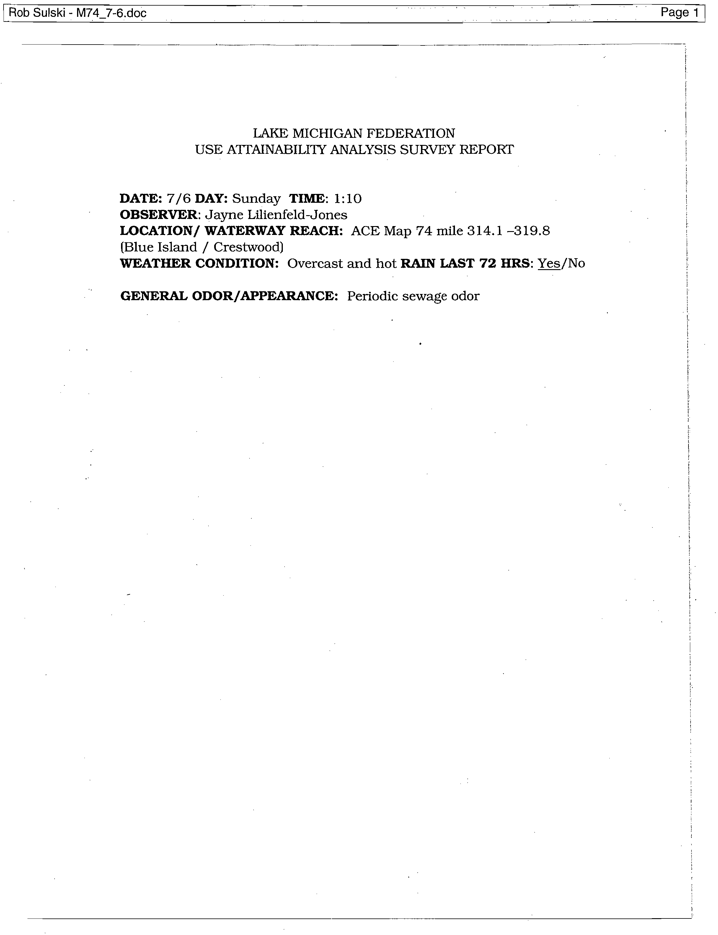
LOCATION/ WATERWAY REACH:
ACE Map 74 mile 314.1 -319.8
(Blue Island / Crestwood)
WEATHER CONDITION:
Overcast and hot
RAIN LAST 72 HRS:
Yes/No
GENERAL ODOR/APPEARANCE:
Periodic sewage odor
Rob Sulski - M74_7-6.doc
?
Page 2.
Activity
Number observed
Comments
Canoe
Kayak
Sculling
Power/Ski boat, Yacht
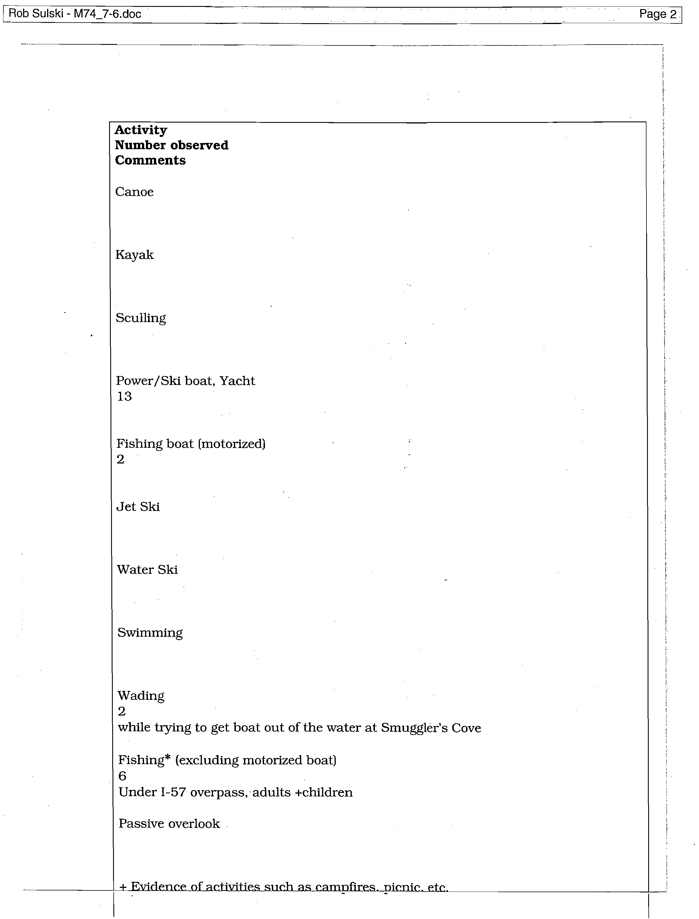
13
Fishing boat (motorized)
2
Jet Ski
Water Ski
Swimming
Wading
2
while trying to get boat out of the water at Smuggler's Cove
Fishing* (excluding motorized boat)
6
Under 1-57 overpass, adults +children
Passive overlook
+ Evidence of activitie, _such as cam
pfires
p
icnic etc
Rob Su!ski - M747-6.doc
* (includes evidence such as tackle and lines etc.)
OTHER:
channel walls change from earth to rock cut.
Rob Sulski - M75_7-6.doc
?
Page 1
LAKE MICHIGAN FEDERATION
USE ATTAINABILITY ANALYSIS SURVEY REPORT
DATE:
7/6
DAY:
Sunday
TIME:
12:40
OBSERVER:
Jayne Lilienfeld-Jones
LOCATION/ WATERWAY REACH:
ACE Map 75 mile 319.8 - 325.5
(Acme Bend)
WEATHER CONDITION:
Sunny and hot
RAIN LAST 72 HRS:
Yes/No
GENERAL ODOR/APPEARANCE:
sewage odor
Rob Sulski - M757-6.doc
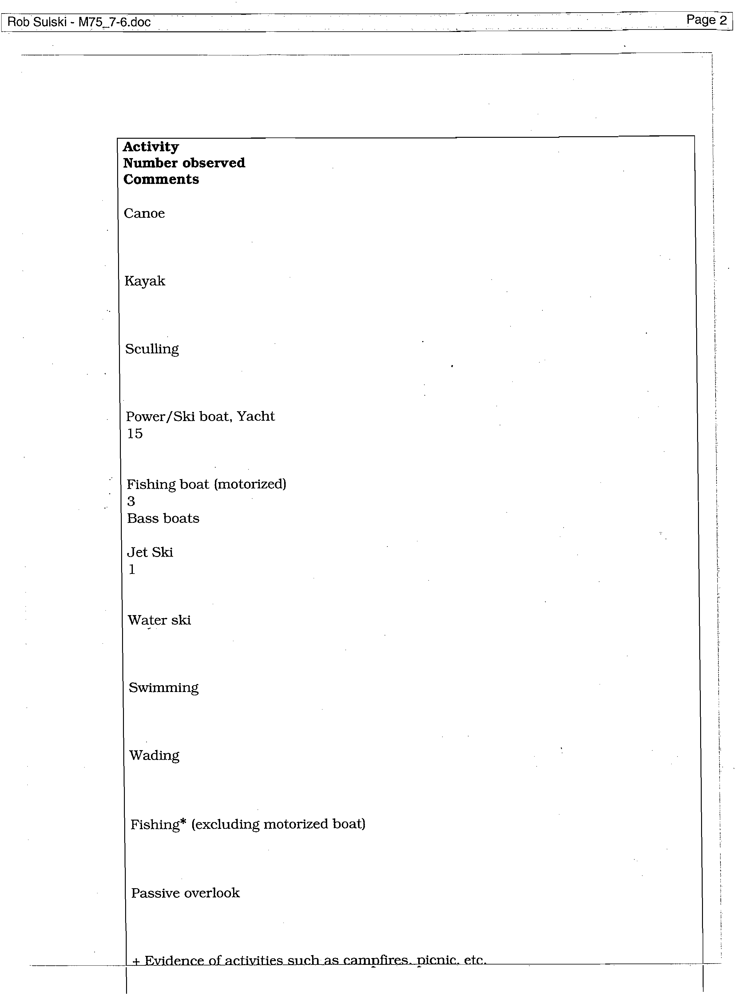
Activity
Number observed
Comments
Canoe
Kayak
Sculling
Power/Ski boat, Yacht
15
Fishing boat (motorized)
3
Bass boats
Jet Ski
1
Water ski
Swimming
Wading
Fishing* (excluding motorized boat)
Passive overlook
+ Evidence of activities such
.
as campfires. p
icnic etc
Rob Sulski - M75_7-6.doc
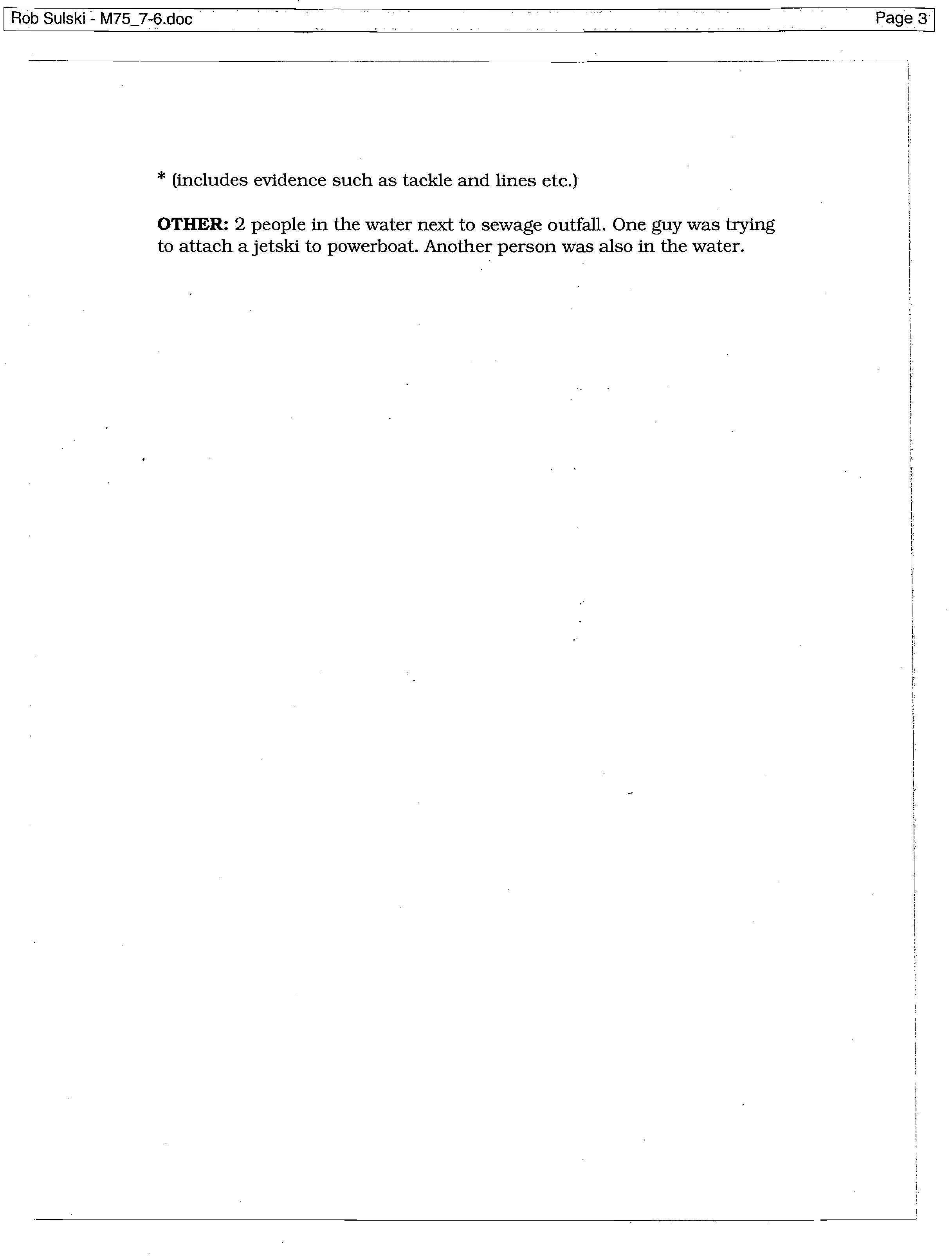
* (includes evidence such as tackle and lines etc.)
OTHER:
2 people
in the water next to sewage outfall. One guy was trying
to attach a jetski to powerboat. Another person was also in the water.
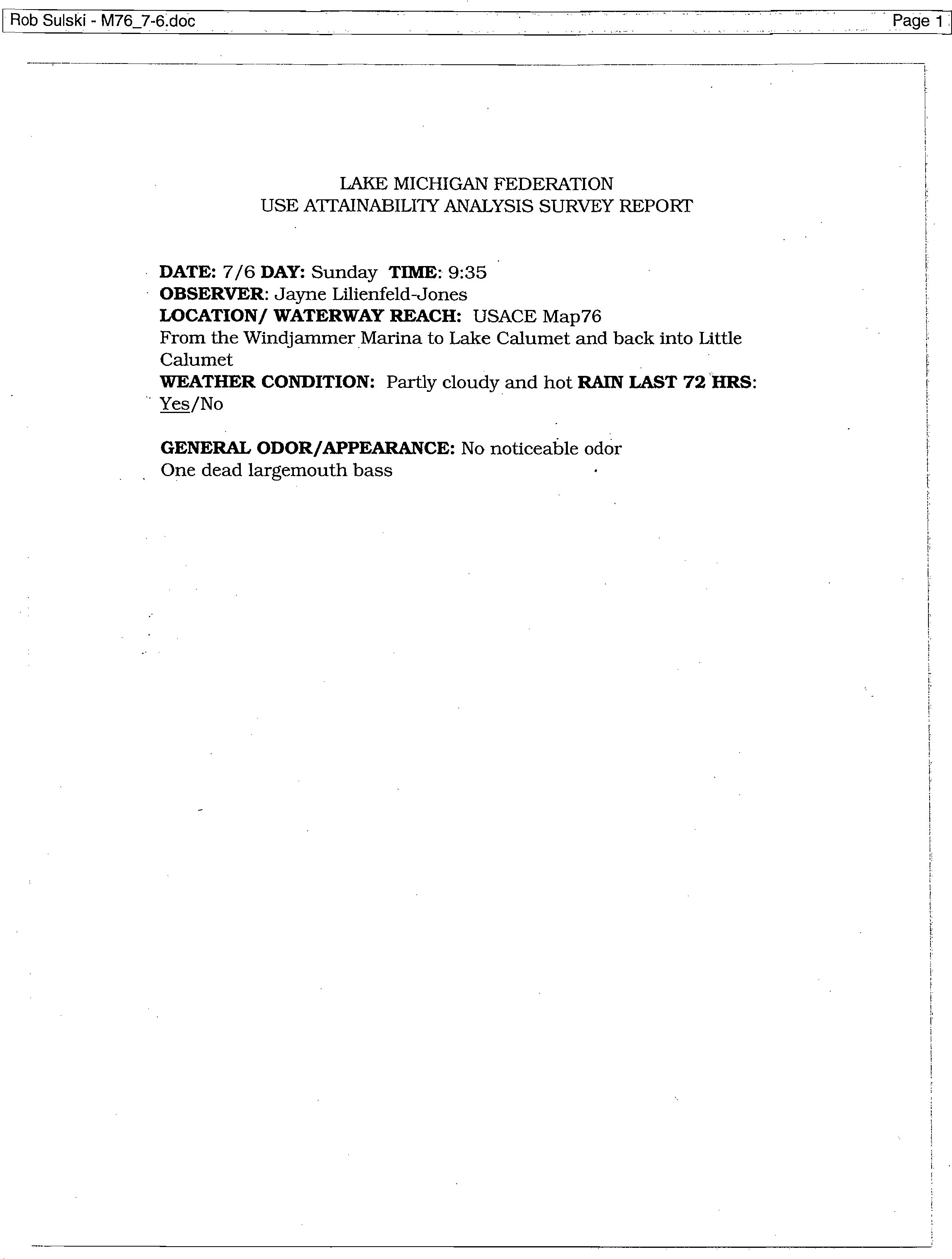
Rob Suiski - M76_7-6.doc
LAKE MICHIGAN FEDERATION
USE ATTAINABILITY ANALYSIS SURVEY REPORT
DATE:
7/6
DAY:
Sunday
TIME:
9:35
OBSERVER:
Jayne Lilienfeld-Jones
LOCATION/ WATERWAY REACH:
USACE Map76
From the Windjammer Marina to Lake Calumet and back into Little
Calumet
WEATHER CONDITION:
Partly cloudy and hot
RAIN LAST 72 HRS:
Yes/No
GENERAL ODOR/APPEARANCE:
No noticeable odor
One dead largemouth bass
Rob Sulski - M76_7-6.doc
?
Page 2
Activity
Number observed
Comments
Canoe
Kayak
Sculling
Power/Ski boat, Yacht
16
Fishing boat (motorized)
7
Bass boats
Jet Ski
Swimming
Wading
Fishing* (not from motorized boat)
14
Group of 7 in Beaubien Woods
Group of 5 @ mouth of Grand Cal
Passive overlook
+ Evidence of activities such as campfires, picnic, etc.
Rob Sulski - M76_7-6.doc
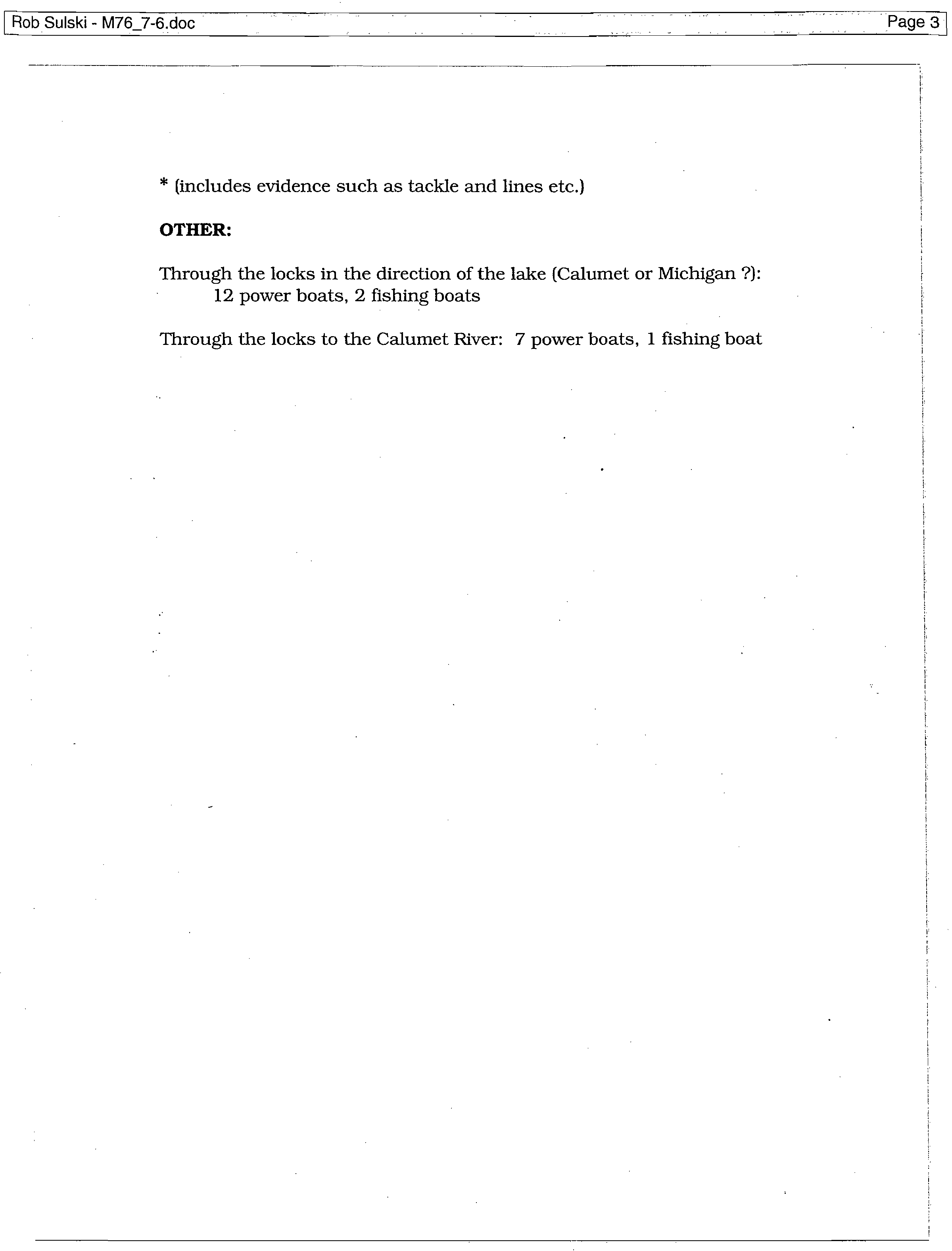
* (includes evidence such as tackle and lines etc.)
OTHER:
Through the locks in the direction of the lake (Calumet or Michigan ?):
12 power boats, 2 fishing boats
Through the locks to the Calumet River: 7 power boats, 1 fishing boat
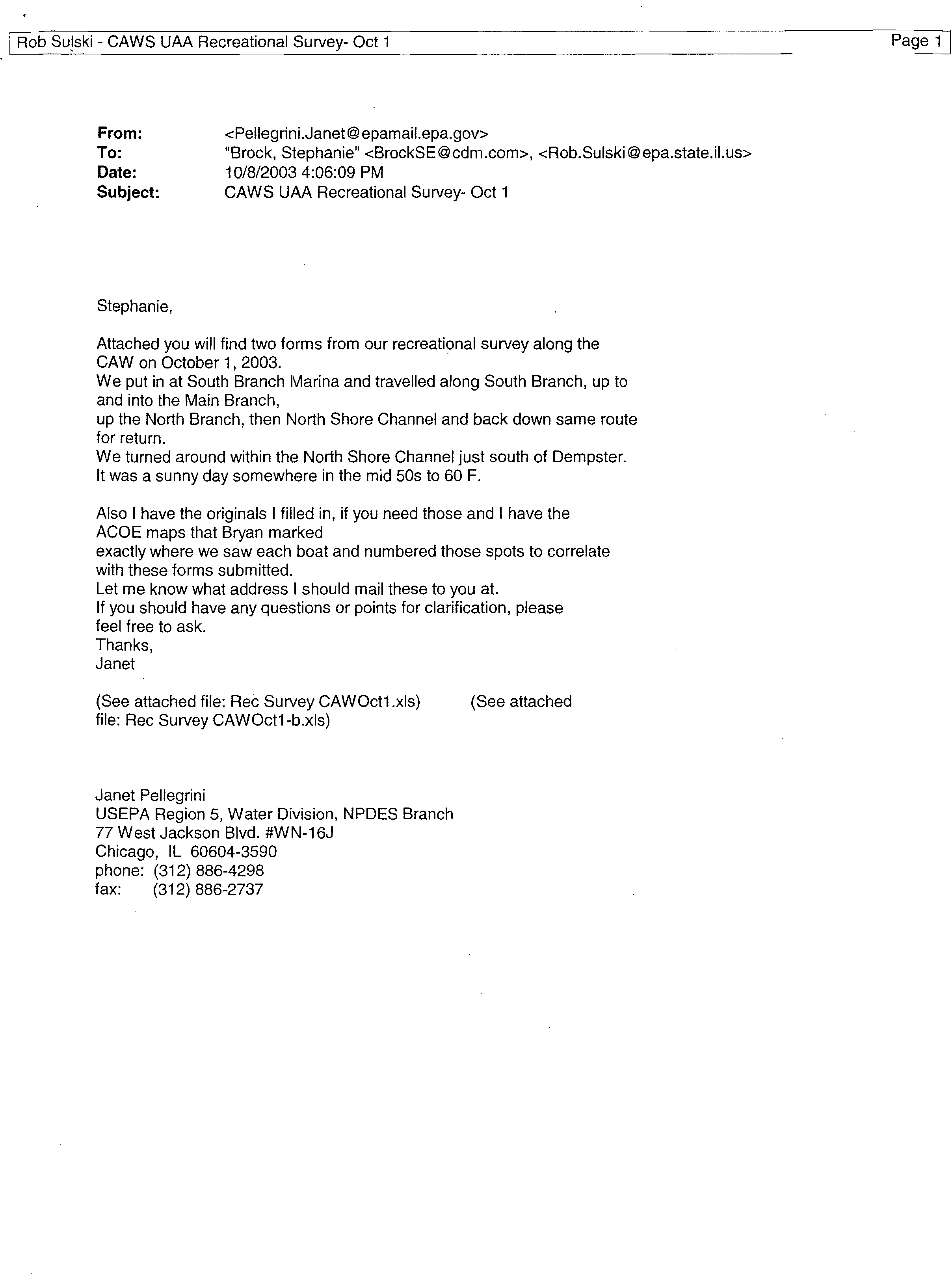
Tom Nagawiecki - Fwd: CAWS UAA Recreational Survey- Oct 1?
Page 1
From:
?
Rob Sulski
To:?Nagawiecki, Tom
Date:?
6/11/2007 10:48:07 AM
Subject:?
Fwd: CAWS UAA Recreational Survey- Oct 1
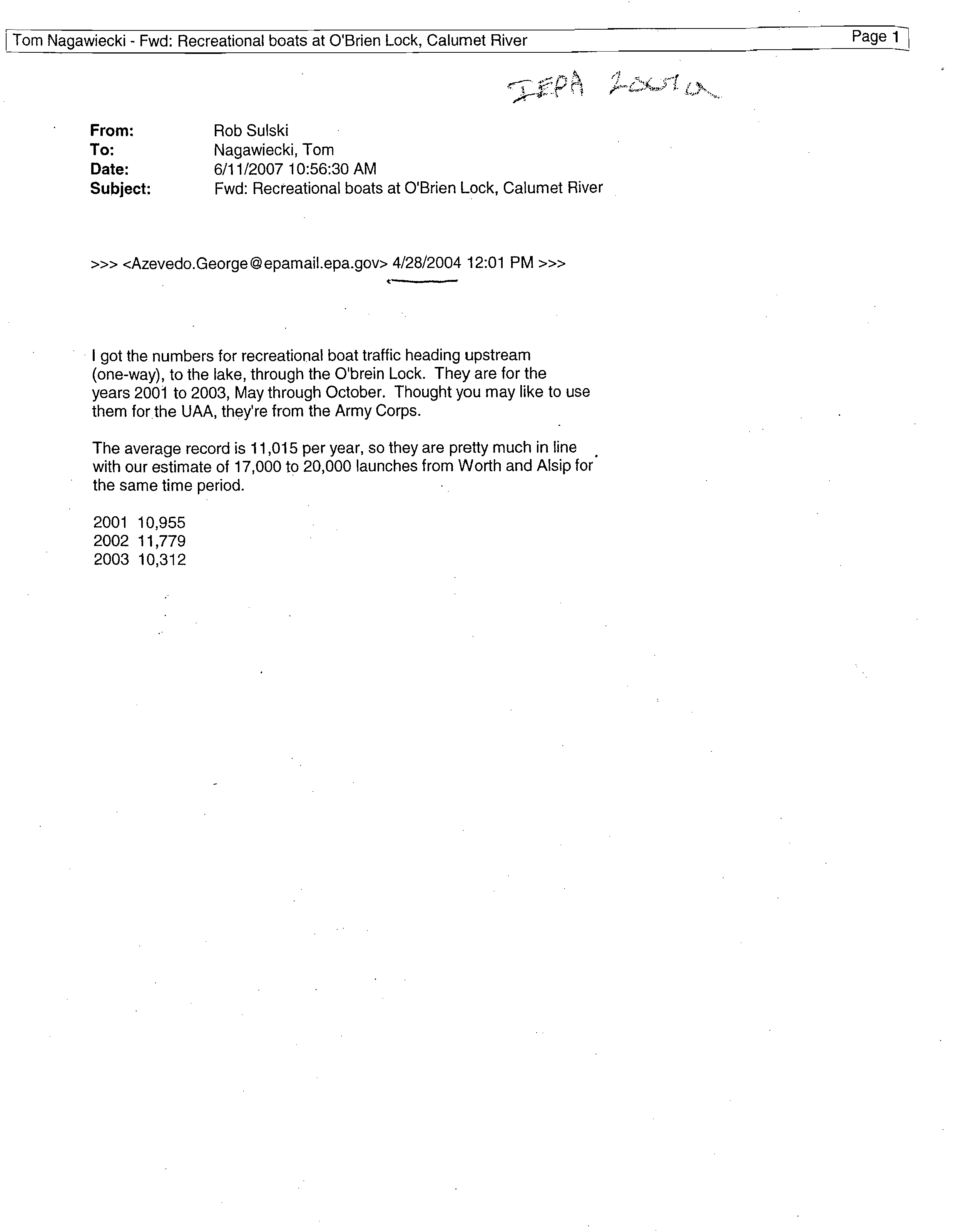
>>> <Pellegrini.Janet@epamail.epa.gov> 10/8/2003 3:58 PM >>>
Stephanie,
Attached you will find two forms from our recreational survey along the
CAW on October 1, 2003.
We put in at South Branch Marina and travelled along South Branch, up to
and into the Main Branch,
up the North Branch, then North Shore Channel and back down same route
for return.
We turned around within the North Shore Channel just south of Dempster.
It was a sunny day somewhere in the mid 50s to 60 F.
Also I have the originals I
filled in, if you need those and I have the
ACOE maps that Bryan marked
exactly where we saw each boat and numbered those spots to correlate
with these forms submitted.
Let me know what address I should mail these to you at.
If you should have any questions or points for clarification, please
feel free to ask.
Thanks,
Janet
(See attached file: Rec Survey CAWOct1.xls)?
(See attached
file: Rec Survey CAWOct1-b.xls)
Janet Pellegrini
USEPA Region 5, Water Division, NPDES Branch
77 West Jackson Blvd. #WN-16J
Chicago, IL 60604-3590
phone: (312) 886-4298
fax:?
(312) 886-2737
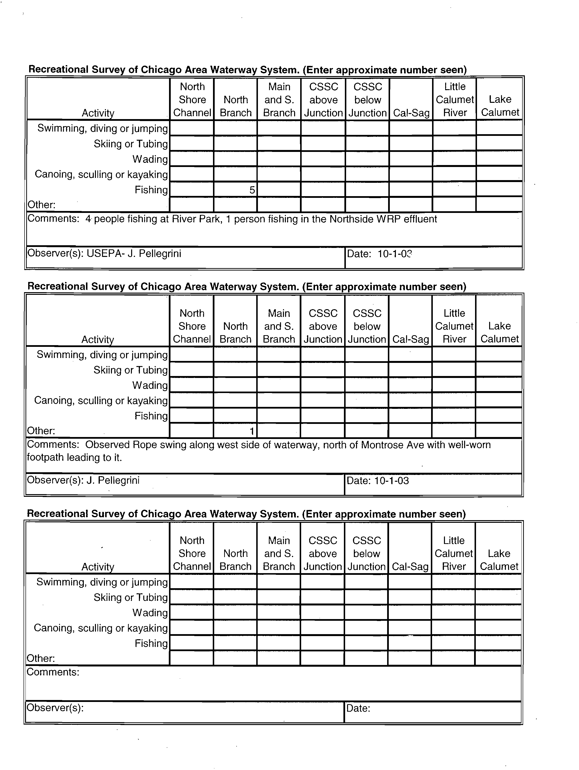
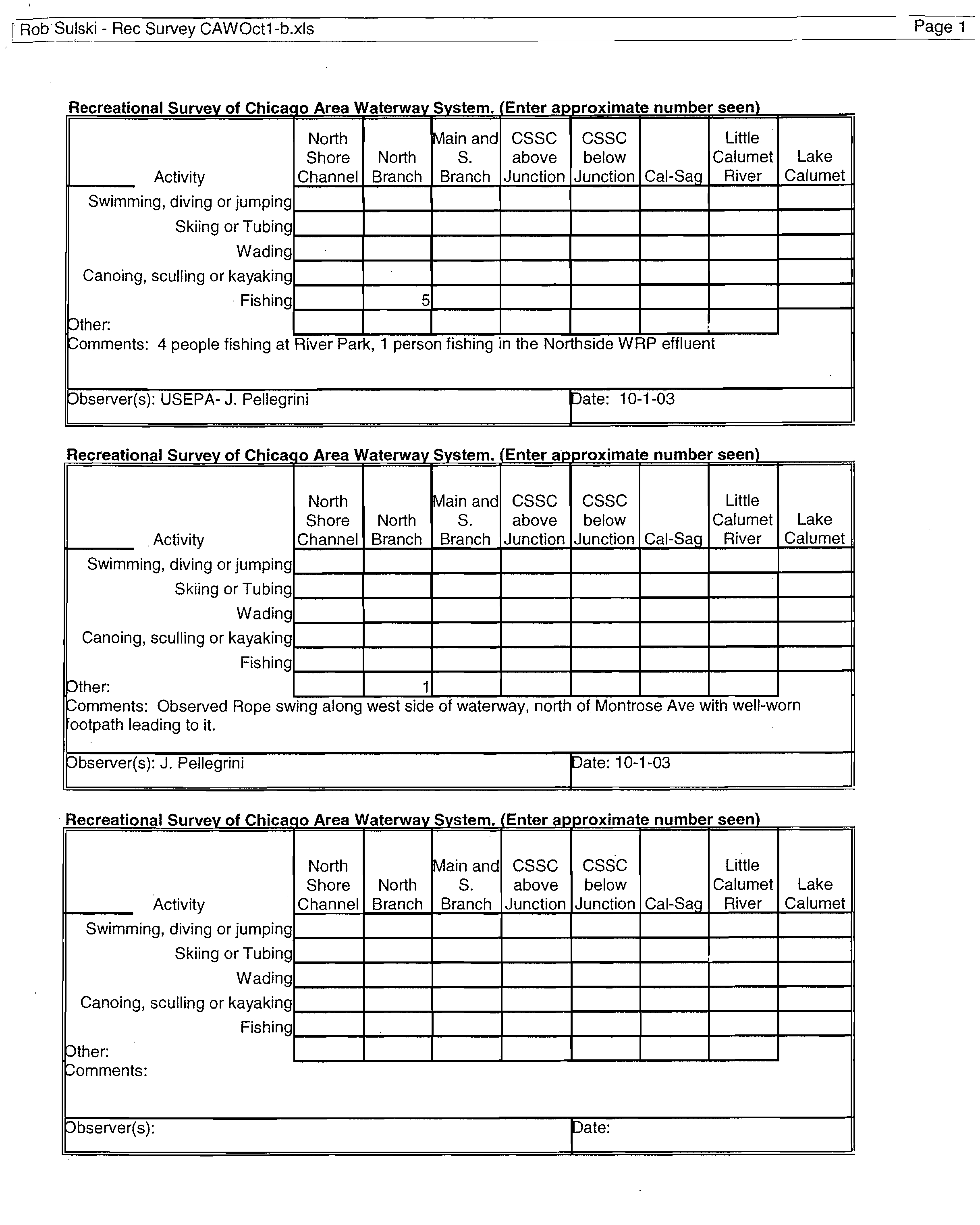
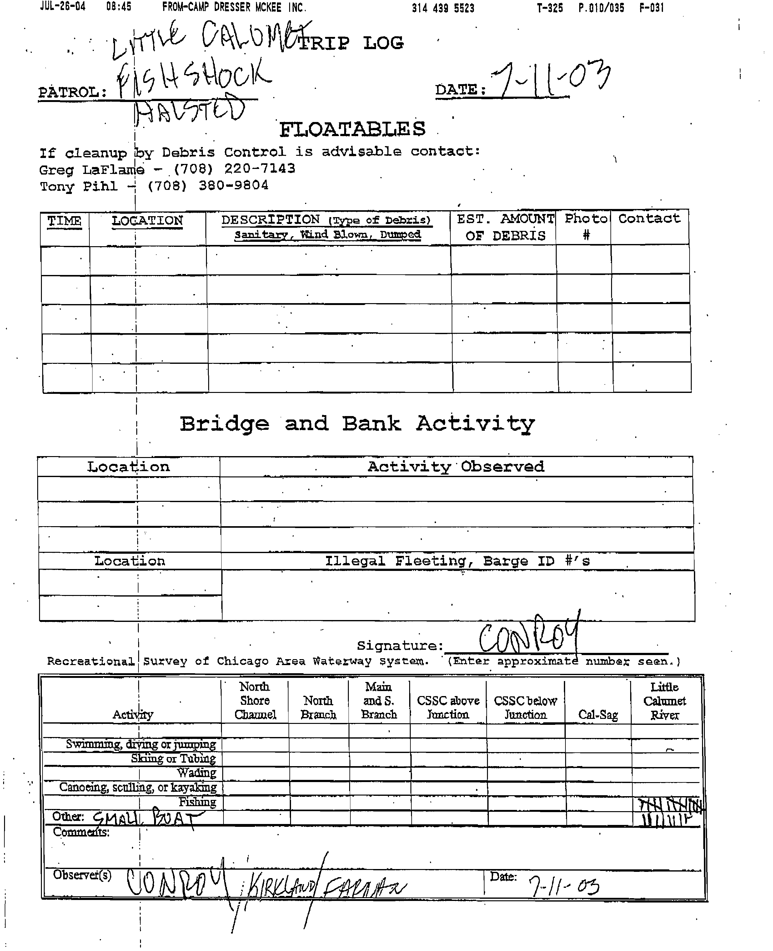
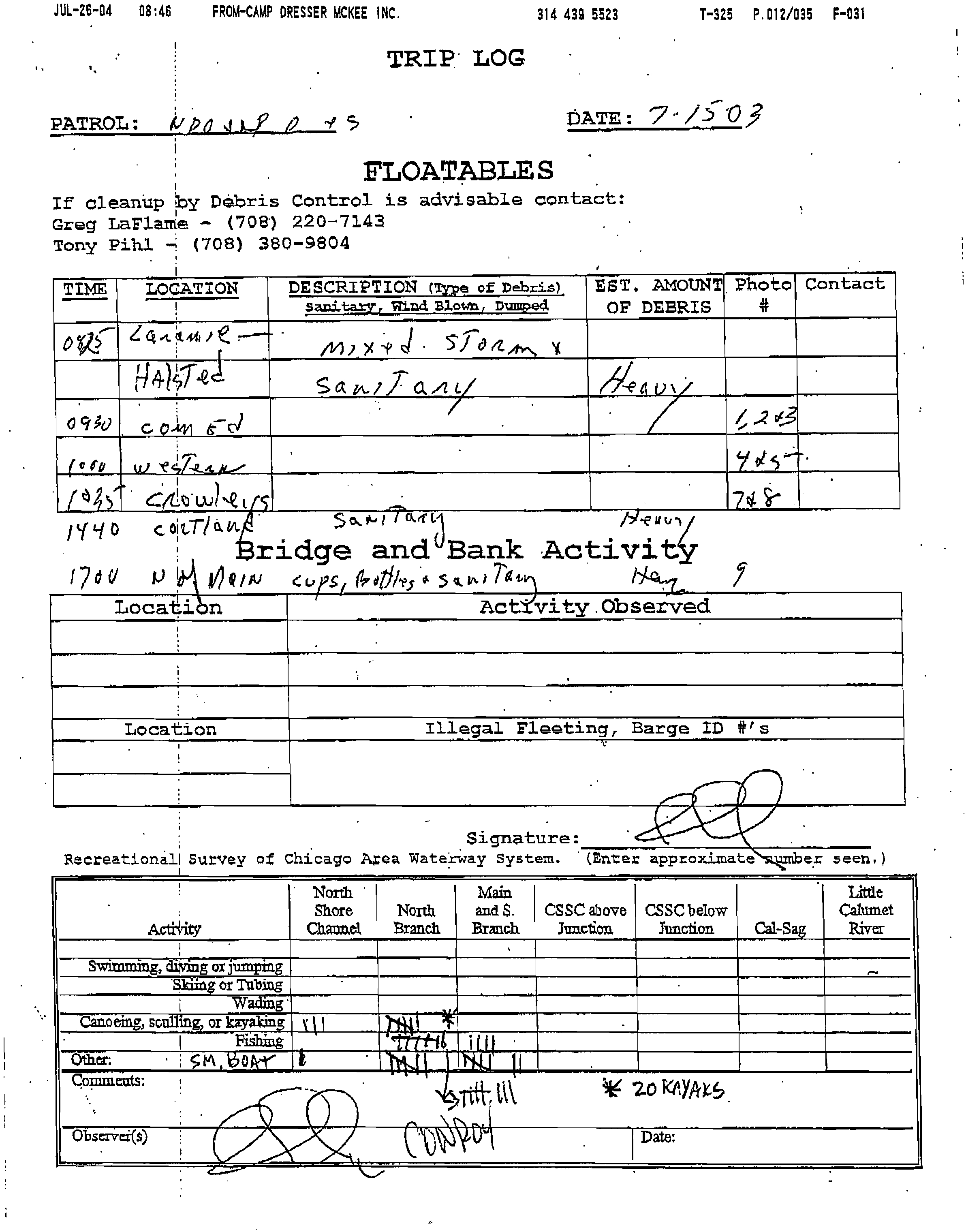
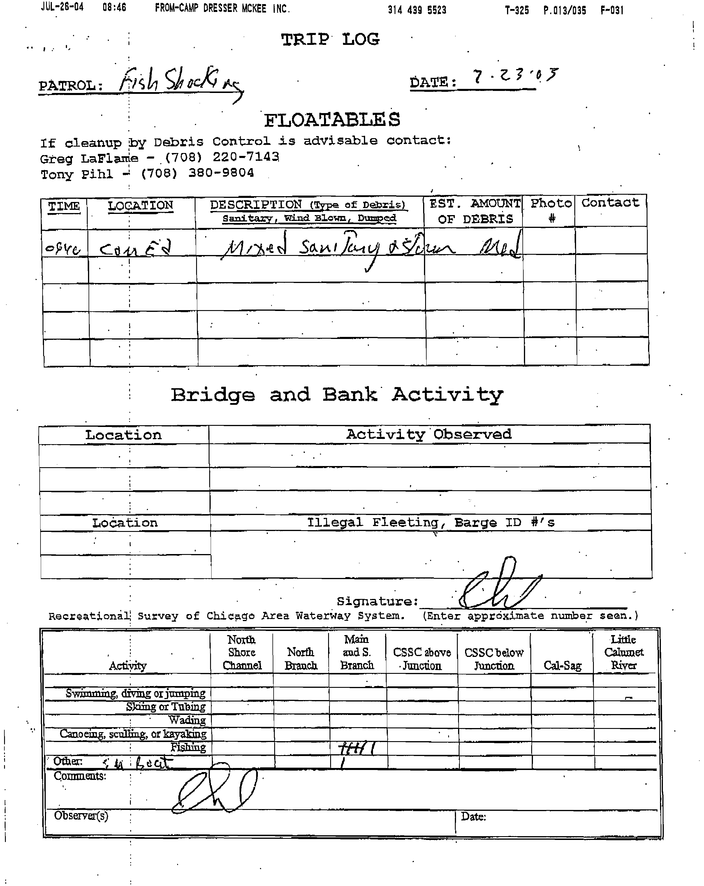
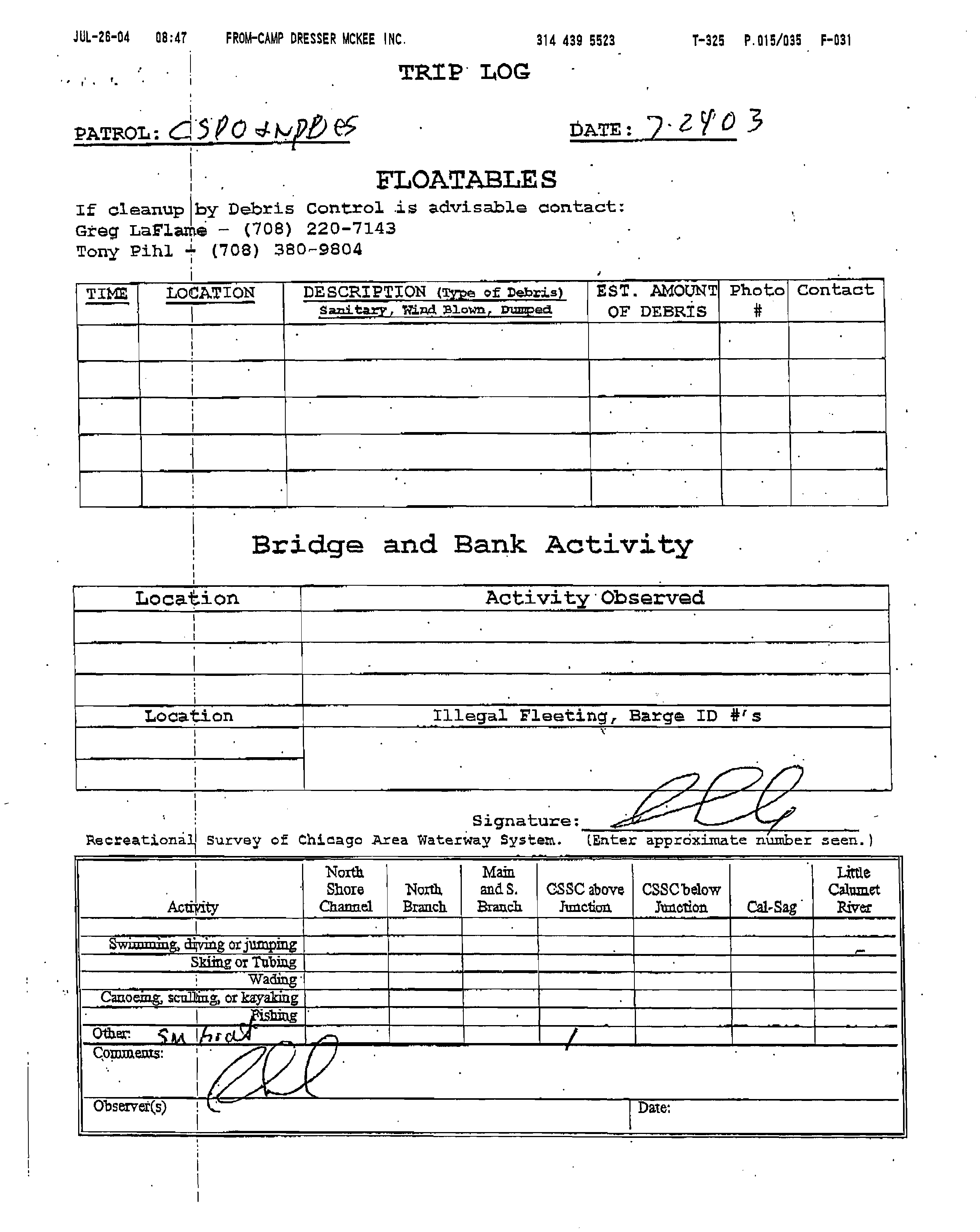
Recreational Survey of Chicago Area Waterwa
y
System. (Enter a pproximate number seen
Activity
North
Shore
Channel
North
Branch
Main
and S.
Branch
CSSC
above
Junction
CSSC
below
Junction
Cal-Sag
Little
Calumet
River
Lake
Calumet
Swimming, diving or jumping
Skiing or Tubing
Wading
Canoing, sculling or kayaking
Fishing
Other:
5
Comments: 4 people fishing at River Park, 1 person fishing in the Northside WRP effluent
Observer(s): USEPA- J. Pellegrini
[Date: 10-1-0?
Recreational
Survey of Chicago Area Waterway System. (Enter approximate number seen)
Activity
North
Shore
Channel
North
Branch
Main
and S.
Branch
CSSC
above
Junction
CSSC
below
Junction
Cal-Sag
Little
Calumet
River
Lake
Calumet
Swimming, diving or jumping
Skiing or Tubing
Wading
Canoing, sculling or kayaking
Fishing
Other:
1
Comments: Observed Rope swing along west side of waterway, north of Montrose Ave with well-worn
footpath leading to it.
Observer(s): J. Pellegrini
'Date: 10-1-03
Recreational Survey of Chica
go Area Waterwa
y
S
y
stem. (Enter a
pp
roximate number seen
Activity
North
Shore
Channel
North
Branch
Main
and S.
Branch
CSSC
above
Junction
CSSC
below
Junction
Cal-Sag
Little
Calumet
River
Lake
Calumet
Swimming, diving or jumping
Skiing or Tubing
Wading
Canoing, sculling or kayaking
Fishing
Other:
Comments:
Observer(s):
'Date:
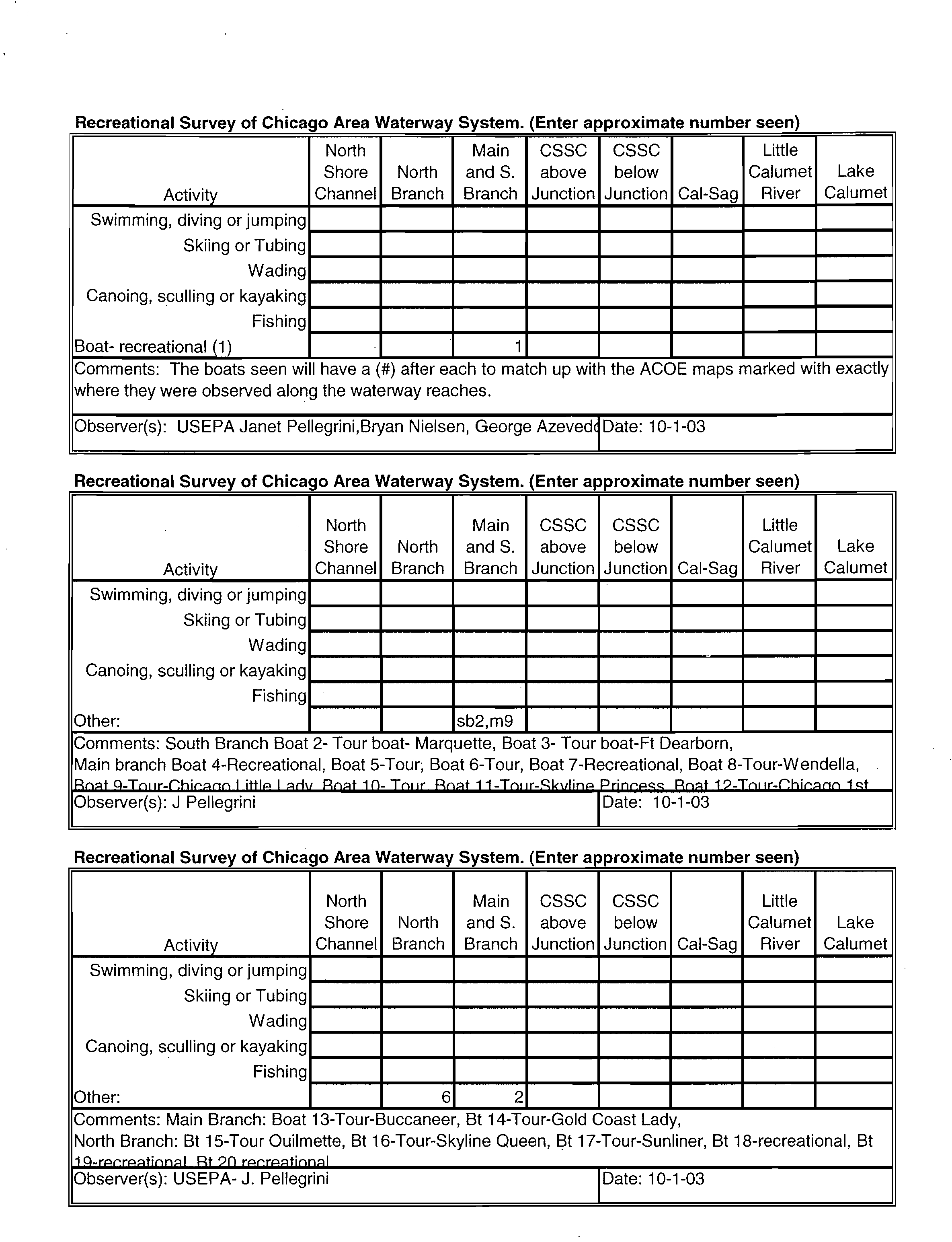
Recreational Survey of Chicago Area Waterway Sy
stem. (Enter approximate number seen)
Activity
North
Shore
Channel
North
Branch
Main
and S.
Branch
CSSC
above
Junction
CSSC
below
Junction Cal-Sag
Little
Calumet
River
Lake
Calumet
Swimming, diving or jumping
Skiing or Tubing
Wading
Canoing, sculling or kayaking
Fishing
Boat- recreational (1)
1
Comments: The boats seen will have a (#) after each to match up with the ACOE maps marked with exactly
where they were observed along the waterway reaches.
Observer(s): USEPA Janet Pellegrini,Bryan Nielsen, George AzevediDate: 10-1-03
Recreational Survey of Chicago Area Waterway System. (Enter approximate number seen)
Activity
North
Shore
Channel
North
Branch
Main
and S.
Branch
CSSC
above
Junction
CSSC
below
Junction Cal-Sag
Little
Calumet
River
Lake
Calumet
Swimming, diving or jumping
Skiing or Tubing
Wading
Canoing, sculling or kayaking
Fishing
Other:
sb2,m9
Comments: South Branch Boat 2- Tour boat- Marquette, Boat 3- Tour boat-Ft Dearborn,
Main branch Boat 4-Recreational, Boat 5-Tour; Boat 6-Tour, Boat 7-Recreational, Boat 8-Tour-Wendella,
Rnat A-Trn n--rhirann I ittl
p I Priv Rnat -In- Tnin- Rnat 11-Trnir-Sloilin p?rinepqc Rnat 12-Ten tr-nhirann
i qr.
Observer(s): J Pellegrini
Date: 10-1-03
Recreational Survey of Chicago Area Waterway System. (Enter approximate number seen)
Activity
North
Shore
Channel
North
Branch
Main
and S.
Branch
CSSC
above
Junction
CSSC
below
Junction
Cal-Sag
Little
Calumet
River
Lake
Calumet
Swimming, diving or jumping
Skiing or Tubing
Wading
Canoing, sculling or kayaking
Fishing
Other:
6
2
Comments: Main Branch: Boat 13-Tour-Buccaneer, Bt 14-Tour-Gold Coast Lady,
North Branch: Bt 15-Tour Ouilmette, Bt 16-Tour-Skyline Queen, Bt 17-Tour-Sunliner, Bt 18-recreational, Bt
1Q-rprrpatinnal Rt
9n
rprrPatinnal
Observer(s): USEPA- J. Pellegrini ?
'Date: 10-1-03
Rob Sulski - CAWS UAA Recreational Survey- Oct 1 ?
Page 1
From:
?
<Pellegrini.Janet@epamail.epa.gov>
To:?
"Brock, Stephanie" <BrockSE@cdm.com>, <Rob.Sulski@epa.state.il.us>
Date:
?
10/8/2003 4:06:09 PM
Subject:?
CAWS UAA Recreational Survey- Oct 1
Stephanie,
Attached you will find two forms from our recreational survey along the
CAW on October 1, 2003.
We put in at South Branch Marina and travelled along South Branch, up to
and into the Main Branch,
up the North Branch, then North Shore Channel and back down same route
for return.
We turned around within the North Shore Channel just south of Dempster.
It was a sunny day somewhere in the mid 50s to 60 F.
Also I have the originals I filled in, if you need those and I have the
ACOE maps that Bryan marked
exactly where we saw each boat and numbered those spots to correlate
with these forms submitted.
Let me know what address I should mail these to you at.
If you should have any questions or points for clarification, please
feel free to ask.
Thanks,
Janet
(See attached file: Rec Survey CAWOct1.xls)?
(See attached
file: Rec Survey CAWOct1-b.xls)
Janet Pellegrini
USEPA Region 5, Water Division, NPDES Branch
77 West Jackson Blvd. #WN-16J
Chicago, IL 60604-3590
phone: (312) 886-4298
fax:?
(312) 886-2737
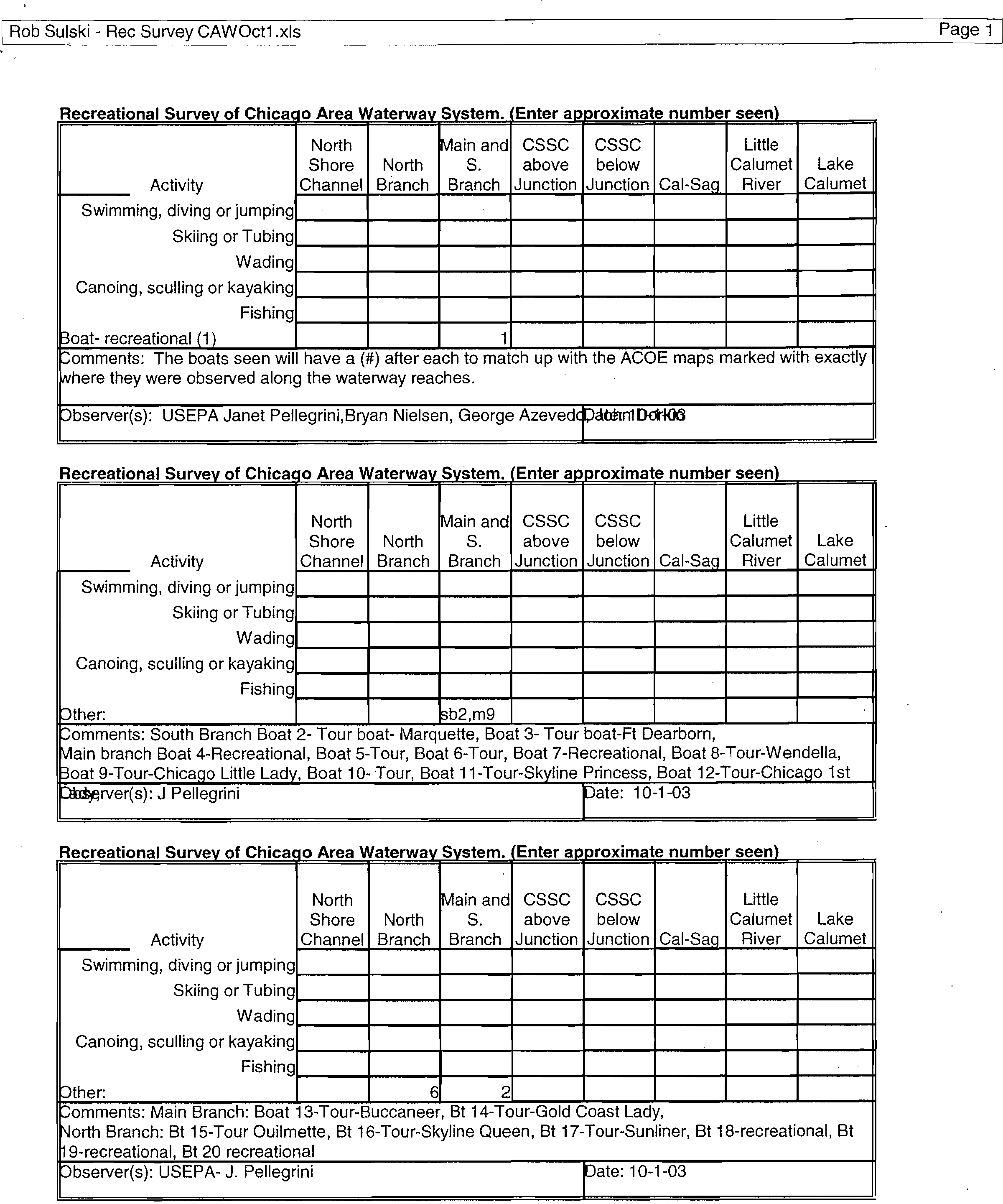
Rob Sulski - Rec Survey CAWOct1.xls?
Page 1
Recreational Survey of Chica
g
o Area Waterwa
y
S
y
stem. ( (Enter approximate number seen
Activity
North
Shore
Channel
North
Branch
Main and
S.
Branch
CSSC
above
Junction
CSSC
below
Junction
Cal-Sag
Little
Calumet
River
Lake
Calumet
Swimming, diving or jumping
Skiing or Tubing
Wading
Canoing, sculling or kayaking
Fishing
:oat- recreational (1)
1
omments: The boats seen will have a (#) after each to match up with the ACOE maps marked with exactly
here they were observed along the waterway reaches.
• bserver(s): USEPA Janet Pellegrini,Bryan Nielsen, George Azevedcrain1Dolr103
Recreational Survey of?
Chica
(
o Area Waterway S
y
stem. (Enter approximate number seen
Activity
,
North
Shore
Channel
North
Branch
Main and
S.
Branch
,
CSSC
above
Junction
CSSC
below
Junction
-
Cal-Sag
Little
Calumet
River
Lake
Calumet
Swimming, diving or jumping
Skiing or Tubing
Wading
Canoing, sculling or kayaking
Fishing
Other:
,
sb2,m9
Comments: South Branch Boat 2- Tour Coat- Marquette, Boat 3- Tour boat-Ft Dearborn,
Main branch Boat 4-Recreational, Boat 5
-
Tour, Boat 6-Tour, Boat 7-Recreational, Boat 8-Tour-Wendella,
3oat 9-Tour-Chicago Little Lady, Boat 10- Tour, Boat 11-Tour-Skyline Princess, Boat 12-Tour-Chicago 1st
Dttprver(s): J Pellegrini?
rate: 10-1-03
Recreational
Recreational Survey
.
of Chicago
w
Area Water a
y
S stem (Enter approximate number seen
Activity
-
North
Shore
Channel
North
Branch
Main and
S.
Branch
CSSC
above
Junction
CSSC
below
Junction Cal-Sag
Little
Calumet
River
Lake
Calumet
Swimming, diving or jumping
Skiing or Tubing
Wading
Canoing, sculling or kayaking
Fishing
Other
_
6?
2
bomments: Main Branch: Boal13-Tour-fucca
neer, Bt 14-Tour-Gold Coast Lady,
North Branch: Bt 15-Tour Ouilmette, Bt 16-Tour-Skyline Queen, Bt 17-Tour-Sunliner, Bt 18-recreational, Bt
19-recreational, Bt 20 recreational
Observer(s): USEPA- J. Pellegrini?
pate: 10-1-03
Recreational Survey of Chicago Area Waterway System. cEnter approximate number seen
North
Main and CSSC
CSSC
Little
Shore
North
S.
above
below
Calumet
Lake
Activity
Channel
Branch Branch Junction Junction Cal-Sag
River
Calumet
?Swimming, diving or jumping
?
Skiing or Tubing,
Wading ?
Canoing, sculling or kayaking
?
Fishing
?
other:
–omments: 4 people fishing at River Park, 1 person fishing in the Northside WRP effluent
Observer(s): USEPA- J. Pellegrini
r
ate: 10-1-03
5
Recreational Survey of Chicago Area Waterway_System. Enter approximate number seen
North
Main and CSSC
CSSC
Little
Shore
North
S.
above
below
Calumet
Lake
Activity
Channel
Branch Branch Junction Junction Cal-Sag
River
Calumet
Swimming, diving or jumping
Skiing or Tubing
Wading
Canoing, sculling or kayaking
Fishing
Other:
?
1
comments: Observed Rope swing along west side of waterway, north of Montrose Ave with well-worn
.00tpath leading to it.
Observer(s): J. Pellegrini
r
ate: 10-1-03
Recreational Survey of Chicago Area Waterway System. cEnter approximate number seen
)
North
Main and CSSC
CSSC
Little
Shore
North
S.
above
below
Calumet
Lake
Activity
Channel Branch Branch Junction
Junction Cal-Sag
River
Calumet,
Swimming, diving or jumping
Skiing or Tubing
Wading
Canoing, sculling or kayaking
Fishing
Other:
–omments:
Observer(s):?
rate:
( Rob Sulski - Rec Survey CAWOct1-b.xls?
Page 1
Recreational Survey of Chicago Area Waterway S y
stem. (Enter approximate number seen)
North
Shore
North
Main
and S.
CSSC
above
CSSC
below
Little
Calumet
Activity
Channel
Branch Branch
Junction Junction
Cal-Sag
River
Swimming, diving or jumping
Skiing or Tubing
Wading
Canoing, sculling or kayaking
Fishing
Other:
Comments:
Observer(s):
'Date:
Recreational Survey of Chicago Area Waterway S
ystem. (Enter approximate number seen)
North
Shore
North
Main
and S.
CSSC
above
CSSC
below
Little
Calumet
Activity
Channel
Branch Branch
Junction
Junction
Cal-Sag
River
Swimming, diving or jumping
Skiing or Tubing
Wading
Canoing, sculling or kayaking
Fishing
Other:
Comments:
Observer(s):
Date:
Recreational Survey of Chicago Area Waterway S
y
stem. (Enter approximate number seen)
North
Shore
North
Main
and S.
CSSC
above
CSSC
below
Little
Calumet
Activity
Channel
Branch Branch
Junction Junction
Cal-Sag
River
Swimming, diving or jumping
Skiing or Tubing
Wading
Canoing, sculling or kayaking
Fishing
Other:
Comments:
Observer(s):
Date:
PORT DEVELOPMENT & SAFETY COUNCIL
Summary of Meeting
November 10, 2003
1:00 p.m.
Columbia Yacht Club
Discussion:
Topics discussed included the following:
1.
Area Maritime Security Plan - setting up subarea committees -USCG
CDR Terry Carter;
2.
Marine Event Notification Protocol - problem of impact of relatively
smaller events which do not meet the threshold requirements for official
permitting;
3.
Chicago Department of Transportation - commencement of new role for
CDOT
as point of contact/clearinghouse for
issues
relating to the Chicago
River; initial focus is to develop a traffic and safety plan - limited study
underway with Volpe with input from PDSC members; other important
issues include access, water quality, and development - Michelle Woods,
CDOT and Jackson Royal, Volpe (617.494.3409).
4.
PDSC Focus for 2004 - notion that PDSC should also become active in
helping to anticipate, articulate and resolve issues relating to waterway
safety and use, given the expertise and communications resources which
exists among its members.
Action Items:
1.?
Safety Working Group
It was agreed that the PDSC has the opportunity to perform a much needed educational
function for promoting safety, by utilizing the expertise of its members to develop
unofficial guides that can be published in print and on websites (e.g., MSO Chicago), to:
a)
develop an organizational guide/checklist
for event organizers
(which
will include description of how event organizers can evaluate whether their event will
have an impact on the waterway, and, if so, then who to go to and what to do);
b)
develop a user guide to utilizing the waterway.
The following individuals volunteered to lead the PDSC's effort to develop these guides:
Bob Agra, Gene Arbetter, Grant Crowley, Lloyd Karzen, Erik Pickering, Joe
Sarna, Susan Urbas, Earl Zuelke.
The first step will be to produce a rough draft which can then be circulated to all
members of the PDSC for their input.
2.
?
Membership Outreach
Concern was expressed that participation in the PDSC should include the Metropolitan
Water Reclamation District and the Chicago Park District. Susan Urbas will follow-up
with Terry O'Brien regarding potential MWRD participation and Michelle Woods will
follow-up with Bob Foster regarding potential Park District participation.
Determine Need/Set Date for Next Full PDSC Meeting:
LCDR David Fish requested that the next PDSC be set for early January.
Announcements:
There being no further matters to discuss, the meeting was adjourned at 2:10 p.m.
Respectfully submitted,
Susan K.B. Urbas
DEC-30-2003 11:30
?
MWRDGC R&D
?
312 751 5194 P.01/02
100 East Erie Street
Chicago, Illinois 60611
Phone: (312) 7514600
Metropolitan Water
Reclamation District
of Greater Chicago
To:
?
Rob Sulski, !EPA
?
From
Richard
L.anyon 312-751-5190
Ron French, CDM
Fax'
847-294-4058
?
Pages:
2
(with cover)
312.348-5228
Phone:
847-294-4037
?
Date:
12/30/03
312.346-\5000
News Article
Re:
?
CC:?
(Click
here
and type name)
Urgent?
For Review
?
Please Comment
?
Please Reply
?
q
Please Reoyole
•
Continents
Attached news article reports that southwest suburbs along the Calumet-
Sag Channel want to follow the lead of north suburbs along the North
Shore Channel.
"CONFIDENTIALITY NOTICE:
The information contained in this facsimile message may be legally
privileged and confidential and is intended only for the use of the individual or entity named above. if
the reader of this message is not the intended recipient, you are hereby notified that any dissemination,
distribution or copying of this facsimile message is prohibited. If you have received this facsimile
message in error, please immediately notify us by telephone and return the original message to us at
the
above address via U.S. Postal
Service."
DEC-30-2003 11:30
MWRDOC R&D
312 751 5194 P.02/02
11111.141.1t#L11
al2nti-tie
/Our Neighborhood
REPORTER
OAK
LAWN. IL
PURL-. TTHU*SOAV
CIRC. 15.304
GEC IC.
2003
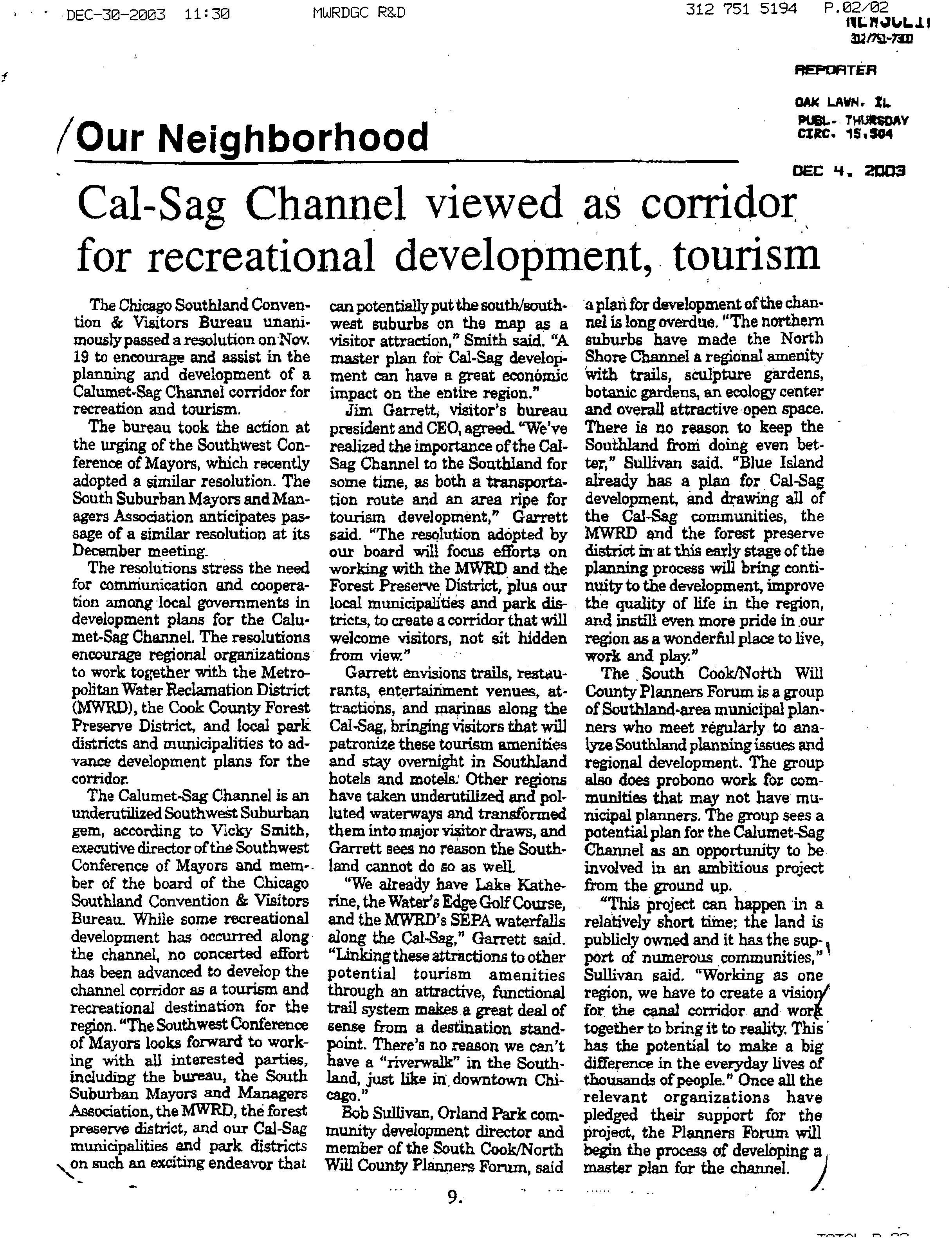
Cal-Sag Channel viewed as corridor
for recreational development, tourism
The Chicago Southland Conven-
tion & Visitors Bureau unani-
mously passed a resolution on Nov.
19 to encourage and assist in the
planning and development of a
Calumet-Sag Channel corridor for
recreation and tourism.
The bureau took the action at
the urging of the Southwest Con-
ference of Mayors, which recently
adopted a similar resolution. The
South Suburban Mayors and Man-
agers Association anticipates pas-
sage of a similar resolution at its
December meeting_
The resolutions stress the need
for corcuriunication and coopera-
tion among local governments in
development plans for the Calu-
met-Sag ChanneL The resolutions
encourage regional organizations
to work together with the Metro-
politan Water Reclamation District
(MWRD), the Cook County Forest
Preserve District, and local park
districts and municipalities to ad-
vance development plans for the
corridor.
The Calumet-Sag Channel
is
an
underutilized Southwest Suburban
gem, according to Vicky Smith,
executive director of the Southwest
Conference of Mayors and mem-
ber of the board of the Chicago
Southland Convention & Visitors
Bureau. While some recreational
development has occurred along
the channel, no concerted effort
has been advanced to develop the
channel corridor as a tourism and
recreational destination for the
region. "The Southwest Conference
of Mayors looks forward to work-
ing with all interested parties,
including
the
bureau, the South
Suburban Mayors and Managers
Association, the MWRD, the forest
preserve district, and our Cal-Sag
municipalities and park districts
N
on such an exciting endeavor that
can potentially put the south/south-
west suburbs on the map as a
visitor attraction," Smith
said. "A
master plan for Cal-Sag develop-
ment can have a great economic
impact on the
entire
region."
Jim Garrett, visitor's bureau
president and CEO, agreed. "We've
realized the importance of the Cal-
Sag Channel to the Southland for
some time,
as
both a transporta-
tion route and an area ripe for
tourism development," Garrett
said. "The resolution adopted by
our board will focus efforts on
working with the MWRD and the
Forest Preserve District, plus our
local municipalities and park dis-
tricts, to create a corridor that will
welcome visitors, not sit hidden
from view."
Garrett envisions trails, restau-
rants, entertainment venues, at-
tractions, and marinas along the
Cal-Sag, bringing visitors that will
patronize these tourism amenities
and stay overnight in Southland
hotels and motels: Other regions
have taken underutilized and pol-
luted waterways and transformed
them into major visitor draws, and
Garrett
sees
no reason the South-
land cannot do so as well.
"We already have Lake Kathe-
rine, the Water's Edge Golf Course,
and the MWRD's SEPA waterfalls
along the Cal-Sag," Garrett said.
"Linking these attractions to other
potential tourism amenities
through an attractive, functional
trail system makes a great deal of
sense from a destination stand-
point. There's no reason
we
can't
have a "riverwalk" in the South-
land, just like downtown Chi-
cago!'
Bob Sullivan, Orland Park com-
munity development director and
member of the South Cook/North
Will County Planners Forum, said
9.
a plan for development of the chan-
nel
is
long overdue. "The northern
suburbs have made the North
Shore Channel a regional
amenity
with trails, sculpture gardens,
botanic gardens, an ecology center
and overall attractive open space.
There is no reason to keep the
Southland from doing even bet-
ter," Sullivan said. "Blue Island
already has a plan for Cal-Sag
development, and drawing all of
the Cal-Sag communities, the
MWRD and the forest preserve
district
in
at this early stage of the
planning process will bring conti-
nuity to the development, improve
the quality of life in the region,
arid instill even more pride in our
region as a wonderful place to live,
work and play."
The South Cook/No*th Will
County Planners Forum is a group
of Southland-area municipal plan-
ners who meet regularly to ana-
lyze Southland planning issues and
regional development. The group
also does probono work fox com-
munities that may not have mu-
nicipal planners. The group sees a
potential plan for the Calumet-Sag
Channel as an opportunity to be
involved in an ambitious project
from the ground up.
"This project can happen in a
relatively short time; the land is
publicly owned and it has the sup-I
port of numerous communities,"
Sullivan said. "Working as one
region, we have to create a visiot
for the canal corridor and wor
together to bring it to reality. This
has the potential to make a big
difference in the everyday lives of
thousands of people." Once all the
relevant organizations have
pledged their support for the
project, the Planners Forum will
begin the process of developing a
master plan for the channel. )
CHICAGO POLICE MARINE UNIT
CITY OF CHICAGO
SCHEDULE OF 2004 MARINE EVENTS
(Additional information will be distributed prior to each event)
Memorial Day to
Labor Day
Time:
Location:
Sponsor:
Other:
NAVY PIER FIREWORKS DISPLAYS
Wednesday -2130hrs.;
?
Saturday - 2200hrs.
Navy Pier, south or east fairway
Navy Pier
Fireworks barge maneuvered by tug; exact placement dependent on wind/weather
conditions at time of shoot. Security zone of 500ft. around barge/tug.
Saturdays,
September 11,18,26
October 2, 9, 16, 23, 30 NAVY PIER SPECIAL FALL FIREWORKS DISPLAYS
Time:
?
TBD
Location:
?
Navy Pier, south or east fairway
Sponsor:
?
Navy Pier
Other:
?
Fireworks barge maneuvered by tug; exact placement dependent on wind/weather
conditions at time of shoot. Security zone of 500ft. around barge/tug.
Saturday, June
Time:
Location:
Sponsor:
Other:
Friday, 11 June
Time:
Location:
Sponsor:
Other:
Saturday, 3 July
Time:
Location:
Sponsor:
Other:
Sunday, 4 July
Time:
Location:
Sponsor:
Other:
CHICAGO TO MICHIGAN CITY SAIL RACE
Monroe Harbor
Columbia Yacht Club
AMERICAN INSTITUTE OF ARCHITECTS FIREWORKS
2215/2245hrs.
off east end of Navy Pier
American Institute of Architects
Tug/barge position based on wind/weather conditions. CDP & USCG establish 500yd.
safety zone around event.
CITY OF CHICAGO
3rd
JULY FIREWORKS
2130hrs.
Monroe Harbor
City of Chicago;
Safety zone around fireworks barges; "No Wake" zone in Chicago Harbor (inner harbor
from Oak St. Gap to Planetarium) enforced from 2000hrs. to 2300hrs. Monroe Harbor
closed to vessel traffic from1930hrs. to completion of show.
EVANSTON FIREWORKS DISPLAY
2115/2200hrs.
Beach - Evanston, II.
Evanston Fourth of July Association
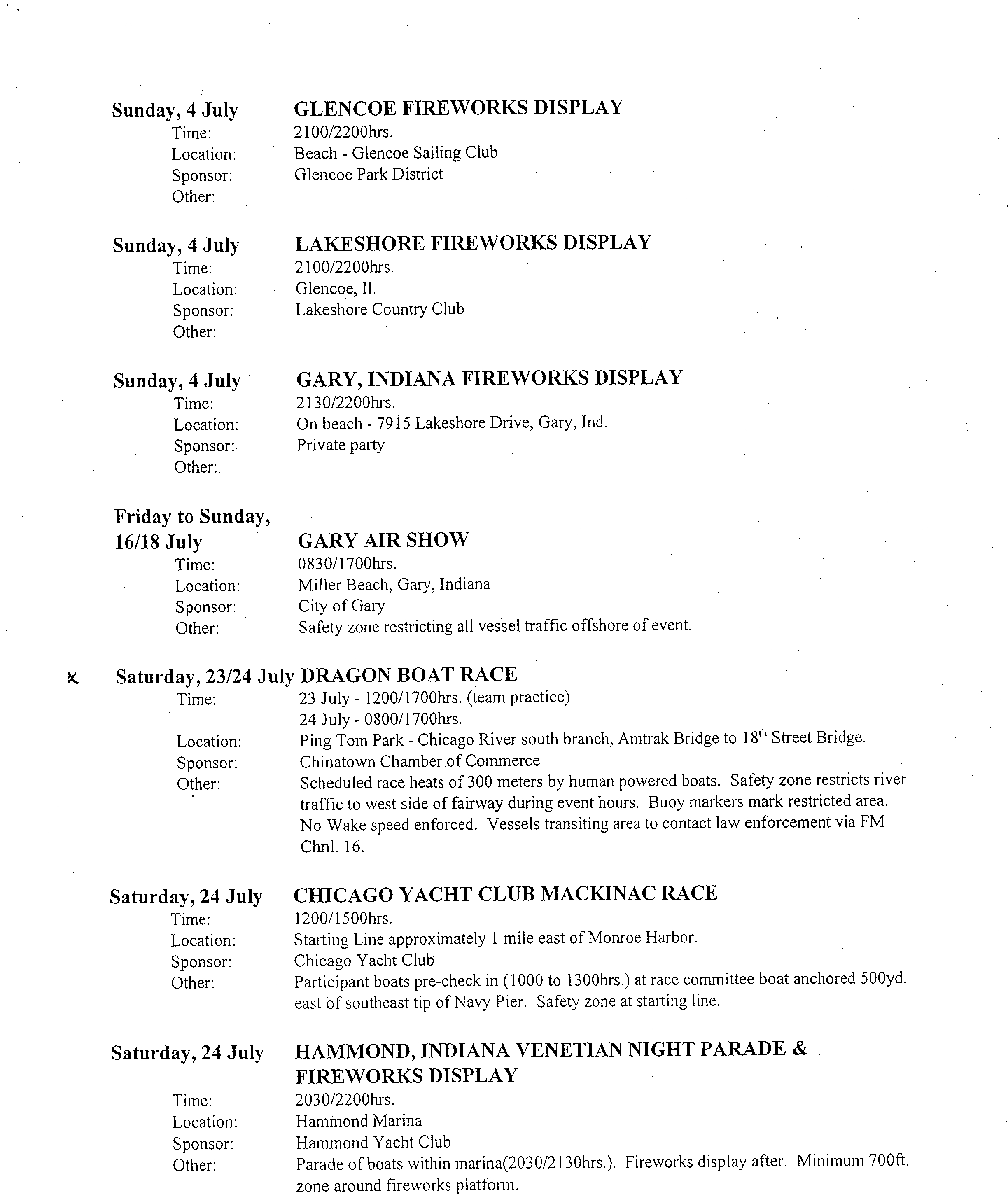
Sunday, 4 July
Time:
Location:
Sponsor:
Other:
Sunday, 4 July
Time:
Location:
Sponsor:
Other:
Sunday, 4 July
Time:
Location:
Sponsor:
Other:
Friday to Sunday,
16/18 July
Time:
Location:
Sponsor:
Other:
GLENCOE FIREWORKS DISPLAY
2100/2200hrs.
Beach - Glencoe Sailing Club
Glencoe Park District
LAKESHORE FIREWORKS DISPLAY
2100/2200hrs.
Glencoe, II.
Lakeshore Country Club
GARY, INDIANA FIREWORKS DISPLAY
2130/2200hrs.
On beach - 7915 Lakeshore Drive, Gary, Ind.
Private party
GARY AIR SHOW
0830/1700hrs.
Miller Beach, Gary, Indiana
City of Gary
Safety zone restricting all vessel traffic offshore of event.
Saturday, 23/24
Time:
Location:
Sponsor:
Other:
July DRAGON BOAT RACE
23 July - 1200/1700hrs. (team practice)
24 July - 0800/1700hrs.
Ping Tom Park - Chicago River south branch, Amtrak Bridge to 18' Street Bridge.
Chinatown Chamber of Commerce
Scheduled race heats of 300 meters by human powered boats. Safety zone restricts river
traffic to west side of fairway during event hours. Buoy markers mark restricted area.
No Wake speed enforced. Vessels transiting area to contact law enforcement via FM
Chnl. 16.
Saturday, 24 July
Time:
Location:
Sponsor:
Other:
CHICAGO YACHT CLUB MACKINAC RACE
1200/1500hrs.
Starting Line approximately 1 mile east of Monroe Harbor.
Chicago Yacht Club
Participant boats pre-check in (1000 to 1300hrs.) at race committee boat anchored 500yd.
east of southeast tip of Navy Pier. Safety zone at starting line.
HAMMOND, INDIANA VENETIAN NIGHT PARADE &
FIREWORKS DISPLAY
2030/2200hrs.
Hammond Marina
Hammond Yacht Club
Parade of boats within marina(2030/2130hrs.). Fireworks display after. Minimum 700ft.
zone around fireworks platform.
Saturday, 24 July
Time:
Location:
Sponsor:
Other:
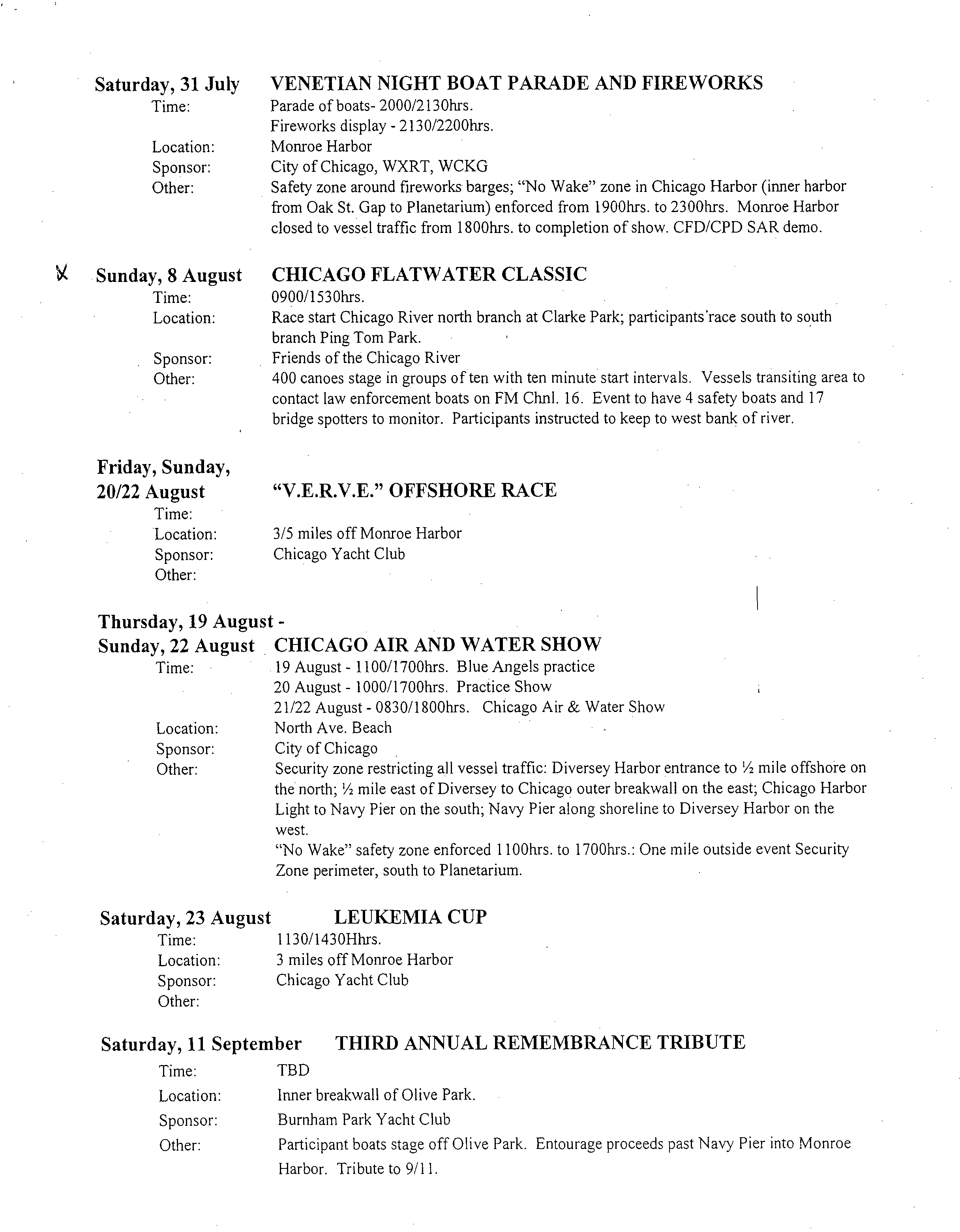
Saturday, 31 July VENETIAN NIGHT BOAT PARADE AND FIREWORKS
Time:?
Parade of boats- 2000/2130hrs.
Fireworks display - 2130/2200hrs.
Location:?
Monroe Harbor
Sponsor:
?
City of Chicago, WXRT, WCKG
Other:
?
Safety zone around fireworks barges; "No Wake" zone in Chicago Harbor (inner harbor
from Oak St. Gap to Planetarium) enforced from 1900hrs. to 2300hrs. Monroe Harbor
closed to vessel traffic from 1800hrs. to completion of show. CFD/CPD SAR demo.
b.
Sunday, 8 August CHICAGO FLATWATER CLASSIC
Time:?
0900/1530hrs.
Location:?
Race start Chicago River north branch at Clarke Park; participants' race south to south
branch Ping Tom Park.
Sponsor:
?
Friends of the Chicago River
Other:?
400 canoes stage in groups of ten with ten minute start intervals. Vessels transiting area to
contact law enforcement boats on FM Chnl. 16. Event to have 4 safety boats and 17
bridge spotters to monitor. Participants instructed to keep to west bank of river.
Friday, Sunday,
20/22 August
Time:
Location:
Sponsor:
Other:
"V.E.R.V.E." OFFSHORE RACE
3/5 miles off Monroe Harbor
Chicago Yacht Club
Thursday, 19 August -
Sunday, 22 August CHICAGO AIR AND WATER SHOW
Time:
?
19 August - 1100/1700hrs. Blue Angels practice
20 August - 1000/1700hrs. Practice Show
21/22 August - 0830/1800hrs. Chicago Air & Water Show
Location:
?
North Ave. Beach
Sponsor:
?
City of Chicago
Other:?
Security zone restricting all vessel traffic: Diversey Harbor entrance to '/2 mile offshore on
the north; 1/2 mile east of Diversey to Chicago outer breakwall on the east; Chicago Harbor
Light to Navy Pier on the south; Navy Pier along shoreline to Diversey Harbor on the
west.
"No Wake" safety zone enforced 1100hrs. to 1700hrs.: One mile outside event Security
Zone perimeter, south to Planetarium.
Saturday, 23 August
?
LEUKEMIA CUP
Time:?
1130/1430Hhrs.
Location:
?
3 miles off Monroe Harbor
Sponsor:
?
Chicago Yacht Club
Other:
Saturday, 11 September THIRD ANNUAL REMEMBRANCE TRIBUTE
Time:
?
TBD
Location:
?
Inner breakwall of Olive Park.
Sponsor:
?
Burnham Park Yacht Club
Other:
?
Participant boats stage off Olive Park. Entourage proceeds past Navy Pier into Monroe
Harbor. Tribute to 9/11.
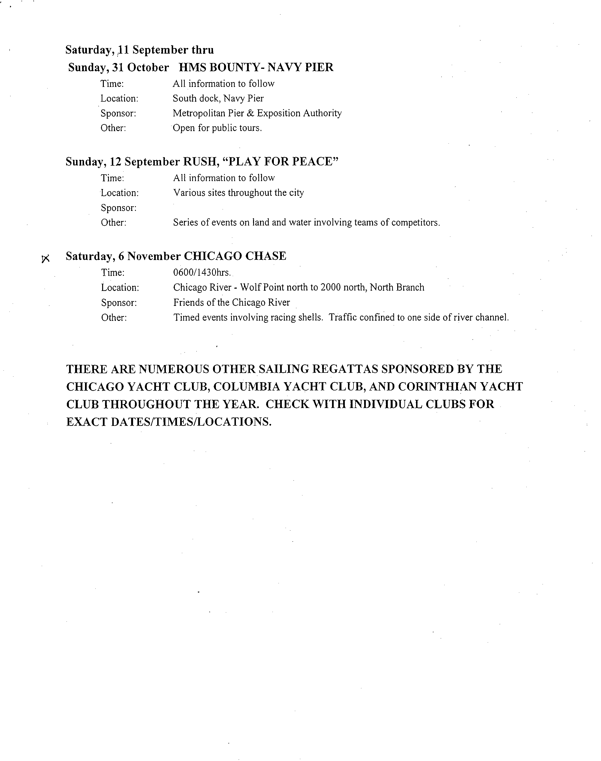
Saturday, 11 September thru
Sunday, 31 October HMS BOUNTY- NAVY PIER
Time:?All information to follow
Location:?
South dock, Navy Pier
Sponsor:
?
Metropolitan Pier & Exposition Authority
Other:?Open for public tours.
Sunday, 12 September RUSH, "PLAY FOR PEACE"
Time:
?
All information to follow
Location:
?
Various sites throughout the city
Sponsor:
Other:
?
Series of events on land and water involving teams of competitors.
Saturday, 6 November CHICAGO CHASE
Time:
?
0600/1430hrs.
Location:?
Chicago River - Wolf Point north to 2000 north, North Branch
Sponsor:?
Friends of the Chicago River
Other:?
Timed events involving racing shells. Traffic confined to one side of river channel.
THERE ARE NUMEROUS OTHER SAILING REGATTAS SPONSORED BY THE
CHICAGO YACHT CLUB, COLUMBIA YACHT CLUB, AND CORINTHIAN YACHT
CLUB THROUGHOUT THE YEAR. CHECK WITH INDIVIDUAL CLUBS FOR
EXACT DATES/TIMES/LOCATIONS.
•
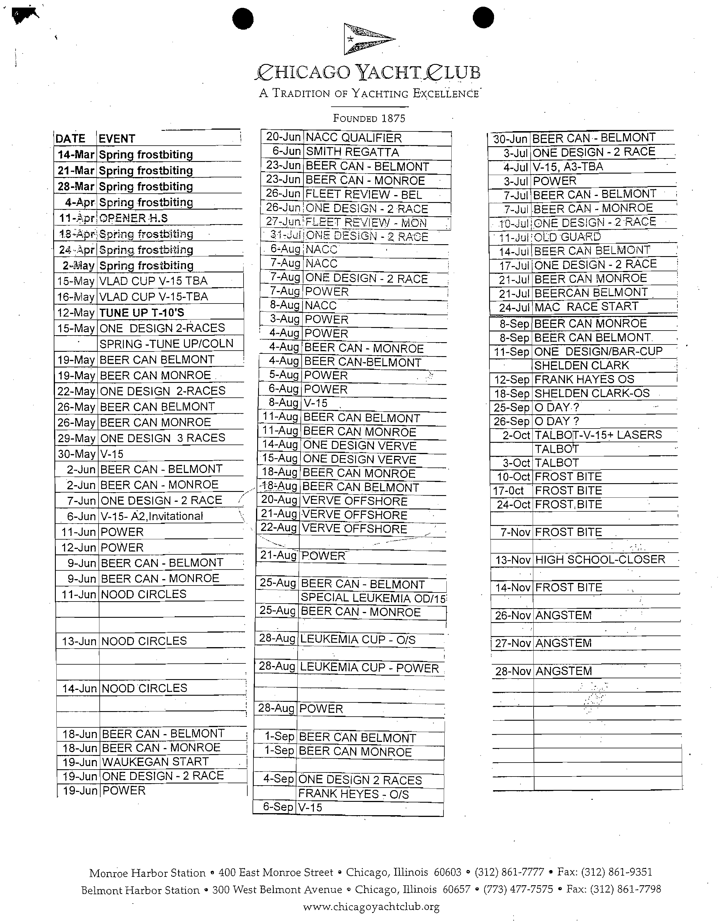
£HICAGO YACHTELUB
A
TRADITION OF YACHTING EXCELLENCE
FOUNDED
1875
20-Jun
NACC QUALIFIER
30-Jun
BEER CAN - BELMONT
6-Jun
SMITH REGATTA
3-Jul
ONE DESIGN - 2 RACE
23-Jun
BEER CAN - BELMONT
4-Jul
V-15, A3-TBA
23-Jun
BEER CAN - MONROE
3-Jul
POWER
26-Jun
FLEET REVIEW - BEL
7-Jul
BEER CAN - BELMONT
26-Jun
ONE DESIGN - 2 RACE
7-Jul
BEER CAN - MONIROE
27-Jun
FLEET
REVIEW - MON
ONE DESIGN - 2 RACE
10-Jul
ONE DESIGN - 2 RACE
11-Jul OLD GUARD
6-Aug
NACC
14-Jul BEER CAN BELMONT
7-Aug
NACC
17-Julj ONE DESIGN - 2 RACE
7-Aug
ONE DESIGN - 2 RACE
21-Jul
BEER CAN MONROE
7-Aug
POWER
21-Jul
BEERCAN BELMONT
8-Aug
NACC
24-Jul
MAC RACE START
4-Aug
3-Aug
POWERPOWER
8-Sep
BEER CAN MONROE
f
4
6
4-Aug
5-Aug
-
AugAug
BEER
POWER
BEER CAN
CAN-BELMONT
- MONROE
11-Sep
12-Sep
8-Sep
SHELDEN
ONE
BEER
FRANK
DESIGN/BAR-CUP
CAN
HAYES
CLARK
BELMONT.
OS
-
11-Aug
11-Aug
8 Aug
V-15
BEER
BEER
POWER
CAN
CAN
BELMONT
MONROE
26-Sep25-Sep
18-Sep
2-Oct
SHELDEN
0
TALBT-V-15+
0
DAY
DAY?
?
CLARK-OS
LASERS
14-Aug
ONE DESIGN VERVE
TALBOT
-18-Aug
20-Aug
18-Aug15-Aug
VERVE
BEER
ONE
BEER
DESIGN
CAN
CAN
OFFSHORE
BELMONTMONROEVERVE
17-Oct
24-Oct
10-Oct
3-Oct
TALBOTFROST
FROST,
FROST
BITEBITE
BITE
21-Aug
VERVE OFFSHORE
22-Aug
VERVE OFFSHORE
7-Nov
FROST BITE
21-Aug`
POVVER
-
13-Nov
HIGH SCHOOL-CLOSER
25-Aug
BEER CAN - BELMONT
14-Nov
FROST BITE
SPECIAL LEUKEMIA OD/15
25-Aug
BEER CAN - MONROE
26-Nov
ANGSTEM
28-Aug
LEUKEMIA CUP - 0/S
I 27-Nov
ANGSTEM
28-Aug
LEUKEMIA CUP - POWER
28-Nov
ANGSTEM
28-Aug
POWER
1-Sep
BEER CAN BELMONT
1-Sep
BEER CAN MONROE
4-Sep
ONE DESIGN 2 RACES
FRANK HEYES - 0/S
6-Sep
V-15
DATE EVENT
14-Mar Spring frostbiting
21-Mar
Spring frostbiting
28-Mar Spring frostbiting
4-Apr
Spring frostbiting
11-Apr
OPENER-KS
18-:Apr Spring frostbiting
24 -Apr
Spring, frostbiting
2-lay
Spring
frostbiting
15-May VLAD CUP V-15 TBA
16-May
VLAD CUP V-15-TBA
12-May
TUNE UP T-10'S
15-May
ONE DESIGN 2-RACES
SPRING -TUNE UP/COLN
19-May BEER CAN BELMONT
19-May BEER CAN MONROE
22-May ONE DESIGN 2-RACES
26-May BEER CAN BELMONT
26-May
BEER CAN MONROE
29-May ONE DESIGN 3 RACES
30-May V-15
2-Jun
BEER CAN - BELMONT
2-Jun
BEER CAN - MONROE
7-Jun ONE DESIGN - 2 RACE
6-Jun
V-15- A2,Invitational
11-Jun POWER
12-Jun POWER
9-Jun
BEER CAN - BELMONT
9-Jun BEER CAN - MONROE
11-Jun
NOOD CIRCLES
13-Jun
NOOD CIRCLES
14-Jun
NOOD CIRCLES
18-Jun
BEER CAN - BELMONT
18-Jun
BEER CAN - MONROE
19-Jun
WAUKEGAN START
19-Jun
ONE DESIGN - 2 RACE
19-Jun
POWER
Monroe Harbor Station
e
400 East Monroe Street
0
Chicago, Illinois 60603 (312) 861-7777 • Fax: (312) 861-9351
Belmont Harbor Station
0
300 West Belmont Avenue o Chicago, Illinois 60657
0 (773) 477-7575 Fax: (312) 861-7798
www.chicagoyachtclub.org
Tom Nagawiecki - Fwd: FW: water quality recreation
?
Page 1
EPA
From:
?
Rob Sulski
To:?
Nagawiecki, Tom
Date:?
6/11/2007 10:55:25 AM
Subject:
?
Fwd: FW: water quality recreation
>>> "Laurene von Klan" <Ivonklan@chicagoriver.org> 2/23/2004 9:43 AM >>>
More on seasonal issues
?
Original Message
From: Michael O'Gorman fmailto:michael oporman@hotmail.coml
Sent: Friday, February 20, 2004 6:06 PM
To: Ivonklan@chicacioriver.orq
Subject: RE: water quality recreation
Laurene,
We (Chicago Rowing Center) row from the middle of March (March 13 this year)
through the middle of October (October 15 last year).
Some other members of the South Chicago Rowing Association begin maybe as
early as the first week of March, and row through maybe the middle of
November (weather permitting).
Thank you for including us.
Thanks,
Michael O'Gorman
(312) 593-8040
>From: "Laurene von Klan" <Ivonklan@chicaporiver.orq>
>To: "urbas, susan" <chicaporiverrowinp@vahoo.com>,"mechanic, gary"
><Istroker@email.msn.com>,"hurtowy, vic"
><vic@chicapolandcanoebase.com>,<rowinp@entropvcentral.com>,"Michael
>Ogorman" <michael ogorman@hotmail.com>,"Arbetter, Gene"
><riverbikes@hotmail.com>,"Lynn Dinzole" <thedinz123@aol.com>
>Subject: water quality recreation
>Date: Fri, 20 Feb 2004 16:37:08 -0600
>Hello rowers: the IEPA is evaluating whether or not recreational water
>quality
>standards for the Chicago river (the channelized portions) should be linked
>to a
>"recreation season." Presumably, standards would be lower off season. Is
>there
>a season? Year round? Let me know.
>Thanks.
>Laurene von Klan?
-
>Executive Director
Tom Nagawiecki - Fwd: FW: water quality recreation
?
Page 1
From:
?
Rob Sulski
To:?
Nagawiecki, Tom
Date:?
6/11/2007 10:52:58 AM
Subject:?
Fwd: FW: water quality recreation
>>> "Laurene von Klan" <Ivonklan@chicagoriver.org> 2/23/2004 9:28 AM >>>
Hi Rob - I was wondering about the use of a recreational seasonal standard and
here is some of the feedback that I got...
?
Original Message
From: Scott Williamson fmailto:stw 25@hotmail.coml
Sent: Saturday, Februarv21, 2004 11:46 PM
To: Ivonklan@chicacioriverorg
Subject: Re: water quality recreation
Hi,
?
.
On the south side we see rowing from March to November, with the highest
volume in the spring (March-May) and fall (mid-August-November). The same
is true with the boat house on the near-north branch at North Ave. The
summers are active, but the high school teams who make up 2/3 of all the
rowers in the city aren't rowing then.
Scott
>From: "Rose Marchuk" <roserows@ameritech.net>
>To: "Laurene von Klan" <Ivonklan@chicagoriver.orq>
>CC: "Sally Stults" <sdsscout@aol.com>,"Matt Baldino"
><mhoqback@aol.com>,"Libby Rockwood" <libbv rockwood@hotmail.com>,"Tim
>Grant" <torant@lunavista.com>,"Rachel Waterston"
><drwaterman@hotmail.com>,"Scott Williamson" <stw 25@hotmail.com>,"Scott
>Runkle" <SERunkle@skokieparkdistrict.orq>
>Subject: Re: water quality recreation
-
>Date: Sat, 21 Feb 2004 12:34:36 -0700
>Laurene,
>The peak usage for rowing on our stretch of the river is mid-March thru
>June. Summer rowing also takes place with camps (and canoes/kayaks) but
>with less rowers than Spring, but that should increase over time. Summer
>extends to mid- August when the fall season begins. Fall rowing ends by the
>end of October to coincide with racing schedule or when water freezes over.
>I am also forwarding this on to Sally Stults our parent liaison at New
>Trier, Matt Baldino, Loyola Head Coach, Tim Grant, North Park College and
>Libby Rockwood, Woodlands Academy Head Coach. I don't have an email for
>Northwestern We all row out of the same boathouse. Also included Rachel
>Waterson, Lincoln Park Juniors & Scott Williamson, St. Ignatius, & Scott
>Runkle, Skokie Park Dist.
>-Rose Marchuk
>Head Coach
>New Trier High School
?
Original Message ?
2001 10,955
2002 11,779
2003 10,312
Page 1
Tom Nagawiecki - Fwd: Re: Recreational boats at O'Brien Lock, Calumet River
?
Page 1
From:
?
Rob Sulski
To:?
Nagawiecki, Tom
Date:?
6/11/2007 10:56:43 AM
Subject:
?
Fwd: Re: Recreational boats at O'Brien Lock, Calumet River
>>> <Azevedo.George@epamail.epa.gov> 4/28/2004 3:45 PM >>>
Here you go Rob, Recreational Vessel traffic for the Chicago Harbor
Lock, same time period as below are:
2001 Up 17,372
2002 •
Up 18,268
2003 Up 15,009
Rob Sulski
<Rob.Sulski@epa.s?
To:?
George Azevedo/R5/USEPA/US@EPA, Edward
Hammer/R5/USEPA/US@EPA, Rebecca
tate.il.us>?
Harvey/R5/USEPA/US@EPA, Linda Holst/R5/USEPA/US@EPA, Peter
Howe/R5/USEPA/US@EPA, Allen
Melcer/R5/USEPA/US@EPA, Janet Pellegrini/R5/USEPA/US@EPA, David
04/28/2004 03:17
?
Pfeifer/R5/USEPA/US@EPA, Peter Swenson/R5/USEPA/US@EPA
PM
?
cc:?
BrockSE@cdm.com
Subject: Re: Recreational boats at O'Brien Lock, Calumet River
George, can you get this data for the Chicago Lock, too?
>>> <Azevedo.Georqe@epamail.epa.00v> 4/28/2004 12:01:57 PM >»
I got the numbers for recreational boat traffic heading upstream
(one-way), to the lake, through the O'brein Lock. They are for the
years 2001 to 2003, May through October. Thought you may like to use
them for the UAA, they're from the Army Corps.
The average record is 11,015 per year, so they are pretty much in line
with our estimate of 17,000 to 20,000 launches from Worth and Alsip
for
the same time period.
2001 10,955
2002 11,779
Tom Nagawiecki - Fwd: south chicago rowing ?
Page 1
From:?
Rob Sulski
To:?
Nagawiecki, Tom
Date:?
6/11/2007 10:58:49 AM
Subject:
?
Fwd: south chicago rowing
>>> Lisa Kallal <learntorow@yahoo.com> 5/11/2004 4:09 PM >>>
Rob,
I just attended your meeting on the Chicago River quality at the State of Illinois Bldg. and
I just wanted to tell you how happy I am to see that such efforts are being made to help clean up the river.
I had to leave the meeting early for work, but wanted to offer up info about our rowing groups in case you
need it.
First my name is Lisa Kallal. I am a rower for Chicago Rowing Center, which is located at corner of Lock
and Fuller, or the turning basin where bubbly creek begins. But there are several groups at our site South
Chicago Rowing Center.
We have about 20-30 competitive women rowers depending on the time of year and one novice program
with about 15 rowers. We row from mid-March to mid-Oct.
There is also St. Ignatius High School, which can possibly have 50 rowers go out on a daily basis during
the fall and
. spring seasons.
Univ. of Chicago also rows during the fall and spring seasons. They have at least
30
rowers.
Chicago Youth Rowing Club rows more sporadically. I am not sure on their numbers.
Kenwood Academy is also at our site, but has not been rowing as of late.
At times the local colleges and high schools will have competitive scrimmages from our location. The
shipping canal is perfect for rowing, because it is straight so no turns to get around and we can see on-
coming boats better.
Bubbly creek is pretty small to get in a good row for a competitive team, but its shielded from the wind a
little more, which makes it easier for novice boats. Plus barges and speed boats tend to avoid it.
I have been rowing out of the south location for the last four years and have seen a visual improvement in
how much trash is in the water. However bacteria is the great unknown that we can't see. Thus, if we can
be of any help in helping the EPA clean up the river, please let us know.
We are having a neighborhood picnic at our site on May 22...please let me know if you would like to come.
Lisa Kallal (773-972-0068)
Do you Yahoo!?
Win a $20,000 Career Makeover at Yahoo! HotJobs
I'm Looking for:
Female
-martmmrs-s-
.lavalife.co
Page 1 of 2
MSN Home
I
My MSN
I Hotmail I
Shopping
I
Money People & Chat
Sign
Web Search:
sarnajoe@hotmail.com
?
Free Newsletters 1 I
el3 Reply I (9,'; Reply All I
a
Forward I X Delete I 0 Block I L
CC This is not Junk I ta,
Put in Folder -■ I
43
Print View
?
Sa
Rachel Waterston
<drwaterman@hotmail.com>
Friday, May 21, 2004 3:16 PM
drwaterman@hotmail.com
fckern@yahoo.com, TheDinz123©aol.corn,
pwohlman@aol.com
Subject :?
• 2004 Chicago Chase
I
L=4
T
:1'
Junk E-Mail I t Inbox
From :
Sent :
To :
CC :
Attachment : 2004ChicagoChaseNotification.doc (0.04 MB)
FIND A DATE
The Chicago Union Rowing and Paddling Foundation will be hosting
the 4th Annual Chicago Chase rowing regatta on November 6, 2004.
The Chicago Union runs this annual fall regatta to support the
Lincoln Park Juniors, a high school club rowing team offering the
sport of rowing to a socio-economically diverse group of
approximately 80 students from around the Chicago area.
As in the previous two years, the Chicago Chase will be holding
this event on the northern branch of the Chicago River from
Wolf's
.
Point (Lake Street) to north of the North Avenue bridge.
The. Chicago Chase last year brought in over 400
. participants and
more than 600 onlookers from several states throughout the
Midwest. In anticipation of the event this year, we would like.to
notify you of this regatta so as to avoid any conflicts with
other events on the Chicago River. Please see the attached
document for further details about the 2004 Chicago Chase. We are
excited to once again hold this event near the downtown Chicago
area, which provides an exciting and beautiful backdrop to the
race, and a great incentive for visiting teams to attend the
event.
If you no longer work on these type of events related to the
Chicago River, I sincerely apologize! I would like to update the
contact list from two years ago, so if you know of a better
person within your department for me to contact regarding the
race, please let me know if possible. I would greatly appreciate
it! If you have any questions regarding this event, please do not
hesitate to contact me, Rachel Waterston, at 773/750-7212 or
drwaterman©hotmail.com
Thank you for your time, and we look forward to a great race in
November!
Sincerely,
Rachel Waterston
Rachel Waterston
Head Coach
Lincoln Park Juniors
IIMNIAZWIVNt111111
Streamside
East of Ashland Avenue, RM
319.5, south bank
Park, Blue Island Park
District, MWRDGC
Fishing and Streamside
West of Chatham Street, RM
318.0, north bank
Aeration Station No. 3,
Blue Island Park District,
MWRDGC
Canoe and Dock
RM 313.8, north bank
Howe's Landing Boat
Ramp, Alsip Park District,
MWRDGC
'Fishing and Streamside
East of Harlem Avenue, RM
311.5, north bank
Aeration Station No. 4,
Worth Park District,
MWRDGC
West of Harlem Avenue, RM
311.1, south bank
Lake Katherine Nature
Center, Palos Heights Park
District, MWRDGC
Streamside
Canoe and Dock
West of Harlem Avenue, RM
311.0, north bank
Boat Ramp, Worth Park
District, MWRDGC
Fishing and Streamside
West of 104th Avenue, RM
307.3, north bank
Sauganashkee Slough,
Forest Preserve District of
Cook County
West of IL Route 83, RM 303.6,
north bank at junction of
Chicago sanitary and Ship Canal
Streamside
Aeration Station No. 5,
MWRDGC
CHICAGO AREA WATERWAYS
PUBLIC ACCESS INVENTORY
Access Category
Location
Name, Operator, Owner
Calumet-Sag Channel
Chicago River
Streamside
East of Ogden Slip, north bank
Parking Lot and North
Inner Harbor Wall, Corps
of Engineers
Streamside
Ogden Slip, west of Lake Shore
Drive, north bank
Restaurants and stores,
North Pier Terminal
Streamside
East of Lake Shore Drive, south
bank
DuSable Park and new
South Inner Harbor Wall,
Chicago Park District
Streamside
McClurg Court, north bank
Promenade at Centennial
Fountain, MWRDGC
Streamside
Lake Shore Drive to Michigan
Avenue, south bank
Path, City of Chicago
Streamside
East of Columbus Drive, north
bank
Promenade, Sheraton
Hotel
Streamside
East of Michigan Avenue, north
bank
Promenade, Equitable
Building
1
Dock
East of Michigan Avenue, south
bank
Chicago's First Lady
Dock
West of Michigan Avenue, north
bank
Wendella
Dock
West of Michigan Avenue, south
bank
Mercury
Streamside
Michigan Avenue to Lake Street,
south bank
Promenade, City of
Chicago
Dock
West of State Street, north bank
SkipperBud's, Marina City
Streamside
East of LaSalle Street, north
bank
Sorriso Restaurant
Chicago Sanitary and Shi
• Canal
Dock
West of Western Avenue, south
bank. (under construction)
Boat ramp, Chicago Park
District
/
MWRDGC
Streamside
Summit to Romeoville, both
banks
Centennial and I&M
Canal Corridor Trails
Dock
IL Route 171, east bank
Boat Ramp, MWRDGC
-
permit required for access
Grand Calumet River
Streamside
State Line RR Bridge to Penn-
Central RR Bridge, both banks
Owner unknown
Streamside
Burnham Woods, north bank
Forest Preserve District
Streamside
138th Street to Burnham Avenue,
both banks
Burnham Prairie, Private
residences, trailer court
Streamside
Torrence Avenue Bridge, south
bank
Owner unknown
Lake Calumet
Streamside
Stony Island Avenue, north bank
of entrance channel
Owner unknown
Little Calumet River
Dock
13701 Hoxie Avenue, RM
326.0, east bank
M&M Wind Jammer,
Marina
Dock
13620 Hoxie Avenue,
RM
326.0, east bank
Dawson's Creek Marina
Dock
14002 Croissant Drive, east bank
Croissant Marina
Dock
14042 Croissant Drive, RM
325.4, east bank
A-1 Millennium Marina
Dock
RM
325.3, east bank
Riley's Marina
2
Canoe and Dock
Dock
West of 1-94, RM 324.6, north
bank
140th
and Cottage Grove, RM
324.2, south bank
Boat Ramp, Beaubien
Woods, Forest Preserve
District of Cook County
Marine Services
Dock
826 East 138th
Street, RM 323.3,
south bank
Pier II, Marina
Dock
RM 323.2, south bank
Lake Calumet Boat and
Gun Club
Dock
13421 Vernon Avenue, east of
Skippers Marina
Indiana Avenue, RM 322.8,
north bank
Dock
East of Indiana Avenue, RM
322.7, south bank
Rueters Marina
Streamside
Indiana Avenue, east bank of
Acme Bend
Owner unknown
Streamside
East of Halsted Street, south
bank
Whistler Preserve, Forest
Preserve District of Cook
County
Streamside and Dock
East and west of Halsted Street,
north bank
Calumet Park
Dock
1310.0 Halsted Street, RM 320.0,
south bank
Riverdale Marina
North Branch
Fishing, Canoe, and
Streamside
North of Argyle Street, west
bank
West River Park, Chicago
Park District, MWRDGC
Streamside
Argyle Street to Lawrence
Avenue, west bank
Ronan Park, Chicago Park
District, MWRDGC
Streamside
Montrose Avenue to Berteau
Street, east bank
Path, North Branch
Neighbors and
Neighborspace,
MWRDGC
Canoe
Berteau Avenue, east bank
Street end, North Branch
Neighbors and
Neighborspace,
MWRDGC
Dock
4130 N. Rockwell, east bank
Ravenswood Boat Yard
Canoe
South of Addison Street, east
bank
Clark Park, Chicago Park
District, MWRDGC
Dock
Roscoe Street to Belmont
Avenue, west bank
Belmont River Club, c/o
Foster Premier
Development, MWRDGC
3
Streamside
North of Diversey Boulevard,
east bank
Path, Lathrop Homes,
Chicago Housing
Authority
Dock
West of Metra Railroad Line,
east bank
Unknown owner
Dock
South of Division Street, west
bank
AAA Boatyard
Canoe
North Branch Canal at Weed
Street, east bank
Street end, City of
Chicago
Streamside
Erie Street, east bank
Erie Landing , City of
Chicago
North Shore Channel
Streamside
Sheridan Road, north bank
.
Wilmette Pumping
Station, MWRDGC
Canoe
East of Bridge Street, north bank
Evanston Ecology Center,'
City of Evanston,
MWRDGC
Canoe
North of Oakton Street, east
bank
Oakton Aquatic Center,
Skokie Park District,
MWRDGC
Streamside
Devon Avenue to Foster Street,
east and west banks
Paths, Chicago Park
District, MWRDGC
South Fork of South Branch (Bubbly Creek)
Streamside
North of 35
th
Street, east bank
Paths, Bridgeport Village,
unknown developer
Fishing and Streamside
2900 South Ashland Avenue,
west bank
Origins Park, Chicago
Park District
South Branch
Dock
Polk Street, east bank
River City Marina
Streamside
South of 18th Street, east bank
Ping Tom Park, Chicago
Park District
Dock
East of Canal Street, west bank
Marinus Marine Service
Dock
West of Canal Street, west bank
Skokie Marine
Corporation
Dock
South of Cermack Road, west
South Branch Marina
bank
Dock
West of Halsted Street, south
bank
Crowley's Yacht Yard
Dock
West of Ashland Avenue, north
bank
Marine Services
Corporation
Streamside
West of Ashland Avenue, south
bank
Path, Sun-Times Printing
plant
4
Dock
?
West of Ashland Avenue, north Chicago Yacht Yard
bank
Note: Location by street address or street name is preferred. River mile (RM) is given for
locations not near streets.
Access Categories:
•
Canoe = Put-in and take-out places for paddle-powered watercraft
•
Dock = Dock facility for motor-powered watercraft
•
Fishing = Paths, overlooks or wade-in places where fishing is known to occur
•
Streamside = Paths, overlooks and walkways
6-4-2004
Lanyon
5
Tom Nagawiecki - Fwd: Licoln Park Juniors & Chicago Chaase
?
Page 1
T
?
26610\
From:
?
Rob Sulski
To:?
Nagawiecki, Tom
Date:?
6/11/2007 11:01:06 AM
Subject:?
Fwd: Licoln Park Juniors & Chicago Chaase
>>> "Rachel Waterston" <drwaterman@hotmail.com> 6/10/2004 12:03 PM >>>
Rob,
Attached is the electronic version of the Chase letter you received and
asked for. Thank you for including us in your consideration of the zoning of
the Chicago River. The Lincoln Park Juniors are avid users of the river and
likely use the river more than anyone else!
The Chicago Chase launch site at the turning basin at North Avenue is also
our launching/docking site for practices for both LPJ and the LPBC (Lincoln
Park Boat Club - separate organization) rowing teams. Crews are on the water
from the end of February/beginning of March all the way through the
beginning of November. From early March through early June, and from the end
of August through the beginning of November, LPJ practices six days a week -
Monday - Friday from 4:15- 6:30, and Saturday mornings. For any one
practice, LPJ will have about 8-10 rowing boats on the water with safety
launches alongside (we have approximately 80 kids on the team). During the
summer months of late June through July, LPJ practices in the mornings from
6-8am, Monday - Saturday. The LPBC rowing teams practice out of the same
site Monday - Thursday 6:30-8:30pnn and Saturday and Sunday mornings from
late March through mid-October, and generally have 1-2 rowing boats on the
water..
Crews travel both north and south from North Avenue each practice. Because
LPJ has so many boats practicing at the same time, generally about half our
crews head south and half head north. When travelling north, in one practice
our northern limit is around Lawrence and our southern limit is around Ping
Tom Park at 22nd street.
We certainly appreciate you taking us into account when looking at river
users and zoning. Our kids are frequent users of the river and we are always
looking for ways to make it safer to be out on the water with so many other
river users. We appreciate what you are trying to do, and please let us know
if you need any other information.
Sincerely,
Rachel Waterston
Rachel Waterston
Head Coach
Lincoln Park Juniors
Phone: 773/750-7212
Website: www.rowchicaoo.com
MSN 9 Dial-up Internet Access fights spam and pop-ups – now 3 months FREE!
http://ioin.msn.click-url.com/oo/onm00200361ave/direct/01/
[ Tom `Nagawiecki - Fwd: Re: CRRPC Open House/Learn to Row Day - June 12th
Page 1
PA 2467e
From:?
Rob Sulski
To:?
Nagawiecki, Tom
Date:
?
6/11/2007 12:57:14 PM
Subject:?
Fwd: Re: CRRPC Open House/Learn to Row Day - June 12th
>>> Susan Urbas <chicagoriverrowing@yahoo.com> 6/10/2004 5:14 PM >>>
PDSC Members -
Will send summary of June 7th meeting and follow-up items by early next
week.
Please read message to follow per separate email from FOCR concerning
the upcoming Flatwater Canoe Race.
And,
In the meantime, please join us at CRRPC's annual Open House and Learn to Row Day.
See attachment for details.
Very much looking forward to seeing you there!
Susan
susan k.b. urbas, presidentchicago river rowing & paddling centertele: 312.458.0810cell:
312.286.9102email:
chicaqoriverrowinq@vahoo.comwebsite:
chicagorowing.org
CHICAGO RIVER ROWING & PADDLING CENTER
OPEN HOUSE & LEARN TO ROW DAY
Saturday, June 12, 2004
8:00 a.m. — 2:00 p.m.
(Rain or Shine)
Please join us at CRRPC's annual Open House and Learn to Row
Day.
Festivities will include refreshments, tours of the. Interim Boating Center,
rowing videos, membership information, technical demonstrations on the rowing
ergometer, free mini-rowing lessons (8:00 a.m. – 11:00 a.m. only), and sales of
official CRRPC team shirts and other rowing gear (cash or check only).
This event is part of the National Learn to Row Day sponsored by the
United States Rowing Association/USRowing.
The Chicago River Rowing & Paddling Center, formerly known as the
Chicago River Rowing Club, was established in 1979. CRRPC is the oldest boat
club on the Chicago River and was the first organization to provide access to the
River for the pursuit of canoeing, kayaking and rowing on the Chicago River. It
continues to be the only organization which provides access for human-powered
craft on the Main Branch (downtown portion) of the Chicago River. Co-founder
and president of CRRPC, Susan K.B. Urbas, was also a founding member of the
Friends of the Chicago River and was formerly chair of the U.S. Women's
Olympic Rowing Committee. CRRPC is celebrating its 25
th
anniversary in 2004.
The Chicago River Rowing & Paddling Center is located on the south side
of the Chicago River where Lake Shore Drive crosses over the River (that is,
between Michigan Avenue and Lake Shore Drive at the level of the River). It sits
between the Lake Shore Drive bridge tower and the archway over the footpath
that runs along the south side of the River between Michigan Avenue and Lake
Shore Drive. The entrance to the Interim Boating Center is on the west end of
the archway and bridge tower (near the north end of DuSable Harbor). When
you see black iron gating covered with forest green fabric, you are there.
If you are driving, you should go east on Randolph Street (the middle level
- not the upper level) - the east end of which slopes down to the lower level and
then dumps into a cul-de-sac that functions as the entrance to DuSable Harbor.
The Interim Boating Center is directly north of there by foot (follow along the
sidewalk/footpath next to DuSable Harbor; when you come to the end of that
walkway, you will be at the River, facing north; take a sharp left (going west from
there, and walk under the arched walkway). At the end of the archway, the
Interim Boating Center will be to your right.
Parking is available for $10/day in the DuSable Harbor parking lot under
Lake Shore Drive (entrance to it is close to the above-mentioned cul-de-sac) or
at meters on the upper, middle, and lower levels of Randolph and Columbus. If
you use the DuSable Harbor parking lot, drive to the north end of the lot, park on
the west side of the lot, and walk directly north to the Interim Boating Center.
Please drop in anytime between 8:00 a.m. and 2:00 p.m. on June 12th.
Persons wishing to partake of a free mini rowing lesson should arrive between
8:00 a.m. – 11:00, and be dressed in comfortable athletic clothing (e.g., t-shirt,
running or biking shorts, socks, athletic shoes).
resser
&
McKee Inc.
'\ 355
Obe
Blvd. Suite 386
. axis, MO 63141
,_
?
14.436.5522
1
;lit
,
,tfjoc 414.499.6623
JUL-26-04
?
08:43?
FROM-CAMP DRESSER MCKEE INC.
?
314 439 5523?T-325?
P.001
?
F-031
Tg_ppt
604/:6;_;7,7
Organization:
I
E-
Fax No.:
7
71,-9
1
- itosi
#
of Pages:
(noudngcovershomi
Message:
hi/? wit
717r:
i0
C7 -S
?
k)c,c7ta/
Mc_
projecZ?
1)//
se 4e1
(14
cfl
e
P
c4
,
over'
?
r26;x7e-
4(-0
e
ac.
To:
From:
Jennifer Harness
Date:?
eD.C4
Time:
•
Job
#:
/Ler
/
7A04,4-C
JUL-26-04?
08:44?
FROM-CAMP DRESSER MCKEE INC.
?
314 439 5523
T-325?
P.002?
F-031
•
?
TRIP • LOG
PATROL:
O
qi-0
1°>
•
?
FLOATABLE
S
If cleanup' by Debris Control
.is
advisable contact:
Greg LaFlaine - (708) 220-7143
Tony Pihl - (708) 380-9804
DATE:
TIDE
LOCATION
DESCRIPTION
(Zie
of
Deb=is)
EST. AMOUNT
Photo
Contact
Bridge.and Bank Activity .
.Location
Activity:Observed
Sic.?
'1
4/
v,
4
'1
?
,
c2/,?
?
.13
),,.
,
•
etik74/6.7 ,
•?
•
I
.
•
- ' 4
7D
: -ote,
6>e,,
Location
Illegal Fleeting, Barge ID #
r s
Recreationali Survey of Chicago
•
Area
Waterway
•
Signature:System.
(Enter approximate number seen•)
Activity
'
North
•
Shore
Channel
North
Branch
Main
and S.
Branch
CSSC above
Junction
CSSC below
junction
.
Cal-Sag
•?
Little
Calumet
Rivers
Swimming, diymg or].
n
'mg
-
.
Siding or Tu agg
111111
a
•
Cam=?
scwiling,
or
airing
Fishing
1
i
/1It
other:
Contateuts:
ILANIMMWMWEIMUNIMMIXIMMINE
. ..
•
Obsertmrw
Date:
6
2r03
JUL-26-04?
08:44?
FROM-CAMP DRESSER MCKEE INC.?
314 439 5523
?
T-325
?
P.003?
F-031
TRIP* LOG
PATROL:
C
5
PO
)
Air
.
LL5
.
41- 0
C
Y\?
DATE :
G • L. C
a 2-
FLOATABLES
If clean.up
i
by Debris Control is advisable contact:
Greg LaFlame - (708) 220-7143
Tony Pihl
(708) 380-9804
TIME
LOA.TION
DESCRIPTION
(Typeofnebr30
EST. AMOUNT
OF D8BRiS
Photo
it
Contact
sanitary, Rind Sloven, Damned.
it
UlUJ
eu?
,
5
i•
1?
L
7
Id
?
'
.4
•
•
.?
.
.
•
•
,
—
.
•
•
.
Bridge and Bank Activity
Location
Activity'Observed
Location
Illegal Fleeting,
Barge ID #r$?
._
61.&10?.
.
KAGy
P060.
i
_
Signature:
Recreational Survey of
Chicago Area
Waterway
System.
'(Enter approximate number seen.)
.?
.
?•
Acti
4
vity
North
Shore
Channel
North
Branch
Maio
and S.
Branch
CSSC above
Junction
CSSC below
Junction
Cal-Sag
Little
Calumet
River
1
.
•
?
Swimming, diving or jumpin
•
_
-
.
SkiingarThbing
•
Wading
.
.
.
•
.
-77
zweiag,scuatog,ozkayakiag
—
,
FxsilIng '
t►.
?
ii
■■—
0d=
?
6, A
.
..
•
01111
Comments:
•?
.
•
Observers)
Date;
6 "
C
�
-
63
JUL-26-04
?
08:44
?
FROM-CAMP DRESSER MCKEE INC.
?
314 439 5523?
1-325?
P.004/035?
F-031
TRIP LOG •
PATROL.
?
NI2P71
DATE :
?
-
0
FLOATABLE
S
If cleanup by Debris.Control is advisable contact:
Greg LaFlaMe -
(708) 220
-
7143
Tony Pihl
(706)
380
-
9804
T
IME
i?
6
LOCATION
?
DESCRIPTION ('Tpeofnebris)
EST. AMOUNT
OF DEBRIS
Mil
Photo
#
Contact
EMIEn
..z)
7
Pa-F121ac
lAt
.
?
Aka
,
U.,
/?
4
(It 1/
P -
II
WA
111
Bridge and Bank Activity
Location
Activity' Observed
A.
11
)-e
f
er
g A---
c.0.5/ l a
ki
C
?
4 c
a- 471-eit
q
.
I'
Location
Illegal
Signature:
Fleeting, Barge ID
ist
#'s
i
Recreational Survey of Chicago Area Waterway System. .(Enter approximate number seen.)
•?
1
•
Activity
North '
Shore
Channel
North
Branch
Main
and S.
Branch
CSSC above
Junction
CSSC below
I
-
anction
Cal-Sag
Little
Calannet
River
Swinaniug,
diving
°dumping
,-
Siding or Tubing
_ _
Wading
-
•
?
Canoeing
.
, sculling,
or kayaking
_
1111I
I
I
?
_
Fishing
Other
Comments:
/
-111ffirinliiIVEN
1
.
I
(...-
kti
II
t
•
trows_ti
144-1
?
•
i(cky.:X5
?
0
owed
e
IA-/
Observer(s)
[ Date:
Location
Activity:Observed
Location
Illegal Fleeting,
Barge ID
#'s
Signature:
Recreational: Survey of Chicago Area Waterway System.
ix
approximate
.
?
.
seen.
JUL-26-04?
08:44?
FROM-CAMP DRESSER MCKEE INC.
?
314 439 5523
?
T-325?
P.005/085
?
F-031
TRIP • LOG •
PATROL:
‘,S0
c)
of
PrPe5
?
DATZ:
7r?
3
FLOATABLES
If cleanup•by Debris.Control is advisable contact:
Greg LaFlame - (708) 220-7143
Tony Pihl - (708) 380-9804
TIES
-
LOCATION
DESCRIPTION mrpeof-nabrls,
EST.
AMOUNT
OF
DEBRIS
Photo
#
Contact
Sard.t.azy,
mind Plowno Dtx=sed
212.._ IQ§?
/V- .
?
.1.41)\-eJ
?
• cirAfir
?
_
.
.
--
•?
.
—
.
Bridge and Bank Activity
.
Activity
North •
Shore
Channel
North
Branch,
Maio.
and
S.
)3ranch
CSSC above
Junction
CS SC below
Ituaction
Cal-Sag
Little
Calumet
River
•
Swimming, diving or jumping
.
,...
. Skiing or Tabing
•
•
Wading
•
Canoeing, sculling, or
kayaking
.
Fisig
• •
Comments:
•
?
•
er-
'M
ii!.
•?
.?
.
.
Observer(s) '
\
?
vr
•
Date:
JUL-26-04
?
08:44?
FROM-CAMP DRESSER MCKEE INC.
?
314 439 5523
?
T-325?
P.006/035?
F-031
TRIP' LOG •
PATROL:
?
P
6 19
"
ifillf5
?
•?
BATE :
7-5'03
FLOATABLE
S
If
cleanup
joy
Debris Control
is
advisable contact:
Greg LaFlarrie - (708) 220-7143
Tony Pihl -,. (708) 380-9804
TIME
LOCATION
DESCRIPTION (Type of Debris)
EST. AMOUNT
OS.
DEBRIS
Photo
#
Contact
sanitary,
land
Blown, Dur5Dea.
1
0
1
(
56J if-
A?
.,?
.
?
4
4 •
?
e
•I
.
.
Bridge and Bank Activity
Loca
.Elon.
•?
Activity
Observed
•
,?
.
i
.?
.
Location
Illegal Pleetinv, Barge ID #'s
a3 so utut44
r/?
.9o?
1.1
Plc
5/0 .
?
.17/ A? cezS
•
.Signature:
Racreationii
survey
of Chicago Area Waterway System.'
. (Enter approximate number seen.)
ActiVlty
'
?
North *
Shore
Channel
North
Branch
Main
and S.
Branch
CSSC above
Junction
CSSCbelow
Junction
Cal-Sag
MI
11111
Little
Calumet
wizomm diving orprolung
•
Mill=
River
Skiing or Tubin
•
Wading'
Canoeing, sculling, or kayaking
Fmbin:
PIIIIIIIMMIIIIIIIIIIIIIIIIIIIIIIIIIINIIIIIMMI
I?
111111.11EIMM
,
Omer?
..
M-
!‘
.'
Comments:
?
:
Observer(s)
'?
a
,1 0
0
V frV -
bate:
Signature:
Reoreational Survey of Chicago Area Waterway System. .(Ent
proximate =ober seen.)
JUL-26-04
?
08:45?
FROM-CAMP DRESSER MCKEE INC.
?
314 439 5523?T-325?
P.007/035?
F-031
TRIP' LOG •
PATROL:
AL"
bA.TE:
7-sr-0
3
FLOATABLE S
If cleanup lby Debris .Control is advisable'
contact:
Greg LaFlame - . (708) 220-7l4
Tony Pihl
?
(708) 380-9804
TIME
LOCATION
'
DESCRIPTION
.
AMOUN '
OF DEBRIS
Photo
#
Contact
.?
san
itj
axy , w4,,?
Blown, trumped.
O
log .
,
4.d!'ih, -e
FERIMISIBMIMEIBUI
7
1
.
4?
144
111M1
NIMIll
f?
,
.11=11111811
1G/Z__
V.?
C3
%?
r
.
NO
'
.?
/?
-e?
01,71-?
c cL,t- i
?
"...
vilid-e4
z 0
—
6
. -
0 ;
/`7/a
45144.
7
A. I
Lai
c444 ?
?
J
S e
..W1 (1-1.0 .
4
570/1
Bridge and Bank Activity
?
/
.Location
Activity'Observed
•
A i
\
?
A?
'
llr
•?
1?
c__c
Q,1
?44...--
A WO.
A
A.AI/
?
1
.
.
Location
Illegal Fleeting, Barge ID # s
v
.
•?
7--->
Activity
North
Shore
rbaun
el
North
Smack
Main
.
and S.
)3ranch
CSSC
above
Junction
CSSC
below-
lunation
Cal-Sag
Little
Calumet
River
Swimming, diving ()dumping
,-.
Skiing or
Tubing
I
Wading
•
"--- o emg, sculling,
'
,
or kayakin
Fishing
clA
11
.
•
Other:
lffilt
A, li......_____:_______L.......L...........______.__
Coreaments:
•
•
.
Observet(s)
‘
\).._t
.
Date:
0
JUL-26-04
08:45
FROM-CAMP DRESSER MCKEE INC.
314 439 5523
1-325
P.008/035
F-031
TRIP LOG
PATROL :
454
5
(4ta
CAI. SA
?
FLOATABLE S
If cleanupiby Debris Control
.is
advisable contact:
Greg LaFlarne -(708) 220-7143
Tony Pihl
-r
(706) 380-9804
DATE:
•
TIME
LOCATION
DESCRIPTION Mypeofnebrio
EST. AMOUNT
OF DEBRIS
Photo
#
Contact
Sakti:harp' , W
?
Blown, Dupiped.
O
q(C
/
5
f'?
11(
l1
5 AP(T
AFq
4 4-rohl
.p
a
pe
-
5
Nte
.
Nb
.
.
.
.
.
.?
.
.
.
Bridge and Bank Activity
Location
Activity'Observed
KV,
?
C.
4
,5(---
bP,W-5
14100
W)
?
Pif P-
-(45'
?
CI1Pt4
•
.
.
.
Location
Illegal Fleeting, Barge ID #'s
ieri
ff3
)?cce7c-
•
mkt.)t-iikk•
7c
103?
•
,?
...
Signature:
Recreational Survey of Chicago Area Waterway System. Enter approximate umber seen.)
.?
•?•
Activity
North.
Shore
Channel
North
Branch
Maim
and S.
Branch
CSSC above
Junction
CSSC below
hnotion
Cal-Sag
Litle
Calumet
River
!
,.
Swimming, drvxng orjuniping
Skiing or Tubing
I
Wading'
Canoeing, sculling, or kayaking
.
-1;ishilig
,
W7E)47.2;41-7
_
,-------_.
'
gmamoits:
•
Otsexv&W
.
Date.
JUL-26-04
?
08:45?
FROM-CAMP DRESSER MCKEE INC.
?
314 439 5523
?1-325?
P.009/035?
F-031
TRIP LOG
r)ATE:
7-/
0.07
1
If cleanuplby Debris Control is advisable contact:
Greg taFlaMe - (708) 220-7143
Tony
Pihl
(708)
380-9804
TIME
LOCATION
DESCRIPTION
Mr
p
eofDebris
EST. AMOUNT
OF DEBR
Photo
4
Contact
7-----
San.itarz, VO-nd. Blown, Dumped
0
S
t...
•
o?
.?
.
?
0
?
ti
l if
•
.
,
.
?
.
.
,
Bridge. and Bank Activity
Location
Activity Observed
.?
.
Loca
t
ion
Illegal
Fleeting?
Barge ID #'s
-p..-r .
s3
?
(,se, 6
-----
?
.
1
ff
25in
•?
•?
i
14
-no
?.?
_... c–N,
/1
Signature:
Recreational
survey
of Chicago Area Waterway System. .(Enter ai
p
proximate number seen-)
•
Activity
tY
North
Shore
Charinel
North
Branch
Main
and S.
Branch
CS SC above
hinclion
CSSC below
To:action
Cal-Sag
•?
Little
Calumet
River
-----—g7T1..---
fring oriwziaprof
I
•
•
_
Skiing or Tubing
•
I
Wadtg
•
Carmen*
Scrliling,
or kayaking
.
•?
I
?
Fxsifittg
.
•?
Other.
6
.
6
.2
1?
hoert
4
•
?
•
-1----
.
Comments:
I
;
I
•
Observet(s)
H
C614-b
Dam
FLOATABLES
JUL-26-04
?
08:45
?
FROM-CAMP DRESSER MCKEE INC.
?
314 439 5523?1-325?
P.010/035
?
F-031
Nr-IWRIP LOG
PATROL:
r
k
c
i
?
‘-loc)1-
?
DATE :?
Lzoii)
FLOATABLES
If cleanup
b:)y- Debris Control is
advisable contact:
Greg LaElaine —
(708) 220-7143
Tony Pihl
?
(708) 380-9804
TIME
LOCATION
DESCRIPTION
(Trpe
of
Debris)
EST. AMOUNT
OF DEBRIS
Photo
#
Contact.
sanitary, Wind
mown,
DInISCS
•
?
.
•?
t?
.
1
•
.
I
I
•
?
.
•
-
?
•
.
.
.
•
.
•
Bridge and Bank Activity
Loca4o
Activity-Observed
1
.?
.
1
.
.
?
.
Location
Illegal Fleeting, Barge ID #'s
•?
1
.?
.
I?
Signature:
Recreationa1
I
survey
of Chicago Area
Waterway
sygtmt.
Enter
co
approximate
tit
number seen.)
I■
Activity
I.
.?
North
Shore
Channel
3
North
)3ranch
r
Main
and S.
Branch
CSSC above
junction
CSSC ban?
Junction
Cal-Sag
Little
Calumet
River
1
.
Swimming,
?or jumping
_
or Tubin
•
i?
Wading
Canoeing, smiting, or kayaking
IFishmg
si
-iorgi
Other:
?
4 t?
,
-
.?
i
-
li?
i-
Comra-,
.
:
Observer(s)?
UU
Date:
7-//- 0-5
JUL-26-04
?
08:46
?
FROM-CAMP DRESSER MCKEE INC.
?
314 439 5523
?
T-325?
P.011/035
?
F-031
pATROL: k
?
Oocic.
TRIP LOG
DATE: 1--;
?
cl)
FLOATABLE
S .
If Cleanup By Debris Control is advisable contact:
Greg LaFIartie – (708) 220-7143
Tony Pihl – (708) 380-9804
TIME
LOCATION
DESCRIPTION
(T
yp
e of
Debris)
EST. AMOUNT
OP DEBRIS
Photo
#
Contact
sanitaxy,
Vinci. Blown,
Dumped
.
?
.
.
.
.
.
Bridge and Bank Activity
Activity Observed
92Uhk, W
•
Illegal
Fleeting, Barge ID
PS
WO* I-1
Ni&5 4* B
?
MoVb
?
.
Signature: ?
Recreational Survey
of Ch1c4go
Area Waterway System. -
(Enter approximate niAmber seen.)
Acfyity
North .
Shore
Channel
North
Branch
Main.
and S.
Branch
CSSC above
Junction
CSSC b elow
Junction
Cal-Sag
Little
Calumet
River
I.
Swimming, diving orproping
Skiing or Tubing
•
acing
Canoeing, smiling, or kayaking
•
•
,
i
ik.._. ih,
t
•
?
Faring
Other:
?
.
imini,_
i?
•
Carom ?
.
Observes(s)
•?
;
-04
Date:
?
.
7
\ L. 03
Signature:
Recreational! Survey o4
Chicago Area Waterway System. (Enter approximate
er seen.)
JUL-26-04
?
08:46?
FROM-CAMP DRESSER MCKEE INC.
?
314 439 5523
?1-325?
P.012/035?
F-031
TRIP' LOG
PATROL: i
Vpd
'
a
L.,
If
5
?
tATE:
'7-/103
FLOATABLES
If cleaniv by Debris Control is advisable contact:
Greg LaFlame - (708) 220-7143
Tony Pihl
?
(708)
380-9804
TIME
LOCATION
DESCRIPTION
(TypeofDebris)
EST. AMOUNT
OF DEBRIS
Photo
#
Contact
1
sanitarz, wind
Blown
./
Damped
0
0
Z4.44.441/C
Al?
X -4'
.?•?
S're 4
rtv.,
Y
0,
;e)rmiffi
il i4.)47.e
...
S a 1A., jae41.
Aim
FINIIIMill
.?
1?
,
Ell
t)
?
• c/t1t-Luke ,
tL'r-
/V-(0
1
7“/
c oi ZTf
d.
0.0,1*fir,/
ride
g
and
u
Bank Activit
OfiN
S OA,
4- 5 i
Tti
?
7
Locat2. n
Ac•&vity.Observed
Location
Illegal Fleeting,Barge ID ft s
.
?
,
.
•
ActiVity
•
?
North
Shore
Channel
North
Branch
Main
and $.
Branch
CSSC above
Junction
CSSC below
!unction
Cal-Sag
Little
Calumet
River
Swimming, &ping
!
?
ox
jinni=
•
'
,...,
'Skiing
or Tubing
•
Wading '
Canoeing, sculling or
?
'.. -
e.,
IM
Other:
?
' I
I?
CIA V
)
Fishing
0
'a
I
I
?
.
Comments:
.?
.?
Alle
k?
•
tiVill
IN ■._
.
11111
?
_
i%
4
'
?a
.
V 20 Oypty,5
Obstavei(s)
4INPIN!
..
I
.°.
Date:
JUL-26-04
?
08:46
?
FROM-CAMP DRESSER MCKEE INC.
?
314
439 5523
?T-325?
P.013/035?
F-031
TRIP LOG •
PATROL:
I
s CA a rt.
bATE:
7
'6
FLOATABLES
If
cleanup by Debris
Control
is advisable contact:
Greg Lanarrie - (708) 220-714a
Tony Pihl
?
(708) 380-9804
TIME
LOCATION
DESCRIPTION
(Ty
pe
c1CDeil
aris
EST. AMOUNT
OF DEBRIS
Photo
#
Contact
Sant
1Win:IBloc"
in
?
ed
OW/
r:04/1,
/ 4
Sakti
alci CI
,
tze"..
Bridge and Bank Activity
Location
Activity'Obsorved
.?
.?
.
.
.?
,
Location
Illegal Fleeting, Barge ID #'s
,?
.
v
.
•
.
•
Signature:
Recreational; Survey of Chicago Area Waterway System. (Enter approximate number seen.)
•
Activity
North
Shore
Channel
North
Branch
Main
and S.
)3ranc13.
CSSC above
•?
J11110611
__
CSSC below
Junction
Cal-
Sag
Little
Calumet
River
---"rimming, diving or jumping
Skiing or Tubing
•?
Wading
Can
oeing, sciang, or kayakin
•?
.
OdAer:?
4;
44
?
I„
dca—
Railing
*lit
I
Comments:
1
?
•
Observer(s)
?
I
Date:
friltEX
approximate number
S06111.
JUL-26-04
06:46
FROM-CAMP DRESSER MCKEE INC.
314 439 5523
1-325
P.014/035
F-031
TRIP LOG
PATROL:
Kid
g26L
4
C,k
4 c
4 r$
e
FLOATABLES
If cleanup y Debris Control is advisable contact:
Greg LaF1
(708) 220-7143
Tony Pihl
(708) 380-9804
DATE:
TIME
LOCATION
DESCRIPTION
cry-pa of
Debris)
EST. AMOUNT
OF DEBRIS
Photo
41
Contact
!
sanitary,. Rind
Blown
DVE1315ed,
I.
.
.?
.
?
.
,
.
•?
!
.
.?
.
.
.
Bridge and Bank Activity
Location
Activity'Observed
1
.?
•
.
.
.
?
-
Location
Illegal Fleeting, Barge ID #'s
•?
!
.
.?
.
i
Recreationa
-
Signature:
Survey
of Chicago Area
Waterway System.
Actiyty
1
i
North
Shore
Channel
North
Branch
Main
and S.
Branch
CSSC above
J113IC,OD,
CSSC
below
hinciion
Cal
-Sag
Little
Carnet
River
I.
Swimming, diming or jampiag
--
Skiing or Tubing
•
•
?
.?
Wading
•
•
C
anoeing,
s.
1
------r-L1--•----ALLELL---------:---
'
or
kaYa361
----
Ofb.er:
Comments:
•
Observer(s)
i?
Date:
JUL-26-04?
08:47?
FROM-CAMP DRESSER MCKEE INC.
?
314 439 5523
?
T-325?
P.015/035 ?
F-031
TRIP LOG
FLOATABLE
S
If
cleanuplby Debris Control is advisable contact:
Greg LaFlame – (708)
220-7143
Tony Pihl
t (708) 380•9804
TIME
LOCATION
DESCRIPTION qyzaefDebrio
EST. AMOUNT
OF DEBRIS
Photo
#
Contact
1
Sanitary,
Wind clown,
Dumped
I
•
I.
.
1
i
!
•
.?
.
.
1
.
!
.
.?
.
.
Bridge and Bank Activity
Location
Activity.Observed
_.
1
1
1
......._?...
.
?
.?
.
I
.
•
?
. .
Location
Illegal Fleeting, Barge ID #rs
I,?
.
1
?
.
v
•
?
,----2 /---:;-)72
Signature:
Recreetiona. survey of Chicago Area Waterway System. (Enter approximate number seen. )
—
•
Aa0fty
North
Shore
Channel
North
Branch
Main
and
S.
Branch
CSSC
above
Junction
CSSC
below
Sutton
.
Cal-Sag
Little
Calumet
River
I
•
.
S
y
nnmxim
d4vbigoriump
.
,--
SkiingorTebiag
.
Wading.
Canoeing, =Mug, or kayaking
.
I?
'tang
-
Cq4841
?
SAA
Ihr
•
..
I/
Comments:
;
•?
•?
.?
'?
•
I
.?
,
I
•
Observers)
?
!?
'
?
I
I
Date:
PATROL :
e
5
Po
4iy?
I5ATE
:•
•
I.
JUL-26-04
?
08:47
?
FROM-CAMP DRESSER MCKEE INC.
?
314 439 5523?
T-325?
P.010/035?F-031
TRIP LOG •
DATE
:
°75-4
FLOATABLE S
If cleanup by Debris Control is advisable contact:
Greg LaFlame - (708) 220-7143
Tony Pihl - (708) 380-9804
TIME
EST. AMOUNT
OF DEBRIS
Photo
#
Contact
sanita
fi* ,
Grind slorrn,
wed
Bridge and Bank Activity
•
Location
Activity-Observed
I.
1
?•
•
.
I'
Location
Illegal Fleeting, Barge ID #'s
•
?
1
?
'
T
?
.
Signature:
Recreational Survey of Chicago Area Waterway System.
.(Enter approximate number seen.)
.
Activity
•
?
North
Shore
Chaanel
North
Branch
Main
.
and S.
Branch
CSSC above
Juncticai.
CSSC below
Junction
Cal-Sag
Little
Calumet
River
.
.
' Swimmung, diving or Jumping
Skin or Tabmg
I
Warr....
•
canoeing, sculling,
or kayaking
1
Fisbing
(Aim? 1
Comments:
?
1
1
.
•
Observers
?
1?
di
?
0
.,.,
Date: _
AffIr
PATROL:
JUL-26-04?
08:47?
FROM-CAMP DRESSER MCKEE INC.
?
314 439 5523
?
T-325
?
P.017/035?
F-031
TRIP LOG
PATROL i1"22i±22217
DATE:
7
.
epl',0
FLOATABLES
If
cleanuplby Debris Control is advisable
contact:
Greg
La.F1arre - (708) 220-7143
Tony Pihi
T
(708) 380-9804
TIME
LoCA.T
ION
DESCRIPTION C
.
Drpe of Debris)
OF DEBRIS
#
Contact
Unita-VI',
Wind Blown, Dumped
" I. 0
•
?
11 i
l
...,
.?
e?
,
Ze)/-3
,i'
.
?
.
.
?
.
.
__.
Bridge and Bank. Activity
Location
Activity Observed
.
•
.
Location
Illegal Fleeting, Barge ID Vs
•
1
•
•
Signature:
Recreationa
31
Survey of Chicago Area Waterway System. (Enter approximat number seen.)
Activity
.
North
Shore
(Manuel
North
Branch .
Main
and S.
Branch
CSSC
above
Junction.
CSSC
below
Junction
Cal-Sag
•?
Little
Cabinet
River
I.
Swimming, diving oriumping
-
•
kiinz
or Tubm
•
it
I
Wading
•
Canoeing, sculling, or kayaking
i
PIS' hing
Other:
s'
'_ , ,
c
Al"
-Jr./.
Conuneuts: I?
.
,.
Obs
er(s)
•?
.?\
Date:
)
PATROL: (1)S h 5"
LI
g c.3%
•
JUL-26-04
?
08:47
?
FROM-CAMP DRESSER MCKEE INC.
?
314
432
5523
?
T-325?
P.018/035?
F-031
TRIP' LOG •
DATE:
FLOATABLES .
If cleanup
O
p
y
Debris Control is
advisable contact:
Greg Larlanie - (708') 220-7143
Tony Pihl - (708) 380-9804
TIME
LOCATION
o‘c
■-
?
"A
•
111111111
Bridge and Bank Activity
Location
Activity Observed
.
.
Location
Illegal Fleeting, Barge ID #'s
.?
.
Alik
Signature :
Recreational! Survey of Chicago
Axe*
Waterway System. .(Enter approximate number seen.)
.
?
I
Actiyity
.?
North
Shore
Channel
North.
Branch
Main
and
S.
Branch
CSSC above
Junction
CSSC below
inaction.
Cal-Sag
Little
Calumet
River
•
,
Swi
p
ing, diving or?
•
?
mg
Slaing or
?
bing
'
?
'
Wading
'
Other:
Canoeing,
?
=Bing,
.
delig
°Kix/rakin
ff
i i
l
fter
p.-
.?
.
_
Comments:
?
•
?
,
?
.?
kik/
Observer(s)
bate:
JUL-26-04?
08:47?
FROM-CAMP DRESSER MCKEE INC.
314 439 5523?
1-325?
P.019/035
?
F-031
TRIP LOG
PATROL :
),1 \t
Dc
DATE:
?
/
"si)
3'
FLOAT.ABLE S
If cleanup by Debris Control is advisable contact:
Greg LaElame - (708) 220-7143
Tony Pihl - (708) 380-9804
TIME
LOCATION
DESCRIPTION (Type of Debris)
EST. AMOUNT
OF DEBRIS
Photo
4
Contact
sanitary, Wind Blown, Dlinuaed
.
,
.
Bridge and Bank Activity
Locq.tion
Activity Observed
Location
Illegal Fleeting, Barge
ID ifr.s
Signature:
Recreational Survey of Chicago Area waterway System. (Enter approximate number seen.)
Activity
?.
North
Shore
Channel
North
Branch
Main
'and S.
Branch
CSSC above
Junction
CSSC below
Junction
Cal-Sag
Little
Calumet
River
Swimming,
Canoeing, seining,
Other;
-..--
iiving or jumping
Skiing or Tubing
Wading
or kayaking
Pis -
-1,-,4*
/1
^tr
UtU&
Comments:
I
Observer(s):
Date:
JUL-26-04
08:48
FROM-CAMP DRESSER MCKEE INC.
314 439 5523
1-325
P.020/035
F-031
TRIP LOG
PATROL:p.
DATE:
6-
FLQATA33LE S
If cleanup by Debris Control is advisable contact:
Greg LaFlame - (708) 220-7143
Tony Pihl - (708) 380-9804
TIME
LbcATIoN
DESCRIPTION
(T?
of
EST. AMOUNT
OF DEBRIS
Photo
#
Contact
.
I
Sanita.ty, Wind
Blown,
Dumped. ,
V
2
7)()
QA44-
ft-4
am/
't.-i, 6cer
?
1).
eP,gA
--
? -
Bridge and Bank Activity
Location
.
?
Activity Observed
Location
Illegal Fleeting, Barge ID #'.s
$
Acty
North
Shore
Channel
North
Branch
Main
and S.
)3ranch
CSSCabove
function
CSSC below
Junction
Cal-Sag
Little
Calumet . ,
--River-11A
diving
Canoeing, se
Other:
or jumping
Skiing ox Tubing
Wading
g, or kayaking
Fig./Ting
•
14...----
•
Comments:
Obscrver(s);
j
,.._
V
A
,:
l'-441reflAjAv,-,./
Date:
*S'-..0
signature:
Recreation 1 Survey of Chicago Area Waterway System. (Enter appro;irnat number
seen.)
e4.4_,.
Aka..
JUL-26-04
?
08:48?
FROM-CAMP DRESSER MCKEE INC.
314 439 5523?
T-325?
P.021/035?
F -031
TRIP LOG
PATROL : N
0
?
Y
DATE:
?
-"G*
FLOATABLE S
If cleanup by Debris Control
is advisable contact:
Greg LaFlame – (708)
220-7143
Tony
pih1H
(708) 380-9804
TIME
LOCATION
DESCRIPTION crypeofio
EST. AMOUNT
OF DEBRIS
/ 12(4,
Photo
#
.
Contact
_____C
....1
s
.
15
4
1g
1211
0
1
.,-..
11
-
4
C
--i.E;.1
1 0?
C.
_► s
i
?
s
f
o
),.5
Al
Bridge and Bank Activity
Loc
a
tion
Activity Observed
•
Location
Illegal Fleeting, Barge ID 4V.s
.
I
_4(
1
Recreationa). Survey of Chicago Area Waterway
Signature:
System. (Enter
?
approxima
S41448144,C.
e number seen.)
Activity
North
Shore
Channel
North
Branch
Main
azigl S.
Branch
CSSC
above
Junction
CSSC below
Junction
-
Cal-Sag
Little
Calumet
River
S-wn:oraing,
diving
Orjtirripillg
!Skiing or Tubing
Wading
Canoeing; sculling, or kayaking
•?
FisY
".
P
.:
Other:
?
:
.
4201111
if
r
111101
merit
.
--...
Comments:
?
•
Observer(s):
?
.
Date:
JUL-26-04?
08:48
?
FROM-CAMP DRESSER MCKEE INC.
314 439 5523?
T-325
?
P.022/035
?
F-031
TRIP LOG
PATROL
?
1P
0---0
5
DATE :?
C .
7
FLOATABLE S
If cleanup by
Debris Control is advisable contact:
Greg La.Flame - (708) 220-7143
Tony Pita! - (708)
580-9804
TIME
LIOCAT
ION
DESCRIPTION
(Type
of
Delorio)
EST.
AMOUNT
OF DEBRIS
ISIII
IIIIIIIIIIIIIII
Photo
#
Contact
MAU
i
IIIIIII
41
74._.
-
Santaxj,
Wind
Blown, Dumped
111116111111MIRM111111111111M11
-
(.61-
IEPIIIMIIIIIWMIIIIIIIIM1M11
C/
1)
it*61
I ;(
.?
.
Bridge and
Bank Activity
Location
Activity Observed
Location
Illegal Fleeting, Barge ID #'s
Z:17122
Signature:
?
_
Recreational Survey of Chicago Area Waterway System.
(Enter
approximate mum.b er seen. )
Ac
ti
vity
North
Shore
?
.
Channel
North
Braucb
Main
and S.
Branch
CSSC above
Junction
CSSC below
Junction
Cal
-
Sag
Little
Calumet
River
Synz i
mg,
'
diving
g or jumping
Skiing or Tubing
Wading
Canoeing,
sc01-frig,
or kayaking
Fishing
Other:?
I
////
/
•
—
.....„....---r
--
.
Muancnts:
Obscrver(s);
•
?
"
bat :
JUL-28-04
08:48
FROM-CAMP DRESSER MCKEE INC.
314 439 5523
T-325
P.023/035
F-031
•
TRI P LOG
PATROL:
(k)
FLOATABLE
S
If cleanup by Debris Control is advisable contact:
Greg LaFlarne - (708) 220-7143
Tony Pihl!-- (708) 380-9804
TTh
LOCATION
DESCRIPTION (Txpe of D
e
bris)
AMOUNT
OF DEBRIS
Photo
#
Contact
sax:II-tax-
Lc.,
wind BlowA , Dined.
04,2
__(0
:-
.-
•
--
.
Bridge and Bank Activity
Location
Activity
...
Observed
.?
.
.,.-
Location
Illegal
Fleeting, Barge
ID
#
/N?
1
•
Signature:
Ya
Recreational Survey of Chicago Area Waterway System. (Enter app.V. gt;;;1Tumber seen.)
-.w--------7---
.
•
MiivitY
North.
Shore
Channel
North
Branch
Main
and S_
Branch
CSSC above
Junction
.
CSSC below
Amption,
Cal-Sag
Little
Calumet
River
Swimming, diving or jumping
in:ling or Tubing
Wading
Canoeing,
Canoe
scOing, or kayaking
Fishing
Other:
!
_
•
II
1
4
?
. - --
COMlneatS!
?
1
Observer(s):
.
Dam:
DATE
k- i-
0
hr
JUL-26-04
?
08:49?
FROM-CAMP DRESSER MCKEE INC.
314 439 5523?T-325
?
P.024/035
?
F-031
TRIP LOG
w-03
FLOATABTIES
If
cleanup by. Debris Control is advisable contact:
Greg LaFlame – (708) 220-7143
Tony Pihl
?
(708) 380-9804
TIME
LOCATION
laSat
IFTItEToflDel
Debris_)_
EST. AMOUNT
OF DEBRIS
Photo
#
Contact
--
a4.,-1,naeJ
wed
J
re'
•D1556b
.
-
,
.
111111111111111111.11
11111.1111111111111111
-
_ Bridge and Bank
pAztiv ity
Location
?
/Activity
Observed
_......._.
.
-
Location
Illegal
Fleeting, Barge ID
vs
Signature:
Recreational Survey of Chicago Area Waterway
System.
(Enter approximate• number seen.)
Activity
North
Shore
Channel
North _,./.
Braush
Main
and S.
Braucli
CSSC above
Junclion
CSSC below
function
cal-Sag
Little
Calumet
River
Swimming, diving =jumping
Siding or Tubing
Wading
Canoeing,
sculling, or
kayaking
Fishing
Other:
,-,
Counnerms:
Observer s):
Date:
Recreationll Survey of Chicago Area Waterway System.
(Zatez approximate number seen.)
Signature:
JUL-26-04
?
08:49?
FROM-CAMP DRESSER MCKEE INC.
?
314 439 5523
?
T-325?
P.025/035
F-031
TRIP LOG
PATROL:
c
c _T400
DATE:
FLOATABLE S
If cleanup by Debris Control
is advisable contact:
Greg LaFilame — (708) 220-7143
Tony Pihl — (708) 380-9804
TIME
LOCATION
DESCRIPTION (Type or Debris)
EST_
AMOUNT
OF
DEBRIS
Photo
#
Contact
Sanitary, MInd Blown, Dumped
6 M
6 03S
erlta
Bridge and Bank Activity
Location
Activity Observed
i
,
i
L
ocation
Ille•al Fleeting,
Barge ID #
A.O.Yily
North
Shore
Channel
North
Branch
Main
and S.
Branch
CSSC above
Junction
CSSC
below
Junction
Cal-Sag
Little
Calumet
River
Swimming, diving or jumping
I
I
Siciilag or
Wading
Tubing
Canoeing, seining, or kayaking
i?
Fishing
Other:
?
._....a4i
ri -.7-7
4;
Comments:
.
.
Obscrster(s):
5
pAcd
o
ec--
4
Date:
g--/./.,
0.3
JUL-26-04
?
08:42?
FROM-CAMP DRESSER MCKEE INC.
314 439 5523?
T-325?
P.026/035
?
F-031
TRIP LOG
PATROL :
?
a d.
'J Pi)
DATE ;
?
3
FLOATA.T3LE
S
If
claanup by Debris Control is advisable contact:
Greg
LaVliame -
(708) 220 -7143
Tony Pihl - (706) 380-9804
TIME
tOCAT ION
DESCRIPTION (Typal of Debris)
•
photo
#
Contact
Sanitary,
wind
Blown, Doped
I f' 111
1111P
s
it
?
CO
z
IIIIIIFMIIIIIIII
11111111111111111111111
10111111
Bridge and Bank Activity
Location
Activity
Observed
Q ,
?
„,4.--t.
,
,4,/?
. ,,,,
?
a. .4t?-?
.
4:to?
Ili
Si 0F ifil
ostv
g
iT,
sict-4
c
a Pi ' D?
ass.?
c
a 477-P
tzS
Location
Illegal Fleeting, Barge ID #
r-,N
n
1
•
Signature
Rec.reational Survey of Chicago Area Waterway System_ (Enter approximate number seen.)
1
Activity
North
Shore
Channel
-
North
Branch
Main
-
and S.
Branch
CSSC
above
Junction
CSSC below
Junction
Cal-Sag
Lathe
Calumet
Swimmmg,
diving
River
Canoeing, minin
g
,
other.
or jumping
Skiing or Tubing
or
Wadirt
a
''."
:
'Fri
—ran.
.
-
"
""" g
Al
•
.5 .
11
&Clef
.?
if
.1211 ._111/-0
5-
-
111111/11111111.11
- —
Comments:
Observer(s):
•
Date:
JUL-26-04?
08:49
?
FROM-CAMP DRESSER MCKEE INC.
?
314 439 5523
T-325?
P.027/035?
F-031
•
r
TRIP LOG
PATROL:
1500 N/9
,P
f)
DATE:
?
S'
3
FLOATABLES
If cleanup' by Debris Control is advisable contact:
Channel g
a.'in.tenance Office:
(708) 588-4040
Greg LaFlame - (708) 220-7143
Tony Pihl
r
(708) 380-9804
TIME
LOCATION
DESCRIPTION (1
•9
,m
of Debris)
EST. AMOUNT
OF DEBRIS
P2?.oto
1 #
Contact
sanitary, Wind Blown, Dumped
.•
0 41 e
•
..----,-----_,!
.
.?
•
i
.
.
Bridge and Bank Activity
Location
Activity Observed
•
Location.
Illegal
Fleeting, Barge ID #'
/
--
C
/--)
Signature:
Recreational Survey of Chicago Area Waterway System.
(Enter
?
proximate
umber seen.)
Acti4ity
North
Shore
Channel
North
Branch
Main
'
and
S.
Branch
CSSC above
Junction
..
,
CSSC below
Junction
Ca
'
-Sag
Little
Calumet
River
Swimming, diving orjuniping
Sliding or Tubing
Wading
Canoeing, sculling, or kayaking
1
Fishing
Other?
4.,
-
,04:4
Comments:
)
4
.
?
.
server
s):
Date:
Signature:
Recreationali Survey of Chicago Area Waterway System. (Enter approximate
umber seen.)
JUL-26-04?
08:49?
FROM-CAMP DRESSER MCKEE INC.
?
314 439 5523
TRIP LOG
:
FLOATABLE S
If cleanuplby Debris Control is advisable contact:
Channel Maintenance Office:
(708) 588-4040
Greg Larlaine - (708) 220-7143
Tony Pihl - (708) 380-9804
DATE
T-325?
P.028/035
?
F-031
6--/Y
'tai?
53
-
6 -
f/
PATROL:
?
Oa /07/7-1
0
5
P
51?
3
TIME
LOCATION
DESCRIPTION (Tsroe of Debris)
EST. AMOUNT
OF DEBRIS
P oto
#
Contact
sanitary, Wind
Blown,
Dumped
•
I
?
$
vr
Bridge and Bank Activity
Location
a0
Activ ty Observed
? •
Location
Illegal Fleeting, Barge ID
#r
N) 0 ')k
I
Activity
North
Shore
_
Channel
North
Branch
Main
and S.
Branch
CSSC above
Junction
CSSC below
Junction
-Sag
Little
Calumet
River
Swimming,
diving or jumpin
j
Skiing or Tabing
Wading
Canoeing,
sculling, or
kayaking
Other:?
S i
,
?
•
?
.
?
Fishing
•
11111111111
il
hi
-
?
.
-
lirrjr".%.
Comments:
/71
Observer(s):
•
1
Date:
.
JUL-26-04?
08:50
?
FROM-CAMP DRESSER MCKEE INC.
314 439 5523
?
1-325
?
P.020/035
?
F-031
•
TRIP LOG
PATROL :
P?
'Th?
Alotry
Pairat-tli
DATE : --Ar-e..13
FLOATABLE
S
If cleanup
by
Debris Control is
advisable contact:
Channel Ma
i ntenance Office:
(708) 588-4040
Greg LaFlame - (708) 220-7143
Tony Pihl 1- (708) 380-9804
TIME
LOCATION
DESCRIPTION (Tyye of Debris)
EST. AMOUNT
OF DEBRIS
PIrto
1#
Contact
sanitary, Wind Blown, Dnmped
y
4,
z
,,,,:5,,.;
EViie?' l
a
i-4e "
liii A:69
g
4-0 IZet)
/1iP.
/0
--
1
•
1
1
Bridge and Bank Activity
Location
?
Activity
Observed
.
.--
.
I—
I
LocationIllegal
Fleeting,
Barge ID i'S
(Th
?
•
Signature:
Survey of Chicago Area Waterway System. (Enter ap
North
Main
Little
I
Shore
North
and S.
CSSC above
CSSC below
Calumet
Acti4ity
Channel
Branch
Branch
Junction
Junction
Ca -Sag
River
Swimming, di'ring
OT
jumping
.
Skiing
or Tubing
.
.
Wading
.
Canoeing, sculling, or kayaking
Fishing
ii
1
Other:?
1
#
1
Comments:
i
1
.
1
i
-
17
g
7C7rZ757
-
1
.
mac:
SOA
5 /1
i
,-)
a•
-■
)/ 7_ , A,7-4,e_e_,
k-Ar- 1).
Recreational
seen.)
JUL-26-04
?
08:50?
FROM-CAMP DRESSER MCKEE INC.
?
314 439 5523
?
T-325?
P.030/035?
F-031
TRIP LOG
PATROL:
PC...
-
.
Iwo
BATE :
/,144-6-11'3
•
FLOATABLE S
If cleanup by Debris
;
Control
.is
advisable contact:
Greg LaFlame - (708) 220-714
Tony Pita
?
(708) 380-9804
TIME
LOCATION
DESCRIPTION
(Typa
of Debris)
EST. AMOUNT
OF DEBRIS
Photo
#
Contact
1
sanitary wind 331.9wn,
DIllit.
.
.
.
A/ '
C) i\J
�
---
•
.
.?
.
.
.
.
,
.
.
•
•
•
•
•
Bridge and Bank Activity
Loc
g
tion
'
Activity' Observed
.
.
•
Al N
?
.
i.
1
.
•
Location
Illegal Fleeting, Barge ID e s
v
ONL
'i
?
Y
• •
Signature:
Recreational. Survey of Chicago Area Waterway Systam• •
(Enter
approximate number seen.)
•
?
Aonvity
I.
•
'
?
North
Shore
Channel
North
Branch
Main
and S.
Drawl).
CSSC above
Junction
,
CSSC below
junelion,
Cal-Sag
Little
Calumet
River
,
Swimming, diving orjinnpin
,
-
-------TrIcang or 'Tubing
Wading
.
C4106Ag.=1-115%Z
�
T4Lg
Fishin
.?
•
-
'
Other,?
'110M-iiili
,
•
cots:.
•
./
.?
•
.
?
.
Observet(s)
?
SPA*
;
?
'?
Pi
•
"Itt
Date:
/64
5 erZ
JUL-26-04
?
08:50?
FROM-CAMP DRESSER MCKEE INC.
314 439 5523
?1-325?
P.031/035
?
F-031
TRIP
.
LOG •
PATROI.?
toATE:
02,0 Atz4,,D3
FLOATABLES
If cleanup by Debris Control
.is
advisable contact:
Greg LaFlame -
(708) 220-7143
Tony Pihl - (708) 380-9804
TIME
LOCATION
DESCRIPTION (Type of Debris)
IIIIIIIIIIIIIIIIIIIIIII
1111111111111
Sanitary, Wind. Blown, Dumped.
•
.
?
.
•
.
.
?
.
.
I,
. •
•
1
'
'
.
411
.
.
Bridge and Bank Activity
Locatio
Activity:Observad
---,------
.
.
.
.
Location
.
Illegal Fleeting, Barge ID it's
.
.?
.
.
.
•
..---------,..---..
?
/.)
Signature:
Recreational Survey of Chicago Area Waterway System. .(Enter apprOxim
•
.
Activity
'?
North
Shore
Channel
North
Branch
Main
and S..
Branch
CSSC above
Junction
CSSC below
Sanction
Cal-Sag
Little
Calumet
---.---.. ..
?
River
•
•?
.
Swimming,
diviag
°rico:aping
,--
Skiing or Tubing
•
.
.
?
Wading
•
Canoeing, sculling, or kayaltiog
-
•?
.?
Fining
'
*. ‘ Other:
A?
ATI
t4c,
.
.
Comments:
?
.
--*%,
•?
,•',..
••
- .
•
.
.?
.
•?
.server(s
•?
.
mg:
JUL-26-04?
08:50
?
FROM-CAMP DRESSER MCKEE INC.
314 439 5523?
1-325?
P.032/035?
F-031
TRIP LOG
PATROL: V C
0
16ATE:oZ/ A(
46 v
3
FLOATABLE S
If cleanup
by Debris
.
Control .is advisable contact:
Greg Lar14.me – ,
(70B) 220-7143
Tony Fibl -- (708)
380-9804
T
IME
LOCATION
DESCRIPTION (Type of Debris)
EST, AMOUNT
OF DEBRIS
Photo
#
Contact
saxlitary,
Wind
Blown,
Dimmed
,
.?
•
MIIIIIMMIIIIIIII
•
IWATIIIIIIIII
.
,
.
.
•
.
.
•
.?
.
.
Bridge and Bank Activity
Locdtion
Activity:Observed
,
.
.
.
r---
;
.
1
.?
.?
../
-.■
.
Location
.?
Illegal
Fleeting, Barge • ID P
s
.?
.
.
?
I'
•
•
? •
..
?
•
?
..x'1)
/2
Signature:.
Recreational SlAr
• ay of Chicago Area Waterway System. '
' (Enter approximate
number seen.)
.?
1
•
Activity
North
Shore
Channel
North
Branch
Main
anal S.
Branch
CSSC above
Junction
CSSC below
'traction
Cal-Sag
•?
Little
Calumet
River
i.
.
swimming, diving
orinmpoig
_
?
.
Sit2inz or Tab:mg
•
Wading
•
Canoeing, scm1M---.
ng,o13s.a.yalcing
Fishing
.Other:?
g,
?
,
Comments:
I
.
•
•
? ....
....?
•
•
•?
.
.
Observers)
I
Date:
JUL-26-04?
08:51
?
FROM-CAMP DRESSER MCKEE INC.
314 439 5523?T-325?
P.033/035?
F-031
TRIP LOG
PATROL:
0471-f
i 0_
?
DATE :
FLOATABLES
If cleanuplby Debris Control is advisable contact:
Channel Maintenance
Office:
(708) 588-4040
Greg LaFlame - (708) 220-7143
Tony Pihl -1- (708) 380-9804
TIME
LOCATION
DESCRIPTION (Tue of Debris)
EST. AMOUNT
OF DEBRIS
Photo
14
Contact
sanitary,
Hind. Blown,
Dump
ed
IIIRIPIL
1.11.
o
?
k.)
a
Bridge and Bank Activity
Location
Activity Observed
Location
Illegal Fleeting, Barge ID
ifr
Signature:
Recreational Survey of Chicago Area Waterway System. (Enter approximate number seen.)
Aeti
ity
North
Shore
Charm
el.
'
North
Branch
NlaM
and S.
Branch
CSSC above
Junction
CSSC below
Junction
Ca -Sag
Link
Calumet
River
Swimming, diving
Canoeing, seuilmg,
Other
Suing
or jumping
or
Tubing
Wading
or kayaking
Fishing
I
-
_
III
Comments:
Obs?
a(s):
Dat :
JUL-26-04
?
08:51
?
FROM-CAMP DRESSER MCKEE INC.
314 439 5523
?
T-325?
P.034/035?
F-031
TRIP LOG
tATE:
-at7-V3
FLOATABLE
S
If cleanup by Debris. Control
.is
advisable contact :
Greg LaFlarne - (708')
22 0-'714 a
Tony Pihl —
(708) 380-9804
TIME
LOCATION
DESCRIPTION
(fie
of Debris)
ES
-
T. AMOUNT
OF DEBRIS
Photo
#
Contact
San.l.t.a.my,Wind.Blown,
Dumped
.?
.?
.
.
.
.
.
.
,
.
.
.
.?
.
.
?
,
Bridge and Bank Activity
Location
Activity:Observed
1
.
Location
Illegal
Fleeting,
Barge ID #'s
.?
.
//----Th?
g
Recreation
al Survey of Chicago Area Waterway System. (Enter app:
imat number seen.)
•?•
Activity
'?
North '
Shore
Chanel
North
Branch
Main
and S.
Branch
CSSC above
Junction
CSSC below
J-tnicdon
.
Cal-Sag
•
?
Little
Calumet
.
,
River
SWiTOraing„
diving or jumping
. • Skiing or Tubin
Wadin
•
Canoeing,
scull-mg,
or /waking
Fishing
jvf,
2211E--..ILIP=112,4
1//
Cpmments:
•
..\.'?
.
•
?
•
ObserveE(s)
?
I
Date:?
.
JUL-26-04?
08:51
?
FROM-CAMP DRESSER MCKEE INC.
?
314 439 5523
?
T-325?
P.035/035?
F-031
TRIP LOG
PATROL :
?
A/pp-105 •
•
. ;?
FLOATABLE
S
If cleanup by Debris
:
Control is advisable contact:
Greg LaF19.rne - (708) 220-7143
Tony
?
- (708) 380-9804
TIM
LOCATION
DESCRIPTION
•(Ty-pQ of
DelDris)
EST_ AMOUNT
OF DEBRIS
Photo
#
•?
Contact
s
wait:nay , Wind $3-own, D'acuP
ect
i
/?
'?
..
•?
./(/
?
.51,/'
.
•
•
.?
.
.
.
?
.
.
Bridge and Bank Activity
Location
Activity' Observed
.1
.
,?
.
Location
•?
Illegal Fleeting
?
Barge ID #
s
.?
.
.
?
.
.
.
II
Signature:
Recreationdl Survey of Chicago Area, Waterway system. '(Enter approximate number
•
Activity
,
North •
Shore
Channel
North
Branch
Main
and S.
Branch
CS SC above
Junction
CSSCbelow
Junction
.
Cal-Sag
•
?
Little
Cahn:net
__.
5v:in:intim
'?
A, diving orjurriping
.
.
River
Slain or Tubing
•
.
__-=
•?Wading •
•
•
Canoeing, scaling, or kayaking
• •
Fishin
•
y.s.en?
•
•
i
CopinelltS:
?
'?
•?
,
? .
.
?
.
?
.
•
?
.
.
Obsava(5)?
.?
.
pan:.
DATE :
?
23 '0
3
een. )
Tom Nagawiecki - Fwd: Re: Boating statistic for UAA
?
Page 1
From:?
Rob Sulski
To:?
Nagawiecki, Tom
Date:
?
6/11/2007 1:04:37 PM
Subject:?
Fwd: Re: Boating statistic for UAA
>>> Ryan Chew <ryanwc@sbcglobal.net> 8/18/2004 5:48 PM >>>
Rob,
I would estimate the number of paddlers at Chicago River Canoe & Kayak as:
2001 - 2,000 (one location)
2002 - 3,000 (one location)
2003 - 5,000 (two locations)
2004 - already about 5,000 thus far (two locations)
Ryan
Rob Sulski <Rob.Sulski@epa.state.il.us>
wrote:
Hey, Ryan. If your comfortable doing so, will you please send me the
numbers of rentals, hours of renting and number of boaters you've had
during each of the last three years so that I can include this
information in the UAA report? Thanks much. Rob
P.S. Thanks again for the run down the Channel and North Branch last
week. Rob
Tom Nagawiecki - Fwd: Re: DOE sponsored waterway recreation activities
?
Page 1
From:
?
Rob Sulski
To:?
Nagawiecki, Tom
Date:
?
6/11/2007 1:05:55 PM
Subject:
?
Fwd: Re: DOE sponsored waterway recreation activities
»> "Nicole Kamins" <nkamins@cityofchicago.org> 8/19/2004 12:36 PM >»
Canoe trips on Lake Calumet with DOE over the Ia'st three years:
June 7, 2003, around 14 people
August 16, 2003, around 13 people
June 13, 2004, around 11 people
Nicole Kamins
Chicago Department of Environment
Division of Natural Resources and Water Quality
30 N. LaSalle, 25th Floor
Chicago, IL
60602
nkamins@cityofchicago.orq
(312)744-5959 phone
(312)744-5272 fax
>» "Rob Sulski" <Rob.Sulski@epa.state.il.us> 08/19/04 11:57AM >»
Hey, Nicole. The only thing I have on this is the knowledge that at
least two canoe trips on Lake Calumet occurred or were scheduled as a
part of the Calumet Stewardship Initiative. Do you have any more
information on the canoe trips (dates, number of participants) or any
other such DOE sponsored waterway recreational activities or events
that
occurred over the last three years, so I can include this information
in
the Use Attainability Analysis report? I have much of the info
piecemeal from UAA meetings, however, I am making one last check so I
don't miss anything. Power boating activities need not be reported.
Thanks,
Rob
This e-mail, and any attachments thereto, is intended only for use
by the addressee(s) named herein and may contain legally privileged
and/or confidential information. If you are not the intended recipient
of this e-mail (or the person responsible for delivering this document
to the intended recipient), you are hereby notified that any
dissemination, distribution, printing or copying of this e-mail, and any
attachment thereto, is strictly prohibited. If you have received this
e-mail in error, please respond to the individual sending the message,
and permanently delete the original and any copy of any e-mail
and printout thereof.
R)1-) SulsKi
_ .
?
- Event Numbers for UAA
"TfriP-4
From:
?
"Marta Nelson" <mnelson@chicagoriver.org>
To:?
<Rob.Sulski@epa.state.il.us>
Date:
?
9/8/2004 4:58:54 PM
Subject:?
Event Numbers for UAA
Hi Rob,
Here is my best guess estimate for our event numbers.
These numbers were compiled from different program people on staff, and come from their estimates. I
tried to give overall program/year totals in the first column. I also broke it out into zones for you so that
you could see estimates and totals by region for the different types of events that we have.
Hope this helps,
Marta
Marta L. Nelson
Project Coordinator
Friends of the Chicago River
407 S. Dearborn, Suite 1580
Chicago, IL 60605
312.939.0490 ext 14
www.chicagoriver.org
Page 1
Friends of the Chicago River Events
-c•
?ref
,..
.c.
a,
?
0
?
-a-
?
?
•
-c-
o
as
4.
?
?
0?
c.
to
c
?
cr
?
•
?
?
it?
c
?
cr
-c•
?
?
$..
.4
e'
c.
?
?
c.,
-C
?
?
C.)
i.
Iv
?
a,
4
?
?
-S
Cr
a>
c.•
•Jg
2.
?
?
v
0
?
••
*?
0)
?
?
!.)4Z.
.''
?
<22
?
?
../
0
?
'.'6
'?
?
C.)
'
C
sr
?
%-
€4:0
?
?
0
?
?
0
0'
?
0
?
i'ir
?
?
0
J
•0
?
4?
?
..".1*
?
?
0
rty
C''
93-
0
••
Totals?
Zone 1?
Zone 2?
Zone 3 Zone 4 Zone 5 Zone 6 Zone 7 Zone 8
Flatwater Classic
UCAN
Canoe Trips
Field Trips
Numbers include FOCR
Staff on trip. Some
schools in CRSN were
trained by FOCR, but
work on their own on the
River. We don't have
those numbers
River Rescue Day
2002
2003
2004
2002
2003
2004
2002
2003
2004
2002
2003
2004
731
785
797
178
474
557
500
210
260
2500
2800
3000
20
420
361
300
210
260
740
745
755
731
785
797
20
42
72
5
731
785
797
46
32
.
64
32
120
0
*
220
220
240
80
30
30
30
80
35
35
12792
0
0
3811
2452
2391
896
170
150
2100 Ridge Avenue
Evanston, Illinois 60201-2798
T 847.328.2100
TTY 847.328.4080
wwvv.cityafevanston.org
`444,34.,
,City of
Evanston
September 14, 2004
Rob Sulski
UAA Project Manager
Division of Water Pollution Control
Bureau of Water
Illinois EPA
9511 West Harrison Street
Des Plaines, IL, 60016
Subject: City of Evanston's Response to Planned Recreational use of the
Upper North Shore Channel
Dear Mr. Sulski:
The City of Evanston ("City") regards the Upper North Shore Channel ("Channel")
as an important recreational resource for its residents, as well as surrounding
communities. Over the last few years, the City has noticed a considerable
increase in use of the Channel by canoeists, kayak boaters, and surrounding
high school and college crew/rowing teams. The City's Parks/Forestry &
Recreation Department now sponsors canoeing activities on the Channel through
the Evanston Ecology Center programs. The Evanston Ecology Center and Ladd
Arboretum, as a coalition, maintain the public parkway along the Channel and
promote its conservation. The parkway itself is easily accessible from ail parts of
Evanston and is a wonderfully-maintained open space used for walking, jogging,
and biking. Throughout the year environmental educators from the Ecology
Center offer basic instruction in canoeing and guide Channel canoe tours,
pointing out the flora and fauna of the region. Experienced canoe and kayak
boaters can now launch their own vessels down-Channel at the relatively-new
Skokie Channel side Park, located north of Oakton and
1/2
block east of
McCormick Boulevard.
The City is currently looking for ways to further promote usage of the Channel for
recreational activities. In this regard, some of the short-term improvements
under consideration for inclusion in the City's Capital Improvement Plan (CIP) are
as follows:
$2©ATHIA
"
SEP 1 7 2004
Div. Water Pollution Control
• Improvements to bike paths on the eastern bank of the Channel. This
could include directing bike paths under the roadway bridges across the
Channel so that bikers can avoid crossing busy roads such as Emerson,
Church and Dempster streets.
• Establishing nature paths and overlooks along the banks of the Channel
that will enhance opportunities for wildlife viewing and study.
• Establishing piers and improved canoe access for disabled persons and
the elderly (an important consideration for an aging population).
The measured water quality of the Ch
-
annelas "limited contact recreation" limits
the City's current utilization optic:
ins to'non
L
Contact usage. Over the long term,
the City of Evanston would like to see improvement
.
in the water quality to
eventually allow full contactrecreationSo that the recreation potential of the
channel could be fully realized. Such a rb=designation Would allow access to the
Channel for fishing and WatercOntact
-actiVities Such as Wading, swimming and
"floating" on inflatables. This' wOUld represent
,
asignifiCant increase in
recreational resources for the -
communities, especially in the moderate-income
residential areas of western Evanston.
In order to achieve this long-term goal ;of re- :designation, the City realizes that the
current measured water quality of the Channel will have to be significantly
improved. Therefore, the City of Evanston strongly supports the
recommendations in the IEPA Chidag6Area Waterway System UAA to improve
the water quality in the channel by implementation of the following steps:
Increasing the flow of the Channel by diversion of a portion of the
MWRD's Skokie Plant effluent to the head of the Channel as well as by
introducing screened surface stormwater runoff.
2. Introducing supplemental artificial water aeration through cascading weir
or other proven methods.
3. Implementing a non-residual disinfection process for the MWRD Skokie
plant discharge.
4. Channel bank improvements to encourage growth of emergent aquatic
vegetation. The use of constructed wetland treatment of surface storm
water runoff only (as opposed to combined sewer and stormwater
discharge) would greatly improve wildlife habitat as well as water quality in
the channel.
The City of Evanston, with the support of the Evanston Environment Board, is
currently developing a public educational program for the Evanston community to
increase the awareness of the educational and recreational potential of the
Upper North Shore Channel and to promote its usage for such purposes.
Sincerely,
Jefdith A: Aiello
Interim City Manager
Tom Nagawiecki Fwd: Fw: jet skis report
?
Page
1
/),Ifit\I
From:?
Rob Su!ski
To:?Nagawiecki, Tom
Date:?
6/11/2007 1:11:11 PM
Subject:?
Fwd: Fw: jet skis report
>>> "Cynthia Fox" <cfox@chicagoriver.org> 9/28/2004 5:07 PM >>>
FYI
?
Original Message ?
From: Margaret Frisbie
To: Laurene von Klan ; Cynthia Fox
Sent: Tuesday, September 28, 2004 4:47 PM
Subject: jet skis report
On Friday, September 24, 2004 I saw two jet skis headed west on the Main Stem under the Michigan
Avenue bridge.
Margaret
Best of any song is bird song in the quiet, but first you must have the quiet. -Wendell Berry
Margaret Frisbie, Deputy Director
Friends of the Chicago River
407 South Dearborn, #1580
Chicago; Illinois 60605
t. (312) 939-0490, ext. 22
f. (312) 939-0931
----Original Message
?
From: CATHY HUDZIK rmailto:chudzikcityofchicago.orol
Sent: Monday, _.AL
Jul
U
.
,..20054:42 PM
To: CATHY HUDZIK
Subject: upcoming events on the Chicago River
To downtown building managers:
As part of Mayor Daley's Chicago River initiatives, the City of Chicago
is promoting some exciting new programming on the Chicago River that is
geared toward office workers in the downtown area.
I am writing to ask if you would help me inform your tenants about a
few upcoming events in one of the following ways:
1. Postcards with information about the events are available. If you
have an area where postcards could be placed, please respond and I will
send you a packet.
- or -
2. Please forward or post the following information.
Chicago River Fishing Derby: Mon - Thurs, August 1-4, 10 am to 2 pm
Go fishing on your lunch hour! The fishing derby will take place on
the south bank of the Chicago River between Columbus and Lake Shore
Drive. Equipment, bait and instructors will be provided for free.
Chicago International Rowing Regatta: Fri, August 5, 12 noon
The US National Rowing Team, including Olympic gold medalists, will
race in a showcase regatta on the Main Branch of the Chicago River. The
finish line is located between Columbus and Lake Shore Drive.
Spectators are encouraged!
Chicago River Market: Arts, Antiques and Collectibles along Chicago's
Second Shoreline: Thurs - Fri, September 8-9, 11:00 am - 7:00 pm
Vendors from the Chicago Antique Market will be selling unique antiques
and collectibles on the sidewalk of Upper Wacker Drive overlooking the
Chicago River.
For more information about events on the Chicago River, visit
www.cityofchicaqo.oro/conservechicaqotogether and click on "The
Chicago River: Chicago's Second Shoreline".
Thank you.
Cathy Hudzik
Assistant to the Mayor for River Initiatives
City Hall, Room 406
121 North LaSalle Street
Chicago, IL 60602
chudzikOcityofchicago.orq
[Torn Nagawiecki - Fwd: Friends' Fall E-News (R)
?
Page 1
From:?
Rob Sulski
To:?
Nagawiecki, Tom
Date:?
6/11/2007 3:09:10 PM
Subject:
?
Fwd: Friends' Fall E-News (R)
>>> "Cynthia Fox" <cfox@chicagoriver.org> 9/1/2005 3:53:44 PM >>>
Friends of the Chicago River's
Volunteer E-News – Fall 2005
Happy Friends of the Chicago River Day!
Mayor Richard M. Daley has proclaimed today, September 1, 2005, as Friends of
the Chicago River Day in recognition of our 25 years of work to protect and
highlight the Chicago River as a vital natural resource to the City of Chicago.
This proclamation is only the beginning of what will become an exciting year
celebrating the last 25 years of river improvement with Friends of the Chicago
River and establishing a vision for the next 25 years. With all of the exciting
things happening in our lives, this seemed like the perfect time to send out
e-news to all of our friends.
In this edition:
Michigan Avenue Fish Hotel – Affordable condo's on Michigan Avenue?
Absolutely!
*?
Fall Events – Bridgehouse Tours, Canoe Trips and more...
Volunteers Needed – River Exploration, fishable-swimmable research and
photo archives
It's Our River Day – Statewide celebrations of all of Illinois' rivers
MICHIGAN AVEUNE FISH HOTEL
Ichthyologically* speaking, some of Chicago's most overlooked residents now have
a new home in the Chicago River. Celebrating it's latest success, Friends'
Adopt A River Downtown (AARD) program announces Chicago's newest river-edge
residences, the Michigan Avenue Fish Hotel.
Funded through AARDs' River Improvement Fund, the Michigan Avenue Fish Hotel is
multi-level condo living for fish, aquatic bugs and other wildlife right in the
heart of downtown. The two levels of the fish hotel are composed of floating
island planted with a variety of native plants and submerged fish cribs. The
planted island structure and the fish cribs provide much needed shelter, food
and protection for wildlife. The planting area also includes some logs that
would provide a place for turtles to sun themselves once they find the hotel.
For detailed information about the fish hotel, including actual dimensions, a
drawing of the multiple levels and a list of possible "guests", click FISH HOTEL
CURRENTS
<http://www.chicadoriver.ord/pdffiles/FishHotelCurrents.pdf>
to view
the detailed information sheet. (Fish Currents is in pdf format.)
CONTACT Cynthia Fox at
cfox@chicadoriver.orq <mailto:cfox@chicadoriver.orq
> or
(312) 939-0490, ext. 13 if you are interested in learning more.
*Ichthyology - The branch of zoology that deals with the study of fishes.
LiTom Ndgawiecki - Fwd: Friends' Fall E-News (R)
?
Page 2
FALL EVENTS
BRIDGEHOUSE WALKING TOURS
Join Friends' staff and trained docent for an unparalleled urban adventure for a
private tour of the southwest Bridgehouse tower on the Michigan Avenue Bridge
and a walk along the Main Stem of the Chicago River downtown. Tours begin
inside the bridgehouse and include interpretation of the tower, talk about
Chicago's history of cutting edge bridge design, and an opportunity to go into
the gear room to see how the bridge really works. After the bridgehouse, you
will walk along the main stem with our trained docents to learn about all the
things happening along now and all about the river's rich history. Tours are
$10.
Wednesdays 5:30 p.m. – Sept. 7 and 21, Oct. 5 and 19
Saturdays 10 a.m. – Sept. 10, Oct. 8
Sundays 10 a.m. – Sept. 25, Oct. 23 .
CONTACT Maggie Cline at friends@chicadoriver.orq <mailto:mcline@chicadoriver.org
> or (312) 939-0490, ext. 10 to register or get more information. Reservations
are required. For group reservations, CONTACT Tina Stubbs at
tstubbs@chicaqoriver.orq or (312) 939-0490, ext. 23 for information about dates
and pricing.
For a complete listing of all Friends' events, click CALENDAR OF EVENTS
<http://www.chicaqoriver.oro/news/calendaras
p
> to see what is happening on the
Chicago River.
CANOE TRIPS
Rollin' on the river is right!! Join Friends' trained canoe guides for a
fantastic day on the Chicago River. Three trips are left for this season and
spaces are still available. All supplies are included in the price of the trip
and you will have an amazing time really getting to explore the Chicago River.
Sept. 17 - Downtown Bridges Canoe Trip – 9 a.m. – 4 p.m. and $40/members,
$50/non-members
Sept. 24 - Fall Colors on the North Branch – 9 a.m. – 4 p.m. and $40/members,
$50/non-members
Oct. 15?
- Full Moon at Skokie Lagoons – 5 – 11 p.m. and $50/members, $60.
non-members.
CONTACT Maggie Cline at friends@chicadoriver.orq <mailto:mcline@chicadoriver.org
> .or (312) 939-0490, ext. 10 to register or get more information. Reservations
are required.
VOLUNTEERS NEEDED
Friends needs a few good people to help us out with two volunteer tasks.
River Exploration – Youth Programs Volunteer – Friends education department is
looking for volunteers to work with students from all over the region as they
explore the wonders of the Chicago River. As a River Exploration volunteer for
our schools program, you will accompany students as they go to the Chicago River
to collect water samples, examine aquatic insects, and help identify various
plants and animals. River Exploration volunteers will be trained by Friends'
education staff through a series of short training sessions, some indoors and
Tom Nagawiecki - Fwd: Friends' Fall E-News (R)
?
Page 3
some outdoors. Volunteers need to be available to volunteer in the mornings
during the week to accommodate school schedules. This is a perfect volunteer
job for seniors looking to get out and meet people or college students
interested in education or science. This is a "hands in the water" kind of job!
CONTACT Joni Mahn at jmarin@chicacioriver.orq <mailto:tmain@chicagoriver.orq >
or (312) 939-0490, ext. 11.
Research Volunteers – Our public policy department needs 3 or 4 people to
conduct research on a variety of issues with regard to getting our river to
become fishable and swimmable by 2020. All of the work can be done from the
comfort of your home and assignments and updates are emailed between you and
your supervisor.
CONTACT Todd Main at tmain@chicauoriver.orq <mailto:tmain@chicaqoriver.org > or
(312) 939-0490, ext. 21.
Photography Archive – Our development staff needs one person to help develop
our photography archives. We need someone to spend approximately 5 – 10 hours a
week in the office working on sorting, organizing and filing hundred of photos.
This volunteer will develop an easy reference system that will allow staff to
locate hard copies and/or CD's of various Friends' projects and events.
CONTACT Maggie Cline at friends@chicacioriver.orq <mailto:tmain@chicagoriver.orq
> or (312) 939-0490, ext. 10.
IT'S OUR RIVER DAY
SATURDAY, SEPTEMBER 17, 2005
Celebrating the best of what Illinois has to offer, It's Our River Day is an
annual celebration that is organized by the office of Lieutenant Governor Pat
Quinn and the Illinois River Coordinating Council. The mission of It's Our
River Day is to increase awareness and appreciation of the rivers in Illinois
through a series of events on education, recreation and conservation each year
on the third Saturday in September. This year's event on Saturday, September
17th will be celebrated at multiple locations along the Chicago River.
Friends is co-sponsoring five events throughout the watershed for It's Our River
Day that will highlight the work of our Adopt A River community groups and will
happen within the week of It's Our River Day. These events are:
September 11, 2005 - Clark Park Moonlight Event - 5:30pm – 9:00
pm
September 17, 2005 - Gompers Park Cleanup (9 a.m. – 12 p.m.);
Homer Park Riverbank Restoration Workday (9 a.m. – 12 p.m.); Calumet Township
Riverbank Cleanup (9 a.m. – 12 p.m.); Downtown Bridges Canoe Trip
?
9 a.m. –
4 p.m.
September 18, 2005 - Monarch Butterfly Festival at Lake
Katherine in Palos Heights (11 a.m. – 4 p.m.)
Please click September
<htto://wvvw.chicacioriver.orq/news/calendarasp?datDate=9/30/2005> on Friends'
website calendar of events to find out how you can participate in one of the
Tom Nagawiecki - Fwd: Friends' Fall E-News (R)
?
Page 4
Chicago River's It's Our River Day Events, OR,
Click It's Our River Day <http://www.state.il.us/Itqov/cleanwaternord.htm> on
Lieutenant Governor Pat Quinn's website on the page for other events throughout
the state.
CONTACT Cynthia Fox at cfox@chicacioriver.orq <mailto:cfox@chicagoriver.orq > or
(312) 939-0490, ext. 13.
Cynthia Fox, Manager of Stewardship and Volunteer Programs
Friends of the Chicago River
407 S. Dearborn, Suite 1580
Chicago, Illinois 60605-1119
P (312) 939-0490 ext. 13
F(312) 939-0931
www.chicacoriver.orq
l'Tom Nagawiecki - Fwd: RE: UAA-LMF Rec Survey
?
Page 1
cy.71
From:?
Rob Sulski
To:?
Nagawiecki, Tom
Date:?
6/11/2007 1:11:33 PM
Subject:?
Fwd: RE: UAA-LMF Rec Survey
>>> "Jonah Smith" <jsmith@greatlakes.org> 12/5/2005 1:49 PM >>>
Hi Rob,
I believe this is the data you are looking for - attached.
Jonah M. Smith
Manager of Membership Programs /
Water Quality Project Manager
Alliance For The Great Lakes
(formerly the
.
Lake Michigan Federation)
220 S. State
,
St., Suite 1900
Chicago,
IL 60604
312.939.0838 x 7
ismith @greatlakes.orq
http://www.qreatlakes.orq <http://www.cireatlakes.orq/>
Make a difference, become a member today!
It's fast and easy and secure at:
https://www.qreatlakes.orq/store/Membership/ProductMemberShip.asp
<https://www.greatlakes.org/store/Membership/ProductMemberShip.asp>
<http://www.greatlakes.orq/>
From: Cameron Davis
Sent: Friday, December 02, 2005 3:56 PM
To: Rob Sulski
Cc: Jonah Smith
Subject: RE: UAA-LMF Rec Survey
Hi Rob. By copy,
I
will pass your request on to Jonah Smith, who is our
project manager.
?
Original Message?
From: Rob Sulskirmailto:Rob.Sulski@epa.state.il.usl
Sent: Fri 12/2/2005 3:42 PM
To: Cameron Davis
Cc: losullivan@a1loqic.com; lilienfeld-iones@comcast.net
Subject: UAA-LMF Rec Survey
Cam,
Chicago River Recreational Uses
Sunday 7/13 Tuesday 7/15 Sunday 9/07
Totals by use
Canoe
9
16
Canoe
25
Kayak
16
1
22 Kayak
39
Sculling
3
Scul[Inc
3
Power boat
21
24 Power 1
45
Water taxi
/ tour boat
9
Tour op
9
Fishing
from
boat
2
4
2
Fishing
8
Jet ski
4
2
Jet ski
6
Swimming
Swimm
0
Wading
1
2
3
Fishing
47
40
24
111
Passive Recreation
16
32
15
63
Evidence of
use .#
2
5
2
9
Totals
126
85
110
.
321
# recurring structures only counted once
•
Calumet Recreational Uses
Sun. 7/6
Sat. 7/26
Sun. 8/17
Wed. 8/27
Totals
(including Lake Cal on 8/24)
by use
Canoe
Kayak
Sculling
Power boat*
179
155
340
53
727
Water taxi
/
tour boat
Fishing from boat
14
31
16
14
75
Jet ski
2
4
7
13
Swimming
3
3
Wading
2
1
3
5
11
Fishing
20
26
36
19
101
Passive. Recreation
14
1
15
Evidence of use
#
5
4
1
10
Totals
225
221
416
93
955
* powerboat counts include trailers at the 2 public boat launches
# recurring structures only counted once
611
Power Boating
MI Fishing
q
Passive Recreation
ONon-motorized boating
■Jetskiing, wading, swimming,
water skiing
Chicago Calumet?
Total
Power Boating
45
727
772
Fishing
119
176
295
Passive Recreation
63
15
78
Non-motorized boating
67
0
67
Jetskiing, wading, swimn
9
27
36
Water taxi
9
0
9
Total Use Analysis - Chicago and Calumet River Systems
El Calumet
Chicago
Chicago
Calumet
Total
Fishing From Bank
111
101
212
Fishing From Boat
8
75
83
Passive Recreation
63
15
78
Canoeing, Kayaking, Sci
67
0
67
Jetskiing, Water skiing
6
13
19
Wading, Swimming
3
14
17
Use Analysis for Chicago and Calumet River
Systems
N
250
o
200
150
100
0
d
50
0
Fishing F om Fishing From
?
Passive
?
Canoeing,
?
Jetskiing,
?
Wading,
Bank?Boat
?
Recreation
?
Kayaking,
?
Water skiing Swimming
Sculling
Activity
b Su - FW: Summit Boat Launch ?
Page 1
From:?
"Renaud, Robert" <Robert.Renaud@mwrdgc.dst.il.us>
T.0
To:?<Rob.Sulski@epa.state.il.us>
Date:?
10/18/2006 11:12:03 AM
Subject:?
FW: Summit Boat Launch
Rob - As we discussed on the phone, I had Sharie contact the Village of
Summit.(The District leases this property to the Village of Summit.) See
her e-mail below.
?
Original Message ?
From: Sopcak Phelan, Sharon
Sent: Wednesday, October 18, 2006 10:47 AM
To: Renaud, Robert
Subject: FW: Summit Boat Launch
?
Original Message ?
From: Sopcak Phelan, Sharon
Sent: Wednesday, October 18, 2006 10:11 AM
To: Renaud, Robert
Subject: RE: Summit Boat Launch
The lease for this site is to the Village of Summit. According to Susan
Morakalis of our Law Dept., they are not allowed to form a boat club for
this facility, nor are they allowed to charge resident/non-resident
fees, only 1 set fee for everyone.
The mayor of Summit referred me to Judy Rivera of the Village of Summit.
She has a set of keys and concurred with the Mayor that it is
essentially run by the people who had the old boat club, because the
Village does not have the resources to run it. She indicated that the
public has not been given any restrictions on what they can or cannot
launch at that facility. She stated that the fire and police dept. have
keys along with MW RD and two sets to the people "managing" the site.
I also spoke with Jack Liekis who is the contact for "managing" the
site. He stated that the launch handles 15' to 25' pleasure boats,
fishing boats...maybe one canoe and just a handful of jet skis this past
season. They are no loner open for the season, they closed 10-15-06.
They will open sometime before Memorial Day in '07. This year it was
Sat., Sun. and Wed. Next year, they may add a day.
I indicated to Ms. Rivera that we would be placing some advisory fliers
at the site and she said that would be fine.
?
Original Message
From: Renaud, Robert
Sent: Wednesday, October 18, 2006 7:32 AM
To: Sopcak Phelan, Sharon
Cc: Kollias, Louis
Subject: FW: Summit Boat Launch
Rob Sufi3ki - FW: Summit Boat Launch
?
Page 2
Sharie - Please have someone go out and check this out today. See me and
I'll explain the?
'advisory sign'.
?
Original Message ?
From: Lanyon, Richard
Sent: Tuesday, October 17, 2006 4:22 PM
To: Kollias, Louis
Cc: Renaud, Robert
Subject: FW: Summit Boat Launch
Please have someone check with the Village of Summit and send answers to
Rob for his questions. Thanks.
?
Original Message?
From: Rob Sulski [mailto:Rob.Sulski@epa.state.il.us]
Sent: Tuesday, October 17, 2006 3:46 PM
To: Lanyon, Richard
Subject: Summit Boat Launch
Dick,
Will the Summit Dock allow other than motorboat launching (No jet skis,
canoes, etc.), and is the dock posted with the advisory sign? Rob
CC:?"Stuba, William" <William.Stuba@mwrdgc.dst.il.us>, "Sopcak Phelan, Sharon"
<Sharon.SopcakPhelan@mwrdgc.dst.il.us>, "Kollias, Louis" <Louis.Kollias@mwrdgc.dst.il.us>, "Lanyon,
Richard" <Richard.Lanyon@mwrdgc.dst.il.us>
LT6m Nagawiecki - Fwd: HELP!! CRITICAL NEED FOR VOLUNTEERS -- River Day and Big Fish Ball
?
Page 1
IPi\
2 Cc>1
41/4
From:?
Rob Sulski
To:?
Nagawiecki, Tom
Date:?
6/11/2007 3:05:11 PM
Subject:?
Fwd: HELP!! CRITICAL NEED FOR VOLUNTEERS -- River Day and Big Fish Ball
>>> "Cynthia Fox" <cfox@chicagoriver.org> 4/20/2007 1:03:20 PM >>>
HELP!! CRITICAL NEED FOR VOLUNTEERS
Chicago River Day & Big Fish Ball Projects
With two MAJOR events right around the corner, Friends' needs a bunch of
volunteers to help with mailing nights and packing nights for both the Big
Fish Ball and Chicago River
.
Day. PLEASE PLEASE PLEASE see if you can spare
time for one or two of these dates
As an incentive to entice more volunteers, all volunteers will entered into
a drawing for one of two hotel packages! (See details below.)
BIG FISH BALL
The Big Fish Ball is Friends' newest event that will be our annual gala
fundraiser. Being super swanky and all that jazz, the Big Fish Ball has a
variety of tasks that need to be filled some sooner and some day-of. See
the critical areas below.
Invitation Mailing Nights -- THREE DATES
Wednesday, April 25th and Thursday, April 26th from 5:30 - 8 p.m.
Sunday, April 29th --- 1:00 to 5:00 p.m.
LOCATION - Friends of the Chicago River offices, 407 S. Dearborn, Suite 1580
JOB DESCRIPTION - Friends needs at least 15 people each night to help
address and get out the invitations to the Big Fish Ball. There is a grand
total of 4,500 invitations that need to be hand-addressed, personalized with
notes and mailed out. We need at least half of the group to have good
handwriting for the notes and addresses. Others will be stuffing, stamping
and whatever else is needed to get the invites out.
PERKS - All volunteers will receive a food and snacks for their efforts plus
the hotel drawing.
RSVP -- Call Cynthia (312) 939-0490, ext. 13 or cfox@chicacioriver.orq.
RSVP is highly encouraged because the building will be closed when you
Tom Nagawiecki - Fwd: HELP!! CRITICAL NEED FOR VOLUNTEERS -- River Day and Big Fish Ball
?
Page 2
arrive. We will need to give you the code to enter the building. Walkups
are acceptable but you will need to contact the staff person in charge that
evening. We will post a sign in the lobby with the number to call.
**HOTEL & DINNER DRAWING**
Everyone who volunteers to help with the Big Fish Ball Mailing Nights will
be entered into a drawing for a 1-night hotel stay with luxury
accommodations at the Hyatt Regency Chicago. If you volunteered last year,
you get an extra entry form. The volunteers from all three nights will be
entered into a drawing. If a volunteer shows up for all three nights, the
volunteer will have three entries in the drawing. Volunteers must commit to
a minimum of 2 hours of work to qualify.
CHICAGO RIVER DAY
River Day is right around the corner - Saturday, May 12th. I have attached
the event flier for you to check out. Besides volunteering at a site on the
12th, we have two other areas of crucial need for volunteers.
Wednesday, May 9th = Packing Night
LOCATION - Fletcher Chicago, 1000 N. North Branch Street.
TIME - 5:30 - 8 p.m.
JOB DESCRIPTION - Packing night is the Wednesday before River Day. We will
be packing a box for every site that will have volunteers working the
following Saturday. We will be packing t-shirts, garbage bags, gloves,
sponsor giveaways and more for all 66 sites.
PERKS - All volunteers will receive a dinner, snacks and beer for their
efforts. Also, volunteers can get their Chicago River Day t-shirts
featuring the Red Fox.
RSVP - Call Cynthia (312) 939-0490, ext. 13 or cfox@chicacioriver.orq. RSVP
is highly encouraged so we can order enough food and give proper directions
or arrange your transportation.
**HOTEL DRAWING**
Everyone who volunteers for packing night will be entered into a drawing for
a 1-night hotel stay for two people at the Hard Rock Hotel in Chicago. I'M
NOT KIDDING. If 10 people show up, those are the 10 people we will chose
from. You can't beat those odds with a stick! Volunteers must commit to a
minimum of 2 hours of work to qualify. Want an extra chance to win?? If
[Tom Nagawiecki - Fwd: HELP!! CRITICAL NEED FOR VOLUNTEERS -- River Day and Big Fish Ball
?
Page 3
you volunteered last year, you get an extra ticket. If you have volunteered
for the last three years, three tickets and so on.
Saturday, May 12th = Festival Setup and Preparation
LOCATION - River Park, 5100 N. Francisco
TIME - 9 a.m. - 3 p.m. (We ask people to commit to a 3 hour block of time.
Not all 6 hours.)
JOB DESCRIPTION - The Festival is Friends' way of thanking the volunteers
who will have spent the morning cleaning riverbanks, planting seeds,
repairing nature trails and more. We need an army of people to help with
the setup the food tent, the supply tent area and the tables and chairs for
the environmental booths.
?
.
PERKS - All volunteers will receive lunch, and an event t-shirt featuring
the Red Fox.
PLEASE SIGN UP FOR ONE OF THESE EVENTS TODAY!!
Cyn
See it? Report It. Help the Chicago River. If you see something in the
river that you think needs to be checked out - spills, oil, chemicals or
mysterious colors - call the MWRD's Dump Line at (800) 332-DUMP. This
number is staffed 24-hours a day and they will check it out right away.
Cynthia Fox, Manager of Stewardship and Volunteer Programs
Friends of the Chicago River
407 South Dearborn, Suite 1580
Chicago, Illinois 60605-1119
P 312-939-0490, ext. 13
F 312-939-0931
<http://www.chicacioriver.orqi> www.chicagoriver.org
h
I
cag 02.07
WHEN
Saturday, May 12, 2007
Workday, 9 a.m. – 12 noon
Festival, 12 noon – 3 p.m.
WHY
Everyone must care for the Chicago River for it
to continue to make a comeback as a natural and
recreational resource. Be a part of its revitalization
by volunteering with Friends of the Chicago River
for our 15th annual Chicago River Day!
From young to old, everyone can help out! Friends
welcomes individuals, families, schools, corporate
groups, scout troops, and community and
conservation groups to take part in Chicago.
River Day.
WHAT
Activities include litter pick-up, invasive species
removal, trail maintenance, planting native seeds,
water-quality testing, river-focused art projects
and more.
WHERE
There are over 60 cleanup sites located along
100 miles of the Chicago River system. From
North Chicago in Lake County to Blue Island
south of Chicago, there is sure to he a site
convenient for you!
HOW TO SIGN UP
Go to chicagoriver.org and
click on Chicago River Day and
then Find a Site.
2.
Pick a site near you or of
particular interest.
3.
Email or call the site captain
listed so they know to expect
you.*
4.
Show up the morning of May
12
•
with a smile and shoes and
clothes you don't mind getting
a lithe dirty.
Ail volunteers receive a t-shirt and
are invited to the Chicago River Day
lest:val for a free barbeque
live music and an ensirenmentc0 fair.
'Groups tacger than 10 people
should call or owed Kim Bevan
at 1312) 939-0490
.
ex.. 15.
or kbevanchivagoriver.org
esidit.orl to contacting
,
their
site captain.
Photography
Ryan Rezvani, Friends at the
Chk:ago River and Anne Evans
Os-1. ‘1,-iicagoriver.org.
for more: ,ntOrrn
Friends of the Chicago River
event
as of April 4, 2007
EDUCATION SPONSOR
MIDWEST
GENERATION
An
EDISON INTERNATIONAL
®
Company
OUTREACH SPONSOR
HSBC
The world's local
41D
bank
SITE SPONSORS
CDM
ComEd
Earth Tech, Inc.
Fay's Point, LLC
Firestone Complete Auto Care
Hefty® Brand Products
Illinois EPA
Torn's of Maine
Wrigley
In addition, Friends of the Chicago River thanks the following partner corporations:
Bridgeport Village, Hitchcock Design Group, MWH, and Unitrin.
chicagoriver.org