!EPA ATTACHMENT NO.
.-&.-.
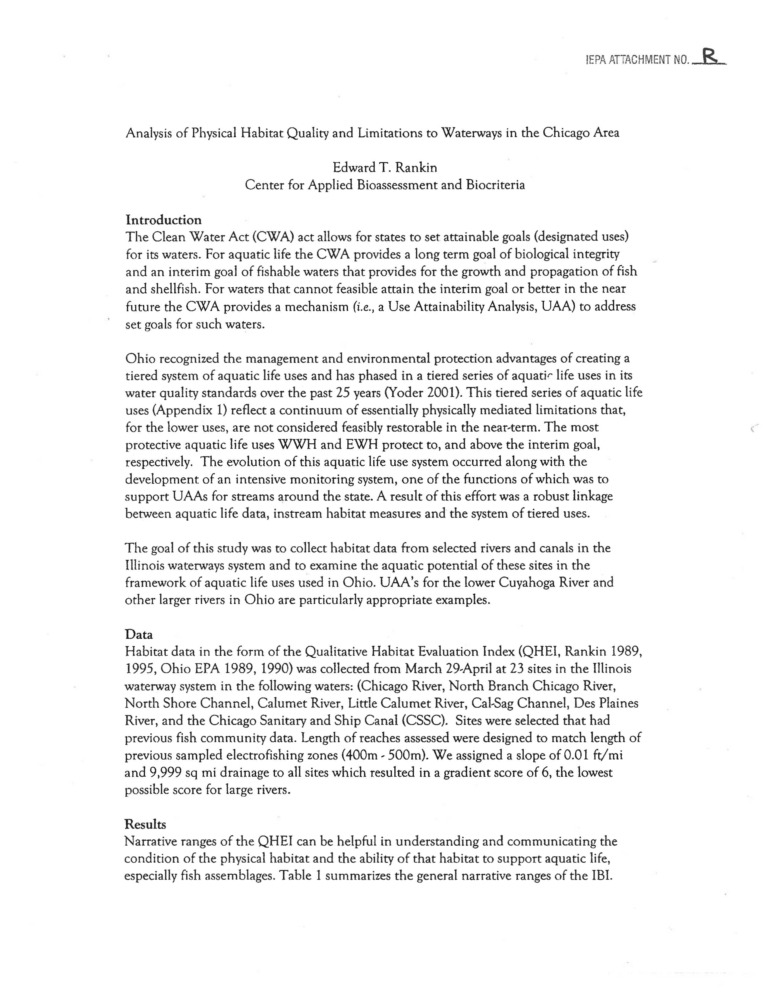
Analysis of Physical Habitat Quality and Limitations to Waterways in the Chicago Area
Edward
T.
Rankin
Center for Applied Bioassessment and Biocriteria
Introduction
The Clean Water Act (CWA) act allows for states to set attainable goals (designated uses)
for its waters. For aquatic life
the CWA provides a long term goal of biological integrity
and an interim goal of fishable waters that provides for the growth and propagation of fish
and shellfish. For waters that cannot feasible attain the interim goal or better in the near
future the
CWA provides a mechanism
(i.e.,
a Use Attainability Analysis, UAA) to address
set goals for such waters.
Ohio recognized the management and environmental protection advantages of creating a
tiered system
of aquatic life uses and has phased in a tiered series of aquatir life uses in its
water quality standards over
the past 25 years (Yoder 2001). This tiered series of aquatic life
uses (Appendix
1) reflect a continuum of essentially physically mediated limitations that,
for the lower uses, are
not considered feasibly restorable in the near-term. The most
protective aquatic life uses WWH and EWH protect to, and above the interim goal,
respectively.
The evolution of this aquatic life use system occurred along with the
development of an intensive monitoring system, one of the functions of which was to
support UAAs for streams a,round the state. A result of this effort was a robust linkage
between aquatic life data, instream habitat measures and
the system of tiered uses.
The goal of this study was to collect habitat data from selected rivers and canals in the
Illinois waterways system and to examine the aquatic potential
of these sites in the
framework of aquatic life uses used in Ohio. UAA's for the lower Cuyahoga River and
other larger rivers in Ohio are particularly appropriate examples.
Data
Habitat data in the form of the Qualitative Habitat Evaluation Index (QHEI, Rankin 1989,
1995,
Ohio EPA 1989, 1990) was collected from March 29-April at 23 sites in the Illinois
waterway system in
the following waters: (Chicago River, North Branch Chicago River,
North Shore Channel, Calumet River, Little Calumet River, Cal-Sag Channel, Des Plaines
River,
and the Chicago Sanitary and Ship Canal (CSSC). Sites were selected that had
previous fish
community data. Length of reaches assessed were designed to match length of
previous sampled electrofishing zones (400m - SOOm). We assigned a slope of 0.01 ft/mi
and 9,999 sq mi drainage to all sites which resulted in a gradient score of 6, the lowest
possible score for large rivers.
Results
Narrative ranges
of the QHEI can be helpful in understanding and communicating the
condition
of the physical habitat and the ability of that habitat to support aquatic life,
especially fish assemblages. Table 1 summarizes
the general narrative ranges of the IBI.
>=
75 - Excellent
60-74 - Good
30-45 - Poor
<
30 - Very Poor
Table 1. Narrative ranges of the QHEI
based on a general ability of
that habitat to support aquatic
life.
Good
al
..
:
Z
60
n:
__ -aD:
Fair
40-- ------IJJ ESZZ2
~
Poor
60 -
20 -
100
Figure
1.
Box and whisker plots of
QHEI
scores for rivers and
canals
in
the Chicago Area sampled during Mar-Apr
2004. Narrative ranges of the
QHEI
are listed
on
the right axis.
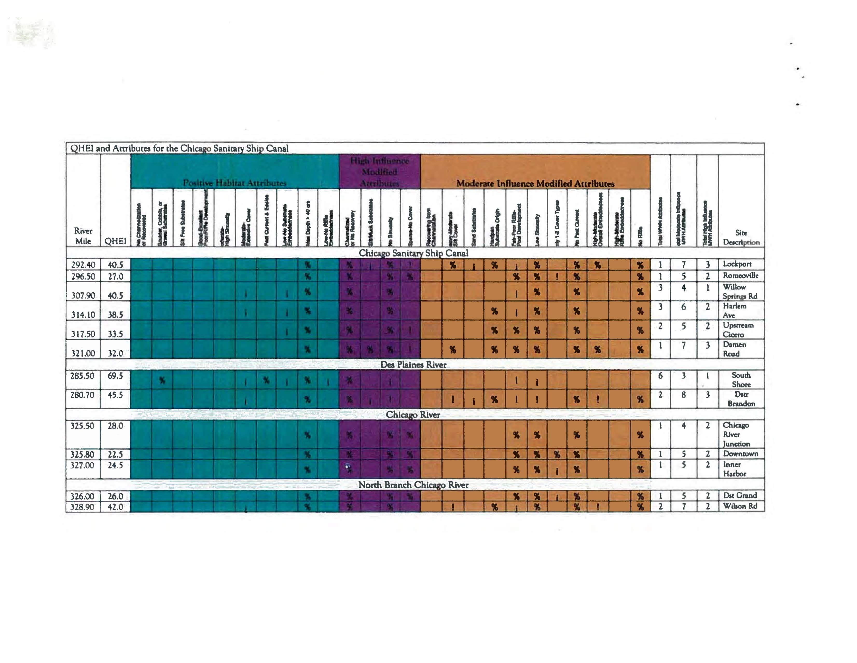
Table 2 summarizes the QHEI and key metrics
generally found
to be most influential to aquatic
life. Figure 1
is a box and whisker plot of QHEI
scores by waterway along with the narrative
ranges for context. Lower scores are
to the left;
highest to
the right.
It
is clear that the Chicago
River
and the North Branch of the Chicago
River are the
most habitat limited of the waters
we surveyed (Figure
1) followed by the CSSe. In
general, the physical
habitat quality of these
waterways
is reduced by lack of consistent
flowing water habitats, straight morphology
of
waterways (reduces habitat heterogeneity) and
the large scale of modifications throughout this
system. This
is above the influence of any additional chemical stressors due to discharges,
overflow,
or urban runoff events. Table 3 illustrates individual cover type scores for each
sites.
These scores are being collected as part of a planned revision to the QHEI. Each
cover type
is assigned a score of 0-3 where zero means the cover type is absent and a three
QHEI Summary Scores from
Chicago
/\rea Waterways
indicates it is present in high quality
and high amounts. No sites in any of
Excellent these waters received a score of three,
few received a two
and most where
absent
or received a score of 1
(marginal quality
or amounts). Even
so,
as illustrated in Figure 1 there is a
range
of habitat
conditio~
among the
waterways that, in our estimation,
- Very
Poor
would result in several different
-_-~ --~--~--~--.-~--.~--"ii--,~-
aquatic life uses under the Ohio
i i u
c
i i
~
i
system.
6
6
~;S
8
~
~
~
~
8
:J
't
'E
.0
Z
:J
Decision Making Process for Assigning
Aquatic
Life Uses
The ultimate arbiter used in the
designation of aquatic life uses under
the Ohio system is the biological
data.
Attainment of biocriteria
derived for each use
is obvious
evidence
of ability to attain the use, and absent error or aberrant results it is the preferred
arbiter or data used in the process. In many cases, however, because of the effects of often
multiple stressors the biological results may underestimate
the potential attainment that
could be expected in the absence of such stressors. In these cases the QHEI and metric
scores
at a site, scores of nearby reaches, and accrual of important limiting habitat factors
and the loss of positive habitat factors are used as evidence in support of a given aquatic
....... Inftuence MOdified AttrIbules
River
I
I
II I r. I I I •• I .. I .. I • I .. I • I it I .. I • I , I , I II I
J'
I • I II I .. I
J
I : I i ,.1
II
Mile
-
,
.
-
,
, ,
,
.
292.40
's
I
7
3
Lockport
296.50
,.
I
5
2
Romeovl1le
S
3
4
1
Willow
307,90
S
Il.d
S
3
6
2
Harlem
314.10
Ave
"
2
5
2
UpsMlm
317.50
Cicero
S-
~.
I
7
3
Dameo
321.00
..!
Road
285.50
' -'
6
3
I
South
Shote
280,70
'"i..
2
8
3
Dstr
. "
Brandon
325,50
4
32S,8O
327,00
In. .>
•
•
•
1
I ..
.......
I', •
1.00
I 54.0
I
I
I'
I _
~"'
.._.• I.
I .=--T
I
I .cl 4
I
7
2
Ust/Dst
Sharon
2.00
47.5
4
4
3
UIl:
o..m
r
3.00
49.0
4
7
1
DstTouhy
4.00
49.S
4
7
1
Olt
Pemson
326.50
I
43.0
I
I
I
I
I
I
2
I
8
I
2
IO'Brim
Lock&.
Dam
326.10 147.0
1 I
I LI
J~_.~-
_I ...
t\.:
...
1
.._LL1':::-Jt..J
3
I
8
ITI1~
St
Hahtnd
~
Route 83
u.tCic:ero
Table 3. Individual cov", metrics values of the QHEI from sites assessed in Mar-Apr 2004 in the
Chica~o
area.
Cover Amount
Over,
Oxbows
Undercut
Hanging
Deep
Side-
Aq.
Cover
Site
QHEI
Banks
Veget.
Shallows
Pools
Roorwads
Rootmats
Boulders
channels
Planes
Logs
E
M
S
N
Score
Chicago Sanitary and Ship Canal
Lockoort
40.5
I
1
2
2
1
X
9.0
Romeoville
27.0
I
I
X
4.0
Willow Sorings Road
40.5
1
2
2
X
11.0
Harlem Avenue
38.5
1
1
J
2
X X
10.0
Upstream Cicero Avenue
3.3.5
J
I
1
X
7.0
Damen Road
32.0
I
J
I
1
J
1
X
10.0
Des Plaines River
South Shore upstream of
45.5
1
22
2
X
X
10.0
Treats Island
Downstream Brandon
69.5
1
2
2
2
1
X
13.0
Lock/Dam
Chicago River
Chicago River Junction
28.0
1
1
1
X
5.0
<WolfPointl
Downtown between
22.5
1
X
1.0
Wells/Lasalle
Downtown-InnerHarbor
24.5
2
X
3.0
Area
North Branch Chicago River
Downstream Grand Ave
I
26.0
I
I
I
1
I
I
I
II
I
xl
3.0
Wilson Road
I
42.0
I
1
I
1
I
1
1
I
1
I
I
1
I XIX
I
12.0
North Shore Channel
Upstream/Downstream
42.0
1
1
1
1
1
X
9.0
Sharon Road
Unstream Demoster Road
37.5
1
1
1
1
I
I
XX
12.0
Downstream Touhy
49.0
1
21
1
1
2
X
14.0
Downstream Peterson
49.5
1
22
2
1
1
X
14.0
Calumet River
O'BrienLock
&
Dam
I
47.0
I
I
I
1
1
1
1
2
I
1
Ix
I
14.0
1300h Street
I
43.0
I
I
I
2
1
1
I
2
1
I
I
IXI
I
9.0
Little Calumet River
Halstead Street
I
48.5
I
1
I
I
1
I
1
J
1
1
I
2
IX
I
I
15.0
Dst 1-94 Bridge
I
48.5
I
1
I
I
1
1
J
1
I
2
I
Ix
I
I
14.0
Cal-8ag Channel
Route 83
I
54.0
I
1
I
I
I
1
2
I
I
I
1
I
IX
I
12.0
Uostream Cicero
I
47.5
I
J
I
I
I
1
2
I
I
I
IX Xl
9.0
60
---------~~-~-
: N.1l29
i
Excellent
Large Riyer Data From Ohio
,
50
~
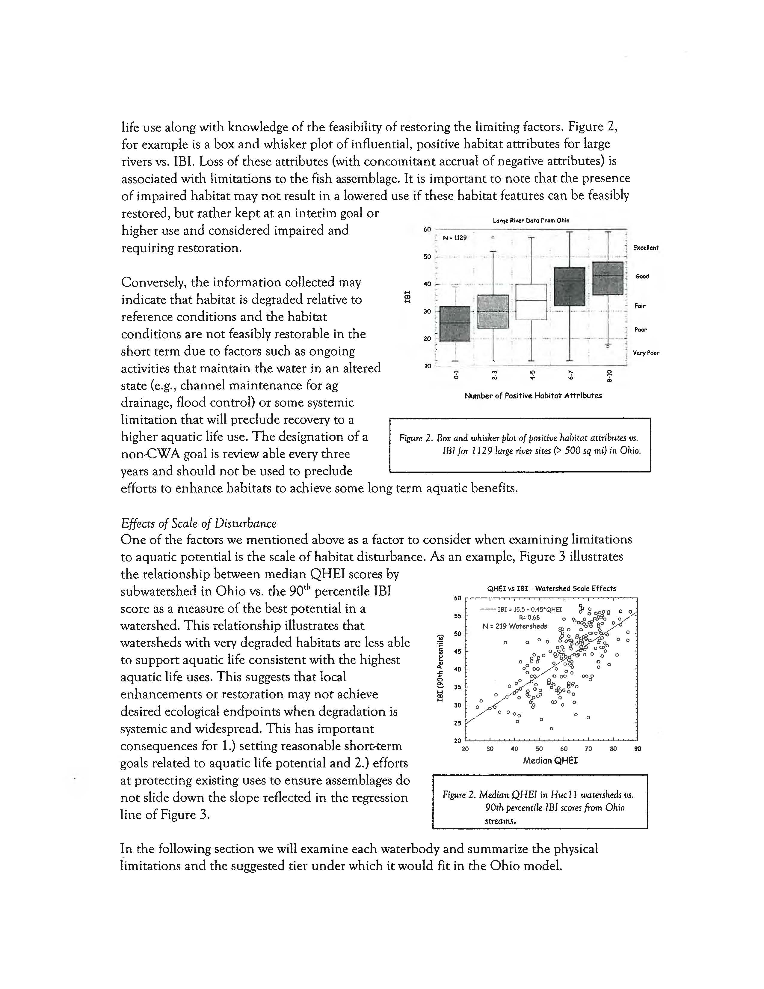
life use along with knowledge of the feasibility of restoring the limiting factors. Figure 2,
for example is a box and whisker plot of influential, positive habitat attributes for large
rivers
vs. IEI. Loss of these attributes (with concomitant accrual of negative attributes) is
associated with limitations to the fish assemblage.
It
is important to note that the presence
of impaired habitat may not result in a lowered use if these habitat features can be feasibly
restored,
but rather kept at an interim goal or
higher use and considered impaired and
requiring restoration.
Figure
2.
Box and whisker plot of
positille
habitat attributes
liS.
ll3/
for
1129
large riller sites
(>
500 sq
mi) in
Ohio.
Good
Poor
Number of Positive Habitat Attributes
j
Very
Poor
10
-----=----~----==-------~
!
40 ,-
....
....en
Conversely, the information collected may
indicate
that habitat is degraded relative to
reference conditions
and the habitat
conditions are not feasibly restorable in the
short term due to factors such as ongoing
activities
that maintain the water in an altered
state (e.g.,
channel maintenance for ag
drainage, flood control)
or some systemic
limitation
that will preclude recovery to a
higher aquatic life use.
The designation of a
non-CWA goal is reviewable every three
years
and should not be used to preclude
efforts to
enhance habitats to achieve some long term aquatic benefits.
50
60
70
80
90
MedianQHEI
40
QHEI vs IBI • Watershed Scale Effects
30
stream.~.
-
ISI :: 15.5 + O.45*QHEI
~
g
~f?8
goo
R= 0.68
0
'0 0
dY::nO~
N. 219 Watersheds
B;>
0
~o
'1,0 0
"R
8
0I0a.
0
•
o
0
0 0
o~ OO~~%
0
0
o
0%
0
0
SOoo
'Ogye,..-
0 0
0
0
0
0
0
0 .......
o~
0
O~~~Oogo
000
0
OO~n~,Il.
8/1
0
0
o ifrP
~
°oll
..,,000
~
o',p
0
o
{)lB
CDOO
o
0°
0
o
0
25
20
t.......-'-'-'~-....L~....L.~--'--'--~
............
--'-'--'~c.....l
20
55
Figure
2.
Median QHE/
in
Huc11 watersheds
liS.
90th percentile
IBI
score.~
from Ohio
:!i' 50
:;::
5
45
~
~
40
-::.
~
35
30
1
Effects of Scale of Disturbance
One of the factors we mentioned above as a factor to consider when examining limitations
to aquatic potential is the scale of habitat disturbance. As an example, Figure 3 illustrates
the relationship between median QHEI scores by
subwatershed
in Ohio vs. the 90
th
percentile IEI
score
as a measure of the best potential in a
watershed.
This relationship illustrates that
watersheds with very degraded habitats are less able
to support aquatic life consistent with the highest
aquatic life uses. This suggests
that local
enhancements or restoration may not achieve
desired ecological
endpoints when degradation is
systemic and widespread. This has important
consequences for 1.) setting reasonable short-term
goals related to aquatic life potential and 2.) efforts
at protecting existing uses to ensure assemblages do
not slide down the slope reflected in the regression
line
of Figure 3.
~n
the following section we will examine each waterbody and summarize the physical
limitations
and the suggested tier under which it would fit in the Ohio model.
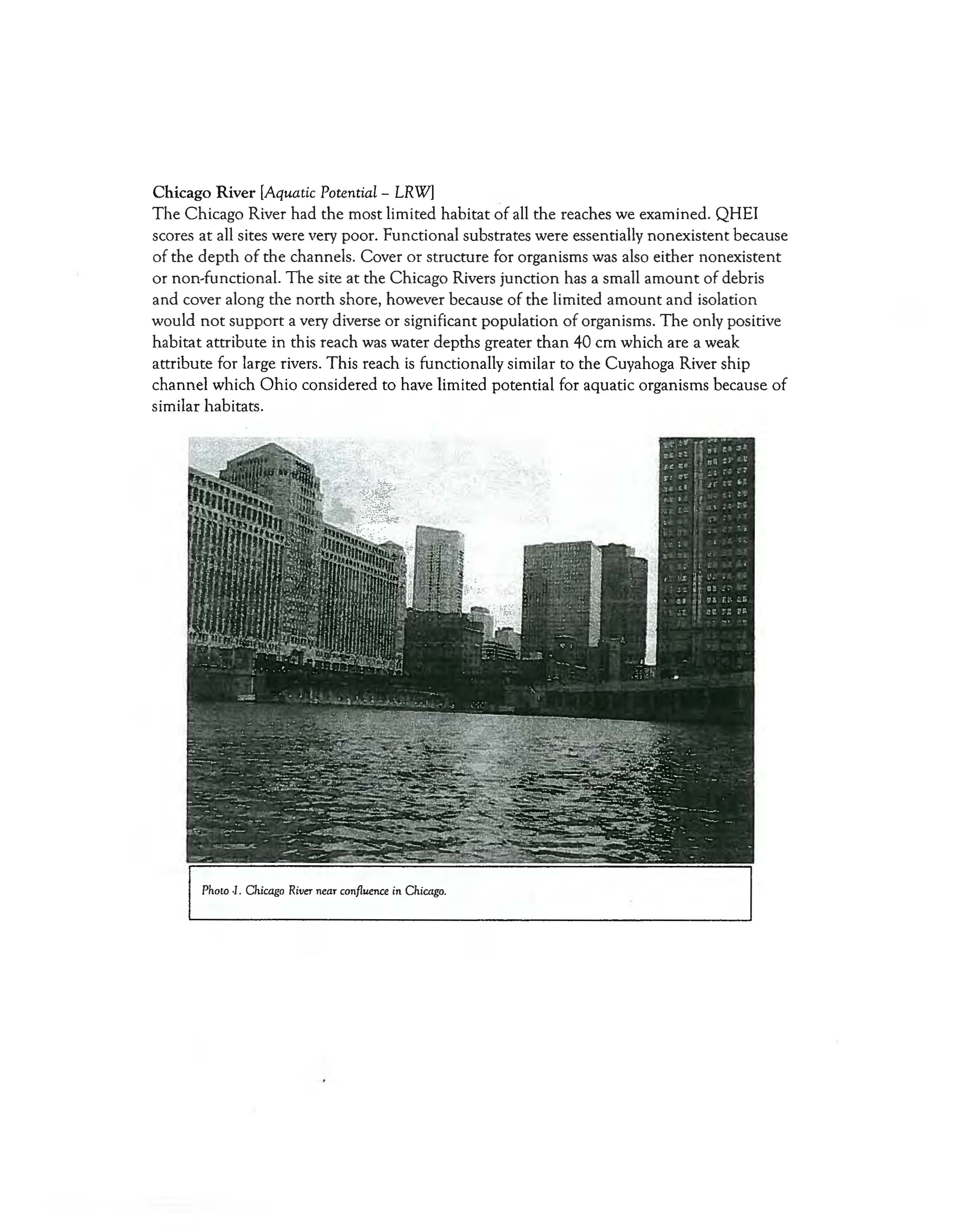
Chicago River
[Aquatic Potential
-
LRWj
The Chicago River had the most limited habitat
~f
all the reaches we examined. QHEI
scores at all sites were very poor. Functional substrates were essentially nonexistent because
of the depth of the channels. Cover or structure for organisms was also either nonexistent
or non-functional. The site at the Chicago Rivers junction has a small amount of debris
and cover along the
north shore, however because of the limited amount and isolation
would
not support a very diverse or significant population of organisms. The only positive
habitat attribute in this reach
was water depths greater than 40 em which are a weak
attribute for large rivers. This reach
is functionally similar to the Cuyahoga River ship
channel which
Ohio considered to have limited potential for aquatic organisms because of
similar habitats.
Photo
.1.
Chicago RiveT
near confluence in
Chicago.
North Branch of the Chicago River.
[Recommended Category:
LRW, MWH-C]
The site downstream of Grand Avenue was similar in nature to the Chicago River sites
with deep pools
and lack of any developed littoral areas. This aquatic potential of this
lower reach was low
and would be equivalent to a LRW aquatic life use. Like the Chicago
River it
had only 1 or 2 positive
habitat attributes.
We would
expect it would
not provide
habitats for significant
populations
of sensitive species
with most fish being transients
or
species adapted to pelagic type
environments.
Upstream reaches
of the North
Branch Chicago River, however,
were similar to
the North Shore
Channel rather than the Chicago
River and had some more littoral
areas,
but still sparse structure,
Phoro 2.
North Branch of
the
Chicago
River in the vicini!:)
of Grande Ave.
mostly in the form of
overhanging vegetation. This reach provides more edge habitat and structure than the
downstream reach. This should support a more permanent assemblage of fish and aquatic
life,
but still dominated by generalist and tolerant species and taxa. This aquatic
pot~ntial
of this upper reach should be able
to support the equivalent
of a
Modified Warmwater
'
Channelized (MWH,C) aquatic
life use.
Photo
3.
North Branch ofthe Chicago River in the vicinity of
Wilson Ave.
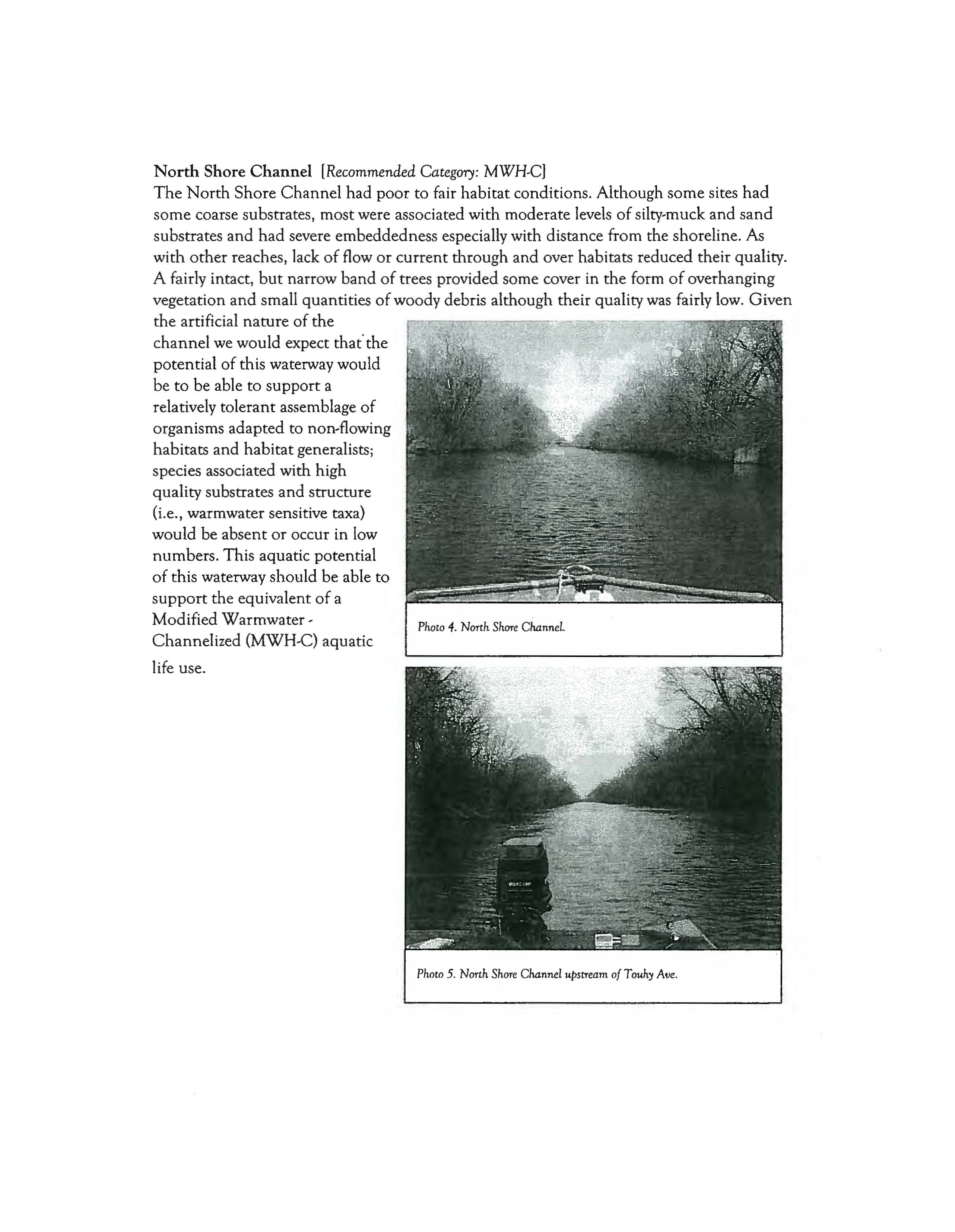
North Shore Channel [Recommended
Category:
MWH.C)
The North Shore Channel had poor to fair habitat conditions. Although some sites had
some coarse substrates, most were associated with moderate levels of silty-muck and sand
substrates and
had severe embeddedness especially with distance from the shoreline.
As
with other reaches, lack of flow or current duough and over habitats reduced their quality.
A fairly intact,
but narrow band of trees provided some cover in the form of overhanging
vegetation
and small quantities of woody debris although their quality was fairly low. Given
the artificial nature of the
channel we would expect that'the
potential
of this waterway would
be
to be able to support a
relatively tolerant assemblage
of
organisms adapted to non-flowing
habitats and habitat generalists;
species associated with high
quality substrates and structure
(i.e., warmwater sensitive taxa)
would be absent
or occur in low
numbers. This aquatic potential
of this waterway should be able to
support the equivalent of a
Modified
Warmwater-
Channelized (MWH-C) aquatic
life use.
Photo 5.
North Shore Channel upstream of Touh:y
Aile.
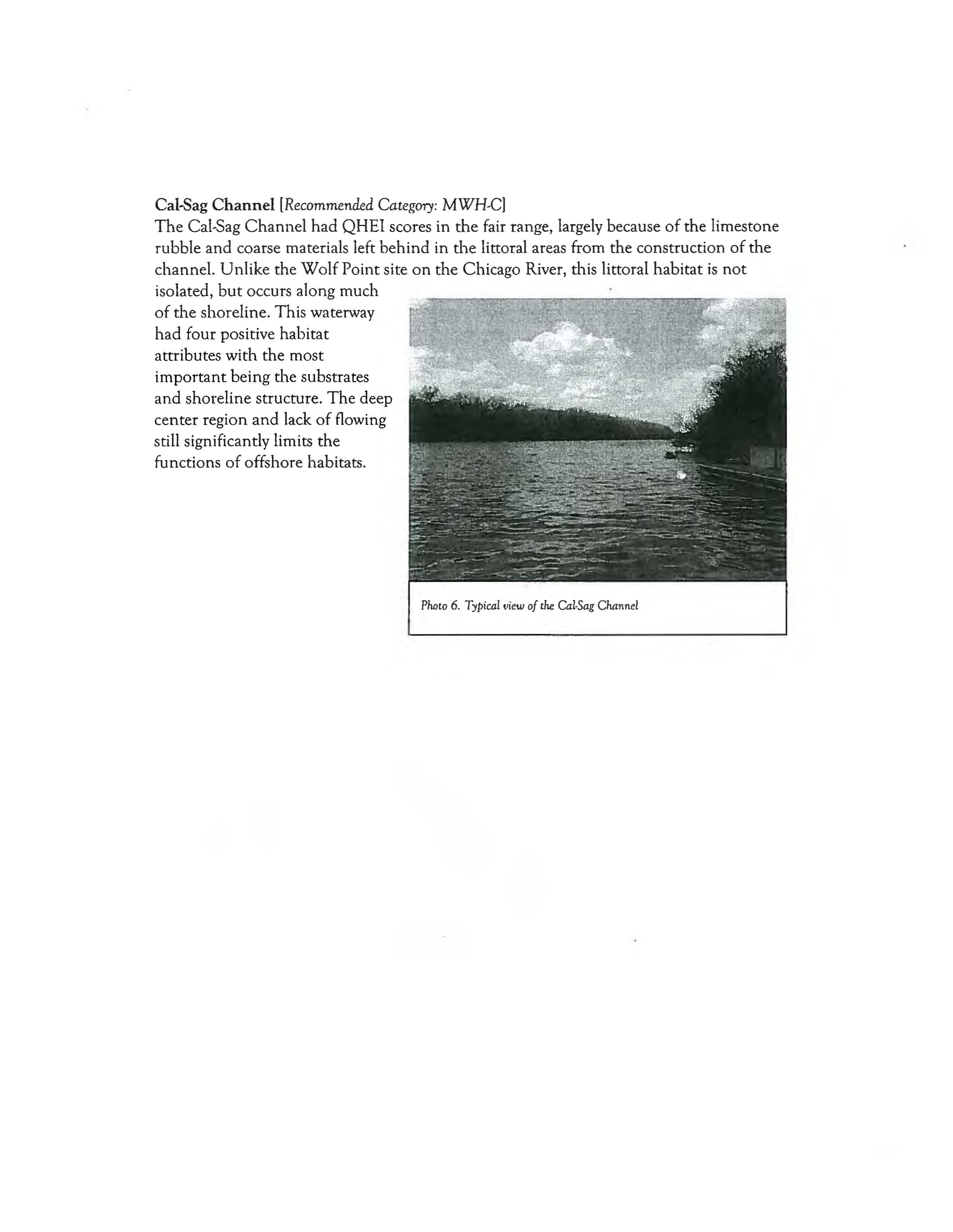
Cal-Sag
Channel
[Recommended Category:
MWH-Cl
The Cal-Sag Channel had QHEI scores in the fair range, largely because of the limestone
rubble
and coarse materials left behind in the littoral areas from the construction of the
channel. Unlike the Wolf Point site on the Chicago River, this littoral habitat is not
isolated, but occurs along much
of the shoreline. This waterway
had four positive habitat
attributes
with the most
important being the substrates
and shoreline structure. The deep
center region
and lack of flowing
still significantly limits
the
functions of offshore habitats.
Plwto 6.
Typicailliew of
the
Cal-Sag
Channel
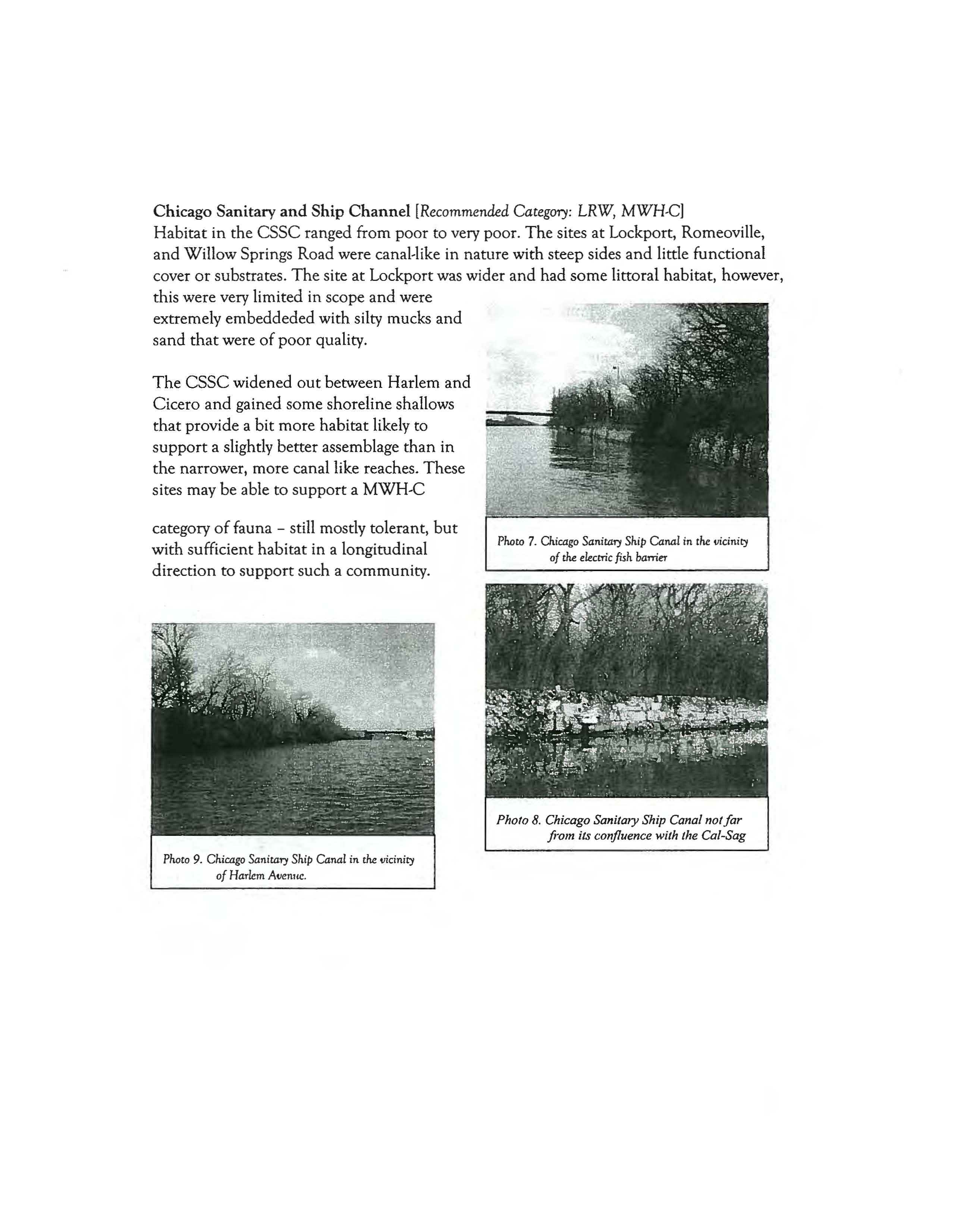
Chicago Sanitary and Ship Channel [Recommended
Category:
LRW, MWH-Cj
Habitat in the essc ranged from poor to very poor. The sites at Lockport, Romeoville,
and Willow Springs Road were canal-like in nature with steep sides and little functional
cover
or substrates. The site at Lockport was wider and had some littoral habitat, however,
this were very limited in scope
and were
extremely embeddeded with silty mucks
and
sand that were of poor quality.
The CSSC widened out between Harlem and
Cicero
and gained some shoreline shallows
that provide a bit more habitat likely to
support a slightly better assemblage than in
the narrower, more canal like reaches. These
sites may
be able to support a MWH-C
category of fauna - still mostly tolerant, but
with sufficient habitat in a longitudinal
direction
to support such a community.
Pharo
8.
Chicago Sanitary Ship Canal norfar
ji-Oln its confluence with the Cal-Sag
Photo
9.
Chicago Sanitary Ship Canal
in
the
vicinity
of Harlem
Avenlle.
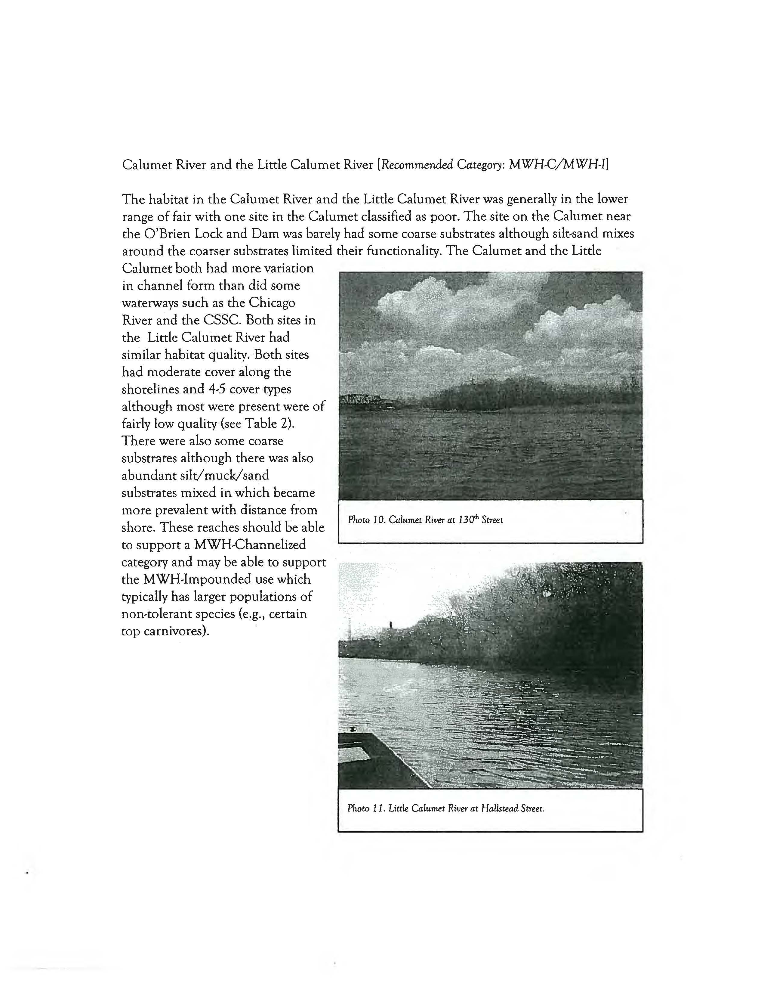
Calumet River and the Little Calumet River
[Recommended Category:
MWH-C/MWH-I]
,
.
.
Photo
10.
Calumet
Ri,'erat 130" Street
The habitat in the Calumet River and the Little Calumet River was generally in the lower
range
of fair with one site in the Calumet classified as poor. The site on the Calumet near
the O'Brien Lock and Dam was barely had some coarse substrates although silt-sand mixes
around the coarser substrates limited their functionality. The Calumet and the Little
Calumet both had more variation
in
channel form than did some
waterways
such as the Chicago
River
and the csse. Both sites in
the Little Calumet River had
similar
habitat quality. Both sites
had moderate cover along the
shorelines
and 4-5 cover types
although
most were present were of
fairly low quality (see Table 2).
There were also some coarse
substrates
although there was also
abundant silt/muck/sand
substrates mixed in which became
more prevalent with distance from
shore. These reaches
should be able
to
support a MWH-Channelized
category
and may be able to support
the MWH-Impounded use which
typically has larger populations
of
non-tolerant species (e.g., certain
top carnivores).
Photo II. Little
Calumet River at Hallstead Street.
Des Plaines River
[Recommended Category:
MWH-I,
Other]
Although modified and impounded in most reaches, one of the two sites on the Des
Plaines had the highest quality
of the sites we examined downstream of the Brandon Road
Dam.
The site downstream of this dam may not be typical of the downstream reaches,
however in
upper portion was a relatively high quality rapids area that was fairly extensive
and if available to downstream and upstream reaches could harbor more sensitive taxa
more typical
of a natural larger river. Although impounded and subjected to barge and ship
traffic the Des Plaines
had a more "natural" shoreline morphology than did most of the
other waterways we examined. It appeared that there were much more extensive shallows
and cover along the edges, although the lack of flow throughout much of the reach we
boated through would limit species
and taxa dependent on flow. Based on the preliminary
data we collected
we suggest that the Ohio Modified Warmwater Habitat Use for
impounded rivers (MWH-I) would be most appropriate category.
T~e
upper most site had
habitat quality generally associated with a WWH river, however the isolation of this site
(among
impounded reaches) could influence the potential of that site.
Conclusions
The above conclusions were based on the QHEI data collected in a week in late March and
early April in 2004. It was based on habitat data alone and for this draft I did not have
access to any biological data.
As mentioned in the introduction, the biological assemblages
are
the ultimate arbiter of aquatic life and can contribute useful insights into the potential
of a site, even when affected by other stressors. Abundances and condition of organisms,
even tolerant ones can provide insight into the magnitude
of habitat resources. Given that
caveat, the physical patterns in these watersheds are very strong and will have a
predominant influence on the types of assemblages one might expect. Most of these
watersheds have major commercial uses (e.g., barge traffic
on the
eSSe)
that can add
important limiting influences. In addition the systemic alteration
and urbanization also
contributes to the physical limitations we observed.
References
Ohio Environmental Protection Agency. 1987a. Biological criteria for the protection of aquatic life:
Volume
I.
The role of biological data in water quality assessment. Division of Water Quality
Monitoring and Assessment, Surface
Water Section, Columbus, Ohio.
Ohio Environmental Protection. Agency. 1987b. Biological criteria for the protection of aquatic life: Volume
II. Users manual for biological field assessment of Ohio surface waters. Div. Water Qual. Monit. &
Assess., Surface Water Section, Columbus, Ohio.
Ohio Environmental Protection Agency. 1989a. Addendum to biological criteria for the protection of
aquatic life: Users manual for biological field assessment of Ohio surface waters. Division of
Water Quality Planning and Assessment, Surface Water Section, Columbus, Ohio.
Ohio Environmental Protection Agency. 1989c. Biological criteria for the protection of aquatic life: Volume
III. Standardized biological field sampling and laboratory methods for assessing fish and
macroinvertebrate communities. Div. Water Quality Plan. & Assess., Ecol. Assess. Sect., Columbus,
Ohio.
Rankin, E. T. 1995. The use of habitat assessments in water resource management programs, pp. 181-208
(Chapter 13). in
W. Davis and T. Simon (eds.). Biological Assessment and Criteria: Tools for
Water Resource Planning and Decision Making. Lewis Publishers, Boca Raton, FL.
Yoder, C.O. and E.T. Rankin. 1995a. Biological criteria program development and implementation in Ohio,
pp. 109-144. in W. Davis and T. Simon (eds.). Biological Assessment and Criteria: Tools for Water
Resource Planning and Decision Making. Lewis Publishers, Boca Raton, FL.
Yoder, e.O'. and E.T. Rankin. 1995b. The role of biological criteria in water quality monitoring, assessment,
and regulation. Environmental Regulation in Ohio: How to
Cope With the Regulatory Jungle. lnst.
of Business Law, Santa Monica, CA. 54 pp.
Yoder,
e.o. and E.T. Rankin. 1996. Assessing the condition and status of aquatic life designated Uses in
urban and suburban watersheds, pp. 201-226. in L.A. Roesner (ed.). Effects of Watershed
Development and Management
on Aquatic Ecosystems, American Society of Civil Engineers, New
York, NY.
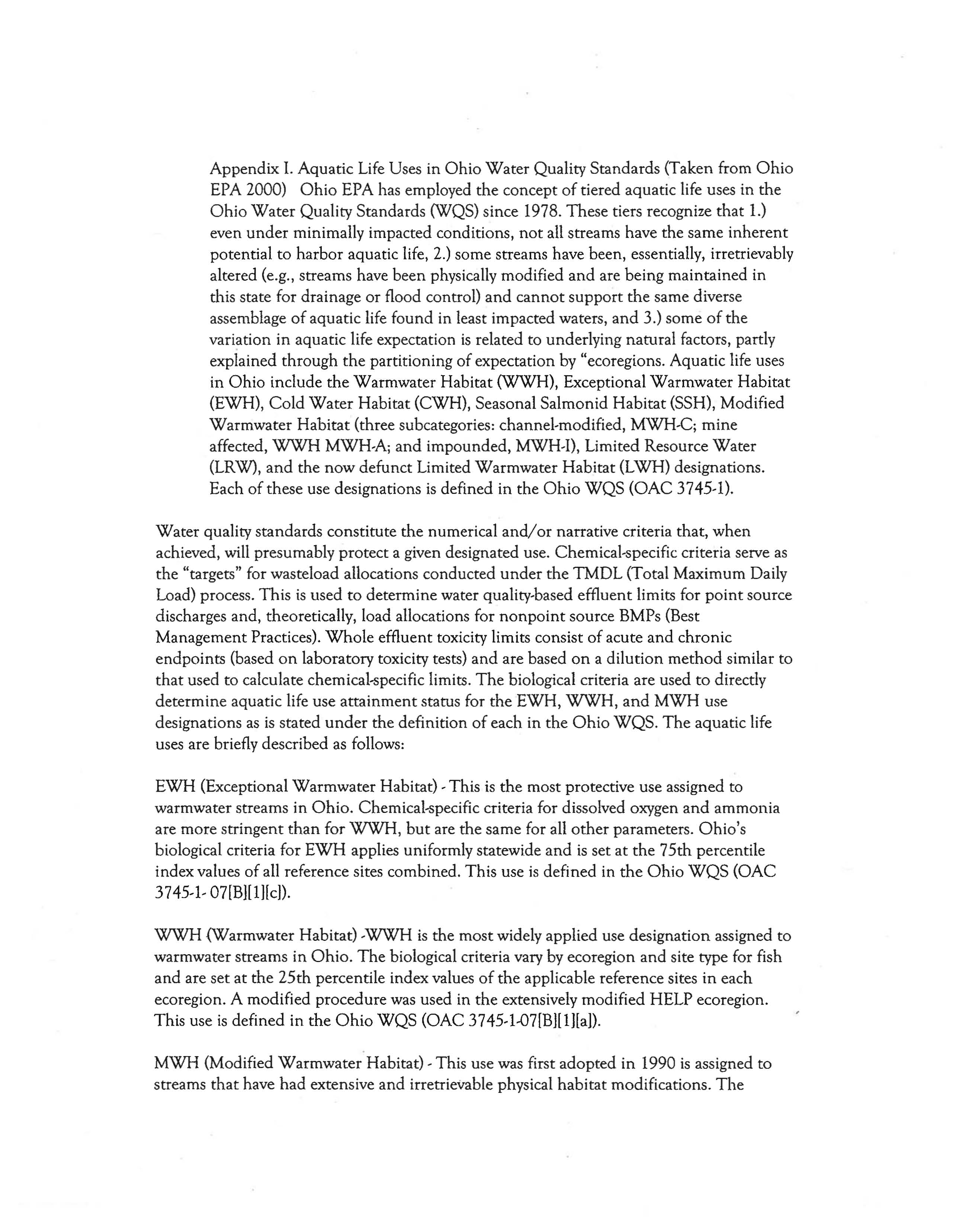
Appendix 1. Aquatic Life Uses in Ohio Water Quality Standards (Taken from Ohio
EPA 2000) Ohio EPA has employed the concept of tiered aquatic life uses in the
Ohio Water Quality Standards (WQS) since 1978. These tiers recognize that 1.)
even under minimally impacted conditions, not all streams have the same inherent
potential to harbor aquatic life, 2.) some streams have been, essentially, irretrievably
altered (e.g., streams have been physically modified
and are being maintained in
this state for drainage
or flood control) and cannot support the same diverse
assemblage
of aquatic life found in least impacted waters, and 3.) some of the
vari~tion
in aquatic life expectation is related to underlying natural factors, partly
explained through
the partitioning of expectation by "ecoregions. Aquatic life uses
in
Ohio include the Warmwater Habitat (WWH), Exceptional Warmwater Habitat
(EWH),
Cold Water Habitat (CWH), Seasonal Salmonid Habitat (SSH), Modified
Warmwater Habitat (three subcategories: channel-modified, MWH-C; mine
affected,
WWH MWH-A; and impounded, MWH-I), Limited Resource Water
(LRW), and the now defunct Limited Warmwater Habitat (LWH) designations.
Each
of these use designations is defined in the Ohio WQS (OAC 3745-0.
Water quality standards constitute the numerical and/or narrative criteria that, when
achieved, will presumably protect a given designated use. Chemical-specific criteria serve
as
the "targets" for wasteload allocations conducted under the TMDL (Total Maximum Daily
Load) process.
This is used to determine water quality-based effluent limits for point source
discharges and, theoretically, load allocations for
nonpoint source BMPs (Best
Management Practices).
Whole effluent toxicity limits consist of acute and chronic
endpoints (based
on laboratory toxicity tests) and are based on a dilution method similar to
that used to calculate chemical-specific limits. The biological criteria are used to directly
determine aquatic life use
attainment status for the EWH, WWH, and MWH use
designations
as is stated under the definition of each in the Ohio WQS. The aquatic life
uses are briefly described
as follows:
EWH (Exceptional Warmwater Habitat) - This is the most protective use assigned to
warmwater streams in
Ohio. Chemical-specific criteria for dissolved oxygen and ammonia
are more stringent
than for WWH, but are the same for all other parameters. Ohio's
biological criteria for EWH applies uniformly statewide and is set at the 75th percentile
index values
of all reference sites combined. This use is defined in the Ohio WQS (OAC
3745-1- 07[B][1)[c)).
WWH (Warmwater Habitat) -WWH is the most widely applied use designation assigned to
warmwater streams in
Ohio. The biological criteria vary by ecoregion and site type for fish
and are set at the 25th percentile index values of the applicable reference sites in each
ecoregion. A modified procedure was used in
the extensively modified HELP ecoregion.
This use
is defined in the Ohio WQS (OAC 3745-1-07[B][1][a)).
MWH (Modified Warmwater Habitat) - This use was first adopted in 1990 is assigned to
streams
that have had extensive and irretrievable physical habitat modifications. The
MWH use does not meet the Clean Water Act goals and therefore requires a Use
Attainability Analysis. There are three subcategories: MWH-A, non-acidic mine
runoff
affected habitats; MWH-C, channel modified habitats; and MWH-I, extensively
impounded habitats. The chemical-specific criteria for dissolved oxygen and ammonia are
less stringent (and the HELP criteria are less stringent
than other ecoregions) than WWH,
but criteria for other parameters are the same. Biological criteria were derived from a
separate set
of modified reference sites. The biocriteria were set separately for each of three
categories
of habitat impact. The MWH-C and MWH-I subcategory biocriteria were also
derived separately for the HELP ecoregion.
The MWH-A applies only within the WAP
ecoregion. This use
is defined in the Ohio WQS (OAC 3745-1- 07[B][I][d]).
LRW (Limited Resource Waters) - This use is restricted to streams that cannot attain even
the MWH use due to extremely limited habitat conditions resulting from natural factors or
those of anthropogenic origin. Most streams assigned to this use have drainage areas <3 sq.
mi.
and are either ephemeral, have extremely limited habitat (with no realistic chance for
rehabilitation),
or have severe and irretrievable acid mine impacts. Chemical-specific
criteria are intended to protect against acutely toxic
or nuisance conditions. There are no
formal biological criteria. This use is defined in the Ohio WQS (OAC 3745-1- 07[B][I][g])
and was formerly known as the Nuisance Prevention use designation, which is being
phased
out of the WQS.
LWH (Limited Warmwater Habitat) - This use was adopted in 1978 to act as a temporary
"variance" mechanism for individual segments
that had point source discharges that were
not capable of meeting the 1977 Clean Water Act mandates. The process of phasing this
use designation
out of the WQS has been underway since 1985. Chemicakpecific criteria
were varied for selected parameters, otherwise the criteria for
the remaining parameters
were
the same as for the WWH use. In 1985 all of the LWH segments were placed in a
"reserved" status pending a Use Attainability Analysis for each segment.
SSH (Seasonal Salmonid
Habitat) - This use designation was introduced in 1985 and is
assigned to habitats that are capable of supporting the passage of Salmonids between
October and May. Another use designation applies during the remaining months. Several
tributaries to Lake Erie are so designated. This use
is defined in the Ohio WQS (OAC
3 745-1-07[B][ l][e]).
CWH (Coldwater Habitat) - This use includes streams that are capable of supporting cold
water aquatic organisms
and/or put-and-take Salmonid fishing. This use is defined in the
Ohio WQS (OAC 3745-I-07[B][I][f]).
Huron !Tie lAke Plain (HELP)
Use
Size IBI M IwI>
ICI
WWH
H
28
NA
34
W
32
7.3
34
B
34
8.6
34
MWH-C H
20
NA
22
W 22
5.6
22
B
20
5.7
22
MWH-I B
30
5.7
NA
Interior Plateau (IP)
Eastern Corn Belt Plain (ElllP)
Use
Size IBI M INb
ICI
WWH--H-"4Q-NA'--3-Ei
W 40
8.3
36
B
42
8.5
36
MWH-C H
24
NA
22
W 24
6.2
22
B
24
5.8
22
MWH-I B
30
6.6
NA
Western Allegheny Pleateau
(WA~
Use
Size IB I Mlwb
ICI
WWH
H
44
NA
34
W
44
8.4
34
B
40
8.6
34
MWH-C H
24
NA
22
W
24
62
22
B
24
5.8
22
MWH-A H
24
NA
30
W
24
5.5
30
B
24
:-.5
30
MWH-I
B
30
6.6
NA
Erie Ontario Lake Plain (EOLP)
llil.!t.-
S
~e---.lID
-.M..~JL_ICl
WWH
H
40
NA
34
W
38
7.9
34
B
40
8.7
34
MWH-C H
24
NA
22
W
24
6.2
22
B
24
5.8
22
MWH-I B
30
6.6
NA
Statewide Exceptional
Warmwater Habitat (EWH)
Bia criteria
Use
Size IBI MlNb
ICI
EWH
H
50
NA
46
W
50
9.4
46
B 48
9.6
46
ICI
30
30
30
22
22
22
NA
IBI MlNb
40
NA
40
8.1
38
8.7
24
NA
24. 6.2
24
5.8
30
6.6
Use
Size
WWA
A
W
B
MWH-C H
W
B
MWH-I B
Map 1. Ohio Biocriteria.