CO-CHAIR :
SEN . MAGGIE CROTTY
CO-CHAIR :
REP
. BRENT HASSERT
EXECUTIVE DIRECTOR :
VICKI THOMAS
b
m :051201
JOINT COMMITTEE
ILLINOIS
ON
GENERAL
ADMINISTRATIVE
ASSEMBLY
RULES
700 STRATTON BUILDING
SPRINGFIELD, ILLINOIS 62706
2171785-225 .
SEN . J . BRADLEY BURZYNSKI
SEN . JAMES CLAYBORNE
SEN
. STEVE RAUSCHENSERGER
SEN. DAN RUTHERFORD
SEN . IRA SILVERSTEIN
REP. TOM HOLBROOK
REP. DAVID R . LEITCH
REP. LARRY McKEON
REP. DAVID MILLER
REP. ROSEMARY MULLIGAN
RELERCEI
ED
DEC -
5 20M
MEMORANDUM
TO:
Agency Rules Coordinators
FROM:
JCAR
pollution
STATE OF
Control
ILLINOISBoard
DATE:
12/1/05
RE:
Mark-up of Agency 1 st Notice Submissions
For some time, JCAR has been sending you a hand marked-up copy of 01 (1
s` Notice) rule text
indicating any changes made prior to Register publication, in addition to the clean copy of the 01
.
Instead of that hand-marked copy, we will now be enclosing a colored copy produced by the text
comparison program that we use
. This document will be created by comparing the final copy published
in the Register to the text you submitted to the SOS on disk .
The comparison document may be a little difficult to follow at first . Generally, when the submitted text
and the final text are the same, the text will be black . Differences will be indicated in color
. However,
colored text does not always mean JCAR published text that differed from your draft
. For example,
spacing differences may result in highlighting . The method you use to indicate changes on your disk
(i.e., track changes, manual striking and underlining, striking before underlining as opposed to
underlining before striking) may be considered by the program to be differences
. When JCAR applies
track changes, it is careful to do so in a manner that results in tight punctuation and good word space
after track changes have been run
. If your agency disk was not as particular, the program will detect
these as differences
. It will not pick up on differences in bolding or the use of italics . It is completely
befuddled by table format, but usually detects text differences in tables . There are also some quirks as to
how some disks are read by the program ; i.e., quote. marks will sometimes read as "A" and "@" and
apostrophes as equal signs
. You will soon be able to quickly discern which highlighted portions are
relevant
The area in which we have found this program to be very reliable is that, if the text is black, you can be
assured the 2 texts are identical . The program points out too many irrelevant differences, but does not
seem to overlook differences .
If you have any trouble following the attached comparison document, your JCAR Staff contact can
probably advise . These documents have been used in our office for the past 3 years
. We believe that use
of the comparison document will provide a cleaner version for your use and will obviously save some
JCAR Staff time.
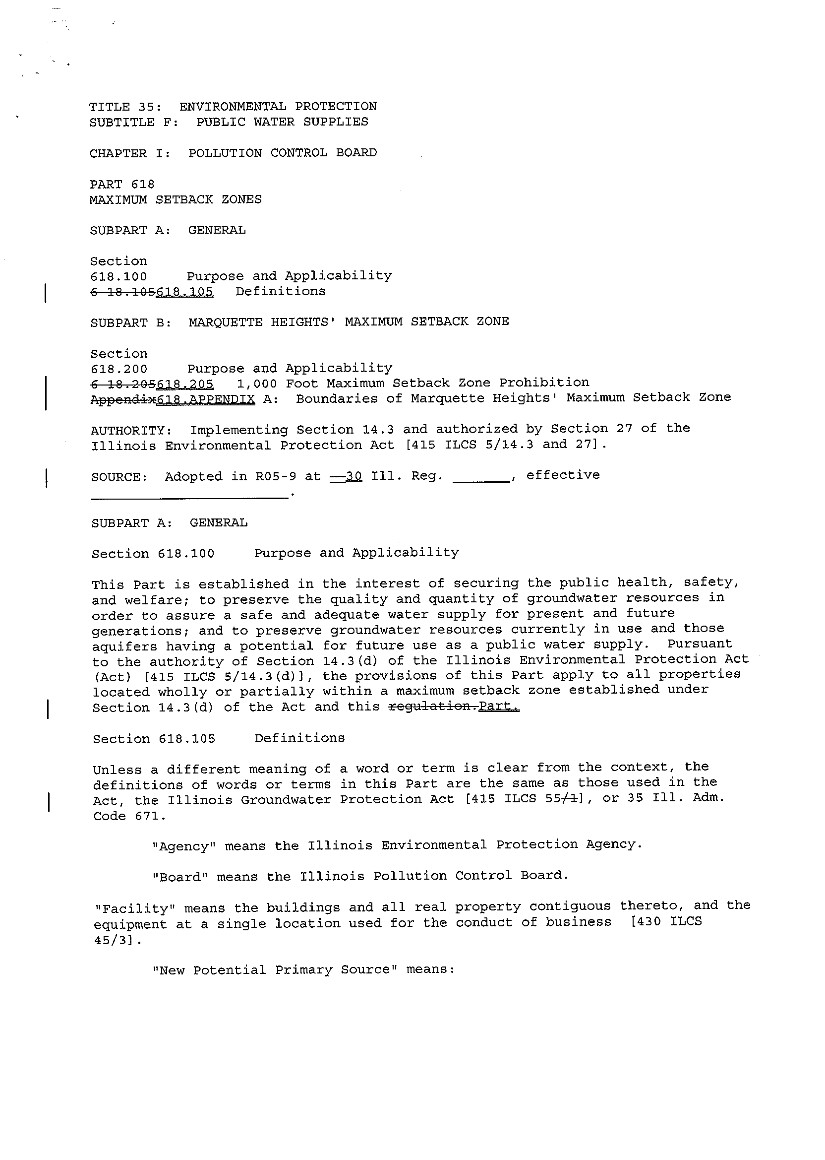
TITLE 35 :
ENVIRONMENTAL PROTECTION
SUBTITLE F : PUBLIC WATER SUPPLIES
CHAPTER I : POLLUTION CONTROL BOARD
PART 618
MAXIMUM SETBACK ZONES
SUBPART A : GENERAL
Section
618 .100
Purpose and Applicability
C10 .10Z6'I9
.~05
Definitions
SUBPART B : MARQUETTE HEIGHTS' MAXIMUM SETBACK ZONE
Section
618 .200
Purpose and Applicability
L10 .20Gf18
.a.
1,000 Foot Maximum Setback Zone Prohibition
Appendi
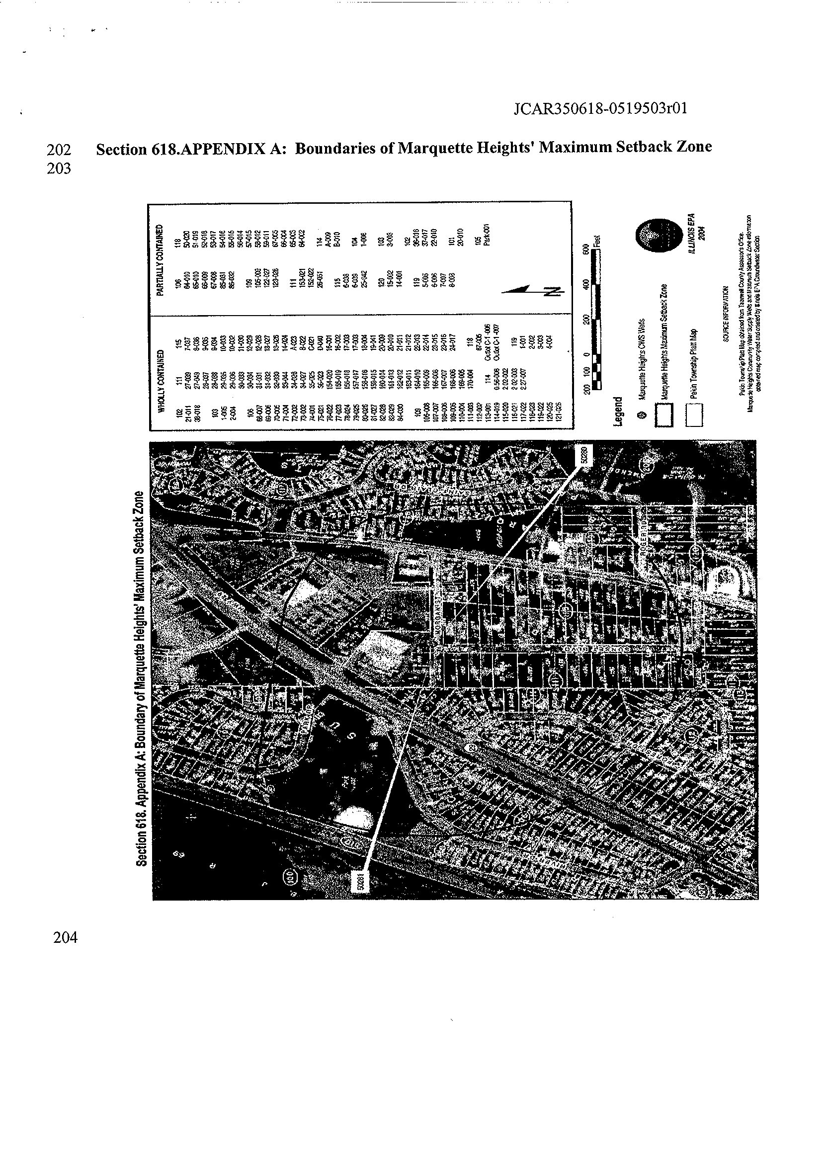
A : Boundaries of Marquette Heights' Maximum Setback Zone
AUTHORITY : Implementing Section 14
.3 and authorized by Section 27 of the
Illinois Environmental Protection Act [415 ILCS 5/14
.3 and 27] .
SOURCE : Adopted in R05-9 at =_3.Q 111
. Reg . , effective
SUBPART A : GENERAL
Section 618 .100
Purpose and Applicability
This Part is established in the interest of securing the public health, safety,
and welfare
; to preserve the quality and quantity of groundwater resources in
order to assure a safe and adequate water supply for present and future
generations
; and to preserve groundwater resources currently in use and those
aquifers having a potential for future use as a public water supply
. Pursuant
to the authority of Section 14
.3(d) of the Illinois Environmental Protection Act
(Act) [415 ILCS 5/14
.3(d)), the provisions of this Part apply to all properties
located wholly or partially within a maximum setback zone established under
Section 14
.3(d) of the Act and this
regulation .
Section 618 .105
Definitions
Unless a different meaning of a word or term is clear from the context, the
definitions of words or terms in this Part are the same as those used in the
Act, the Illinois Groundwater Protection Act [415 ILCS 55J], or 35 Ill
. Adm
.
Code 671 .
"Agency" means the Illinois Environmental Protection Agency
.
"Board" means the Illinois Pollution Control Board
.
"Facility" means the buildings and all real property contiguous thereto, and the
equipment at a single location used for the conduct of business [430 ILCS
45/3] .
I
I
"New Potential Primary Source" means
:
a potential primary source which is not in existence or for which construction
has not commenced at its location as of January 1, 1988
; or
a potential primary source which expands laterally beyond the currently
permitted boundary or, if the primary source is not permitted, the boundary in
existence as of January 1, 1988
; or
a potential primary source which is part of a facility that undergoes major
reconstruction
. Such reconstruction shall be deemed to have taken place where
the fixed capital cost of the new components constructed within a 2-year period
exceed 50% of the fixed capital cost of a comparable entirely new facility [415
ILCS 5/3 .345] .
"New Potential Route" means
:
a potential route which is not in existence or for which construction has not
commenced at its location as of January 1,1988
; or
a potential route which expands laterally beyond the currently permitted
boundary or, if the potential route is not permitted, the boundary in existence
as of January 1, 1988 [415 ILCS 5/3 .3501 .
"New Potential Secondary Source" means :
a potential secondary source which is not in existence or for which construction
has not commenced at its location as of July 1, 1988
; or
a potential secondary source which expands laterally beyond the currently
permitted boundary or, if the secondary source is not permitted, the boundary in
existence as of July 1, 1988, other than an expansion for handling of livestock
waste or for treating domestic wastewaters
; or
a potential secondary source which is part of a facility that undergoes major
reconstruction
. Such reconstruction shall be deemed to have taken place where
the fixed capital cost of the new components constructed within a 2-year period
exceed 50% of the fixed capital cost of a comparable entirely new facility [415
ILCS 5/3 .355] ; and
A new potential secondary source excludes an agrichemical facility that modifies
on-site storage capacity such that the volume of the pesticide storage does not
exceed 125% of the available capacity in existence on April 1, 1990, or the
volume of fertilizer storage does not exceed 150% of the available capacity in
existence on April 1, 1990
; provided that a written endorsement for an
agrichemical facility permit is in effect under Section 39
.4 of the Act and the
maximum feasible setback is maintained
. This on-site storage capacity includes
mini-bulk pesticides, package agrichemical storage areas, liquid or dry
fertilizers, and liquid or dry pesticides [415 ILCS 5/14
.2(g)(4))
.
"Potential Primary Source" means any unit at a facility or site not currently
subject to a removal or remedial action which
:
is utilized for the treatment, storage, or disposal of any hazardous or special
waste not generated at the site
; or
is utilized for the disposal of municipal waste not generated at the site, other
than landscape waste and construction and demolition debris
; or
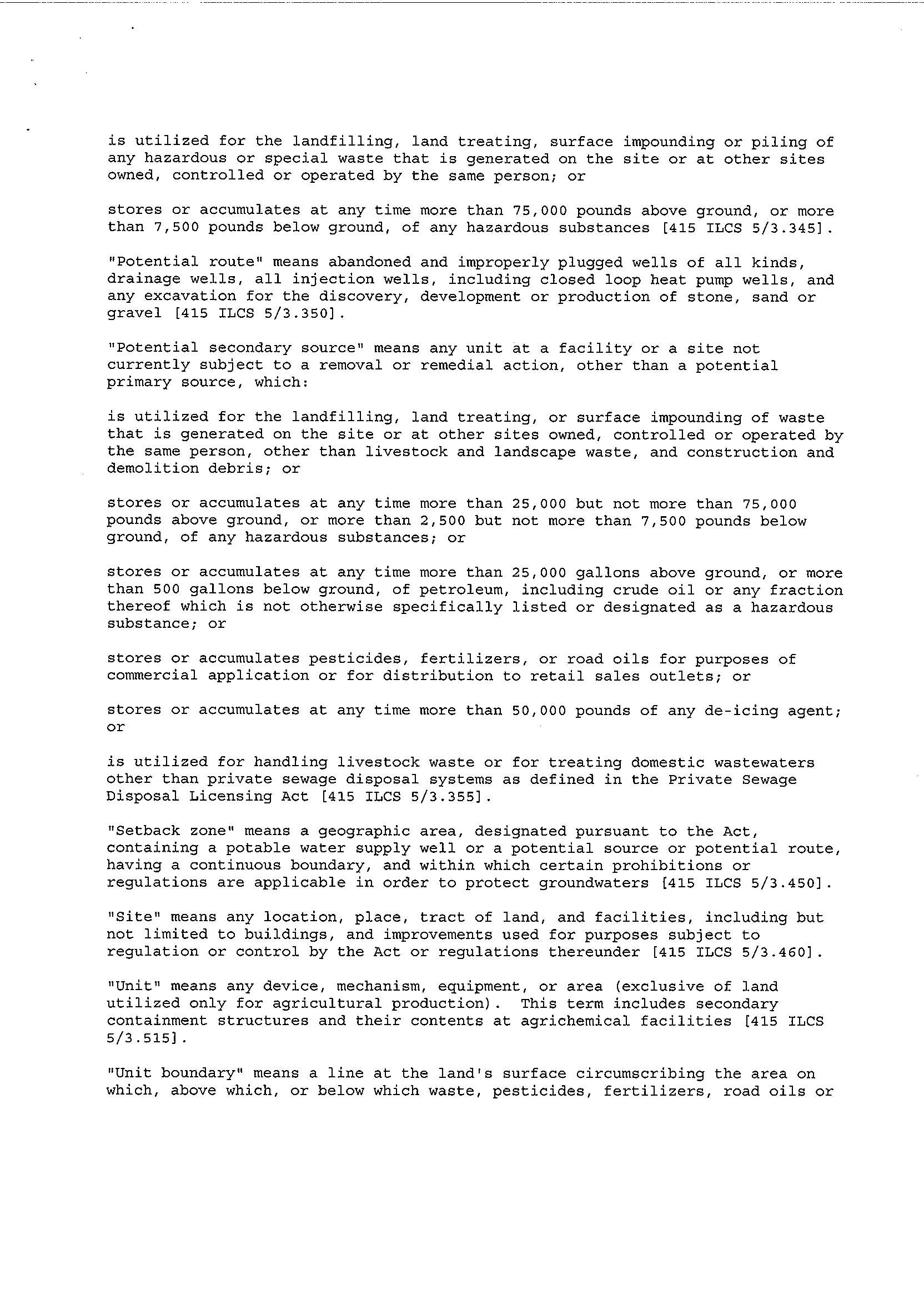
is utilized for the landfilling,
land treating, surface impounding or piling of
any hazardous or special waste that is generated on the site or at other sites
owned, controlled or operated by the same person ; or
stores or accumulates at any time more than 75,000 pounds above ground, or more
than 7,500 pounds below ground, of any hazardous substances [415 ILCS 5/3 .345] .
"Potential route" means abandoned and improperly plugged wells of all kinds,
drainage wells, all injection wells, including closed loop heat pump wells, and
any excavation for the discovery, development or production of stone, sand or
gravel [415 ILCS 5/3 .350] .
"Potential secondary source" means any unit at a facility or a site not
currently subject to a removal or remedial action, other than a potential
primary source, which :
is utilized for the landfilling, land treating, or surface impounding of waste
that is generated on the site or at other sites owned, controlled or operated by
the same person, other than livestock and landscape waste, and construction and
demolition debris ; or
stores or accumulates at any time more than 25,000 but not more than 75,000
pounds above ground, or more than 2,500 but not more than 7,500 pounds below
ground, of any hazardous substances ; or
stores or accumulates at any time more than 25,000 gallons above ground, or more
than 500 gallons below ground, of petroleum, including crude oil or any fraction
thereof which is not otherwise specifically listed or designated as a hazardous
substance ; or
stores or accumulates pesticides, fertilizers, or road oils for purposes of
commercial application or for distribution to retail sales outlets ; or
stores or accumulates at any time more than 50,000 pounds of any de-icing agent
;
or
is utilized for handling livestock waste or for treating domestic wastewaters
other than private sewage disposal systems as defined in the Private Sewage
Disposal Licensing Act [415 ILCS 5/3 .355] .
"Setback zone" means a geographic area, designated pursuant to the Act,
containing a potable water supply well or a potential source or potential route,
having a continuous boundary, and within which certain prohibitions or
regulations are applicable in order to protect groundwaters [415 ILCS 5/3 .450] .
"Site" means any location, place, tract of land, and facilities, including but
not limited to buildings, and improvements used for purposes subject to
regulation or control by the Act or regulations thereunder [415 ILCS 5/3 .460] .
"Unit" means any device, mechanism, equipment, or area (exclusive of land
utilized only for agricultural production)
. This term includes secondary
containment structures and their contents at agrichemical facilities [415 ILCS
5/3 .515] .
"Unit boundary" means a line at the land's surface circumscribing the area on
which, above which, or below which waste, pesticides, fertilizers, road oils or
de-icing agents will be placed during the active life of the facility . The
space taken up by any liner, dike or other barrier designed to contain waste,
pesticides, fertilizer, road oils, or de-icing agents falls within the unit
boundary
.
SUBPART B : MARQUETTE HEIGHTS' MAXIMUM SETBACK ZONE
Section 618 .200
Purpose and Applicability
a)
This Subpart prescribes maximum setback zone prohibitions and the
applicable technology control regulations that apply under 35 111 . Adm . Code 615
and 616 in the interest of securing the public health, safety, and welfare ; to
preserve the quality and quantity of groundwater resources in order to assure a
safe and adequate water supply for present and future generations ; and to
preserve groundwater resources currently in use and those aquifers having a
potential for future use as a public water supply .
b)
The provisions of this Subpart apply to all properties located wholly or
partially within the maximum setback zone boundaries of Marquette Heights
delineated in Section 618 .Appendix A of this Part :
1)
That are new potential primary sources of groundwater contamination
pursuant to Section 14 .3(d) of the Act ; or
2) That are existing or new activities regulated under 35 Ill . Adm . Code 615
or 616, excluding agrichemical facilities that affirmatively opt out of 35 111 .
Adm . Code 615 or 616, which are regulated instead under 8 Ill . Adm . Code 257 or
77 Ill . Adm . Code 830 .
Section 618 .205
1,000 Foot Maximum Setback Zone Prohibition
New potential primary sources of groundwater contamination are prohibited from
locating wholly or partially within the Marquette Heights' maximum setback zone
boundaries delineated in Section 618 .Appendix A of this Part .
Section 618 .
A : Boundaries of Marquette Heights' Maximum
Setback Zone
ILLINOI S RECISTDR
POLLUTION CONTROL BOARD
I
NOTICE OP PROPO SED RULE
Document corn arison done b DeltaView on Thursda ,
December 01, 2005 9 :39:57 AM
Legend:'
Insertion
Dal
Moved from
~ovesL_to
Style change
Format change
Moved deletion
Inserted cell
Deleted cell
Moved cell
Split/Merged cell
Padding cell
Statistics:`;
Count
Insertions
7
Deletions
10
Moved from
0
Moved to
0
Style change
0
Format changed
0
Total changes
17
Input:
. .
Document 1
file://I :/Input/35-618-Agency(issue49) .doc
Document 2
file://I :/Input/35-618-ROl(issue49).doc
Rendering set Standard
ILLINOIS REGISTER
POLLUTION CONTROL BOARD
NOTICE OF PROPOSED RULES
1)
Heading of the Part : Maximum Setback Zones
2)
3)
Code Citation : 35 Ill. Adm. Code 618
Section Numbers :
618.100
618.105
618 .200
618 .205
618
.APPENDIX A
Proposed Action:
New Section
New Section
New Section
New Section
New Section
1
05
4)
Statutory Authority : Implementing Section 14 .3 and authorized by Section 27 of the
Illinois Environmental Protection Act [415 ILCS 5/14
.3 and 27] .
5)
A Complete Description of the Subjects and Issues Involved :
A more complete
description of this proposal may be found in the Board's opinion and order of November
17, 2005, in Board docket R05-09
. The Board is proposing a new Part to establish an
expanded setback zone of up to 1,000 feet to provide additional protection for the
community water supply (CWS) wells of the City of Marquette Heights, in Tazewell
County.
This proposal is the first of its kind under Section 14 .3 of the Environmental Protection
Act (Act) (415 ILCS 5/14
.3 (2004)), which allows for the establishment of "maximum
setback zones" to prevent contamination of particularly vulnerable groundwater sources
used by CWS. A setback zone restricts land use near the CWS well, providing a buffer
between the well and potential sources or routes of contamination
.
The City of Marquette Heights adopted a resolution on March 22, 2004, requesting that
the Illinois Environmental Protection Agency (Agency) propose a rule to the Board that
would increase the setback zone around the Marquette Heights CWS wells . Marquette
Heights has two CWS wells, both of which are located outside of the city limits of
Marquette Heights in North Pekin, Tazewell County
. The wells have an estimated
average daily pumpage from the groundwater source of 240,000 gallons per day,
supplying approximately 3,200 persons directly
. Marquette Heights' water system has
approximately 1,064 service connections within the corporate limits and another 56
service connections in an area of anticipated future expansion east of the City
. Based on
various assessments, including groundwater flow and recharge area modeling, the
Agency concluded that the current minimum setback zones did not adequately protect the
Marquette Heights CWS wells, and that the groundwater source is "highly vulnerable
."
ILLINOIS REGISTER
2
05
POLLUTION CONTROL BOARD
NOTICE OF PROPOSED RULES
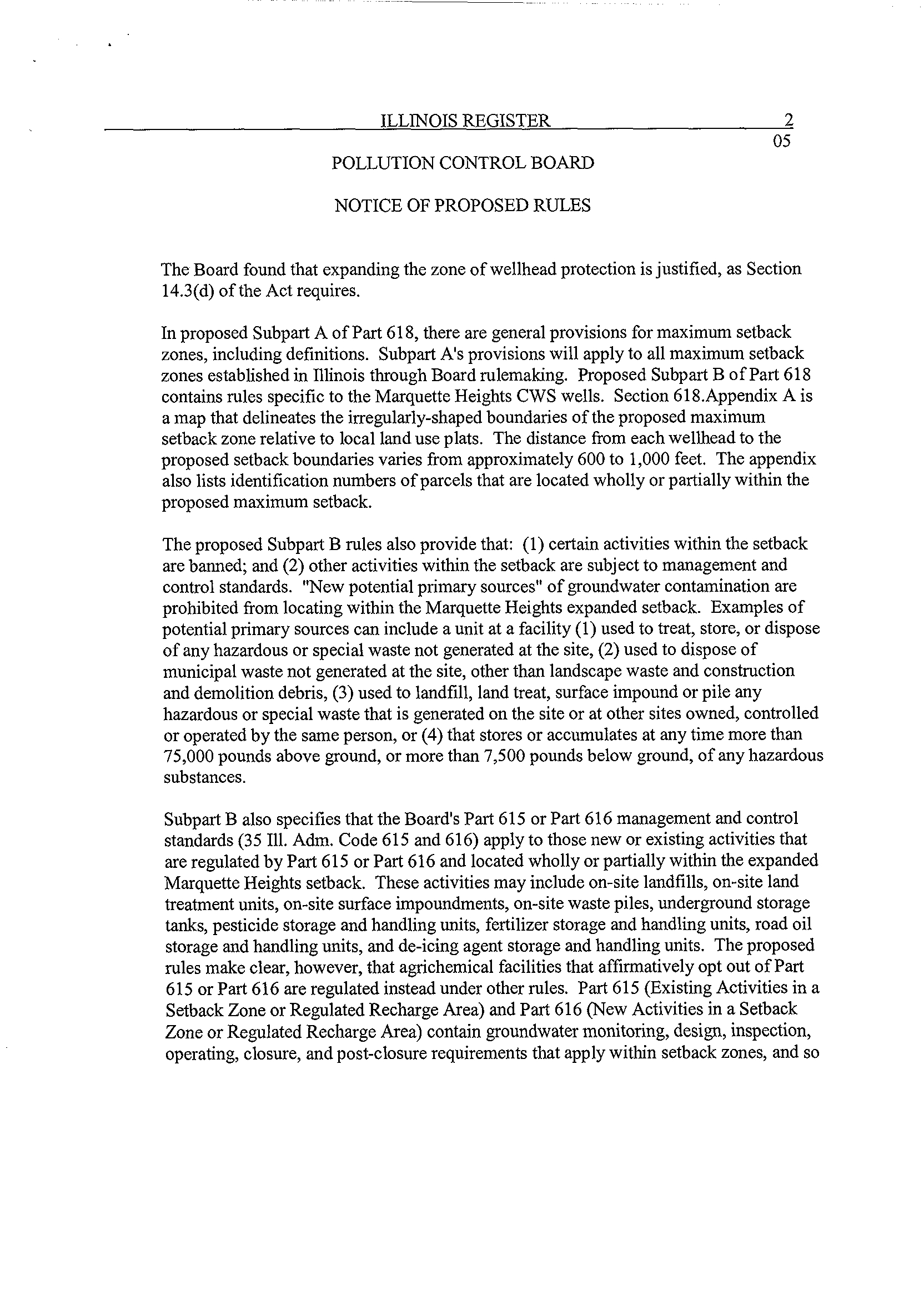
The Board found that expanding the zone of wellhead protection is justified, as Section
14 .3(d) of the Act requires .
In proposed Subpart A of Part 618, there are general provisions for maximum setback
zones, including definitions . Subpart A's provisions will apply to all maximum setback
zones established in Illinois through Board rulemaking . Proposed Subpart B of Part 618
contains rules specific to the Marquette Heights CWS wells
. Section 618 .Appendix A is
a map that delineates the irregularly-shaped boundaries of the proposed maximum
setback zone relative to local land use plats . The distance from each wellhead to the
proposed setback boundaries varies from approximately 600 to 1,000 feet
. The appendix
also lists identification numbers of parcels that are located wholly or partially within the
proposed maximum setback .
The proposed Subpart B rules also provide that
: (1) certain activities within the setback
are banned
; and (2) other activities within the setback are subject to management and
control standards. "New potential primary sources" of groundwater contamination are
prohibited from locating within the Marquette Heights expanded setback
. Examples of
potential primary sources can include a unit at a facility (1) used to treat, store, or dispose
of any hazardous or special waste not generated at the site, (2) used to dispose of
municipal waste not generated at the site, other than landscape waste and construction
and demolition debris, (3) used to landfill, land treat, surface impound or pile any
hazardous or special waste that is generated on the site or at other sites owned, controlled
or operated by the same person, or (4) that stores or accumulates at any time more than
75,000 pounds above ground, or more than 7,500 pounds below ground, of any hazardous
substances .
Subpart B also specifies that the Board's Part 615 or Part 616 management and control
standards (35 Ill . Adm. Code 615 and 616) apply to those new or existing activities that
are regulated by Part 615 or Part 616 and located wholly or partially within the expanded
Marquette Heights setback
. These activities may include on-site landfills, on-site land
treatment units, on-site surface impoundments, on-site waste piles, underground storage
tanks, pesticide storage and handling units, fertilizer storage and handling units, road oil
storage and handling units, and de-icing agent storage and handling units
. The proposed
rules make clear, however, that agrichemical facilities that affirmatively opt out of Part
615 or Part 616 are regulated instead under other rules
. Part 615 (Existing Activities in a
Setback Zone or Regulated Recharge Area) and Part 616 (New Activities in a Setback
Zone or Regulated Recharge Area) contain groundwater monitoring, design, inspection,
operating, closure, and post-closure requirements that apply within setback zones, and so
ILLINOIS REGISTER
3
05
POLLUTION CONTROL BOARD
NOTICE OF PROPOSED RULES
will apply automatically in the Marquette Heights maximum setback zone on the
effective date of this new Part.
6)
Published studies or reports, and sources of underlying data, used to compose this
rulemaking :
•
Anderson, M .P. and Woessner, W.W., 1992, Applied Groundwater Modeling
Simulation of Flow and Advective Transport : Academic Press, 354 p .
•
Bear, Jacob, 1972, Dynamics of Fluids in Porous Media, New York Dover
Publications, Inc., 727 p
.
•
Berg, R.C. and Kempton J.P., 1987, Stack-unit mapping of geologic materials to a
depth of 15 meters : Illinois State Geological Survey Circular 542, 23 p .
•
Bhagwat S
.B
. and R
.C . Berg, 1991, Environmental Benefits Versus the Costs of
Geologic Mapping, Illinois State Geological Survey Circular 159, 40 p .
•
Burch, S.L. and Kelly, D.J., 1993, Peoria-Pekin Regional Groundwater Quality
Assessment
: Illinois State Water Survey Research Report 124 .
•
Cobb, R.P., Wehrmann, H.A., and R.C
. Berg, January 1995, Guidance Document
for Conducting Groundwater Protection Needs Assessments, Illinois EPA, 100 p
.
•
Domenico, P .A. and Schwartz, F.W., 1998, Physical and Chemical
Hydrogeology : New York, NY, John Wiley and Sons Inc ., 506 p .
•
Esling, S.P ., 2000, Graphic Groundwater Version 3 .20
.
•
Fetter, C.W., 1994, Applied Hydrogeology : New York, NY, Macmillan College
Publishing Company, Inc ., 691 p .
•
Freshwater Foundation, 1989, Economic Implications of Groundwater
Contamination to Companies and Cities, 80 p .
•
Hansel, A.K. and Johnson, W.H., 1996, Wedron and Mason Groups :
Lithostratigraphic reclassification of deposits of the Wisconsin Episode, Lake
Michigan Lobe area: Illinois State Geological Survey Bulletin 104, 116 p .
•
Horberg, L . 1950, Groundwater in the Peoria Region, Part 1 - Geology: Illinois
State Geological Survey Bulletin 75 .
•
Illinois Environmental Protection Agency, 1992, The Illinois Wellhead Protection
Program Pursuant to Section 1428 of the Federal Safe Drinking Water Act:
Illinois Environmental Protection Agency, 44 p .
•
Leighton, M.M., Ekblaw, G.E., and Horberg, L., 1948, Physiographic divisions of
Illinois : Illinois State Geological Survey Report of Investigation 129, 19 p
.
•
Lineback, J ., 1979, Quaternary deposits of Illinois (map) : Illinois State
Geological Survey, scale 1 :500,000.
ILLINOIS REGISTER
4
05
POLLUTION CONTROL BOARD
NOTICE OF PROPOSED RULES
•
Marino, M.A. and Schicht, R.J., 1969, Groundwater Levels and Pumpage in the
Peoria-Pekin Area, Illinois, 1890-1966 : Illinois State Geological Survey Report
of Investigation 61 .
•
McDonald, M
.G. and Harbaugh, A.W.,
1988, A modular three-dimensional finite-
difference groundwater flow model : U.S. Geological Survey Open File Report
83-875 .
•
McDonald, M.G., Harbaugh, A .W., Orr, B.R., and Ackerman, D .J, 1991, A
method for converting no-flow cells to variable-head cells for the U .S. Geological
Survey modular finite-difference ground-water flow model : U.S. Geological
Survey Open File Report 91-536 .
Morris, D.A. and Johnson, A.I., 1967, Summary of hydrologic and physical
properties of rock and soil materials as analyzed by the Hydrologic Laboratory of
the U.S . Geological Survey 1948-60 : U.S
. Geological Survey Water Supply
Paper 1839-D, 42 p .
•
Pollock, D.W., 1989, Documentation of Computer Programs to Compute and
Display Pathlines Using Results From the U .S. Geological Survey Modular Three
Dimensional Finite-Difference Groundwater Flow Model
:
U.S
. Geological
Survey Open File Report 89-381, 188 p .
•
Schicht, R.J., 1965, Groundwater Development in East St . Louis Area, Illinois:
Illinois State Water Survey Report of Investigations 51 .
•
Sloto, R.A
. and Crouse, M
. Y.,
1996 HYSEP : A computer program for
streamflow hydrograph separation and analysis : U.S . Geological Survey Water
Resources Investigations Report 96-4040, 46 p .
•
Thornthwaite, C
. W.,
1964, Average climatic water balance data of the continents ;
Part 7 United States : Publications in Climatology, v . 17-3.
•
United States Environmental Protection Agency (U .S
. EPA), June 1987,
Guidelines for the Delineation of Wellhead Protection Areas, 64 p
.
•
U
.S
. EPA, May 1988, Model Assessment for Delineating Wellhead Protection
Areas (WHPAs), 211 p .
•
U.S . EPA, March 1996, Benefits and Costs of Prevention
: Case Studies of
Community Wellhead Protection Volume 1, EPA 813-B-95-005, 62 p .
•
Visocky, A .P . and Sanderson, E. W., 1996, Evaluation of Ground-water Resource
Near Test Holes 5-93 and 9-93 and Sustained Yield of Sankoty Well Field at
Peoria, Illinois : Illinois State Water Survey Contract Report 603
.
•
Willman, H.B . and Frye, J.C .,
1970, Pleistocene stratigraphy of Illinois : Illinois
State Geological Survey Bulletin 94, 204 p .
•
Willman, H.B., et al ., 1967, Geologic map of Illinois (map) : Illinois State
Geological Survey, scale 1 :500,000.
ILLINOIS REGISTER
5
05
POLLUTION CONTROL BOARD
NOTICE OF PROPOSED RULES
•
Willman, H.B.,
et al.,
1975, Handbook of Illinois Stratigraphy
:
Illinois State
Geological Survey Bulletin 95, 261 p .
7)
Will this rulemaking replace emergency rules currently in effect? No
8)
Does this rulemaking contain an automatic repeal date? No
9)
Does this rulemaking contain incorporations by reference? No
10)
Are there any other proposed rulemakings pending on this Part? No
11)
Statement of Statewide Policy Objectives : The proposed amendments do not create or
expand a State mandate as defined in Section 3 of the State Mandates Act [30 ILCS 805] .
12)
Time, Place and Manner in which interested persons may comment on this proposed
rulemaking : The Board will accept written public comment on this proposal for a period
of 45 days after the date of this publication . Comments should reference Docket R05-09
and be addressed to :
Dorothy M . Gunn, Clerk
Illinois Pollution Control Board
State of Illinois Center, Suite 11-500
100 W. Randolph St .
Chicago, IL 60601
Address all questions to Richard McGill, at 312-814-6983 or email at
mcgillr@ipcb .state.il .us.
Request copies of the Board's opinion and order at 312-814-3620, or download a copy
from the Board's Website at http :\\www.ipcb.state.il.us.
13)
Initial Regulatory Flexibility Analysis :
A)
Types of small businesses, small municipalities, and not-for-profit corporations
affected :
This rulemaking would impact small businesses, small municipalities,
and not-for-profit corporations only if they wished to engage in activities that are
either prohibited or subject to additional requirements within the Marquette
Heights maximum setback zone boundaries, as delineated in Section
618 .Appendix A of proposed Part 618 . Specifically, small businesses, small
ILLINOIS REGISTER 6
05
POLLUTION CONTROL BOARD
NOTICE OF PROPOSED RULES
municipalities, and not-for-profit corporations would be impacted only if they
wish to place a "new potential primary source" of groundwater contamination
wholly or partially within the Marquette Heights maximum setback zone
boundary, which is prohibited under the proposed rules . They would also be
impacted if they own or operate properties located wholly or partially within the
maximum setback zone boundaries that constitute "existing activities" or "new
activities" regulated under the management and control standards of 35 Ill . Adm.
Code 615 or 616, which excludes agrichemical facilities that affirmatively opt out
of Part 615 or 616 .
B)
Reporting, bookkeeping or other procedures required for compliance: Proposed
Part 618 does not contain specific reporting, bookkeeping or reporting procedures
.
However, certain activities located wholly or partially within the maximum
setback zone will be subject to the management and control standards of Part 615
(Existing Activities in a Setback Zone or Regulated Recharge Area) or Part 616
(New Activities in a Setback Zone or Regulated Recharge Area) . Parts 615 and
616 contain groundwater monitoring, design, inspection, operating, closure, and
post-closure requirements that apply within setback zones
.
C)
Types of professional skills necessary for compliance : Compliance with the
proposed rules may require the services of an attorney, certified public
accountant, chemist, and registered professional engineer .
14)
Regulatory Agenda on which this rulemaking was summarized : July 2005
The full text of the Proposed Rulemaking begins on the next page :
1
2
3
4
5
6
7
8
9
10
11
Section
12 618.100
13 618.105
14
15
16
17
18
19
20
21
22
23
24
25
26
27
28
29
30
31
32
33
34
35
36
37
38
39
40
41
42
43
TITLE 35 : ENVIRONMENTAL PROTECTION
SUBTITLE F: PUBLIC WATER SUPPLIES
CHAPTER I: POLLUTION CONTROL BOARD
PART 618
MAXIMUM SETBACK ZONES
SUBPART A: GENERAL
Purpose and Applicability
Definitions
SUBPART B
: MARQUETTE HEIGHTS' MAXIMUM SETBACK ZONE
JCAR350618-0519503r01
Section
618 .200
Purpose and Applicability
618 .205
1,000 Foot Maximum Setback Zone Prohibition
618 .APPENDIX A : Boundaries of Marquette Heights' Maximum Setback Zone
AUTHORITY : Implementing Section 14.3
and authorized by Section 27 of the Illinois
Environmental Protection Act [415 ILCS 5/14.3 and 27] .
SOURCE : Adopted in R05-9 at 30 Ill . Reg. , effective
Section 618 .100 Purpose and Applicability
Section 618
.105 Definitions
SUBPART A: GENERAL
This Part is established in the interest of securing the public health, safety, and welfare
; to
preserve the quality and quantity of groundwater resources in order to assure a safe and adequate
water supply for present and future generations
; and to preserve groundwater resources currently
in use and those aquifers having a potential for future use as a public water supply . Pursuant to
the authority of Section 14 .3(d) of the Illinois Environmental Protection Act (Act) [415 ILCS
5/14.3(d)], the provisions of this Part apply to all properties located wholly or partially within a
maximum setback zone established under Section 14 .3(d) of the Act and this Part .
Unless a different meaning of a word or term is clear from the context, the definitions of words
or terms in this Part are the same as those used in the Act, the Illinois Groundwater Protection
Act [415 ILCS 55], or 35111 . Adm. Code 671
.
JCAR350618-0519503r01
"Agency" means the Illinois Environmental Protection Agency
.
"Board" means the Illinois Pollution Control Board
.
"Facility" means
the buildings and all real property contiguous thereto, and the
equipment at a single location used for the conduct
ofbusiness [430 ILCS 45/3]
.
"New Potential Primary Source" means :
a potential primary source which is not in existence or for which
construction has not commenced at its location as
ofJanuary 1, 1988; or
a potential primary source which expands laterally beyond the currently
permitted boundary or, if the primary source is not permitted, the
boundary in existence as
ofJanuary 1, 1988
; or
reconstructiona
potential primary
. Such
source
reconstruction
which is partshall
of
be
a facility
deemed to
that
have
undergoes
taken placemajor
where the fixed capital cost
of
the new components constructed within a 2-
year
new facilityperiod
exceed
[415 ILCS
50%
5/3
of
.345]
the fixed
.
capital cost
ofa comparable entirely
"New Potential Route" means
:
a potential route which is not in existence or for which construction has
not commenced at its location as of
January 1,1988; or
a potential route which expands laterally beyond the currently permitted
boundary or, if the potential route is not permitted, the boundary in
existence as ofJanuary 1, 1988
[415 ILCS 5/3 .350] .
"New Potential Secondary Source" means
:
a potential secondary source which is not in existence or for which
construction has not commenced at its location as
of July 1,
1988; or
a potential secondary source which expands laterally beyond the currently
permitted boundary or, if the secondary source is not permitted, the
boundary in existence as of July
1, 1988, other than an expansion for
handling
of
livestock waste or for treating domestic wastewaters
; or
JCAR350618-0519503r01
a potential secondary source which is part of a facility that undergoes
major reconstruction
. Such reconstruction shall be deemed to have taken
place where the fixed capital cost of the new components constructed
within a 2 year period exceed 50% of the fixed capital cost of a
comparable entirely new facility [415 ILCS 5/3 .355] ; and
A new potential secondary source excludes an agrichemical facility that
modifies on-site storage capacity such that the volume of the pesticide
storage does not exceed 125% of the available capacity in existence on
April 1, 1990, or the volume
offertilizer storage does not exceed 150% of
the available capacity in existence on April 1, 1990
; provided that a
written endorsement for an agrichemical facility permit is in effect under
Section 39
.4 of the Act and the maximum feasible setback is maintained
.
This on-site storage capacity includes mini-bulk pesticides, package
agrichemical storage areas, liquid or dry fertilizers, and liquid or dry
pesticides [415 ILCS 5/14 .2(g)(4)]
.
"Potential Primary Source" means
any unit at a facility or site not currently
subject to a removal or remedial action which :
is utilizedfor the treatment, storage, or disposal of any hazardous or
special waste not generated at the site ; or
is utilized for the disposal of municipal waste not generated at the site,
other than landscape waste and construction and demolition debris
; or
is utilized for the landfilling, land treating, surface impounding or piling
of any hazardous or special waste that is generated on the site or at other
sites owned, controlled or operated by the same person ; or
stores or accumulates at any time more than 75, 000 pounds above ground,
or more than 7,500 pounds below ground, of any hazardous substances
[415 ILCS 5/3 .345] .
"Potential route" means
abandoned and improperly plugged wells of all kinds,
drainage wells, all injection wells, including closed loop heat pump wells, and
any excavation for the discovery, development or production of stone, sand or
gravel
[415 ILCS 5/3 .350] .
"Potential secondary source" means
any unit at a facility or a site not currently
subject to a removal or remedial action, other than a potential primary source,
which :
129
130
131
132
133
134
135
136
137
138
139
140
141
142
143
144
145
146
147
148
149
150
151
152
153
154
155
156
157
158
159
160
161
162
163
164
165
166
167
168
169
170
171
JCAR350618-0519503r01
is utilized for the landfilling, land treating, or surface impounding of
waste that is generated on the site or at other sites owned, controlled or
operated by the same person, other than livestock and landscape waste,
and construction and demolition debris ; or
stores or accumulates at any time more than 25,000 but not more than
75, 000 pounds above ground, or more than 2,500 but not more than 7,500
pounds below ground, of any hazardous substances ; or
stores or accumulates at any time more than 25, 000 gallons above
ground, or more than 500 gallons below ground, ofpetroleum, including
crude oil or any fraction thereof which is not otherwise specifically listed
or designated as a hazardous substance
; or
stores or accumulates pesticides, fertilizers, or road oils for purposes of
commercial application or for distribution to retail sales outlets ; or
stores or accumulates at any time more than 50, 000 pounds of any de-
icing agent; or
is utilized for handling livestock waste or for treating domestic
wastewaters other than private sewage disposal systems as defined in the
Private Sewage Disposal Licensing Act [415 ILCS 5/3 .355] .
"Setback zone" means a geographic area, designated pursuant to the Act,
containing a potable water supply well or a potential source or potential route,
having a continuous boundary, and within which certain prohibitions or
regulations are applicable in order to protect groundwaters [415 ILCS 5/3 .450] .
"Site" means any location, place, tract of land, and facilities, including but not
limited to buildings, and improvements used for purposes subject to regulation or
control by the Act or regulations thereunder [415 ILCS 5/3
.460] .
"Unit" means any device, mechanism, equipment, or area (exclusive of land
utilized only for agricultural production) . This term includes secondary
containment structures and their contents at agrichemical facilities [415 ILCS
5/3.515].
"Unit boundary" means a line at the land's surface circumscribing the area on
which, above which, or below which waste, pesticides, fertilizers, road oils or de-
icing agents will be placed during the active life of the facility . The space taken
up by any liner, dike or other barrier designed to contain waste, pesticides,
fertilizer, road oils, or de-icing agents falls within the unit boundary .
JCAR350618-0519503r01
172
173
SUBPART B : MARQUETTE HEIGHTS' MAXIMUM SETBACK ZONE
174
175
Section 618.200 Purpose and Applicability
176
177
a)
This Subpart prescribes maximum setback zone prohibitions and the applicable
178
technology control regulations that apply under 35 Ill . Adm . Code 615 and 616 in
179
the interest of securing the public health, safety, and welfare ; to preserve the
180
quality and quantity of groundwater resources in order to assure a safe and
181
adequate water supply for present and future generations; and to preserve
182
groundwater resources currently in use and those aquifers having a potential for
183
future use as a public water supply .
184
185
b)
The provisions of this Subpart apply to all properties located wholly or partially
186
within the maximum setback zone boundaries of Marquette Heights delineated in
187
Section 618 .Appendix A of this Part :
188
189
1)
That are new potential primary sources of groundwater contamination
190
pursuant to Section 14 .3(d) of the Act; or
191
192
2)
That are existing or new activities regulated under 35 Ill . Adm. Code 615
193
or 616, excluding agrichemical facilities that affirmatively opt out of 35
194
Ill. Adm. Code 615 or 616, which are regulated instead under 8 Ill . Adm.
195
Code 257 or 77 Ill . Adm. Code 830 .
196
197 Section
618.205 1,000 Foot Maximum Setback Zone Prohibition
198
199 New potential primary sources of groundwater contamination are prohibited from locating
200 wholly or partially within the Marquette Heights' maximum setback zone boundaries delineated
201
in Section 618 .Appendix A of this Part .
204
sry
AN=H~-
O H
Z
JCAR350618-0519503r01
202
Section 618 .APPENDIX A
: Boundaries of Marquette Heights' Maximum Setback Zone
203
L3