v.
)
PCB
No.
08-86
)
(NPDES
Permit
Appeal)
ILLINOIS
ENVIRONMENTAL
)
PROTECTION
AGENCY,
)
Respondent.
)
NOTICE
OF
FILING
//
/
To:
James
Therriault,
Clerk
Carol
Webb
Illinois
Pollution
Control
Board
Hearing
Officer
James
R.
Thompson
Center
Illinois
Pollution
Control
Board
Suite
11-500
1021
North
Grand
Avenue
East
100
West
Randolph
Street
P.O.
Box
19274
Chicago,
IL
60601-32
18
Springfield,
IL
62794-9274
Thomas
Davis
Division
of
Legal
Counsel
Illinois
Attorney
General’s
Office
500
South
Second
Street
Springfield,
IL
62706
On
October
5,
2009,
the
Hearing
Officer
advised
Petitioner’s
counsel
that
the
Board
requested
that
Petitioner
file
two
color
copies
of
photographs,
charts,
etc.,
found
within
pages
304-33
1
(September
11,
2007,
CDM
Memo)
and
pages
338-359
(September
21,
2007,
CDM
Memo)
of
the
Record.
Accordingly,
two
color
copies
of
the
September
1
1,
2007,
CDM
Memo
and
the
September
21,
2007,
CDM
Memo
are
attached
hereto.
CITY
OF
QUINCY,
an
Illinois
municipal
corporation,
Petitioner
By
ZD
Q
Joel
A.
Benoit
MOHAN,
ALE
WELT,
PRILLAMAN
&
ADAMI
1
N.
Old
Capitol
Plaza,
Ste.
325
Springfield,
IL
62701
Telephone:
217/528-2517
Facsimile:
217/528-2553
THIS
FILING
IS
SUBMITTED
ON
RECYCLED
PAPER
James
Therriault,
Clerk
Illinois
Pollution
Control
Board
James
R.
Thompson
Center
Suite
11-500
100
West
Randolph
Street
Chicago,
IL
60601-32
18
and
a
true
and
correct
copy
of
this
Notice
of
Filing,
without
copies
of
the
September
11,
2007,
CDM
memo
and
the
September
21,
2007,
CDM
Memo,
was
today
served
upon
the
hearing
officer
and
counsel
of
record
by
enclosing
the
same
in
envelopes
addressed
to
such
attorneys
and
to
said
hearing
officer
with
postage
filly
prepaid,
and
by
depositing
said
envelopes
in
a
U.S.
Post
Office
Mailbox
in
Springfield,
Illinois
on
the
A
day
of
October,
2009.
Thomas
Davis
Division
of
Legal
Counsel
Illinois
Attorney
General’s
Office
500
South
SecondStreet
Springfield,
IL
62706
Carol
Webb
Hearing
Officer
Illinois
Pollution
Control
Board
1021
North
Grand
Avenue
East
P.O.
Box
19274
Springfield,
IL
62794-9274
•
Joel
A.
Benoit
MOHAN,
ALEWELT,
PR1LLAMAN
&
ADAMI
1
N.
Old
Capitol
Plaza,
Ste.325
Springfield,
IL
62701
Telephone:
217/528-2517
Facsimile:
217/528-2553
THIS
FIIJNG
IS
SUBMITTED
ON
RECYCLED
PAPER
C:\Mapa\Quincy\Not
Filing
color
copieswpd/crk
10/9/09
4:12pm
2
Date:
11
September
2007
Subject:
Primaty
Recreation
Contact
Survey
for
Curtis
Creek
and
Whipple
Creek,
City
of
Quincy,
Illinois
INTRODUCTION
The
City
of
Quincy
has
received
a
Draft
NPDES
permit
(1L0030503)
from
the
Illinois
Environmental
Protection
Agency
(IEPA)
that
describes
three
CSO
outfalls
(002,
006,
and
007)
as
discharging
to
sensitive
areas.
Prior
to
this
draft
permit,
IEPA
had
consistently
found
that
these
three
CSO
outfalls
did
not
discharge
to
sensitive
areas.
The
waterbodies
in
question
are
as
follows:
•
Curtis
Creek
downstream
South
Side
CSO
Outfall
002
discharge
•
CedarStreet
CSO
Outfall
006
discharging
to
Quincy
Bay
•
Whipple
Creek
downstream
CSO
Outfall
007
discharge
Responding
to
the
City
of
Quincy’s
request
for
an
explanation,
the
IEPA
stated
that
it
believed
these
waterbodies
to
be
suitable
for
primary
contact
recreation
because
they
flow
through
residential
areas
or
public
use
areas
that
have
a
high
probability
for
primary
contact
activity
(IEPA
letter
dated
August
28,
2007).
However,
based
uponour
investigation
and
our
experience
in
such
matters,
it
is
our
opinion
that
none
of
these
waterbodies
have
a
high
probability
for
primary
contact
activity,
nor
do
any
of
themcontain
any
of
the
features
that
would
qualify
them
as
“sensitive
areas.”
Primary
contact
use
is
defined
as
‘any
recreationalor
other
water
use
in
which
there
is
prolonged
and
intimate
contact
with
the
water
[wherethe
physical
configuration
of
the
water
bodypermits
it]
involving
considerable
risks
of
ingesting
water
in
quantities
sufficient
to
pose
a
significant
healthhazard,
such
as
swimming
or
water
skiing.”
(35
III.
Adm.
Code
301.355).
A
water
body
that
is
designated
as
primary
contact
is
protected
under
the
Illinois
General
Use
Standards
(35
III.
Adm.
Code
Part
302,
Subpart
B).
To
assess
primary
contact
use
in
streams
in
rivers,
IEPA
uses
fecal
coliform
bacteria
from
water
samples
collected
from
a
waterbody
to
determine
if
the
water
quality
standard
for
fecal
coliform
bacteria
is
being
met.
35
Ill.
Adm.
Code
302.209
states
that
“During
the
months
May
through
October,
based
on
a
minimum
of
five
samples
taken
over
not
more
than
a
30
day
period,
fecal
coliform
shall
not
exceed
a
geometric
mean
of
200
per
100
ml
norshall
more
than
10%
ofthe
samples
during
any
30
dayperiod
exceed
400
per
100
ml
in
protected
waters.
Protected
waters
1-1
be
frequented
by
the
public
on
a
routine
basis
as
determined
by
the
Agency
at
35
Ill.
Adm.
Code
309.
Subpart
A,
are
exempt
from
this
standard.”
METHODS
To
determine
if
the
above
situation
applies
to
the
sensitive
areas
defined
in
the
City’s
Draft
NPDES
permit,
a
stream
assessment
survey
was
conducted
of
Whipple
Creek
and
Curtis
Creek
to
determine
if
primary
contact
uses
were
occurring
and
if
not
what
were
the
limiting
factors
that
prevent
the
attainment
of
that
use.
On
August
20
th
representatives
from
CDM
and
Klingner
&
Associates,
P.C.
conducted
a
preliminary
tour
of
CSO
Outfalls
002,
006,
and
007
to
develop
a
study
approach
to
identifying
existing
uses
downstream
of
the
CSO
discharges.
Under
CDM’s
direction,
a
more
detailed
stream
assessment
was
conducted
on
August
23
(Whipple
Creek)
andAugust
28
(Curtis
Creek)
by
representatives
from
Klingner.
Attachment
A
to
this
report
is
an
example
field
data
sheet
that
the
field
crew
completed
while
conducting
the
stream
assessment.
Key
metrics
to
be
evaluated
werewater
depth,
wetted
stream
width,
visible
signs
of
recreation
(e.g.
swimming),
access
to
the
site
and
proximity
of
residential
and
park
areas.
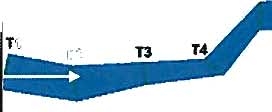
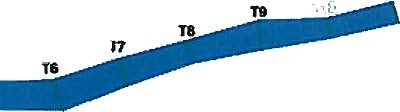
Sampling
locations
(T-_)
were
spaced
300
feet
apart,
starting
upstream
of
the
CSO
discharge
(Figures
1
and
2).
At
each
sampling
location,
a
transect
was
placed
across
the
stream,
and
depth
measurements
were
taken
at
three
equally
distributed
locations
across
the
transect.
RESULTS
Whipple
Creek
Approximately
3,330
feet
of
stream
from
the
CSO
discharge
point
to
theconfluence
of
Cedar
Creek
was
surveyed
in
this
study.
Wetted
stream
width
in
Whipple
Creek
downstream
of
the
CSO
discharge,
ranged
from
I
to
18
feet,
with
the
average
stream
width
being
8.8
feet
(Table
1).
Depths
in
Whipple
Creek
ranged
from
0
to
4.8
inches,
with
the
average
depth
at
1
.5
inches.
Attachment
B
contains
photographs
showing
stream
depths
at
selected
locations
in
Whipple
Creek.
The
stream
bottom
consisted
mostly
of
exposed
bedrock,
with
limited
areas
of
cobble
and
gravel.
Over
95%
of
the
stream
bank
was
rated
DIFFICULT
for
access
to
the
waterbody,
and
moderate
to
steep
for
bank
slope.
Both
stream
banks
are
densely
populated
by
trees
and
shrubs,
the
under
story
composed
of
herbaceous
vegetation
dominated
by
poison
ivy
(Toxicodendron
radicans).
cOM
1-2
T-1B
T-17
1-3
coM
1-4
No
visual
evidence
of
recreation
activity
(swimming,
wading,etc)
past
or
present
was
observed
in
the
creek
during
thesurvey.
Past
recreational
activity
was
identified
by
looking
for
rope
swingsover
the
water,
paths
or
trails
to
the
creek
or
the
presence
of
bait
containers
and
“Y”
sticks
used
for
fishing.
The
creek
is
not
deep
enough
or
provides
sufficient
flow
to
support
recreational
watercraft
such
canoes,
kayaks
and
powerboats.
No
established
beaches
or
public
access
points
to
the
creek
were
present
alongWhipple
Creek.
Along
with
not
supporting
primary
contact
recreation,
Whipple
Creek
has
not
been
designated
an
Outstanding
National
Resource
Water.
It
does
not
contain
threatened
or
endangered
species,
has
no
public
water
intake
structures
and
contains
no
shellfish
beds.
Curtis
Creek
Approximately
5,900
feet
of
Curtis
Creek
was
surveyed
in
thisstudy,starting
just
upstream
of
the
CSO
Outfall
002
to
theconfluence
with
the
Mississippi
River.
The
wetted
stream
width
ranged
from
7
to
60
feet,
with
the
average
width
being
31.5
feet(Table
2).
T-2
3.0
0.6
1.2
0.6
T-3
0.0
0.0
0.0
0.0
T-4
0.0
0.0
0.0
0.0
T-5
7.0
0.6
1.2
0.6
T-6
10.0
2.4
4.8
2.4
T-7
0.0
0.0
0.0
0.0
T-8
11.0
1.2
3.6
1.2
T-9
10.0
0.6
1.2
0.6
T-10
11.0
1.2
3.6
1.2
T-11
8.0
0.6
2.4
0.6
T-12
18.0
1.2
2.4
1.2
1-5
T-2
42.0
18.0
12.0
18.0
T-3
38.0
9.6
9.6
9.6
T-4
34.0
2.4
2.4
2.4
T-5
8.0
3.6
1.8
9.6
T-6
13.0
4.8
6.0
4.8
T-7
13.0
3.6
2.4
3.6
T-8
22.0
8.4
9.6
7.8
T-9
7.0
6.0
4.2
4.2
T-1
0
21.0
19.2
19.2
16.8
T-11
37.0
26.4
34.8
49.2
T-
12
40.0
N/A
N/A
N/A
T-1
3
N/A
N/A
N/A
N/A
T-1
4
35.0
N/A
N/A
N/A
T-
15
60.0
N/A
N/A
N/A
T-1
6
55.0
N/A
N/A
N/A
T-1
7
50.0
N/A
N/A
N/A
T-1
8
35.0
N/A
N/A
N/A
T-1
9
40.0
N/A
N/A
N/A
T-20
40.0
N/A
N/A
N/A
N/A=
Not
Available-
Water
conditions
were
high
and
Mississippi
River
DM
unsafe
to
access
due
to
backflow
from
the
1-6
waterbody,
and
moderate
to
steep
for
bank
slope.
The
lower
portions
of
the
creek
flow
through
an
industrial
area
with
concrete
bank
walls
and
is
channelized
until
the
confluence
with
the
Mississippi
River.
In
the
upper
reaches,
stream
banks
were
densely
populated
by
trees
and
shrubs
making
access
to
the
creek
difficult.
As
observed
on
Whipple
Creek,the
under
story
is
composed
of
herbaceous
vegetation
dominated
by
poison
ivy.
No
visual
evidence
of
recreation
activity
(swimming,
wading,
etc)
past
or
present
wasobserved
in
Curtis
Creek
during
the
survey.
Past
recreational
activity
was
identified
by
looking
for
rope
swings
over
the
water,
paths
or
trails
to
the
creek
or
the
presence
of
bait
containers
and
“Y”
sticks
used
for
fishing.
The
upper
half
of
Curtis
Creek
is
not
deep
enough
or
provides
sufficient
flow
to
support
recreational
watercraft
such
canoes,
kayaks,
and
powerboats.
No
established
beaches
or
public
access
points
to
the
creek
were
present
alongCurtis
Creek.
Along
with
not
supporting
primary
contact
recreation,
Curtis
Creek
has
not
been
designated
an
Outstanding
National
Resource
Water,
does
not
contain
threatened
or
endangered
species,
has
no
public
water
intake
structures
and
contains
no
shellfish
beds.
DISCUSSION
The
United
States
Environmental
Protection
Agency
(EPA)
Combined
Sewer
Overflow
(CSO)
Control
Policy
states
(Federal
Register
Vol.
59,
No.75,
1994)
that
“...a
permittees
long-term
control
plan
to
give
the
highest
priority
to
controlling
overflows
to
sensitive
areas.”
Sensitive
areas
as
defined
by
EPA
include:
•
Outstanding
National
Resource
Waters
•
National
Marine
Sanctuaries
•
Waters
with
threatened
or
endangered
species
and
their
habitat
•
Waters
with
primary
contact
recreation
•
Public
drinking
water
intakes
or
their
designated
protection
areas;
and,
•
Shellfish
beds
Both
Whipple
Creek
and
Curtis
Creek
were
evaluated
to
determine
if
they
contained
any
of
the
features
identified
above,
with
particularly
emphasis
on
“waters
with
primary
contact
recreation”.
1-7
portion
of
the
creek
is
channelized
and
lined
with
concrete
in
selected
locations.The
lower
reach
beforetheconfluence
with
the
Mississippi
River
has
steep
banks
that
are
densely
vegetated
with
trees
and
shrubs.
Public
access
to
this
portion
of
Curtis
Creek
is
restricted
by
the
dense
vegetation
and
steep
banks.
Based
upon
the
physical
and
hydrologic
configuration
of
the
stream
channel
to
support
primary
contact
recreation,the
probability
that
the
stream
is
accessed
by
the
public
on
a
routine
basis
is
low.
Although
Whipple
Creek
flows
by
several
residential
areas
in
its
upper
reaches
(Figure
4),
access
to
the
creek
is
very
difficult.
Stream
banksare
steep
and
densely
covered
with
vegetation,and
at
most
sites
the
under
story
is
dominated
by
poison
ivy.
There
is
low
probability
that
individuals
from
the
residential
areas
are
visiting
or
recreating
in
the
creek
on
a
routine
basis.
Based
upon
the
recentuse
survey
and
the
physical
obstacles
thatprevent
access
to
the
two
creeks,
primary
contact
recreation
is
not
an
existing
use.
Although
IEPA
now
states
that
there
is
a
high
probability
of
primary
contact
activity,
this
statement
alone,
which
contradicts
its
previous
findings,
cannot
support
its
conclusion
that
the
streams
in
questioncan
be
designated
“primary
contact
recreation”
streams,
particularly
in
light
of
all
evidence
to
the
contrary.
Recently,
IEPA
has
proposed
new
standards
for
the
Chicago
Area
Waterway
System
(CAWS)
through
aUse
Attainability
Analysis
approach
(www.chicaqoareawaterways.org)
in
a
Draft
Report
(November
2004).
Although
the
CAWS
areadjacent
to
numerous
residential
areas
and
parks,
and
the
water
depth
is
sufficient
to
support
swimming
and
waterskiing,
IEPA
and
the
stakeholder
group
determinedthat
primary
contact
recreation
was
not
an
existing
or
potential
use
and
therefore
certain
general
use
water
quality
standards
do
notapply.
Instead
new
use
designations
and
water
quality
standards
are
being
proposed
by
IEPA
for
the
CAWS.
CSO
Outfall
006,
Discharging
Into
the
Mississippi
River
With
regard
to
CSO
Outfall
006
discharging
to
a
sensitive
area
in
Quincy
Bay,
it
should
benoted
that
Quincy
Bay
is
not
a
designated
waterway
and
is
only
a
backwaterchannel
of
the
Mississippi
River.
Therefore,
it
should
be
corrected
in
the
City’s
NDPES
Permit
that
the
receiving
water
is
the
Mississippi
River.
There
is
no
known
water
supply
intake
in
the
vicinity
of
CSO
Outfall
006
and
primary
contact
recreation
has
not
beenobserved
in
the
Quincy
Bay
portion
of
the
Mississippi
River.
There
are
several
public
boat
launches
and
severalparks
along
thisportion
of
the
river,
but
the
physical
limitations
of
the
waterway
itself
may
prevent
primary
contact
recreation
from
occurring.
Physical
limitations
include
rip-rap
banks,
deep
sediments
and
unstable
bottoms.
There
is
a
no-wake
policy
on
this
portion
of
the
waterway,
therefore
waterskiing
would
not
be
a
recreational
activity
likely
to
occur.
Based
upon
the
presence
of
boat
launches
and
several
marinas,
recreational
navigation
would
be
the
existing
use
on
this
portion
of
the
Mississippi
River.
There
are
no
known
shellfish
beds
downstream
of
CSO
Outfall
006.
1-8
request
that
IEPA
remove
thesensitive
area
designation
from
its
draft
permit
until
the
LTCP
is
completed.
If
evidence
surfaces
during
the
LTCP
process
which
suggests
a
change
to
the
designation
of
any
of
these
waterbodies,
thisinformation
would
bethoroughly
evaluated
and,
if
necessary,
the
change
made,
as
part
of
the
LTCP.
cOM
1-9
1-10
1—11
Transect
Number
T
__________
Transect
Location
(GPS
coordinates)
Parameter
to
Measure
Transect
Location
insert
or
circle
appropriate
value
Stream
Bottom
A-
Transect
Point
bedrock,boulder,cobble,
gravel,
sand
B-
Transect
Point
bedrock,boulder,cobble,
gravel,
sand
C-
Transect
Point
bedrock,
boulder,
cobble,
gravel,
sand
Stream
Width
(feet)
Wetted
Stream
Width
Stream
Depth
(inches)
A-
Transect
Point
B-
Transect
Point
C-
Transect
Point
Vegetationat
Top
of
Bank
Right
Bank
trees,
shrubs,
weeds,
grass,
lawn,
crop
Left
Bank
trees,
shrubs,
weeds,grass,
lawn,
crop
Stream
Velocity
slight
(few
to
no
riffles)
moderate(balance
of
pools
&
riffles)
high(primarily
riffles)
Bank
Slope
Right
Bank
0.3
slight
(3:1
or
less)
0.6
moderate
(>3:1
but
<
1:1.1)
1.0
steep
(1:1
to
vertical)
Left
Bank
0.3slight
(3:1
or
less)
0.6
moderate
(>3:1
but
<
1:1.1)
1.0
steep
(1:1
to
vertical)
Access
to
Site
at
Transect
Left
Bank
easy,
moderate,
difficult
Right
Bank
easy,
moderate,
difficult
Water
Clarity
Visual
Observation
Clear,
murky,
silty,
turbid
Photographs
(digital
andrecord
photograph
number):
Looking
Upstream
of
Transect____________
Looking
Downstream
of
Transect__________
Photograph
of
Measuring
Rod
at
Transect
B_____
Photograph
of
Right
Bank_________
Photograph
of
Left
Bank
1-12
r
Ou(fallj
&
cOM
t3
TraflseC
NUmt
Transeci
Line
Lref
¶sed
nUtbC?$
no4
up$tve
end
0!
reach
Til
Transect
Transect
A
B
C
Wetted
Width
Stream
Bottom
TI
13
1-13
2)
Any
observed
wading?_____________
3)
Any
observed
water
skiing?__________
4)
Any
rope
swings?_________
5)
Any
bait
buckets,
wormcontainers
to
indicate
fishing
in
the
area?__________
6)
Anyother
recreational
use
of
the
waterbody?
If
yes,
please
identif’:
OtherObservations
or
Notes:
1-14
-
-
-
-
-
-
FP
—
-__;‘_
Figure
B-i
—
CSO
Outfall
007
on
Whipple
Creek
(Photo
W203)
-
::
-‘
I
-
.—,
—
.
.-,-.
-
D
‘
‘‘-::‘
—
-..
e:-
-
3L-
-
-
-;
‘:
-
---.
-
-
;.
e--
-
.-
-
-
—.--/
--
‘I’
=
-
—
—
-
-
-
—
I—
Figure
B-2-
Looking
Downstream
CSO
Outfall
007on
Whipple
Creek
(T-2)
(Photo
W202)
coma
1-15
0)
Figure
8-7-
Whipple
Creek
Water
Depth
Just
West
of
3
rd
Street
(T-8)
(Photo
W803)
‘I
zcE*:z
Figure
8-8-
Whipple
Creek
Channel
—
Looking
Upstream
at
T-11
(Photo
WilOl)
1-18
CD
of
CO
Outfall
002
(Photo
C201)
coM
1-20
Figure
C-
4-
100
Feet
Downstream
of
CSO
Outfall
002
(T-3)
(Photo
W301)
OM
r
.
C-
3-
Looking
Upstream
at
CL
J
Outfall
0
1-3)
(ihoto
C_
-,
•
-
-
:
-
-
-
-
-
-
-
‘_
—
*7.b
g:36Apq
1-21
coM
1-22
C)
*
2aC-4t
ttpk
-
—
-ct:::%
S?--
ad
.
c
-4
e
-
-
-
h_a
-
fla
r
?-
-f
-.,
-.
-
-.
‘-ë2
--
—-
3tC—
Figure
C-
9-
Curtis
Creek
Streambedat
T-5
(Photo
C503)
4’
*-?
tft
t-
-
‘Z
-
;.=&
—
-
4
-
fl—r
-
-
r
-
-
:
-“r
a
•.
-
-.S
If
E
j
•
-
ta-c
Figure
C-
10-
Water
Depth
in
Curtis
Creek
at
T-5
(Photo
C501)
comi
1-24
Figure
C-
11-
Left
Bank
of
Curtis
Creek
at
T-6
(Photo
C605).
Figure
C-
li
Curtis
Cr
Looking
Upstream
at
T-7
(Photo
C702)
1-25
1-26
Figure
C-
14-
CurtisCreek
Water
Depth
at
T-8
(Photo
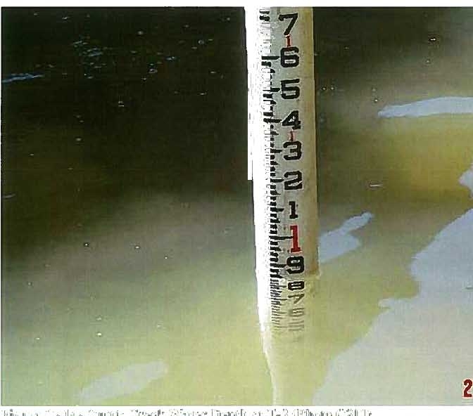
C801)
2?
10:15AM
C-
15-
CurtisCreek
Looking
Upstream
at
T-j
Figure
C-
16-
Curtis
Creek
Looking
Upstream
at
T-11
(Photo
C1104)
DM
1-27
Figure
C-
18-
Curtis
Creek
-
at
T-20
1-28
Date:
21
September
2007
Subject:
Recreational
Use
Survey
of
Quincy
Bay,
City
of
Quincy,
Illinois
INTRODUCTION
In
my
memo
dated
10
September
2007,
I
discussed
the
physical
surveysconducted
on
Curtis
Creek
and
Whipple
Creek
as
they
relate
to
potential
listing
of
sensitive
areas
in
the
City’s
Draft
NPDES
Permit
(lL0030503).
Quincy
Bay,
the
receiving
waters
for
Cedar
Street
CSO
006,
was
also
listed
as
a
“sensitive
area”
in
the
City’s
draft
permit,
but
was
not
fully
evaluated
during
the
streamsurveys
conducted
in
late
August.
In
July
2007,
IEPA
identified
Quincy
Bay
as
a
sensitive
area
because
it
could
potentially
support
primary
contact
recreation.
METHODS
To
determine
if
the
above
situation
applies
to
Quincy
Bay
as
defined
in
the
City’s
Draft
NPDES
permit,a
physical
andrecreational
survey
was
conducted
where
CedarStreet
CSO
enters
into
the
Mississippi
River
(Figure
1).
When
discharging,
the
Cedar
Street
CSO
flows
into
the
east
side
of
the
Mississippi
River
channel
across
from
Quinsippi
Island.
This
channel
is
hydraulically
connected
to
the
Mississippi
River
and
is
not
anisolated
backwaterchannel
or
bay.
The
backwater
bay
called
Quincy
Bay
most
likely
begins
justupstream
of
the
Cedar
Creek
confluence
with
the
Mississippi
River
channel
and
includes
anopen
water
and
floodplain
area
of
approximately
1,300
acres.
The
average
depth
in
Quincy
Bay
is
approximately
two
feet
(US
Army
Corps
Map-
27
Aug
2007)
and
appears
to
be
silting
in.
Cedar
Street
CSO
outfall
is
approximately
1,800
feet
downstream
of
Quincy
Bay
and
most
likely
does
notbackflow
into
the
bay
during
discharge
events.
However,
flood
events
in
the
Mississippi
River
could
create
a
backflow
situation
into
Quincy
Bay
from
the
CedarStreet
CSOwhen
discharging.
On
September
18
th
representatives
from
CDM
and
Klingner
&
Associates,
P.C.
conducted
a
boat
survey
of
the
Mississippi
River
channel
from
a
point
immediately
north
of
Cedar
Creek
to
the
southern
tip
of
Quinsippi
Island
(Figure
2).
An
assessment
of
Art
Keller
Marina
on
the
western
portion
of
the
channel
was
alsoconducted.
Additionally,
representatives
from
CDM
conducted
a
walking
assessment
to
determine
recreational
access
to
the
channel
from
both
the
east
and
west
banks.
Key
metrics
to
be
evaluated
during
this
assessment
were
public
access
to
the
waterway,
water
depth,
visible
signs
of
recreation
(e.g.
swimming,
fishing,
etc.),
and
proximity
of
residential
and
park
areas.
Within
the
marinaand
park
areas,
metrics
included
number
of
docks,
boats
andjet
skis,
availability
of
ladders
for
access
into
and
out
of
the
water,and
public
access
from
the
cDM
1-1
immediately
upstream
of
Cedar
Creek
[39.95222N,
91.420556W]
and
proceeding
to
the
southern
tip
of
Quinsippi
Island
[39.93533N,
91
.41675W].
Attachment
A
contains
photographs
of
the
channel
taken
during
the
tour.
Water
clarity
was
noted
as
murky
with
visibility
limited
to
less
than
1
foot.
Boating
was
limited
primarily
to
the
western
and
middle
portions
of
thechannel
due
to
shallow
water
depths
along
the
eastern
bank
(Figure
3).
Three
fishing
boats
were
present
on
the
western
portion
of
Quinsippi
Island
across
from
the
confluence
of
Cedar
Creek.
Attachment
A
contains
photographs
of
fishing
activities
witnessed
within
this
portion
of
the
channel.
East
Bank
Mississippi
River
Channel
Approximately
0.25
miles
downstream
of
the
confluence
is
an
All-American
Park
with
a
viewing
area.
Steps
lead
from
the
viewing
area
to
the
bank
where
fishing
can
occur.
However,
the
bank
has
a
steep
slope
into
thewater
and
is
composed
primarily
of
dirtwith
no
vegetation.
Further
downstream,
the
Cedar
Street
CSO
discharges
into
the
channel
on
the
south-side
of
the
Quinsippi
Island
Bridge.
This
CSO
is
approximately
1000
feet
upstream
of
Kesler
Park.
Kesler
Park
host
boat
launching
and
docking
facilities.
The
area
is
popular
for
fishing.
Several
boaters
were
viewed
using
the
boat
ramps
and
boating
through
the
channel
to
the
main
stem
of
the
Mississippi
River.
Beyond
the
four
boat
ramps
on
the
east
bank,
there
are
three
small
piers
where
fishing
and
picnicking
were
observed.
In
addition,
there
is
a
small
playground
along
the
bank
with
a
fence
separating
it
from
a
steep
slope
to
the
water.
Thebank
of
the
park
is
primarily
a
moderately
steep
bank
with
large
rocks
scattered
throughout.
Downstream
along
this
bank
is
the
Quincy
Boat
Club
and
a
restaurant
overlooking
the
Mississippi
River.
The
eastern
portion
of
the
channel
is
heavily
vegetated
except
for
city
park
areas.
While
the
parks
contain
boat
ramps
and
piers,
there
are
no
ladders
from
the
piers.
Within
Kesler
Park
there
are
areas
of
easy
access
to
thewater.
However,
there
are
no
established
beaches
or
signs
of
primary
contact
along
either
bank
of
the
channel.
Based
on
water
depths
along
the
east
bank
of
thechannel
(Figure
3),
wading
would
be
limited
to
within
three
feet
from
the
shoreline.
Photographs
of
these
areas
and
the
activities
mentioned
can
be
viewed
in
Attachment
A.
West
Bank
Mississippi
River
Channel
The
western
portion
of
thechannel
is
heavily
vegetated
and
has
limited
access
to
the
waterway.
The
Quinsippi
IslandBridge
is
the
only
connection
from
the
mainland
to
the
island.
Roadways
from
the
bridge
allow
automobile
access
solely
to
Art
Keller
Marina.
Access
to
other
regions
of
the
island
would
have
to
take
place
by
walking
through
primarily
densely
vegetated
areas.
With
the
exception
of
stairways
leading
to
the
marina,
there
were
no
visible
paths
to
the
water
on
the
eastern
portion
of
the
island.
Banks
leading
to
the
marina
had
a
very
high
slope,
limiting
bank
access
mainly
to
the
stairways
leading
directly
to
the
docks.
Art
Keller
Marina
consists
of
two
separate
marinas
with
the
larger
of
the
two
containing
nine
boat
docks
and
thesmaller
containing
three
boat
docksand
a
fueling
station.
Several
small
cOM
1-2
body
contact
recreation
(swimming,
water
skiing,
wading,
etc.).
Primary
contact
recreational
activity
was
identified
by
lookingfor
rope
swings,
beaches,
jet
skis,or
ladders
into
the
water
from
piers
and
docks.
In
addition,
the
Mississippi
River
channel
is
a
no
wake
zone
and
therefore
would
not
permit
waterskiing.
DISCUSSION
Results
from
this
initial
surveyshowthat
existing
uses
in
the
Mississippi
River
channel
are
primarily
recreational
navigation
and
fishing.
Canoeing
and
kayaking
could
exist
within
the
channel
to
gain
access
to
Quincy
Bay
and
its
backwaterwetlands.
The
City
has
no
established
beaches
along
the
channel
and
physical
access
to
the
water
is
limited
on
the
western
bank
of
thechannel.
Although
the
City
maintains
parks
along
the
east
side
of
thechannel,
physical
features
(i.e.
soft
sediments,
steep
drop-offs,
concrete
banks,
limited
visibility)
most
likely
make
the
channel
an
unsuitable
place
for
swimming.
Additionally,
the
Quincy
Park
District
does
not
identify
any
of
theparks
along
the
Mississippi
River
channel
as
suitable
for
swimming.
RECOMMENDATIONS
Based
uponaerial
and
topographical
maps
for
the
Cedar
Street
CSO
006
receiving
waters
and
based
upon
the
results
of
our
site-specific
survey
and
assessment,
as
well
as
our
experience
with
other
CSO
designations
statewide,
the
City’s
permit
should
be
revised
to
reflect
that
the
actual
receiving
watersare
the
Mississippi
River
and
not
Quincy
Bay
andshould
receivethe
same
designation
as
theother
CSO
outfalls
to
the
Mississippi
River.
Combined
sewer
overflows
in
other
in
Mississippi
River
communities
(e.g.
Alton)
are
not
designated
as
discharging
to
sensitive
areas.
In
fact,
a
review
of
recently
issued
NPDES
permits
(Alton,
Galesburg,
Belleville,
LaSalle,Hinsdale,
and
Marseilles)
indicates
that
where
communities
discharge
to
major
waterways,
small
streams,
and
creeks
similar
to
those
in
Quincy,
the
receiving
waters
are
designated
non-sensitive
areas.
This
survey
along
with
theoneconducted
for
Whipple
Creek
and
Curtis
Creekwere
done
on
a
one
time
basis,
and
I
would
recommendexpanding
these
surveys
into
the
2008recreational
season
to
gain
additional
data
regarding
uses
of
these
waterways.
Surveys
should
be
conducted
once
a
month
and
include
weekday
and
weekend
observations.
1-3
woo
c•
1
1-5
coM
1-6
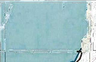
Figure
3 — Depth
Feet Chart:
Mississippi
River
Channel
in Quincy,
Illinois
(Source:
Klinger
and
Associates)
coM
QUINSIPPI ISLAND
V
//
—-
/
/
/
/
/
V
V
V
1-7
coM
1
1-8
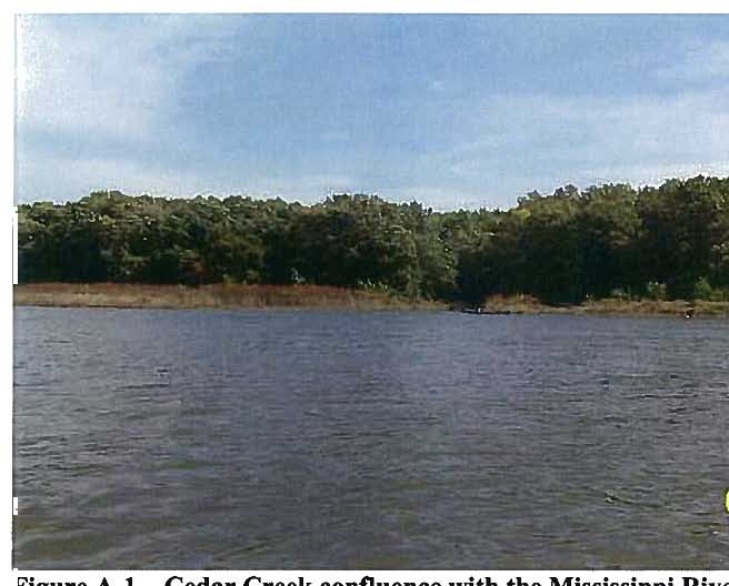
Figure
A-i
—
Cedar
Creek
confluencewith
the
Mississippi
River
Channel
4
confluence
iver
Channel
downstream
of
the
Cedar
Creek
.5.
A
-,
—
-
I,
3S
-
—
-r---
-
-
-
--
--
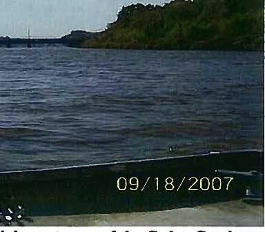
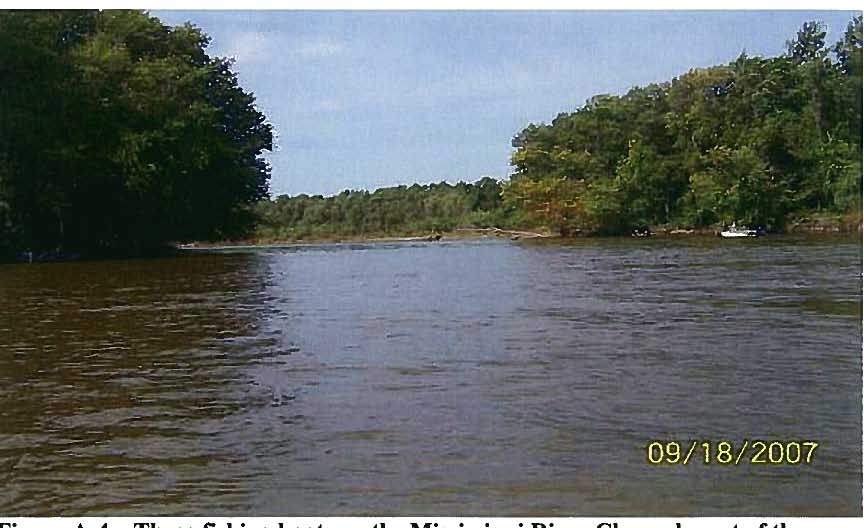
09/tB/2007
Figure
A-3
—
Fishing
on
the
Mississippi
River
Channel,
westof
the
Cedar
Creek
confluence
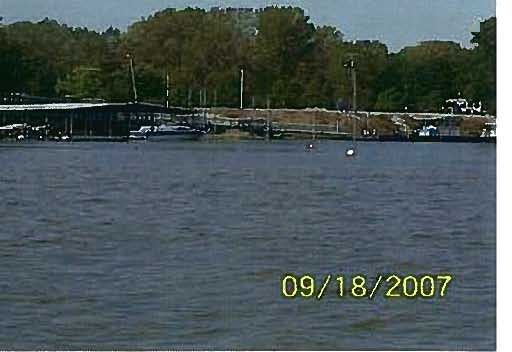
Figure
A-4
—
Three
fishing
boats
on
the
Mississippi
RiverChannel,
west
of
the
Cedar
Creek
confluence
colA
1-9
C
Figure
A-7
—
View
of
trot
lines
set
near
All
America
Park
--
-
Figure
A-8
—
Western
bank
acrossbay
from
All
America
Park
coM
1—11
1-12
a
at
2’
entrance
to
Art
Kc.s
Marina
,
4+.
y
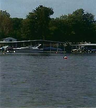
A-1O
—
Boat
docks
and
fueling
station
at
Art
Keller
Marina
c)
II •
I
I.
I i
.j;
IH
I
r
j
—.
-
—
01
•
‘.l
.I’!
)11
-.
¼.i.
.
c.
z:.t
—
—
-.
—
—
-
.—..:-.
:..—
-
_..
-
—
—-t
-
-
—
-r-
-
-‘
-
—
.
_:Z-=-=.
-
-
-
.
—
--
-
-
--
—
.e--
-
09/18/2007
—
--
-
-
-
-.
Figure
A-22
—
View
of
Quinsippi
Island
bank
downstream
of
Lst
entrance
to
Art
Keller
Marina
I
i:e’
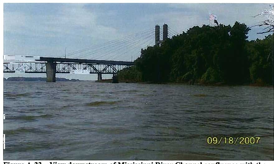
Figure
A-23
—
View
downstream
of
Mississippi
River
Channel
confluence
with
the
main
stem
of
the
Mississippi
River
caM
1-18
Figure
A-24
—
View
of
Quincy
Boat
Club
on
the
Mississippi
River
downstream
of
Kesler
Park
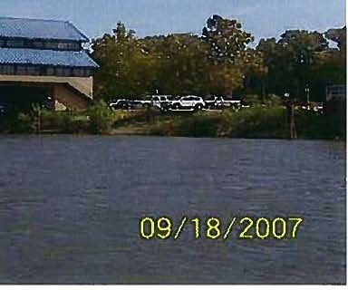
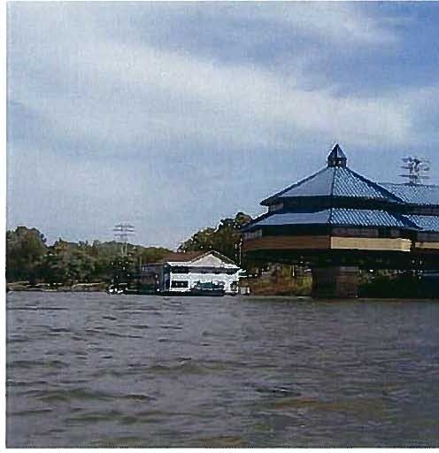
Figure
A-25
—
View
of
restaurant
overlookingtheMississippi
River
Channel
near
the
Memorial
Bridge
CM
1-19
coM
A-26—
View
of
the
southern
tip
of
Quinsippi
Island
Figure
A-27
—
Close-up
view
of
sign
located
at
the
southern
tip
of
Quinsippi
Island
1-20