Comments from the City of Evanston am.i
the City of Chicago
on the CAWS UAA
Page 1 of 2
Stefanie Diers - Comments on the Chicago Area Waterways User Attainability Analysi s Draft
Report
From:?
"Lupton, Stephen F." <stephen.lupton@honeywell.com>
To:?
Rob Sulski <Rob.Sulski@epa.state.il.us>
Date:?
4/14/2005 9:20 AM
Subject:
Comments on the Chicago Area Waterways User Attainability Analysi s Draft Report
April 14
th
, 2005
Rob Sulski
UAA Project Manager
Division of Water Pollution Control
Bureau of Water
Illinois EPA
9511 West Harrison Street
Des Plaines, IL, 60016
Evanston Resident Response to the Draft UAA Report
Dear Mr. Sulski:
The Chicago Area Waterways UAA draft report released on the Chicago Area Waterways
website, www.chicagoareawaterways.org report highlights a number of concerns with regards
to the current water quality of the North Shore Channel but does propose a number of potential
remedial actions. The section of the report that deals with the NSC begins on page 4-24. The
report shows that dissolved oxygen is a severe problem with regards to the channel water
quality. Figure 4-7, p. 4-26 The DO in the Channel does not meet the proposed criteria most
of the time. This is severely limiting to the diversity of aquatic life. Figure 4-14, p. 4-37 shows
that the diversity of fish species in the channel has dramatically declined between 1993 and
2002.
What is of most interest to the users of the channel, however, and one of the my greatest
concerns is the data for bacterial contamination. This information is illustrated in Figures 4-10,
p. 4-29 and figure 4-11, p. 4-30: It shows that the level of
E.coli
in the North Shore Channel
rarely meets secondary use standards, 1030
E.
co/i/100 ml, and often exceeds even the
recreational navigation standard
. of >2470 E.coli/100 ml. This means that the channel is
potentially unsafe for canoeing much of the time. The contamination is particularly severe near
where the undisinfected North Shore treatment plant discharges into the channel at Howard
street. Down stream of Howard the water exceeds recreational navigation standards virtually
100% of the time (this means that people should not even be using power craft here). It is
ironic that this is near the new Dammrich Rowing Center. The water quality at Oakton where
the Dammrich center is located is often out of compliance for both recreational navigation as
well as limited secondary contact.
Some other parameters such as pH and metals are also of concern and have implications for
the consumption of fish taken from the channel (not recommended for human consumption)
but it is the bacterial contamination that is the most important issue in our opinion has it directly
file ://C
:\D
ocuments%20and%20S ettings epauser\Local%20Settings \ Temp \ GWI 00001.HTM 4/14/2005
Page 2 of 2
impacts the health and safety of the current channel users.
The report outlines remedial actions that could be taken to mitigate the poor water quality of
the Channel. These are outlined in Figure 6-1, p. 6-4. They include disinfection of the North
side treatment plant discharge, in-stream aeration and flow augmentation. The strategies to
achieve this are outlined on page 6-5 and do include communities like Evanston and.
Skokie
implementing control systems to reduce or treat CSO discharges into the channel ( item g)).
The report also highlights the arguments that the "stakeholders", e.g. MWRDGC have against
implementing these remedial actions, p. 6-2. However, since the channel is being utilized with
MWRDGC's consent and is being promoted as a recreational resource by communities like
Skokie and Evanston, it's my opinion that these arguments have to be weighted against public
risk.
The report highlights the fact that the North Shore Channel, one of the most actively used
sections of the entire Chicago Area Waterways System (CAWS) is also the section most
heavily contaminated with potentially pathogenic bacteria derived from CSO discharge and
especially the undisinfected discharge from the North Side Treatment Plant.
Section 4.2.5, Letter Response, states
"As part of this UAA study, IEPA requested from
communities along the North Shore Channel if they had any plans for in stream habitat
improvements or the development of swimming areas. The cities that responded did not have
any long-range plans for development in the North Shore Channel."
However, it's my
understanding that the City of Evanston did reply with a response that contained the following
"The
current water quality of the channel and the designation of the UNSCh as limited contact
recreation limits the current utilization options to non-contact usage. Over the long term the
City of Evanston would like to see improvement in the water quality to eventually
allow
full
contact recreation so the that the full recreation potential of the channel could be realized.
This would allow access to the channel for fishing and water contact activities such as wading,
swimming and "floating" on inflatables. This would represent a significant increase in
recreational resources for the communities in the socially disadvantaged areas of western
Evanston."
I should also like to note that the City of Evanston has included the North Shore Channel in its
Capital Improvement Plan.
www.cityofevanston.org/departments/communitydevelopment/planning/pdf/northshore.pdf
Sincerely,
Steve Lupton
1325 Monroe St.
Evanston, IL, 60202
file://CADocuments%20and%20Setfings\epauser\Local%20Settings\Temp\GW100001.HTM 4/14/2005
Stefanie,Diers - EEB UAA Draft Response CEEB Version).doc
Pag
April 15, 2005
Rob Sulski
UAA Project Manager
Division of Water Pollution Control
Bureau of Water
Illinois Environmental Protection Agency
9511 West Harrison Street
Des Plaines, IL, 60016
RE: City of Evanston's Response to IEPA's Draft UAA Report
Dear Mr. Sulski:
By way of this letter, the City of Evanston Environment Board would like to
comment on the Illinois Environmental Protection Agency's ("IEPA") Draft Use
Attainability Analysis ("UAA") Report for the Chicago Area Waterway System
("CAWS"), which was issued in November of 2004. Specifically, these
comments are aimed at the portions of the UAA Report addressing the North
Shore Channel ("Channel"), from its northern most point located at MWRDGC's
Wilmette Harbor and Diversion structure at Lake Michigan, to its southern
crossing into the City of Chicago near the intersection Howard Street and
McCormick Boulevard (approximately seven City blocks north of its confluence
with the North Branch of the Chicago River). These comments were prepared
and officially approved by the Evanston Environment Board for submittal to
IEPA.
To begin with, the Evanston Environment Board agrees that the outflow
from the MWRDGC's Northside WRP into the North Shore Channel near Howard
Street, coupled with reduced discretionary diversion from the Lake Michigan at
the Channel's northern-most point has resulted in a low-flow of Channel water
downstream.
See
AUU Report, Section 3.1.1.7. This low-flow is characterized
in the UAA Report as creating a "stagnant situation."
Id.
This stagnant situation
has led to insufficient dissolved oxygen water content and increased levels of
bacteria. These conditions, in turn, have resulted in the IEPA designating the
portion of the Channel as limited contact recreation" which essentially prohibits
fishing and limiting other recreational activities on the Channel to those where
little actual dermal water contact is likely to occur.
The above situation in the Channel is clearly the result of low water flow
rates, in which the stretch of the Channel that runs through the City of Evanston
has essentially become a wide, shallow, bathtub. The Evanston Environment
Board is very concerned about this and hopes that the IEPA will take remedial
steps aimed at a long-term remedy. As indicated in our previous letter to you.
from the Evanston City Manager, the Environment Board believes that remedial
actions should be investigated including primarily a combination of aeration. and
1
Stefanie Piers -
EEt
UAA
DraftResponse
CEEB Version) doc
age 2t
flow augmentation to return the Channel to a flowing status. While we are
encouraged by the Draft UAA Report's discussion of disinfection as a potential
remedial action which could improve Channel water quality, we also believe that.
disinfection should be viewed as a partial solution. Accordingly, the Evanston
Environment Board encourages the IEPA to give more consideration to aeration
and flow augmentation remedial actions, which, in turn will have positive long
term effects on the canal ecosystem. We believe that aeration and flow
augmentation are far superior to those offered by simple disinfection alone.
We would also like to reiterate Evanston's long-range plans for
development in the North Shore Channel. Section 4.2.5 of the UAA Report
states that no communities along the North Shore Channel have indicated, in
response to an IEPA request, any long range plans for future development of the
North Shore Channel. On the contrary, as part of the City's previous response to
that particular IEPA inquiry, we specifically indicated that, while poor water
quality currently limits utilization options to non-contact usage, "over the long
term the City of Evanston would like to see improvement in the water quality to
eventually allow full contact recreation so that the full recreation potential of the
channel could be realized. This would allow access to the channel for fishing
and water contact activities such as wading, swimming and floating on
inflatables. This would represent a significant increase in recreational resources
for the communities in socially disadvantaged areas of western Evanston." In
other words, remedial activities to increase Channel water quality will drive the
extent to which the City can institute its long-range plans for future development
of the Channel as a source of recreation, which it would very much like to
pursue.
Furthermore, one of the City of Evanston's greatest concerns regarding
water quality in the North Shore Channel is the level and extent of bacterial
contamination. According to the Draft UAA Report, the North Shore Channel,
one of the most actively used sections of the entire CAWS, is also the section
most heavily contaminated with potentially pathogenic bacteria. Data contained
in Figures 4-10, p. 4-29 and figure 4-11, p. 4-30 of the Report illustrate that the
level of E.coli in the North Shore Channel rarely meets secondary use standards,
1030 E. coli/100 ml, and often exceeds even the recreational navigation
standard of >2470 E.coli/100 ml. This means that despite its classification of
"limited contact recreation" the Channel is potentially unsafe for canoeing much
of the time. While some of this contamination is undoubtedly derived from CSO
discharge, the contamination is particularly severe near where the North Shore
treatment plant discharges undisinfected effluent into the Channel at.
Howard
Street. Downstream of Howard the water exceeds recreational navigation
standards virtually 100% of the time, which means that people should not even
be using power craft in this area. We would also like to mention that the new
Dammrich Rowing Center is located near this area. The water quality at Oakton
where the Dammrich center is located is often out of compliance for both
recreational navigation as well as limited secondary contact.
2
Some other parameters such as pH and metals are also of concern and
have implications for the consumption of fish taken from the channel, which are
not recommended for human consumption. But it is the bacterial contamination
that is of the greatest concern to the Environment Board since it directly impacts
the health and safety of the current channel users.
Since dissolved oxygen levels in the Upper North Shore Channel between
the Wilmette locks and the Howard Street discharge are cited as the key
parameter affecting the environmental health of this waterway, we are somewhat
encouraged by the Report's discussion of potential remedial action which could
be taken to mitigate the poor water quality of the Channel. These remedial
actions, which are outlined in Figure 6-1, p. 64, include disinfection of the North
side treatment plant discharge, in-stream aeration and flow augmentation. In
stream aeration could be a separate system that brings oxygen into the water
with small turbines or be combined
.
with flow augmentation to aerate large
quantities of stormwater runoff.
In addition, we would like to improve the quality of that runoff and expand
the drainage area. Evanston currently diverts a portion of our stormwater directly
into the channel and could eventually increase the portion of our surface runoff
and improve the quality of that runoff entering the channel by the use of wetland
"filters" that use aquatic vegetation and small ponds to filter sediment, silt and
other solids. This approach has been successful in other parts of the CAWS and
will provide the best and most cost effective long term solution to reducing the
bacterial contamination by increasing the level of dissolved oxygen and
promoting rapid breakdown of accumulated bio-solids, as well as reducing the
volume of water required to be treated at a major storm event.
We note that the Report p. (p. 6-2) also highlights arguments that the
"stakeholders" such as MWRDGC have made against implementing these
remedial actions. However, since the Channel is being utilized with MWRDGC's
consent and is being promoted as a recreational resource by communities like
Skokie and Evanston, we believe that these "stakeholder" arguments must be
viewed in light of, and weighed against, the very real potential of a public health
risk if no remedial action is taken.
Sincerely,
"a/
Derek Supple
Chairman
City of Evanston Environment Board
3
Stefanie?
? UAA [Sal ResponseTEfi7.
)d 0 c
?
Page
March 31, 2005
Mr. Scott Twait
Illinois Environmental Protection Agency
Bureau of Water
1021 North Grand
Avenue
East
P.O. Box 19276
Springfield, IL 62794-9276
Dear Mr. Twait:
Thank you for the opportunity to comment on the Draft Chicago Area
Waterway Use Attainability Analysis. The City has been pleased with the
quality of work to date and has found real value in the partnerships that have
been forged on the Stakeholder Advisory Committee. The City supports the
UAA process as an important step in achieving a vision that we all desire for
our waterways. Toward that end, we offer the following general statement
about the process,
as
well as specific comments to the report.
As noted in the report, the City of Chicago has made many improvements to
revitalize Chicago Area Waterways. Dozens of acres of new parkland and
several miles of bicycle trails and walking paths have been developed.
Riverbanks by parks, schools and residential neighborhoods have been
restored to reduce erosion and improve wildlife habitat. The City is
committed to continued improvements to water quality, wildlife habitat, and
public amenities on the Chicago Area Waterways.
In the coming months, the Illinois Environmental Protection Agency (IEPA)
will move forward on the important next steps of evaluating the economic
and social impacts of recommendations in the report. We encourage IEPA to
demonstrate the same efficiency and dedication to completing these steps as
was shown in developing the draft report. The City of Chicago is committed
to continuing our participation in this process
as
part of the Stakeholder
Advisory Committee.
It is important that the recommendations in the report be framed in the
context of the timeline of the overall UAA process. The City reminds
participants that the recommendations contained in the report have been
made without the economic and social impact analysis that is necessary to
determine their feasibility. This analysis is an important step in the UAA
process.
More specifically, the report suggests the treatment of combined sewer
overflows in order to address pollution concerns prior to completion of the
Tunnel and Reservoir Project (TARP). Although addressing pollution
City of Chicago
Richard M. Daley, Mayor
Department of Water Management
Richard A. Rice
Commissioner
Jardine Water Purification Plant
1000 East Ohio Street
Chicago, Illinois 60611
(312) 744-7001
(312)
744-9631
(FAX)
(312)
744-2968 (71Y)
www.cityofchicago.org/
watermanagement
NE
ItODS
-`141-
BUILDING CHICAGO TOGETHER
concerns in the short term is clearly desirable, adequate analysis must be
made to determine the most feasible and economically responsible approach
to this issue.
If a strategic plan is included in the final report, the strategies must include an
explanation and plan for seeking funding for local governments to implement
necessary infrastructure improvements. Outside of the work of the UAA, the
City has committed resources to addressing CSOs. However, to adequately
deal with this issue, a more significant investment must be made at the
federal level. The City continues to push for funding for State Revolving
Funds and the completion of TARP. Any strategies in the report should
contain similar funding ideas and goals.
Detailed comments compiled from multiple City of Chicago departments are
attached.
Sincerely,
Richard Rice
?
N.
7.
Marcia S4menez
Commissioner
?
Commissioner
Department of Water Management
?
Department of Environment
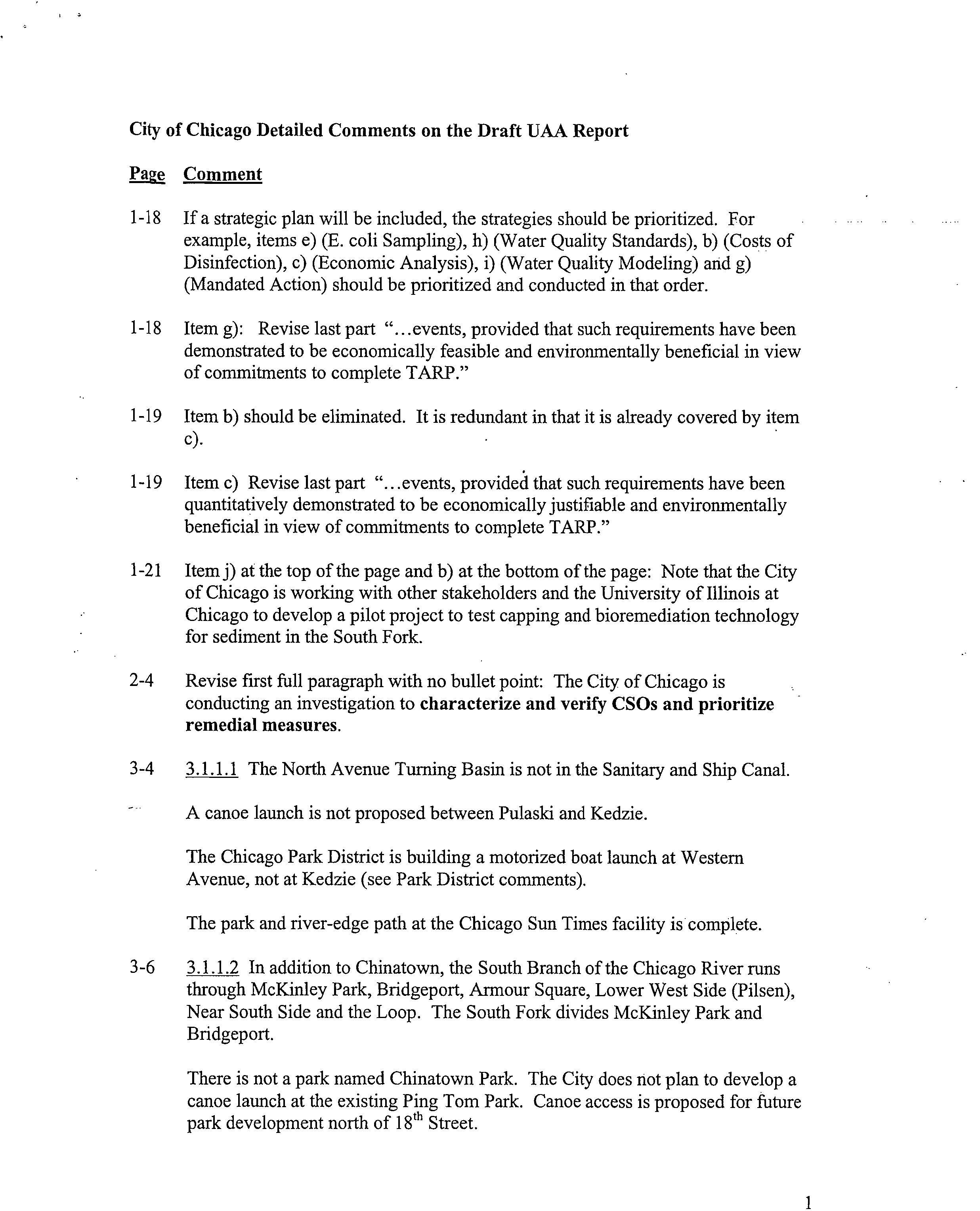
City of Chicago Detailed Comments on the Draft UAA Report
Page Comment
1-18 If a strategic plan will be included, the strategies should be prioritized. For
example, items e) (E. coli Sampling), h) (Water Quality Standards), b) (Costs of
Disinfection), c) (Economic Analysis), i) (Water Quality Modeling) and g)
(Mandated Action) should be prioritized and conducted in that order.
1-18 Item g): Revise last part "...events, provided that such requirements have been
demonstrated to be economically feasible and environmentally beneficial in view
of commitments to complete TARP."
1-19 Item b) should be eliminated. It is redundant in that it is already covered by item
c).
1-19 Item c) Revise last part "...events, provided that such requirements have been
quantitatively demonstrated to be economically justifiable and environmentally
beneficial in view of commitments to complete TARP."
1-21 Item j) at the top of the page and b) at the bottom of the page: Note that the City
of Chicago is working with other stakeholders and the University of Illinois at
Chicago to develop a pilot project to test capping and bioremediation technology
for sediment in the South Fork.
2-4
Revise first full paragraph with no bullet point: The City of Chicago is
conducting an investigation to
characterize and verify CSOs and prioritize
remedial measures.
3-4
3.1.1.1 The North Avenue Turning Basin is not in the Sanitary and Ship Canal.
A canoe launch is not proposed between Pulaski and Kedzie.
The Chicago Park District is building a motorized boat launch at Western
Avenue, not at Kedzie (see Park District comments).
The park and river-edge path at the Chicago Sun Times facility is complete.
3-6
3.1.1.2 In addition to Chinatown, the South Branch of the Chicago River runs
through McKinley Park, Bridgeport, Armour Square, Lower West Side (Pilsen),
Near South Side and the Loop. The South Fork divides McKinley Park and
Bridgeport.
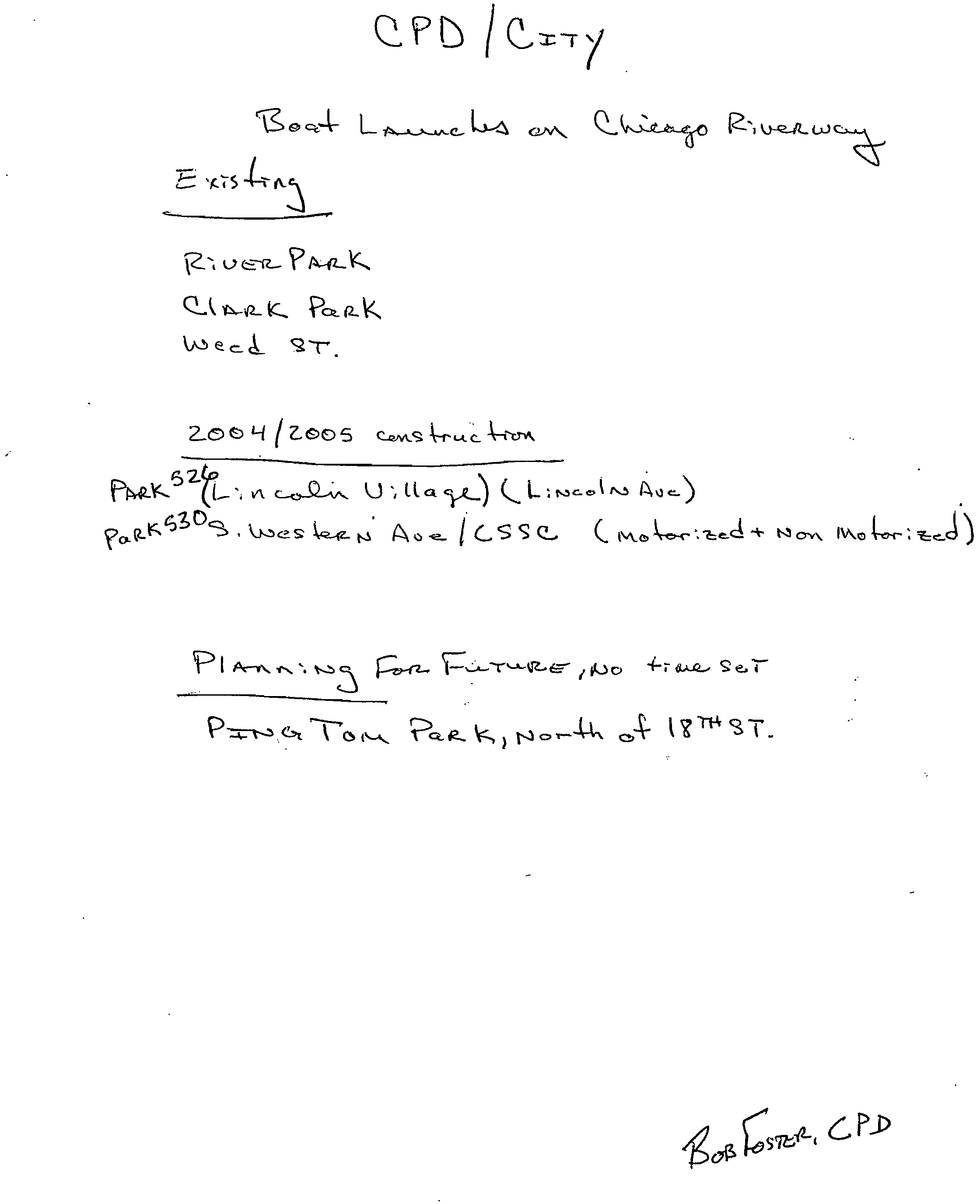
There is not a park named Chinatown Park. The City does not plan to develop a
canoe launch at the existing Ping Tom Park. Canoe access is proposed for future
park development north of 18
th Street.
1
3.1.1.3 Land use on the South Fork north of 35
th Street is transitioning to
residential and open space. Two residential developments have been approved by
the Chicago Plan Commission.
3-7 4th
Paragraph: The City is not planning to develop a canoe launch at Origins Park
or at Ashland Avenue. Canoe and rowing access is proposed for the future park at
Eleanor and Fuller.
3.1.1.4 Wolf Point, at the confluence of the three branches of the river, has a
"natural" riverbank (there is no seawall).
3-8
The Chicago River. Rowing and Paddling Center is no longer located at the old
Coast Guard Station. They are temporarily located at the Lake Shore Drive
Bridge on the south bank of the river.
The text describing river use only mentions rowing and light barge traffic. The
dominant use in this segment is tour boat and water taxi service.
3.1.1.5 Residential units on river-edge land also exist on the Chicago River, the
South Branch and the South Fork. It would be more accurate to say that the North
Branch is one of the few places with
single family
homes bordering the river.
3-9
The existing rowing facility at the North Avenue turning basin is located on
private property. The City does not plan to enhance the facility. The City and the
Chicago Park District are completing a canoe launch nearby at Weed St. on the
North Branch Canal.
3-10 The City does not plan to build a boat ramp from Argyle Street to the canoe
launch at West River Park. The portage path between the two canoe launches in
West River Park is complete.
The City supports investigation of dam modifications at River Park for recreation
and habitat enhancements, but the City has not developed any plans to create a
safe run for small craft over the structure.
3.1.1.6 The waterway is called the North Branch
Canal.
The report states that the Montgomery Ward building will contain 298 units. This
is part of the Kingsbury Park development, which contains 2,000 planned
residential units.
The report states that "residential developments are bringing people closer to the
river where land prices are more affordable than Lake Michigan development. . ."
Is there data to support this statement? Residential developments on the river are
selling at premium prices.
2
3-18 Table 3-2 . Add an asterisk at Chicago CSO Number 231. Include table foot note:
*This number will be reduced pending further field investigations by the City.
3-21 3.2.1 The heading for this section is the Chicago River Corridor Development
Plan, which is not discussed at all in the text of the paragraph. The text describing
the plan in section 3.2.2 should be included in section 3.2.1.
Note that the City and other stakeholders have completed a great deal of planning
and development work on the Chicago River system since the completion of the
CitySpace Plan in 1993. Although this work has been consistent with the goals of
the CitySpace program, the UAA report would provide a more accurate
description of "Chicago River Programs and Projects" if it focused on the plans
and programs specifically targeting the CAWs. The following additional plans
and programs should be included:
1999: In conjunction with the Chicago River Corridor Development Plan, the
City of Chicago passed a new ordinance mandating a 30-foot setback and public
access for developments on the river. The City also adopted the Chicago River
Corridor Design Guidelines and Standards. This document regulates development
within the 30-foot setback zone.
2002: The Chicago Park District completed a Chicago River Master Plan that laid
out strategies for increasing and improving public open space on the river.
2003: Mayor Daley announced the Chicago Water Agenda, a comprehensive
vision for management of Chicago's water resources. The City also published A
Guide to Stormwater Best Management Practices, a booklet that outlines
innovative ways to manage stormwater that are proven to work in Chicago.
2004: The City developed a new cost-share program for repair of private
riverbanks and seawalls located in Tax Increment Finance districts. The program
provides additional incentive for natural riverbank design that includes habitat
enhancements.
3.2.2 Although the text of this section accurately describes City goals to create
greenways in the Chicago River corridor, there is no official program known as
"The Greenways Project."
3-22 3.2.3 The following information may be useful for a more accurate description of
the Calumet Area Land Use Plan and related efforts:
The basic tenets of the plan, and many of the land use designations, date back to 1985
when local residents and area activists developed a set of ideas to preserve natural areas
and create recreational opportunities in Calumet. In 1997, the National Park Service
recognized these planning and research activities by initiating a federal study of the
Calumet area. The
Calumet Area Land Use Plan
began when the Chicago Department of
Planning and Development (DPD) and the non-profit organizations, Openlands Project
and the Southeast Chicago Development Commission jointly submitted a grant to the
U.S. EPA under its Sustainable Development Challenge Grant program for a Calumet
3
plan. The role of the non-profit organizations included outreach to and representation of
the local environmental and community groups. The planning partnership later included
the Chicago Department of Environment (DOE) and Calumet Area Industrial
Commission, a non-profit organization representing area businesses. The Illinois
International Port Authority and Metropolitan Water Reclamation District of Greater
Chicago own large tracts in the area and DPD worked with both agencies to get their
concurrence on the land use designations.
The goal of the
Calumet Area Land Use Plan
is to create a "landscape where industry and
open space are intermingled, interconnected and to the greatest extent possible, co-
existing harmoniously" by:
•
Improving the quality of life in the Calumet area and the surrounding communities
•
Retaining and enhancing existing businesses and industries within the Calumet area
•
Attracting new industrial and business development, and creating new job
opportunities
•
Protecting and enhancing wetland and natural areas within the Calumet area, and
improve habitat for rare and endangered species.
The Chicago Plan Commission adopted the plan on February 14, 2002 and in March
2004 the associated
Calumet Design Guidelines
were adopted to the 1,000 acres of
industrial land ready for redevelopment by providing direction on storm water
management, slag laden soils and planting that will enhance and complement the nearby
natural areas.
More than 2,200 species were identified during the 2002 Calumet Biodiversity Blitz, a
24-hour inventory of Calumet area species that involved more than 100 scientists and
scores of community members and volunteers. To address habitat protection for these
species, the Department of Environment published the
Calumet Area Ecological
Management Strategy
in 2002 to provide a unified strategy for land managers for
rehabilitating the natural areas. Since the plan was adopted, the City has acquired over
300 acres of wetlands and natural areas of statewide significance through donations, tax
sales, and acquisitions using state and federal grants. The Illinois International Port
District, the owner of the west shore, has agreed to dedicate that land for preservation.
4-44
First paragraph: Note that land use on the South Fork north of 35
th Street is
transitioning to residential and open space. Two residential developments have
been approved by the Chicago Plan Commission.
4-45 The text fails to mention the intensive use of the waterway by tour boat and water
taxi service.
5-4 Items 6 and 7: The East and West arms of the South Fork and the West Fork were
filled in long ago.
6-5 If a strategic plan will be included, the strategies should be prioritized. For
example, strategy items h) and i) should be completed before g) unless it is
determined in f) that disinfection at the WRPs does not achieve dry weather
bacteria standards.
6-6
Item b) should be eliminated. It is redundant in that it is included in item c).
Item c): Revise last part "...events, provided that such requirements have been
demonstrated to be economically feasible and environmentally beneficial in view
of commitments to complete TARP."
Item k) should be included with item e) on page 6-5 to better determine sources of
bacteria (human vs. natural sources).
E. coli
is persistent in the open
environment, including in the sediment and soil environment.
An additional item should be included as follows: Seek funding for local
governments and entities to implement point and non-point source controls to
reduce CSOs.
Items d), e) and f) should be completed before items b) or c) are considered.
6-8
Revise item j) to include capping and in-situ treatment of sediment as remediation
alternatives.
5
Recreational Surveys to Local Governmental Units and
Responses
May 14, 2004 UAA Letter to Village of Alsip
Page 2
We are also interested in your organizations' existing and planned river-related,
public recreational events such as: canoeing and kayaking, river-edge cleanup and
restoration and other such activities.
Your earliest submission of this information within the next 30 days would be most
appreciated so that we may include it in the decision-making framework of our study.
Any development plans that are covered in projects governed by an NPDES permit
need not be communicated to us as a part of this Use Attainability Analysis request.
The Chicago area waterways include the following waterbodies:
1. North Shore Channel from Lake Michigan to the confluence with the North Branch of
the Chicago River
2.
North Branch of the Chicago River from it's confluence with the North Shore Channel
to its confluence with the South Branch, including the North Branch Canal along the
east side of Goose Island
3.
Chicago River
4.
South Branch of the Chicago River, including the South Fork and navigation slips
5.
Chicago Sanitary & Ship Canal, including the Collateral Channel
6. Lake Calumet and Lake Calumet Entrance Channel
7.
Calumet River from Lake Michigan to the confluence with the Grand Calumet River
8.
Grand Calumet River
9.
Little Calumet River North Leg from its junction with the Grand Calumet River to the
Calumet-Sag Channel
10. Calumet-Sag Channel
The UAA is the first in-depth evaluation of the Chicago area waterways in nearly
three decades and the analysis and subsequent revisions of water quality standards
will have a major impact on how the waterways can potentially be used ecologically,
commercially and recreationally. Please visit ChicagoAreaWaterways.org for more
information on the UAA.
Thank you in advance for your participation in this effort. If you have any questions,
please contact me at 847/ 294-4037 or via email at rob.sulski@epa.state.il.us.
Very truly yours,
/11
44//
l/ka.
Rob Sulski
UAA Project Manager
Division of Water Pollution Control
Bureau of Water
May 14, 2004 UAA Letter to Village of Alsip
Page 3
cc: Toby Frevert, IEPA
Ronald French, CDM
File
Letter Recipients:
Metropolitan Water Reclamation District
Illinois International Port District
Village of Alsip
City of Chicago - Mayor's Office, Department of Planning and Development,
Department of Environment, Department of Water Management
Chicago Park District
Cook County Forest Preserve District
DuPage County Forest Preserve District
Will County Forest Preserve District
Village of Wilmette
Wilmette Park District
Village of Skokie
Skokie Park District
City of Evanston
Village of Palos Hills
Village of Worth
Village of Palos Park
Village of Lincolnwood
Lincolnwood Park District
Village of Dolton
Dolton Park District
Calumet City
Calumet Memorial Park District
Village of Burnham
City of Blue Island
Village of Summit
Village of Bedford Park
Village of Justice
Village of Stickney
City of Cicero
Town of Forest View
Village of Summit
Village of Hodgkins
Village of Summit
Village of Willow Springs
Village of Lemont
City of Romeoville
Sincerely,
CHRISTOPHER
B. BURKE
ENGINEERING, LTD.
318 Alana Drive • New Lenox, Illinois 60451 • Tel.: 815-463-9050 • Fax: 815-463-9065
July 28 2004
Illinois Environmental Protection Agency
1021 North Grand Avenue East
P. O. Box 19276
Springfield, Illinois 62794
Attention:?
Mr: Rob Sulski
Subject:
?
Palos Hills, Chicago Area Waterway System
Use Availability Analysis (UAA)
Dear Mr. Sulski:
On behalf of the City of Palos Hills, I am responding to your letter dated May 31, 2004.
The City of Palos Hills has no plans within a ten year horizon for the waterways or the
land adjacent to those waterways identified in your letter. They are also not aware of
any private sector plans within the City limits for the areas noted above.
Should you have any further questions on this matter, please direct them to Mr. George
Lutz at the City of Palos Hills.
Dave Vandervelde, PE
Senior Civil Engineer
Cc: George Lutz, City of Palos Hills
DV/gmf
CAWINNT Profiles \ DVANDERV\Temporary Internet Files \ OLKBPAL1.0723041.dec
pzmawg
AUG 2 2004
Div. Water Pollution Control
Field Operations Section-Reg. 2
Rob Sulski - Request for information ?
g e 1
From:?
"Bob Porter" <Bob-Porter@lemontparkdistrictorg>
To:?
<rob.sulski@epa.state.il.us>
Date:?
7/8/2004 7:51:36 AM
Subject:?
Request for information
I received the letter you forwarded to the Lemont Park District
regarding issues including modification or restoration of waterway
channels and others issues as it relates to recreation and commercial
opportunities. The park district has no application these issues. Any
questions, please contact me. Thank you.
Robert A. Porter
Director of Parks & Recreation
VILLAGE
1200
OF
Wilmette
WILMETTE
Ave.
WILMETTE, ILLINOIS 60091-0040
OFFICE OF
THE MANAGER
?
June 14, 2004
(847) 251-2700
FAX (847) 853-7700
TDD (847) 853-7634
Rob Sulski
IEPA
UAA Project Manager
James R. Thompson Center
100 West Randolph, Suite 11-300
Chicago, IL 60601
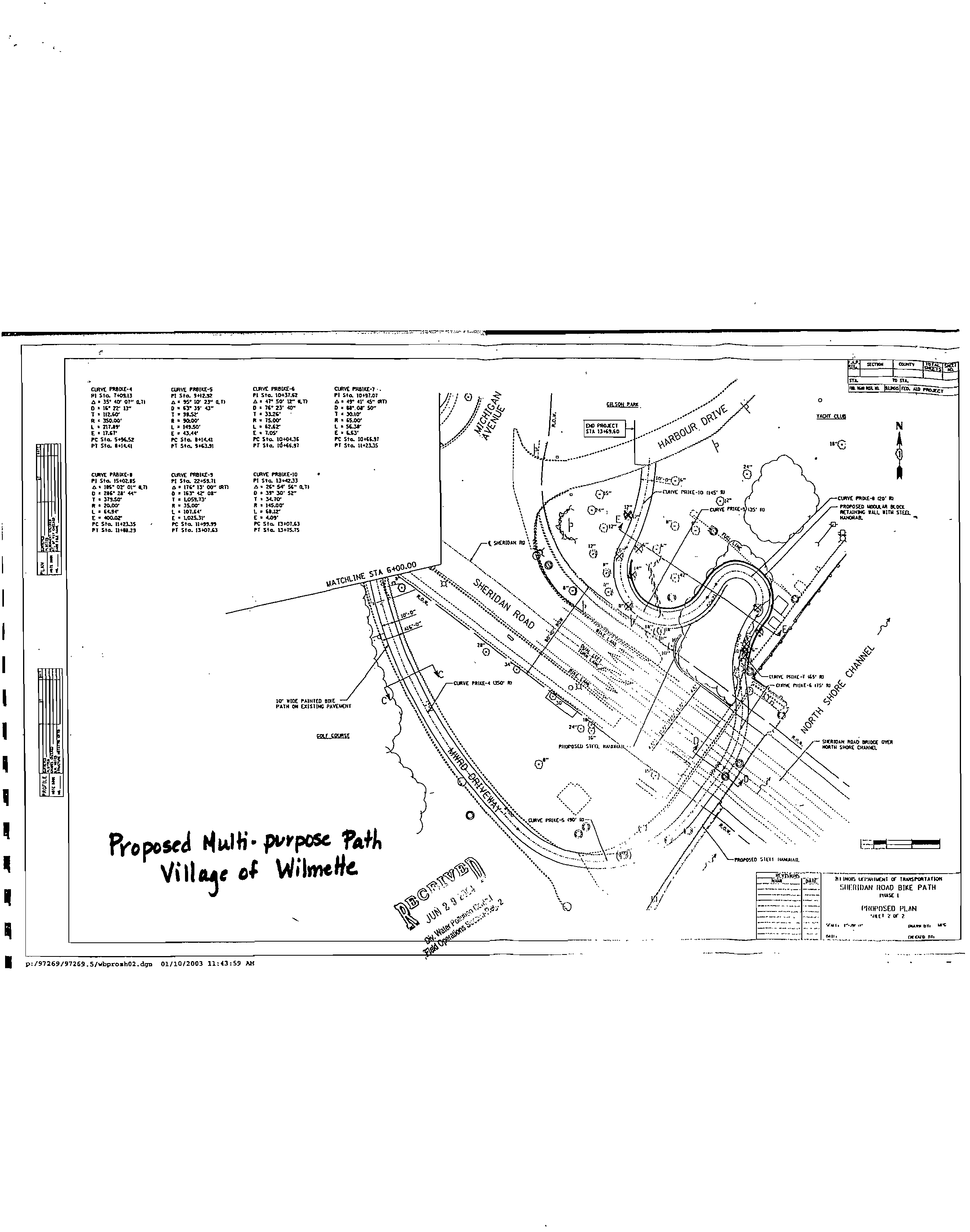
Dear Mr. Sulski:
In response to your request regarding waterway related development plans
underway, I have enclosed a site plan indicating where the proposed bikeway/pedway
will run through the Village of Wilmette. Please note that the multi-purpose path will be .
adjacent to the Wilmette Harbor (Lake Michigan) and the North Shore Channel.
If you have any questions about this project, please contact Director of
Engineering Brigitte Mayerhofer at either 847-853-7627 or
mayerhoferb(i4wilmette.com.
Sincerely,
Michael J.
IL
-
Village Manager
cc:?
Brigitte Mayerhofer
g
JUN 2 9
2
004
Div. Water Pollution Control
Field Operations Section-Reg. 2
S
g
ERIOAR RJ
stcrp••
37.1.?70 sm.
WIxE PROIXE-G
racoon. 111.0.11.
70. •./.0
PI Sta. 10•37.51
A • .1
. SO. IS-
It • 7S..00.
L • Stir
E • 7.0S.
PC St. 10+03.76
Pi Sta. 0145.37
el'
to.
10417.07
fr
• AI' 4.S. 017/
0 • WAY SO-
I • X•10/
• SI.00,
L
• scu-
PC St. 10.637
PI Sta. 11•2••5
rm3
SU.P"'
13.0.C670
51150/1 r
un
1.0.00
um 'mac-
.
PI Sta. IS•07.PS
0. IRV Or 01-171
7 • 37,10/
R • 20.00.
L• PUP
E •
•Doar
PC Sta. 1147.3.10
P7 Sta. 11-48.29
OAK PROISE,
PI Sta. 22•39.71
A • 176. 13' CO
. dan
0 • 1ST 12/
R • /SOO/
L • 10734.
E • LO1S.71•
PC Sta. 11.9.35
PI Sta. 13.07.0
CLevE PR81KE•10
PI Sta.
A • SG- SP St- 0.11
0 • 3S
• 10. 3r-
11.70/
R • 143.00.
L • fdi.tr
PC St. 13•07.0
Pi sta. 1,4,7S
fur.
POIKE-10
MIRK PRIM
"0
CUM 1
1
9101-0 00'10
PRCPOSED WAWA Kt.
RE7/0014 TALL PIM 51(11.
7x ax ,11311.4 P7.vEPExr
ca
001•115
Pro pose4 141411i•
paposo ?AA
Vi
I
I
a^c
o$
PIHIPMED PLAN
,
..•••••?
••••••• ay.
1?1/11.40.1 O InotSPOIlAt
:iiirsiii)AN
ROAD BIKE PATH
MAY
I
WISE FUME-4
Pi
Sio.
7.113
D • IS
.
Ur 07.0.71
0 • 16•
Sr LY
11240.
L • 117.0r
E •
Itsr
PC Sta.
SHLSS
P1 Sta. 11•14.41
WIVE PROPLE-S
p/ Sta. S•17...32
A • 71. 10' SY CO
I • Er Sr
7 • MSS'
11 • NEW
L • 1..SO.
E • 43.44.
PC Sta. 11•1141
PI Sta. S41.31
I
1
1
9
I
;or/97269/9 269.5/wbprosh02.d5. 01/10/2001 11:43:59
AM
2100 Ridge Avenue
Evanston, Illinois 60201-2798
T 847.328.2100
TTY 847.328.4080
www.cityofevanston.org
City of
Evanston-
September 14, 2004
Rob Sulski
UAA. Project Manager
Division of Water Pollution Control
Bureau of Water
Illinois EPA '
9511 West Harrison Street
Des Plaines, IL, 60016
Subject: City of Evanston's Response to Planned Recreational use of the
Upper North Shore Channel
Dear Mr. Sulski:
The City of Evanston ("City") regards the Upper North Shore Channel ("Channel")
as an important recreational resource for its residents, as well as surrounding
communities. Over the last few years, the City has noticed a considerable
increase in use of the Channel by canoeists, kayak boaters, and surrounding
high school and college crew/rowing teams. The City's Parks/Forestry &
Recreation Department now sponsors canoeing activities on the Channel through
- the Evanston Ecology Center programs. The Evanston Ecology Center and Ladd
Arboretum, as a coalition, maintain the public parkway along the Channel and
promote
its
conservation. The parkway itself is easily accessible from all parts of
Evanston and is a wonderfully-maintained open space used for walking, jogging,
and biking. Throughout the year environmental educators from the Ecology
Center offer basic instruction in canoeing and guide Channel canoe tours,
pointing out the flora and fauna of the region. Experienced canoe and kayak
boaters can now launch their own vessels down-Channel at the relatively-new
Skokie Channel side Park, located north of Oakton and
1/2
block east of
McCormick Boulevard.
The City is currently looking for ways to further promote usage of the Channel for
recreational activities. In this regard, some of the short-term improvements
under consideration for inclusion in the City's Capital Improvement Plan (CIP) are
as follows:
SEP 1 7 2004
Div. Water Pollution Control
t!■..1,4
?
ennfitv, Clenel
•
Improvements to bike paths on the eastern bank of the Channel. This
could include directing bike paths under the roadway bridges across the
Channel so that bikers can avoid crossing busy roads such as Emerson,
Church and Dempster streets.
•
Establishing nature paths and overlooks along the banks of the Channel
that will enhance opportunities for wildlife viewing and study.
Establishing piers and improved canoe access for disabled persons and
the elderly (an important consideration for an aging population).
The measured water quality of the Channel as "limited contact recreation" limits
the City's current utilization options to
non-contact usage. Over the long term,
the City of Evanston would like to see improvement in the water quality to
eventually allow full contact recreation so that the recreation potential of the
channel could be fully realiZed. Such a re-designation would allow access to the
Channel for fishing and watercOntact activities such as wading, swimming and
"floating" on inflatables. This .would represent a significant increase in
recreational resources for the communities, especially inthe moderate-income
residential areas of western Evanston.
In order to achieve this long-term goal of re-deeignation, the City realizes that the
current measured water quality of the Channel will have to be significantly
improved. Therefore, the City of Evanston strongly' ssupports the
recommendations in the IEPA Chicag6"Area Waterway System UAA to improve
the water quality in the channel by implementation of the following steps:
1. Increasing the flow of the Channel by diversion of a portion of the
MWRD's Skokie Plant effluent to the head of the Channel as well as by
introducing screened surface stormwater runoff.
2.
Introducing supplemental artificial water aeration through cascading weir
or other proven methods.
3.
Implementing a non-residual disinfection process for the MWRD Skokie
plant discharge.
4. Channel bank improvements to encourage growth of emergent aquatic
vegetation. The use of constructed wetland treatment of surface storm
water runoff only (as opposed to combined sewer and stormwater
discharge) would greatly improve wildlife habitat as well as water quality in
the channel.
The City of Evanston, with the support of the Evanston Environment Board, is
currently developing a public educational program for the Evanston community to
increase the awareness of the educational and recreational potential of the
Upper North Shore Channel and to promote its usage for such purposes.
Village President
Richard S. Grenvich
Trustees
Richard M. Hubacek
Dennis W. Tetens
Linda Mladek
Lawrence Powell
Mike Grossi
James Sudkamp
7000 West 46th Street
Forest View, Illinois 60402
(708) 788-3429
(708) 788-8266 Fax
?
Village
Ity
i
new
oorest
of
June 7, 2004
Mr. Rob Sulski
UAA Project Manager
Division of Water Pollution Control
Illinois EPA
9511 West Harrison Street
Des Plaines, IL. 60016
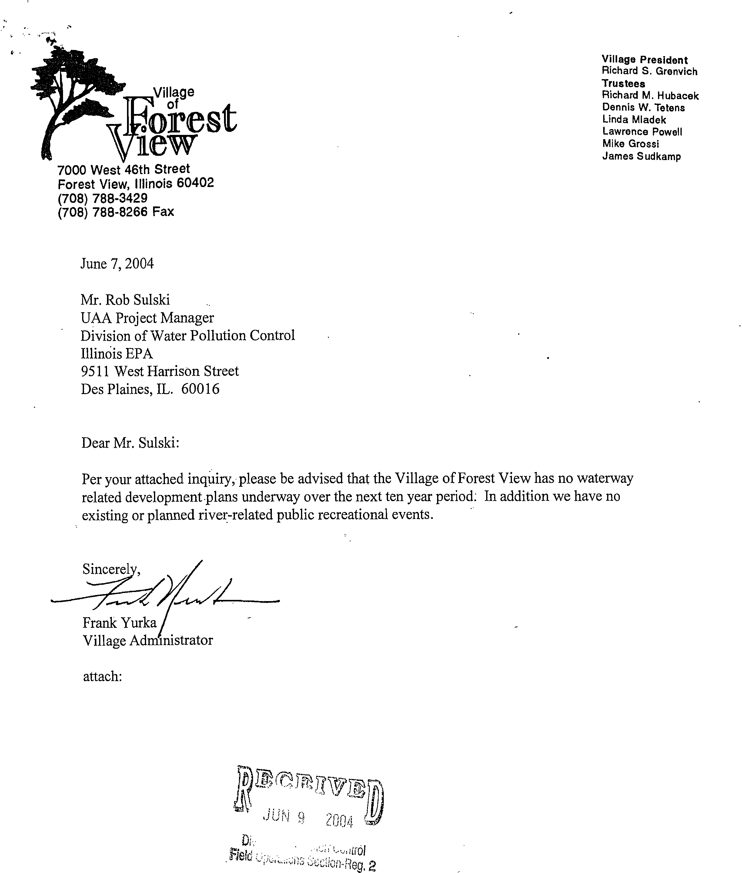
Dear Mr. Sulski:
Per your attached inquiry, please be advised that the Village of Forest View has no waterway
related development plans underway over the next ten year period: In addition we have no
existing or planned river-related public recreational events.
Sincerel
Frank Yurka
Village Administrator
attach:
,JUN
::‘,14,•;,ccilon-Fieg.
2
VILLAGE OF FOREST VIEW
7000 W. 46TH STREET
FOREST VIEW, ILL. 60402
MR. ROB SULSKI
UAA Project Mahager
Divisior
.
of Water Pollution Control
Illinois EPA
9511 West Harrison StreeL.:
Des Plaines, IL. 60016
• 5001 6+ 1S27:::
Q,Pb
Q..cs_t_eLt
o R)
Q-
ca-/L w
‘A.ZS
`-3
Cl
ur-42_
tc,
Pc),(2.k
ecA_
20
s
t
.)
y
t zoo
5 c.,2Aks?
-k-
z
h
s,,,oc.5t_- V1
c—c..5-0—.■".
V ila
yL)
?
Irac_cA
t,s A ,)
ICSS?
C Nve,?
oNN
IV
∎
o
?
,J)
P
t?
Y.
ti7
3?•-"--re-
r
ik)
?P
?
<st?
?ck.
a.. V., )
N
c,
?
,z,A-
k g .114
ST.
Metropolitan Water Reclamation District of Greater Chicago
I Q -, r.
•-•
Div i
.14/
l?, ( ,,,
- e,:,
'
.)10/0( 0901
.4
1.0
.
Paiiiw
on
0
li
s Se?
oiVel
cil07.P,
ery truly you s,
tut:-
ohn C. Farnan
eneral Superintendent
BOARD OF COMMISSIONERS
Terrence J. O'Brien
President
Kathleen Therese Meany
Vice President
Gloria Alitto Majewski
Chairman Of Finance
Frank Avila
James C. Harris
Barbara J. McGowan
Cynthia M. Santos
Patricia Young
100 EAST ERIE STREET
?
CHICAGO, ILLINOIS 60611-3154
?
312.751.5600
Harry "Bus" Yourell
John C. Farnan, P.E.
General Superintendent
?
July 12,2004
312 .
751
.
7900
?
FAX 312 -751.5681
Mr. Rob Sulski, Project Manager
Illinois Environmental Protection Agency
9511 West Harrison
Des Plaines, IL 60016
Dear Mr. Sulski:
Subject: Request for Information
This responds to your letter dated June 16, 2004, requesting plans that would have an impact on the Chicago Area
Waterways and be useful to the Illinois Environmental Protection Agency for the Use Attainability Analysis (UAA)
Study. The Metropolitan Water Reclamation District of Greater Chicago (Chicago) has no plans for developments
that fit the description outlined in your letter. However, we wish to inform you of the following:
•
North Branch Canal. The District has discussed the possibility of our participation with the City of Chicago (City)
in a project to create a wetland out of the current canal. Since the canal is City-owned and the only known
permitted discharges to the canal are from five combined sewer overflow outfalls owned by the City, the District
is taking a subordinate role in promoting this project. We believe that this project would have some marginal
benefits in improving water quality in the North Branch of the Chicago River.
•
South Fork of the South Branch. As you are aware, we have studied the benefit of inducing artificial flow in this
reach to improve water quality. Chicago has engaged the Chicago District, U.S. Army Corps of Engineers
(Corps) to investigate improvement of this reach. However, Corps resources to proceed with this work are
limited and the District will include this work in the Scope of Work for the North Side Water Reclamation Plant
Master Plan Study.
•
The District does not undertake recreational improvements on property it owns along the waterways. However,
we do lease property for this purpose. Recreational improvements have been made at numerous locations, as
you well know. At present, the only known plans of potential recreational/residential developments on District-
owned property is in the vicinity of Lemont. In addition, the Chicago Park District is planning the installation of a
boat ramp at Western Avenue on the Chicago Sanitary and Ship Canal (CSSC).
• The following is a list of pending plans for use of District property in or along the waterways.
1. Army Corps of Engineers — Fish barrier in Romeoville, north of 135
th
Street on the CSSC
2.
Chicago Park District — Bike paths on east and west side of North Shore Channel, from Lawrence to Devon
Avenue
3. At Route 83, east of Cicero Avenue on the Calumet-Sag Channel, the Illinois Mining Company is removing
spoil, and the IL Tollway Authority has an easement there for construction on 1-294
4.
Bank stabilization project at 3014 W. 41
st
(Main and Collateral Channels of the CSSC)
If you have any questions, please contact Richard Lanyon, Director of Research and Development at 312-751-5190.
RL:dl
[
-
Rob Sulski - IEPA 06-15-04 doc
June 15, 2004
Mr. Robert Sulski
UAA Project Manager
Division of Water Pollution Control
Bureau of Water
Illinois Environmental Protection Agency
Email: rob.sulski@epa.state.il.us
Re: Chicago Area Waterway System Use
Attainability Analysis (UAA)
Dear Mr. Sulski:
Please be advised that the District does not own, manage or plan to utilize any of the
listed waterways. Thank you for your interest. If I can be of any further assistance,
please let me know.
Sincerely,
Timothy W. Good
Planning Program Supervisor
cc:
District file; Misc/County/00-EP/Chicago Area Waterways/IEPA 06-15-04
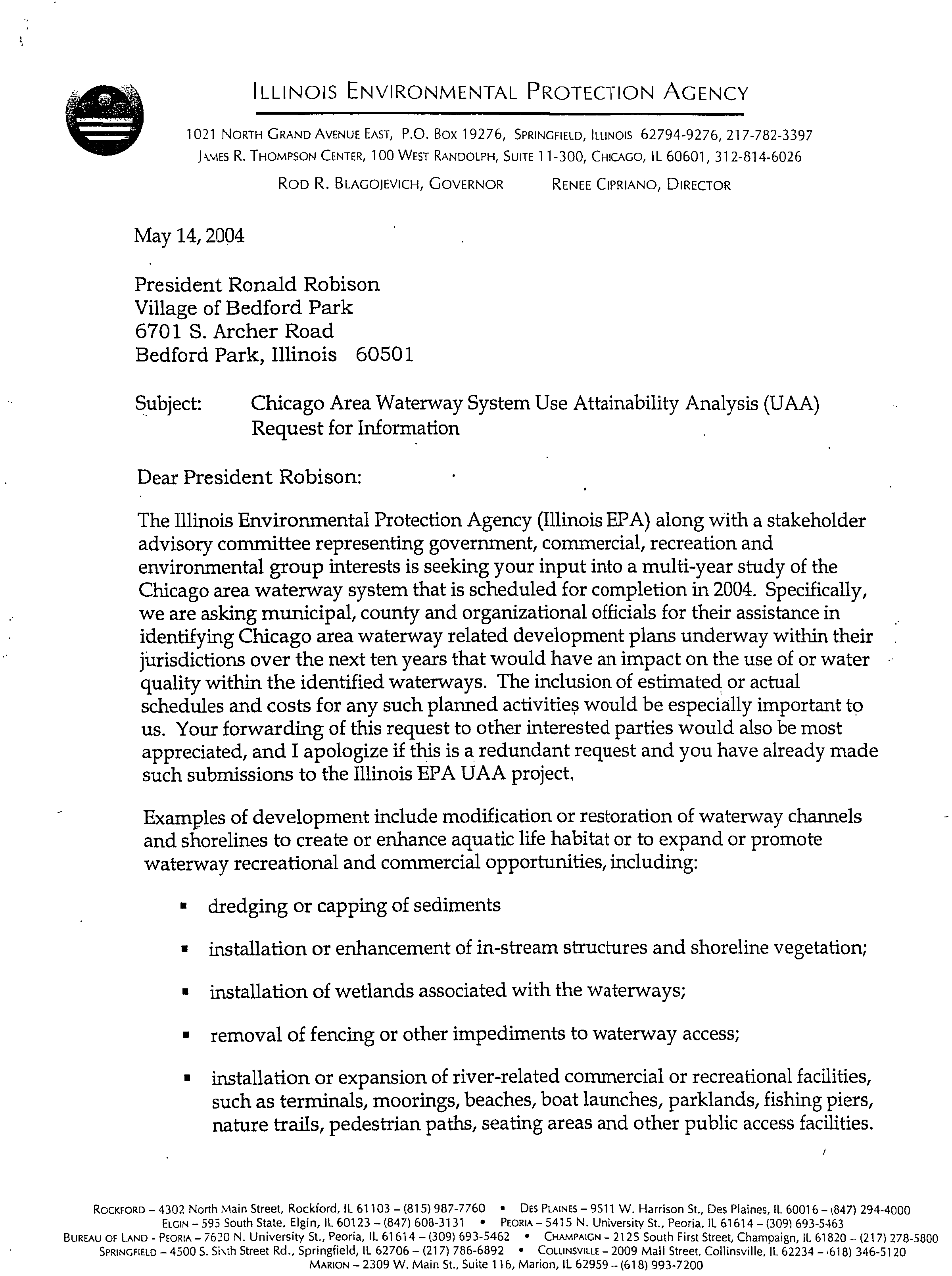
ILLINOIS ENVIRONMENTAL PROTECTION AGENCY
1 021 NORTH GRAND AVENUE EAST, P.O. Box 19276, SPRINGFIELD, ILLINOIS 62794-9276, 217-782-3397
J
.WES R. THOMPSON CENTER, 100 WEST RANDOLPH, SUITE 11-300, CHICAGO, IL 60601, 312-814-6026
ROD
R.
BLAGOJEVICH, GOVERNOR?
RENEE CIPRIANO, DIRECTOR
May 14, 2004
President Ronald Robison
Village of Bedford Park
6701 S. Archer Road
Bedford Park, Illinois 60501
Subject:
Chicago Area Waterway System Use Attainability Analysis (UAA)
Request for Information
Dear President Robison:
The Illinois Environmental Protection Agency (Illinois EPA) along with a stakeholder
advisory committee representing government, commercial, recreation and
environmental group interests is seeking your input into a multi-year study of the
Chicago area waterway system that is scheduled for completion in 2004. Specifically,
we are asking municipal, county and organizational officials for their assistance in
identifying Chicago area waterway related development plans underway within their
jurisdictions over the next ten years that would have an impact on the use of or water
quality within the identified waterways. The inclusion of estimated or actual
schedules and costs for any such planned activities would be especially important to
us. Your forwarding of this request to other interested parties would also be most
appreciated, and I apologize if this is a redundant request and you have already made
such submissions to the Illinois EPA UAA project,
Examples of development include modification or restoration of waterway channels
and shorelines to create or enhance aquatic life habitat or to expand or promote
waterway recreational and commercial opportunities, including:
■
dredging or capping of sediments
■
installation or enhancement of in-stream structures and shoreline vegetation;
■
installation of wetlands associated with the waterways;
■
removal of fencing or other impediments to waterway access;
■
installation or expansion of river-related commercial or recreational facilities,
such as terminals, moorings, beaches, boat launches, parklands, fishing piers,
nature trails, pedestrian paths, seating areas and other public access facilities.
ROCKFORD -
4302 North
Main Street,
Rockford, IL 61103 – (815) 987-7760 •
DES PLAINES -
9511 W. Harrison St., Des Plaines, IL 60016 – i,847) 294-4000
ELGIN -
595 South
State, Elgin, IL 60123 – (847) 608-3131 •
PEORIA –
5415 N. University St., Peoria, IL 61614 – (309) 693-5463
BUREAU OF LAND - PEORIA -
7620 N. University St., Peoria, IL 61614 – (309) 693-5462 •
CHAMPAIGN -
2125 South First Street, Champaign, IL 61820 – (217) 278-5800
SPRINGFIELD –
4500 S.
Si \th
Street Rd., Springfield, IL
62706 –
(217) 786-6892 •
COWNSVILLE -
2009 Mall
Street, Collinsville, IL 62234 – 618) 346-5120
MARION -
2309 W. Main St., Suite 116, Marion, IL 62959 – (618) 993-7200
May 14, 2004 UAA Letter to Village of
Bedford Park
Page 2
We are also interested in your organizations' existing and planned river-related,
public recreational events such as: canoeing and kayaking, river-edge cleanup and
restoration and other such activities.
Your earliest submission of this information within the next 30 days would be most
appreciated so that we may include it in the decision-making framework of our study.
Any development plans that are covered in projects governed by an NPDES permit
need not be communicated to us as a part of this Use Attainability Analysis request.
The Chicago area waterways include the following waterbodies:
1.
North Shore Channel from Lake Michigan to the confluence with the North Branch of
the Chicago River
2. North Branch of the Chicago River from it's confluence with the North Shore Channel
to its confluence with the South Branch, including the North Branch Canal along the
east side of Goose Island
3.
Chicago River
4. South Branch of the Chicago River, including the South Fork and navigation slips
5. Chicago Sanitary & Ship Canal, including the Collateral Channel
6.
Lake Calumet and Lake Calumet Entrance Channel
7. Calumet River from Lake Michigan to the confluence with the Grand Calumet River
8.
Grand Calumet River
9.
Little Calumet River North Leg from its junction with the Grand Calumet River to the
Calumet-Sag Channel
10.
Calumet-Sag Channel
The UAA is the first in-depth evaluation of the Chicago area waterways in nearly
three decades and the analysis and subsequent revisions of water quality standards
will have a major impact on how the waterways can potentially be used ecologically,
commercially and recreationally. Please visit ChicagoAreaWaterways.org for more
information on the UAA.
Thank you in advance for your participation in this effort. If you have any questions,
please contact me at 847/ 294-4037 or via email at rob.sulski@epa.statell.us.
Very truly yours,
Rob Sulski
UAA Project Manager
Division of Water Pollution Control
Bureau of Water
May 14, 2004 UAA Letter to Village
Bedford Park
Page 3
cc: Toby Frevert, IEPA
Ronald French, CDM
File
Letter Recipients:
Metropolitan Water Reclamation District
Illinois International Port District
Village of Alsip
Village of Bedford Park
City of Chicago - Mayor's Office, Department of Planning and Development,
Department of Environment, Department of Water Management
Chicago Park District
Cook County Forest Preserve District
DuPage County Forest Preserve District
Will County Forest Preserve District
Village of Wilmette
Wilmette Park District
Village of Skokie
Skokie Park District
City of Evanston
Village of Palos Hills
Village of Worth
Village of Palos Park
Village of Lincolnwood '
Lincolnwood Park District
Village of Dolton
Dolton Park District
Calumet City
Calumet Memorial Park District
Village of Burnham
City of Blue Island
Village of Summit
Village of Justice
Village of Stickney
City of Cicero
Town of Forest View
Village of Summit
Village of Hodgkins
Village of Summit
Village of Willow Springs
Village of Lemont
City of Romeoville