AMERICAN BOTTOM CONSERVANCY,
EAST ST. LOUIS COMMUNITY ACTION
NETWORK, KATHY ANDRIA, and JACK
NORMAN,
Petitioners,
V .
VILLAGE OF FAIRMONT CITY and
WASTE MANAGEMENT OF ILLINOIS,
INC.,
Respondents .
BEFORE THE ILLINOIS POLLUTION CONTROL BO4M
C E I V E D
CLERK'S OFFICE
To
:
See Attached Service List
PLEASE TAKE NOTICE that on September 14, 2001, we filed with the Illinois
Pollution Control Board, the attached Waste Management of Illinois, Inc.'sMEMORANDUM
OF WASTE MANAGEMENT OF ILLINOIS, INC. INRESPONSE TO POST-HEARING
BRIEF IN SUPPORT OF PETITIONERS' SITING APPEAL AND PETITION FOR
REVIEW
.
Respectfully submitted,
Donald J. Moran
PEDERSEN & HOUPT, P.C
.
161 North Clark Street, Suite 3100
Chicago, IL 60601
Telephone: (312) 641-6888
This filing is submitted on recycled paper
.
DJM
318042 v1
September 14, 2001
NOTICE OF FILING
SEP 1 4 2001
STATE OF ILLINOIS
Pollution Control Board
PCB 01-159
(Pollution Control Facility
Siting Appeal)
e
Management of Illinois, Inc
.
Respondents .
MEMORANDUM OF WASTE MANAGEMENT OF ILLINOIS, INC .
IN RESPONSE TO SITING APPEAL OF PETITIONERS AMERICAN BOTTOM
CONSERVANCY, EAST ST. LOUIS COMMUNITY ACTION NETWORK,
KATHY ANDRIA AND JACK NORMAN
PEDERSEN & HOUPT
By: Donald J . Moran
Attorneys for Respondents
161 North Clark Street
Suite 3100
Chicago, IL 60601
(312) 641-6888
(312) 641-6895 Fax
DJM
318019
v1
September 14, 2001
BEFORE THE ILLINOIS POLLUTION CONTROP
S IVED
OFFICE
SEP 1 4 2001
SLAT
t
ur
ILLINOIS
Pollution Control
Board
PCB 01-159
(Pollution Control Facility
Siting Appeal)
AMERICAN BOTTOM CONSERVANCY,
EAST ST. LOUIS COMMUNITY ACTION
NETWORK, KATHY ANDRIA, and JACK
NORMAN,
Petitioners,
V .
VILLAGE OF FAIRMONT CITY and
WASTE MANAGEMENT OF ILLINOIS,
INC .,
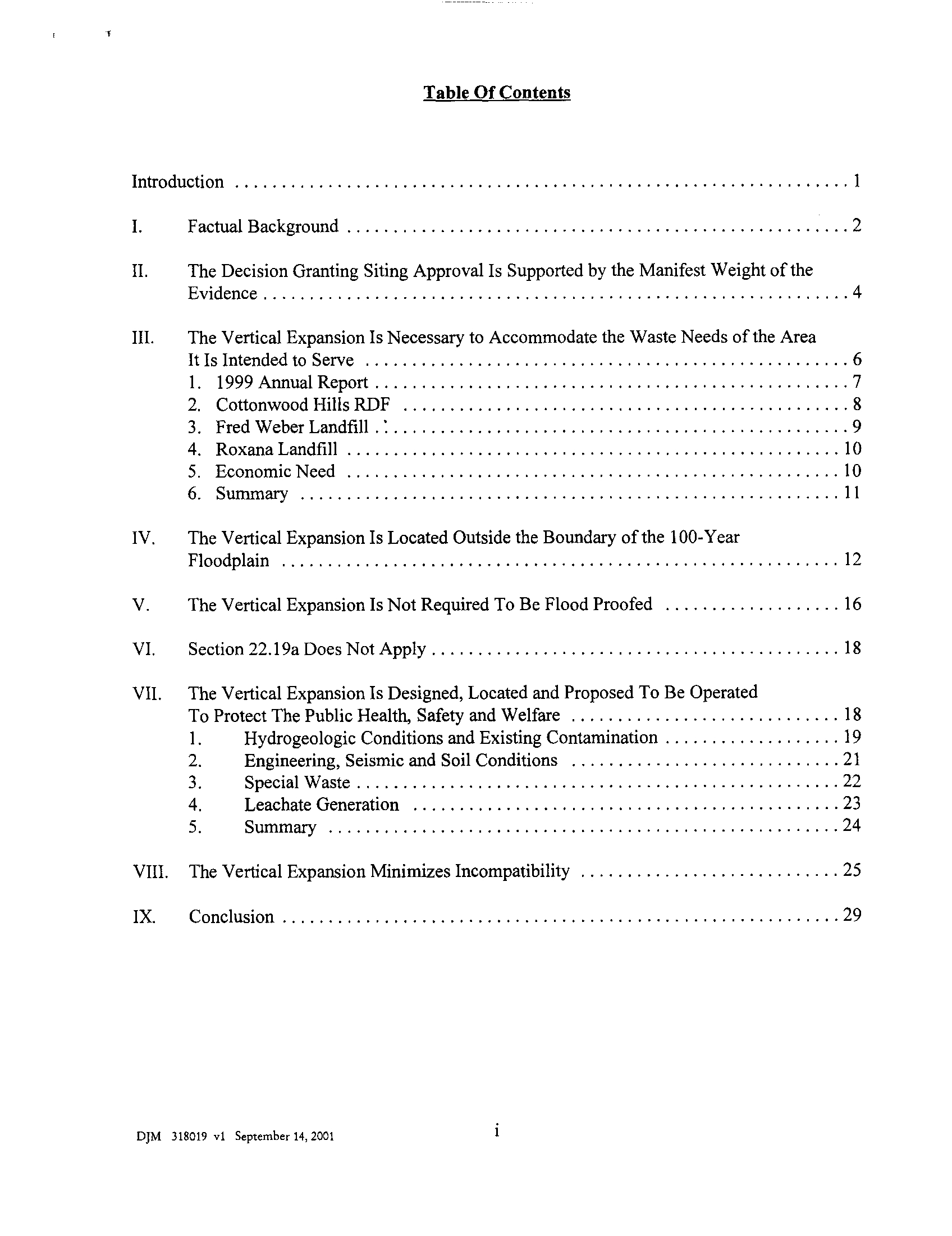
Table Of Contents
Introduction
1
I
.
Factual Background
2
II
.
The Decision Granting Siting Approval Is Supported by the Manifest Weight of the
Evidence
4
III .
The Vertical Expansion Is Necessary to Accommodate the Waste Needs of the Area
It Is Intended to Serve
6
1 . 1999 Annual Report
7
2. Cottonwood Hills RDF
8
3. Fred WeberLandfill
9
4. Roxana Landfill
10
5. Economic Need
10
6. Summary
11
IV .
The Vertical Expansion Is Located Outside the Boundary of the 100-Year
Floodplain
12
V .
The Vertical Expansion Is Not Required To Be Flood Proofed 16
VI .
Section 22.19a Does Not Apply
18
VII .
VIII
.
The Vertical Expansion Minimizes Incompatibility
25
IX.
Conclusion
29
DJM
318019 v1
September 14, 2001
The Vertical Expansion Is Designed, Located and Proposed To Be Operated
To Protect The Public Health, Safety and Welfare
18
1
.
Hydrogeologic Conditions and Existing Contamination 19
2 .
Engineering, Seismic and Soil Conditions
21
3
.
Special Waste
22
4 .
Leachate Generation
23
5
.
Summary
24
BEFORE THE ILLINOIS POLLUTION CONTROL B
CEIVED
RK'S OFFICE
2001
AMERICAN BOTTOM CONSERVANCY,
SEP 14
2001
EAST ST. LOUIS COMMUNITY ACTION
SIS
E OF
IS
)
Pollution Control
Board
NETWORK, KATHY ANDRIA, and JACK )
NORMAN,
)
Petitioners,
)
V .
)
PCB 01-159
(Pollution Control Facility
VILLAGE OF FAIRMONT CITY and
)
Siting Appeal)
WASTE MANAGEMENT OF ILLINOIS,
)
INC .,
)
Respondents .
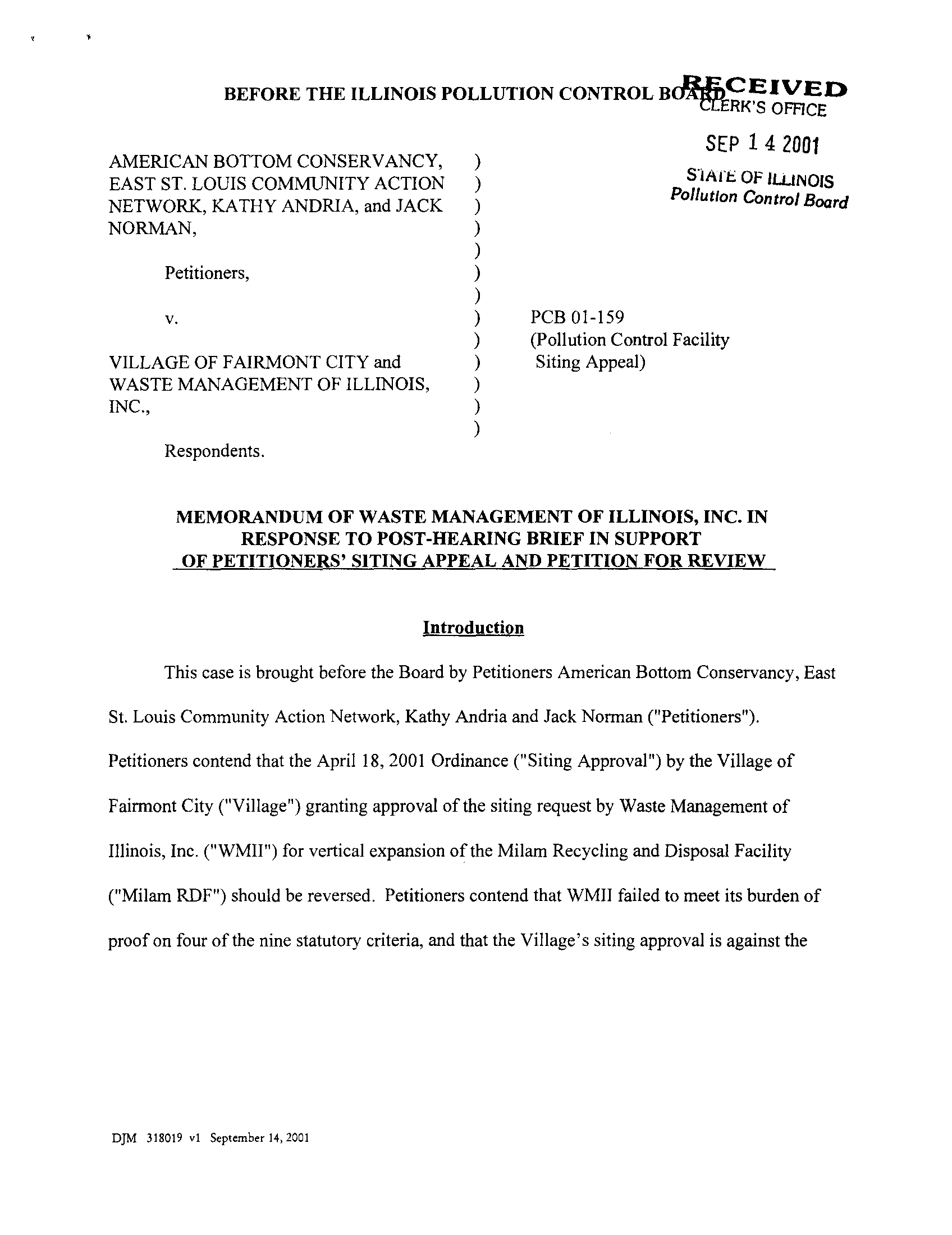
MEMORANDUM OF WASTE MANAGEMENT OF ILLINOIS,
INC. IN
RESPONSE TO POST-HEARING BRIEF IN SUPPORT
OF PETITIONERS' SITING APPEAL AND PETITION FOR REVIEW
Introduction
This case is brought before the Board by Petitioners American Bottom Conservancy, East
St. Louis Community Action Network, Kathy Andria and Jack Norman ("Petitioners")
.
Petitioners contend that the April 18, 2001 Ordinance ("Siting Approval") by the Village of
Fairmont City ("Village") granting approval of the siting request by Waste Management of
Illinois, Inc. ("WMII") for vertical expansion of the Milam Recycling and Disposal Facility
("Milam RDF") should be reversed . Petitioners contend that WMII failed to meet its burden of
proof on four of the nine statutory criteria, and that the Village's siting approval is against the
DJM
318019 vl
September 14, 2001
manifest weight of the evidence. Petitioners' Memorandum in Support of Siting Appeal, dated
August 30, 2001 (Pet. Mem. 2001) at 2.11
Petitioner's contention that criteria one through four were not satisfied is not supported by
the evidence of record . Other than the witnesses presented by
WMII,
no one testified regarding
the Siting Application or statutory criteria . There was no relevant or probative evidence offered
at the public hearing that controverted
WMII's
prima facie case
.
I.
Factual Background
Initially permitted in 1974, the Milam RDF is located in the Village of Fairmont City
near the intersection of Interstates 55 and 70, U.S. Highway 40 and Illinois Highway 203 . (C
12798.) It currently accepts municipal solid waste, demolition and construction wastes, and non-
ha7ardous permitted special waste. The existing facility is 208 acres, 176 of which are permitted
for waste disposal . (C 12736.)
Milam RDF is comprised of several disposal areas. These include Old Milam, located
west of the old channel of Cahokia Creek and forming the westernmost and bottommost area of
the Milam RDF (C 12800.); New Milam, located east of the old channel of Cahokia Creek and
forming the central and bottommost area of the Milam RDF (C12800
.); the Old Milam vertical
expansion, sited in 1988 and permitted in 1989 (C 12800 .); and the Milam RDF vertical and
lateral expansion, consisting of a vertical expansion of Old and New Milam and a horizontal
expansion of New Milam totaling 176 acres, sited in 1990 and permitted in 1991 . (C 12800 .)
Y
WMII will cite to the transcripts using the same designations as Petitioner . (Pet. Mem
.
2001
at
3.) Further, Petitioners' Post-Hearing Brief in Support of Petitioners' Siting Appeal and Petition for
Review dated August 30,
2001
will be referenced as (Pet. Mem .
2001) .
Unless indicated otherwise,
citations(CJ will be to the record of the siting proceedings in
2000 (No .
PCB
00-200) .
DJM
318019 v1
September 14, 2001
-2-
Old Cahokia Creek was relocated pursuant to a permit issued by the U.S. Army Corps of
Engineers in August, 1987. (C 12800 .)
On November 19, 1999, WMII filed a Site Location Application for the Vertical
Expansion of the Milam RDF with the Village of Fairmont City ("Siting Application") . The
Siting Application proposed a vertical expansion above the 176-acre waste footprint previously
sited and permitted in 1991 . The Siting Application does not propose any lateral expansion of the
Milam RDF . The vertical expansion includes disposal capacity of approximately four million
tons of municipal solid waste and non-hazardous special waste, which would increase the
facility's site life by four years . (C 12736 .) The vertical expansion is located above the top of
Milam RDF's currently permitted waste grades . (C 12902.) In its Siting Application, WMII
presents evidence and facts establishing each of the nine criteria set forth in Section 39 .2 of the
Illinois Environmental Protection Act, 415 ILCS 5/39 .2 (1998) ("Act")
.
A public hearing on the Siting Application was held by the Village on March 17, 2000
.
Petitioners attended the public hearing and participated in the proceedings . They cross-examined
five witnesses presented by WMII, and addressed various matters relating to criteria one (need),
two (location, design and operation), three (compatibility), and four (flood plain). They
submitted two written comments within the post hearing 30-day written comment period . No
person or party, however, presented any testimony or facts at the public hearing, or subsequently,
that contradicted or rebutted the evidence submitted by WMII on the statutory criteria . The
Village approved the Siting Application on April 19, 2000
.
Petitioners filed their first appeal with this Board on May 23, 2000, challenging the
Village's approval of the Siting Application, contending that the siting proceedings were
DJM
318019 v1
September 14, 2001
-3-
fundamentally unfair and that the Village's decision granting siting approval was against the
manifest weight of the evidence
.
On October 19, 2000, this Board found that the siting proceedings were fundamentally
unfair, vacated the Village's siting approval, and ordered a new public hearing . American
Bottom Conservancy, et al . v. Village of Fairmont City, et al .,No. PCB 00-200, slip op .(P.C.B .
October 19, 2000)
.
The remanded public hearing was held by the Village on February 12 and February 19,
2001 . Again, Petitioners attended the public hearing and participated in the proceedings. They
cross-examined four witnesses presented by WMII, and addressed various matters relating to
criteria one (need), two (location, design and operation), four (flood plain), and six (traffic)
.
Petitioners, however, presented no testimony or facts at the public hearing, or subsequently, that
contradicted or rebutted the evidence submitted by WMII on the statutory criteria.
On April 18, 2001, the Village approved Ordinance No . 584, granting siting approval for
the vertical expansion of Milam RDF . Petitioners filed their appeal with this Board on May 22,
2001 .
II.
The Decision Granting Siting Approval Is Supported By The
Manifest Weight Of The Evidence .
Petitioners contend that the Village's findings on criteria one, two, three and four were
against the manifest weight of the evidence . (Pet. Mem. 2001 at 2.) However, other than the
witnesses presented by WMII, no one testified regarding the Siting Application or statutory
criteria. There was no relevant or probative evidence offered at any of the hearings that
controverted WMII's prima facie case. The case presented by WMII established the statutory
DJM
318019 v 1
September 14, 2001
-4-
criteria by clear and convincing evidence. Accordingly, the decision granting siting approval is
supported by the manifest weight of the evidence and should be affirmed .
A decision of a local siting body regarding compliance with the statutory siting criteria
will not be disturbed unless the decision is contrary to the manifest weight of the evidence . Land
and Lakes Co. v. Illinois PCB, 319 Ill. App. 3d 41, 743 N .E.2d 188, 197 (3d Dist. 2000). A
decision is against the manifest weight of the evidence only if the opposite conclusion is clearly
evident and indisputable .
Turlek v. Pollution Control Board, 274 Ill. App. 3d 244, 653 N.E.2d
1288 (1st Dist. 1995) .
The province of the Village Board is to weigh the evidence, resolve conflicts in
testimony, and determine the credibility of witnesses .
Environmentally Concerned Citizens
Organization v. LandfillL.L.C., No. PCB 98-98, slip op. at 3 (May 7, 1998). Merely because
there may be some evidence which, if accepted, would have supported a contrary conclusion,
does not mean that this Board should reweigh the evidence and substitute the judgment for that
of the Village Board
. Tate v. Illinois Pollution Control Board,
188 Ill. App. 3d 994, 544 N.E.2d
1176, 1197 (4th Dist. 1989) ; Waste Management of Illinois, Inc . v. Illinois Pollution Control
Board, 22 Ill. App. 3d 639, 461 N.E.2d 542 (3d Dist. 1984) .
If there is any evidence which supports the Village decision, and this Board finds that the
Village Board could have reasonably reached its conclusion, the decision must be affirmed . File
v. D & L Landfill, No. PCB 9-94, slip op. at 3 (P.C.B
. August 30, 1990). That a different
decision might also be reasonable is insufficient for reversal. The opposite conclusion must be
clear and indisputable
. Willowbrook Motel v. Pollution Control Board, 135 Ill. App. 3d 343,
481 N .E.2d 1032 (1st Dist. 1985) .
DIM
318019 v1
September 14, 2001
-5-
III.
The Vertical Expansion Is Necessary to Accommodate the
Waste Needs of the Area It Is Intended to Serve .
Petitioners argue that the vertical expansion is not necessary to accommodate the waste
needs of the area it is intended to serve . (Pet. Mem. 2001 at 2 .) They correctly state that need is
established where an applicant shows that a proposed facility is reasonably required by the
disposal needs of the service area, taking into account the waste production and waste disposal
capacity of the area .
Waste Management of Illinois, Inc . v. Illinois Pollution Control Board,
112 I11.App. 3rd 639, 461, N.E.2d, 542, 546, (3rd Dist. 1984). Petitioners, however, offered no
evidence that contradicted or impeached WMII's proof that the vertical expansion is necessary
.
(C 12733-12785); (Tr. #1 at 135-136 .)
Petitioners argue that the vertical expansion is not needed because "there has been an
explosion of waste capacity in Illinois" since 1999, which WMII did not consider in evaluating
need, and "the most urgent need perceived by the Village is its own economic need." (Pet. Mem .
2001 at 6.) Specifically, Petitioners rely on language contained in the "1999 Annual Report,
Nonhazardous Solid Waste Management and Landfill Capacity in Illinois," January 2001
(" 1999
Annual Report") describing a "capacity explosion ."ZI (Pet. Mem. 2001 at 6, 7 .)
Petitioners further allege that WMII did not address the expanded capacities at the
Cottonwood Hills, Fred Weber, and Roxana (also referred to in the record as Cahokia Road
Landfill or CRLF) landfills as part of their evaluation of need for the vertical expansion . (Pet .
Mem. 2001 at 5-10.) These contentions are groundless
.
Z'
WMII has filed a motion to bar admission of the 1999 Annual Report on the ground that it was
not presented or included in the record of siting proceedings before the Village . The motion was pending
at the time this brief was filed
.
DJM
318019 v1
September 14, 2001
-6-
1 .
1999 Annual Report.
Petitioners quote the following statement from the 1999 Annual Report
:
The available capacity of 130.6 million gate cubic yards recorded
for that date [January 1, 2000] was 80 .2 million gate cubic yards
more than the volume reported one year earlier . This was the
highest capacity increase and the only region to report an increase
this year .
(Pet. Mem. 2001 at Appendix 2 .)
The quoted language is misleading . The very next sentence,
which was omitted in
Petitioners' brief
states that this "capacity explosion" includes "almost 83.6 million gate cubic
yards reported by Cottonwood Hills RDF, Marissa, a facility that had not yet opened as of Jan . 1,
2000." (Pet. Mem. 2001 at Appendix 2.) The IEPA acknowledges in its report that
it did not
previously include
the Cottonwood Hills RDF capacity until the 1999 Annual Report, which was
published in January 2001 . WMII, however, accounted for capacity of the Cottonwood Hills
RDF in its evaluation of need for the vertical expansion in November 1999, 14 months prior to
the IEPA reporting this capacity in the 1999 Annual Report. Petitioners' implication that WMII
did not consider the additional waste capacity of Cottonwood Hills RDF is simply wrong
.
Further, Petitioners quote that part of the 1999 Annual Report which says that "Sufficient
capacity exists to handle the state's requirements for landfill disposal of nonhazardous solid
waste for the next 16 years, ensuring there should be no landfill capacity crisis in Illinois for the
foreseeable future." (Pet. Mem . 2001 at 7 .) This statement is taken out of context. The
statement that immediately follows is "The State of Illinois, seeking to avoid potential crises, has
asked all Illinois counties to adopt and update every five years well-conceived plans to
accommodate their future disposal needs." (Pet. Mem. 2001, Appendix 2.) As such, the Agency
is directing local counties to manage their solid waste disposal needs to avoid crisis . As is shown
DJM 318019 v1 September 14, 2001
-7-
in the Siting Application, St. Clair County has adopted and completed a Plan and a 5-year Plan
update to manage its solid waste disposal requirements . (Siting App. at Crit. 8.) The Siting
Application establishes that the vertical expansion is consistent with this Plan update . (Siting
App. at Crit. 8.) The vertical expansion will "provide ongoing disposal capacity to the service
area once the existing site reaches capacity." (Tr. #1 at 140.)
Hence, the 1999 Annual Report does not, contrary to Petitioners' suggestion, declare that
no landfill capacity is needed anywhere in the State of Illinois for 16 years . The 1999 Annual
Report states that each county should plan for its own waste disposal needs on a continuing basis
to avoid capacity shortages .
In addition, the 1999 Annual Report neither prevents an assessment or precludes a finding
of need for additional capacity in appropriate locations . To do so would deprive local
governments of the flexibility and authority necessary to respond to changing capacity
requirements. It would also force local governments to accept existing landfills for their waste
disposal, irrespective of distance, cost, safety and contractual limitations . Neither result serves
the purposes of the Illinois Environmental Protection Act and its mandate for a uniform system
for solid waste disposal and environmental protection .
2 .
Cottonwood Hills RDF
.
The analysis presented in Table 4 of Criterion 1 of the Siting Application demonstrates
that, although not available for disposal at the time, the projected capacity of the Cottonwood
Hills RDF was included when calculating the remaining disposal capacity at landfills located
within the service area. (Siting App. at Crit. 1, Table 4, pp. 28, 34.) The service area for
Cottonwood Hills RDF includes the same counties as for the vertical expansion, but
"also
includes an additional 25 counties in Illinois, and an additional 9 counties in Missouri ."
(Siting
DJM
318019 v1 September 14, 2001
-8-
App. at Crit. 1, p. 35, emphasis added.) This is a total of 34 more counties than the service area
for the vertical expansion. As such, in its calculation of available disposal capacity from
Cottonwood Hills RDF for the service area of the vertical expansion, WMII accounts for this
overlap and reduces the total available capacity at Cottonwood Hills RDF by only 25% to reflect
this. (Siting App. at Crit. 1, p. 36, Table 4.) The Siting Application indicates that as of January
1, 2004, the remaining service area capacity of 81,973,427 gcy includes 75% of the available
disposal capacity of Cottonwood Hills RDF. (Siting App. at Crit. 1, p. 36.) Petitioners are
wrong in alleging that WMII only referred to anticipated Cottonwood Hills RDF capacity in the
Siting Application, but did not use it in their calculations . (Pet. Mem. 2001 at 6.)
3 .
Fred Weber Landfill.
Petitioners imply that the expanded Fred Weber landfill provides capacity for the service
area. (Pet. Mem. 2001 at 8 .) This is incorrect. The Fred Weber landfill does not accept out of
state waste or special waste . (Siting App. at Crit. 1, pp. ES-2, 31, 32.) ; (Tr. #3 at 49-50.)
Petitioners offered no evidence to dispute this fact .
In addition, the Fred Weber landfill does not have its own fleet of trucks, so that any
waste delivered to it will come from outside customers . However, the distance from Missouri
transfer stations in the service area is greater to the Fred Weber landfill than to the vertical
expansion, by a distance ranging from 7-26 miles one way. (Siting App. at Crit. 1, p. 44.)
Increased hauling distances mean higher costs for waste haulers, who will consider such higher
costs in making disposal decisions
.
The cost of hauling special waste from St . Clair County to Fred Weber landfill, if it were
accepted there, would be higher than transporting it to the vertical expansion . Such higher costs
would result in inefficiencies and disrupt existing hauling patterns
.
DJM
318019 vi September 14, 2001
-9-
In sum, WMII appropriately considered the available disposal capacity for the expanded
Fred Weber landfill in its evaluation of the service area for the vertical expansion. This airspace
cannot be relied upon for disposal of out-of-state municipal waste, and it is not permitted for the
disposal of special waste. (Siting App. at Crit. 1, p. 31 .)
4 .
Roxana Landfill .
In November 1999, WMII included the Roxana landfill in evaluating need for the vertical
expansion, stating "Capacity is available at this landfill ." (Siting App. at Crit. 1, p. 34.) This
referred to the capacity existing as of November 1999. At that time, no expansion of the Roxana
landfill was anticipated, and therefore, WMII appropriately did not consider future disposal
capacity for the service area. (Tr. #3 at 34 .)
Ms. Smith knew that Roxana had applied for an expansion. (Tr. #3 at 29.) This
expansion, however, was approved only for local siting . No IEPA permit was issued .
(Tr. #3 at 46, 47.) Without an IEPA permit, the Roxana expansion is not a fact but merely an
expectancy, and need not be considered. Tate, 544 N .E.2d at 1193 .
Significantly, Ms. Smith testified that even if the Roxana landfill expansion is approved
and permitted by IEPA, "it would only provide an additional three years of capacity to the
service area" and therefore did not change her opinion concerning the need for the vertical
expansion. (Tr. #3 at 52.)
5.
Economic Need .
Petitioners allege that the most urgent need perceived by the Village is economic need
.
(Pet. Mem. 2001 at 6 .) In support of its contention, Petitioners refer to certain public comment
offered by county and village members. (Board Tr. at 415-419.) These statements provide no
support for Petitioners' argument. While these persons agree that Milam RDF has provided
DJM
318019 v1
September 14, 2001
-10-
economic revenues to the Village, they do not state in any way that the "need" for the vertical
expansion is established on the basis of the Village's own economic need . Moreover, Mr. Bregen
discussed the Village's review of the Siting Application and stated "We did our best as an
administration, I believe to review all questions and points . We did make a point to accept
information and responses and to review even after the certain due dates . I think that we took
every step that we could to make sure that our vote was fair ." (Board Tr. at 420-421 .)
There is no impropriety in the Village considering the economic benefit of a proposed
siting request . Fairview Area Citizens Task Force v . Pollution Control Board, 198 Ill. App. 3d
541, 555 N.E.2d 1178, 1182 (3d Dist. 1990) . So long as the statutory criteria are satisfied, the
Village may consider the economic benefit or revenue that the proposed expansion would provide .
Fairview Area Citizens Task Force, 555 N.E.2d at 1182 .
6 .
Summary.
Petitioners claim that is it "abundantly clear from the evidence in the record" that the vertical
expansion is not needed. (Pet. Mem. 2001 at 11 .) In fact, the record establishes the opposite. WMII
included the capacity of Cottonwood Hills RDF and an expanded Fred Weber landfill in its service
area capacity analysis (Siting App. at Crit. 1, p . 32, 36.) The Roxana landfill, even if it were to
receive an IEPA permit, would not provide sufficient capacity to preclude the need. (Tr. #3 at 51,
52.)
WMII has presented credible evidence and expert opinion establishing that the vertical
expansion is necessary to accommodate the waste needs of the area it is intended to serve . No
contrary evidence was admitted or offered
. Industrial Fuels & Resources v. Pollution Control
Board, 227 Ill. App.3d. 533, 592 N.E.2d 148, 156 (1st Dist. 1992). There is ample evidence
supporting the Village's finding of need and therefore, the decision of the Village is not against
DJM
318019 v1 September
14, 2001
the manifest weight of the evidence. Tate, 544 N.E.2d at 1195-96 ; Fairview Area Citizens Task
Force, 555 N.E.2d at 1184-85
.
IV .
The Vertical Expansion Is Located Outside The Boundary Of
The 100-Year Floodplain .
Petitioners claim that the Siting Approval did not comply with Section 39.2 of the Act
because the "Milam landfill is in the floodplain ." (Pet. Mem. 2001 at 11 .) According to
Petitioners, as the vertical expansion sits on an existing landfill that is in the floodplain, the entire
facility is within the 100-year floodplain . (Pet. Mem. 2001 at 11, 15 .)
Petitioners' contention misconstrues the nature of the Siting Application and the applicable
legal standard. The Siting Application proposes a vertical expansion above the previously
permitted contours of the existing Milam RDF . (C13005.). The Act requires local siting approval
for new pollution control facilities, not for existing or permitted facilities . 415 ILCS 5/3 .32(b),
39(c) (1998) .
A new pollution control facility includes "the area of expansion beyond the boundary of a
currently permitted pollution control facility ." 415 ILCS 5/3 .32 (b)(2)(1998) . The area of
expansion beyond the boundary of an existing facility includes a vertical expansion above an
existing landfill . M.I.G. Investments v. EPA, 122 Ill. 2d, 392, 523, N.E.2d 1, 4-5 (1988) . Thus,
the plain language of the Act requires siting approval for a vertical expansion, but not for the
permitted facility .
The Siting Application requested local siting approval for the vertical expansion, not the
existing Milam RDF. (C 12798-12907 .) The Milam RDF was previously sited and permitted .
Local siting approvals for vertical and horizontal expansions were obtained in 1988 and 1991 . (C
12800.) These prior siting approvals and permits are not subject to a second review in the Siting
DJM
318019 v1 September 14, 2001
-12 -
Application. This request concerns only the vertical expansion which is proposed above the
permitted contours of the Milam RDF at elevation 410 MSL . (C 12902, 13005 .) Consideration of
the Siting Application properly evaluates the vertical expansion, not the existing landfill
. Hediger
v. D & L Landfill,No. PCB 90-163, slip op. 12-13 (P.C.B. December 20, 1990); Tate, 544 N.E.2d
at 1179, 1195-97 .
Petitioners attempt to discredit the technical correctness of the Siting Application and the
competency of WMII's witness by alleging that "Waste Management's entire evidence on the
flood plain issue consists of an expert's report contained in its application that is five sentences
long." (Pet. Mem. 2001 at 11, 12.) The length of the factual report does not lessen the credibility
of its contents .
Mr. Conner testified that the floodplain is three-dimensional, having length, width and
height. Location above the elevation of the 100-year water level is outside the floodplain . (Tr. #3
at 78.) The facts clearly demonstrate that the 100-year floodplain elevation at the existing Milam
RDF is 405 MSL. (Tr. #3 at 60 .) The vertical expansion begins at elevation 410 . (Tr. #3 at 61 .)
As such, Mr. Conner correctly states that "the proposed expansion as shown on the drawings is
above elevation 410 at every location. The 100 year flood elevation is 405
.
So
we're 5 feet above
the floodplain at every location ."
(Tr. #3 at 79, 80, emphasis added .)
Petitioners base their argument on the current FEMA Flood Insurance Rate Map, dated
1981 . (Tr. #3 at 76.) Testimony indicates that the FEMA map relied upon by Petitioners in this
case is inaccurate and should not be relied upon for flood plain determination . Mr. Conner
testified
:
1 .
There are no elevations on the map. (Tr. #3 at 73 .)
DJM
318019 v1
September 14, 2001
-13-
2 .
The purpose of the FEMA flood insurance rate maps
" . ..is to determine flood
hazards as relating to structures that are built and then being eligible for flood
insurance." (Tr. #3 at 73 .)
3 .
A note on the map indicates that the initial identification was in 1976 . Some
features on the map are in excess of 25 years old . (Tr. #3 at 76.) The map does not
reflect existing conditions at the site . (Tr. #3 at 73 .)
Mr. Conner provided a detailed description of geographical changes at the site, including
IDOT Interstate and State highway construction and interchange changes, culvert construction,
permitted relocation of Old Cahokia Creek, permitted berm construction at Milam RDF, and
restaurant construction. (Tr. #3 at 76-78.) He superimposed these features onto a projected
scanned portion of the FEMA map . The revised FEMA map, admitted at the remanded hearing,
more accurately characterizes the 100-year floodplain in and around the existing Milam RDF
.
(Tr. #3 at 79.); (C 14248, 2001 Record.)
Mr. Mike Mitchell, Director of Zoning for St. Clair County and the Local Flood Plain
Coordinator, confirmed that the FEMA map does not accurately depict existing conditions
.
(Board Tr. at 418.)
Petitioners attempt to substantiate their argument that the Milam landfill is within the 100-
year floodplain with a letter from Mr. Paul Osman. (Pet. Mem. 2001 at 13 .) The proper question
is whether the proposed vertical expansion is located in the 100-year floodplain . The undisputed
evidence presented by WMII is that it is not?' (Tr . #1 at 34-40; C13005 .)
3'
Petitioners presented no testimony or evidence regarding criterion four at any of the
Village hearings. They submitted a letter from Paul Osman of the Illinois Department of Natural
Resources as part of their post hearing written comment. (Pet. Mem. 2001 at 13 .) Of course, the
Osman Letter is hearsay, and without Mr. Osman appearing to testify at the public hearing,
Petitioners were unable to provide the necessary foundation for the assertions made . This
DJM
318019 v1
September
14, 2001
-14-
The Hediger decision addressed the very issue Petitioners raise here . In -Hediger, the
applicant received local siting approval for the vertical expansion of its existing landfill
. Hediger,
slip op. at 2. The objectors claimed that the county board's decision on all the applicable statutory
criteria was against the manifest weight of the evidence . Hediger, slip op . at 8. With respect to
criterion four, the objectors alleged that, based upon the county consultant's report, the existing
landfill was within the floodplain . Hediger, slip op. at 14. The proper question, however, was
whether the vertical expansion was located within the floodplain
. Hediger, slip op. at 14. The
evidence and testimony established that the vertical expansion, as opposed to the existing landfill,
was not within the 100-year floodplain . This Board determined, therefore, that the county board's
finding on criterion four was not against the manifest weight of the evidence, and affirmed the
county's siting approval
. Hediger, slip op. at 14, 17 .
As in Hediger, Petitioners here allege that the existing landfill, not the vertical expansion,
is within the 100-year floodplain. The question of whether the existing Milam RDF is in the 100-
year floodplain is not the proper inquiry . Rather, the relevant issue is whether the vertical
foundation was critical to the admissibility and weight accorded the statements, particularly
where, as here, there was no evidence that Mr . Osman (1) had the authority or experience to
determine whether Milam RDF was in the 100-year floodplain, (2) had the experience or the
capability of making floodplain determinations in a siting proceeding, (3) reviewed the Siting
Application, (4) knew that Cahokia Creek had been relocated, (5) knew of the facts relating to
the proposed vertical expansion, or (6) intended to give an opinion that theproposed vertical
expansion was within the 100-year floodplain .
Even if Mr. Osman's assertions were admitted, they are entitled to no weight . According
to Petitioners, his letter "verifies" that: (1) "Milam is in the 100-year floodplain ." This addresses
the existing Milam RDF, not the vertical expansion, which is above the 100-year floodplain
. (2)
"The FEMA map was the current FEMA map." As explained in this memorandum, while the
FEMA map may be current, it is not accurate or relevant in determining the 100-year floodplain
.
(3) "Additional flood zones had been identified at the Milam Landfill ." The existing Milam RDF
has been flood proofed by permit . There are no flood zones in the vertical expansion . (4) "The
100-year flood elevation was even lower than that shown on the FEMA map." The FEMA map
provides no elevations
.
DIM
319019 v1
September
14, 2001
-15-
expansion is in the 100-year floodplain . The uncontroverted evidence is that the vertical
expansion is not located in the 100-year floodplain . (Tr. at 34-40 .); (C 13005 .); (Tr. #3 at 79 .)
Where, as here, there is evidence supporting the Village's finding regarding criterion four,
this Board cannot reweigh the evidence and reverse
. Environmentally Concerned Citizens
Organization v. LandfillL.L.C ., No. PCB 98-98, slip op. at 10-11 (P.C.B
. May 7, 1998). This
Board has consistently upheld a local governing body's determination that criterion four was
satisfied, even in cases where there was conflicting testimony or uncertainty regarding the
location of the floodplain . Environmentally Concerned Citizens, slip op. at 10-11 ; C.O.A.L . v
.
Laidaw Waste Systems, No. PCB 92-131, slip op. at 11-14 (P.C.B . January 21, 1993) ; Hediger,
slip op. at 14 ; Tate v. Macon County Board, No. PCB 88-126, slip op. at 25-26 (P.C.B
.
December 15, 1988) ; Wabash and Lawrence Counties Taxpayers and Water Drinkers Association
v. County of Wabash,No. PCB 88-110, slip op. at 14 (P.C.B . May 25, 1989)
.
There is no evidence that the vertical expansion is or will be located within the 100-year
floodplain. The Village's finding that criterion four was satisfied is supported by uncontradicted
evidence, and should be affirmed . Tate, 544 N.E.2d at 1188-89, 1195
; Hediger, slip op. at 14 .
V .
The Vertical Expansion Is Not Required To Be Flood Proofed .
In addition to their floodplain argument, Petitioners contend that the Milam RDF is not
flood proofed and that the vertical expansion is not flood proofed . (Pet. Mem. 2001 at 15, 17 .)
Petitioners cite, curiously, to ground water levels in certain ground water monitoring wells . (Pet .
Mem. 2001 at 16.) Groundwater monitoring well data is not appropriately used in determining
whether the existing landfill has experienced flood conditions, or whether the vertical expansion
will be floodproofed. This argument casts serious doubt on Petitioners' technical understanding
and evaluation of any issue relating to floodplain or facility design
.
DJM
318019 v1
September 14, 2001
- 16-
Petitioners claim that elevated groundwater levels in monitoring wells in May 1995 means
that the landfill had flooded . (Pet. Mem. 2001 at 16.) Petitioners reference groundwater
elevations that were above elevation 403 in monitoring wells at the existing site . (Pet. Mem. 2001
at 16.) Mr. Conner testified that groundwater elevations do not relate to flooding and that
flooding, by definition, is surface water. (Tr. #3 at 85, 86.) Further, Ms. Underwood testified that
groundwater levels can fluctuate and that because there is a higher water level in a well,
"it
doesn't mean anything about what the surface water conditions are in the area .
"' (Tr. #3 at 127,
emphasis added.) Ms. Underwood likened this to an artesian well, where water flows at the
ground surface, but there is no flooding. (Tr. #3 at 127.) She testified that if there was an
elevation in a well that was above a floodplain elevation, in no way did that indicate that there
was flooding. (Tr. #3 at 127, 128.) A water level in a monitoring well does not indicate anything
about flooding conditions . (Tr. #3 at 127 .)
Petitioners' attempt to correlate groundwater elevations and surface water conditions is
technically incorrect. There is no direct correlation between flooding and groundwater . (Tr. #3 at
86.)
Indeed, flood proofing of the existing Milam RDF had been established by IEPA permit
1991-152-LFM. There is no evidence in the record that the Milam landfill has ever flooded . Mr .
Conner testified that there was not flooding at the landfill in 1993, nor any flooding within the
footprint in 1995 . (Tr. #3 at 83 .) He testified that there was ponding, or an accumulation of
standing water, but not flooding . (Tr. #3, at 83 .) Petitioners confuse ponding and surface water in
an attempt to suggest that the Milam RDF floods . Moreover, based upon the fact that the vertical
expansion is not located in the 100-year floodplain, the flood proofing discussion is simply
inapposite .
DJM
318019 v1 September 14, 2001
-17-
VI .
Section 22.19a Does Not Apply
Petitioners argue that WMII is not the same WMII that owned Milam RDF prior to August
19, 1997. (Pet. Mem. 2001 at 17.) According to Petitioners, if WMII is not the same company,
"they (sic) cannot build a new landfill in the floodplain." (Pet. Mem. 2001 at 17.) If it is the same
company, then the vertical expansion must be flood proofed . (Pet. Mem. 2001 at 17.)
As established above, the vertical expansion is not located within the 100-year floodplain .
(See supra, pp. 12-16.) Moreover, there is no evidence that the Milam RDF has flooded . (See
supra, pp. 16-17 .) Therefore, there is no legal or factual basis to prohibit the siting of the vertical
expansion or to require its flood proofing .
WMII is the company that owned and operated the Milam RDF prior to August 19, 1997 .
(Waste Management Exhibit 2.) Petitioners presented no evidence to establish otherwise .
VII.
The Vertical Expansion Is Designed, Located And Proposed To
Be Operated To Protect The Public Health, Safety And Welfare
Petitioners allege that WMII has not satisfied criterion two . (Pet. Mem. 2001 at 18.) No
one testified or presented evidence at the public hearing to challenge WMII's prima facie case on
criterion two. Petitioners refer to documents submitted to the IEPA relating to the existing Milam
RDF, and other hearsay documents, in support of their contentions. (Pet. Mem. 2001 at 18-24 .)
This is patently insufficient to controvert WMII's evidence .
Petitioners raise a number of technical questions that relate to the existing Milam RDF,
not the vertical expansion. Objections to the existing landfill are not sufficient reasons that
require a negative finding on criterion 2 . Hediger, slip. op. at 13. Indeed, to the extent
Petitioners' objections to the existing Milam RDF are challenges to the IEPA permits issued for
the facility, this is not the proper procedure or forum to raise such challenges
. Nevertheless, to
DJM
318019 v1
September 14, 2001
-18-
demonstrate the weakness and insufficiency of Petitioners' contentions, WMII will address their
principal points
.
1 .
Hvdroaeologic Conditions and Existing Contamination .
Petitioners allege that "There is a longstanding problem with hydrogeologic conditions at
the site ." (Pet. Mem. 2001 at 18.) They base this allegation on an Agency letter from 1979 to a
former owner of the Milam facility and an Agency memorandum from 1979 . (Pet. Mem. 2001 at
18.) This information from 1979 is outdated and incomplete, and was gathered by a former owner
of the facility. Geologic investigations of the Milam property began in 1973 . (Siting App. at Crit .
2, page 2-6, Earth Tech.) As of the date of the filing of the Siting Application, over 100 borings
had been drilled at Milam RDF and 75 wells installed to characterize the geology and
hydrogeology. (Siting App. at Crit. 2, p. 2-6 and 4-1, Earth Tech.) These borings and wells are
generally located near the 176-acre footprint area . (Siting App. at Crit. 2, p. 1-1, Earth Tech .)
This is an extensive characterization of the property and demonstrates considerable understanding
of the geology and hydrogeology of the site property today . (Siting App. at Crit. 2, p. 4-1, Earth
Tech.)
Petitioners mischaracterize the testimony of Joan Underwood and Ernest Dennison
regarding the direction of groundwater flow at Milam RDF . Petitioners state that Ms. Underwood
"denied that there was any flow of groundwater to the east," (Tr. #3 at 123 .) and that Mr.
Dennison said that "there was never any flow to the east ." (Tr. #1 at 123, 124.) Ms. Underwood
testified that "overall groundwater flow is from east to west." (Tr. #3 at 123.) She was never
asked if groundwater flow occurred to the east. Mr. Dennison testified that there were 27
groundwater wells at the site and based on those wells, groundwater flow is predominantly west
DJM
318019 vl
September 14, 2001
- 1 9-
to southwest. (Tr. #1 at 123.) However, neither Ms. Underwood nor Mr. Dennison denied the
possibility of localized flow
.
Petitioners point out the groundwater contamination at the existing Milam RDF, and
suggest that it is worsening. (Pet. Mem. 2001 at 19, 20.) They ignore, however, the substantial
evidence describing the contamination and the remedial system installed to address it
.
WMII provides a detailed explanation in the Siting Application which describes the
history of groundwater contamination at Milam RDF, the Agency involvement in evaluating
options to remediate the site, and the permitted remedy . (Siting App. at Crit. 2, p. 1-3, Earth
Tech.) WMII states that groundwater impacts were noted from early development of the Milam
RDF in unlined portions of Old and New Milam . Extensive investigations were completed to
delineate subsurface conditions and to select a suitable remedial system to address impacts . A
long-term remedial process is planned due to low groundwater flow velocities beneath the site
.
(Siting App . at Crit. 2, p. 2-10, Earth Tech .)
Further, Petitioners rely on a limited excerpt of data from the Milam RDF 1999 Annual
Report which summarizes the statistical trends associated with the selected groundwater remedial
action. (Pet. Mem. 2001 at 19.) Petitioners speculatively conclude that the results identified in
the one section of the total report included in their brief, that "although there were 52 cases of
groundwater improvement, there were 45 cases of groundwater degredation, meaning, apparently,
that the
groundwater contamination is worsening."
(Pet. Mem. 2001 at 19, 20.) Petitioners
again take information out of context and exclude the summary comments of the report included
in the report cover letter. The report states that the "overall groundwater quality at the site
appears to be improving based on the Trend Analysis results ." (Pet. Mem. 2001 at Appendix 3 .)
DJM
318019
v1
September 14, 2001
-20-
Petitioners clearly do not understand trend analysis. As stated in the Siting Application, it
is expected to take approximately 35 years to remediate groundwater in the affected area of the
existing facility. (Siting App . at Crit. 2, p. 1-3, Earth Tech.) In their haste to point out the results
of one analysis, Petitioners failed to include that portion of the report which states :
It is still too early for the current remediation program to improve groundwater quality to
background levels. An appropriate measure for determining the effectiveness of the
remediation is more individual improvements than degradations in groundwater quality .
As long as there continues to be a trend toward more improvements than degradations
each quarter, the remediation will be considered to be effective
.
(Pet. Mem. 2001 at Appendix 3 .)
The Siting Application clearly describes the results of the trend analysis associated with
the remedial action, and describes the results of 26 quarters of monitoring data, showing more
trends of decreasing concentration than increasing concentration . (Siting App. at Crit. 2, p. 2-10,
Earth Tech .)
2 .
Engineering, Seismic and Soil Conditions
.
Petitioners make reference to the St . Clair County Soil Survey and other documents that
allegedly state that Milam RDF is located on fragile soils subject to liquefaction . (Pet. Mem .
2001 at 20.) Petitioners have provided no evidence to demonstrate that the vertical expansion is
not properly designed .
Mr. Dennison testified that the design of a landfill takes into consideration the base
materials, foundation, side slope angles, strength of materials, properties of the liner and
properties of the refuse mass . (Tr . #1 at 114, 115 .) He testified that the location is a suitable
foundation for the landfill, and that Milam RDF is underlain by sands and clays . (Tr. #1 at 115 .)
DJM
318019 v1
September 14, 2001
-2 1 -
This is further verified by the extensive geologic and hydrogeologic evaluation as described in the
Siting Application. (Siting App. at Crit. 2, Earth Tech .)
The Siting Application includes the results of all of the geotechnical and seismic analyses
performed for the vertical expansion. The results show that the vertical expansion will not impair
the integrity of the existing facility systems, and that the new systems will be stable and in
compliance with regulatory requirements. (Siting App. at Crit. 2, p. 3-1, Hurst-Rosche.) Static
and seismic conditions were evaluated for the vertical expansion and regulatory factors of safety
were either met or exceeded for all analyses, including bearing capacity, slope failure, long-term
and short-term slope failure conditions, and seismic (earthquake induced liquefaction) conditions
.
(Siting App. at Crit. 2, p. 3-1 through 3-3, Hurst-Rosche .)
3 .
Special Waste .
Petitioners presented no witnesses, nor any evidence, to support their arguments regarding
the acceptance of special waste at Milam RDF. They make no specific allegation about the
acceptance of special waste at Milam RDF . Instead, they provide hearsay information regarding
special wastes and leachate generation. They focus on industrial waste, potentially infectious
medical waste, and fly ash waste, as well as household hazardous waste . (Pet. Mem. 2001 at 21
.)
The Siting Application explicitly states that the vertical expansion will accept general non-
hazardous municipal solid waste, demolition and construction waste, non-hazardous permitted
special waste and some construction and demolition debris for processing and recycling
. It will
not accept regulated quantities of hazardous wastes, radioactive materials, potentially infectious
medical wastes, or polychlorinated biphenyls. (Siting App. at Crit. 2, p. 1-2, Hurst-Rosche .)
Mr. Durako, Division Vice President for WMII, testified that Milam RDF accepts special
waste, and that special waste is "a waste that comes from an industrial process
that has been
DJM
318019 v1 September 14, 2001
-22-
permitted to come into a sanitary municipal solid waste landfill ."
(Tr. #1 at 45, 46, emphasis
added.) He testified that each special waste accepted at Milam RDF is tested by the generator
prior to a permit being issued for disposal at the facility . (Tr. #1 at 47.) WMII reviews the test
results and can select to do additional testing . (Tr. #1 at 47.) He testified that household
hazardous wastes included in residential waste are considered small quantities and can be
accepted at Milam RDF. (Tr. #1 at 50.) Random load checking of three incoming waste loads per
week will be required. (Siting App. at Crit. 2, p. 7-10, Hurst-Rosche .)
4 .
Leachate Generation .
Petitioners make the emotional and unsupported argument that "all of these wastes
combined with liquid in the waste plus rainwater combine into a giant cauldron of leachate
." (Pet.
Mem. 2001 at 21 .) They claim that "when leachate comes into contact with the groundwater or is
inundated with floodwater and spills over into the adjacent creek or into wetlands, waters of the
United States are contaminated ." (Pet. Mem. 2001 at 22.) There is no evidence in this record that
"a giant cauldron" of leachate is going to develop at the vertical expansion, or that leachate will
inundate floodwaters and spill into the adjacent creek . Existing contamination is being
remediated. (Siting App. at Crit. 2, Earth Tech .)
The Siting Application states that the leachate management system will maintain a
maximum of 1 .0 foot of leachate on the liner. Leachate will be extracted and removed from the
landfill. It will be transported offsite for treatment and disposal. (Siting App. at Crit. 2, p . 2-1,
Hurst-Rosche.) Surface water will be managed in accordance with the General National Pollutant
Discharge Elimination System permit. All surface water will be routed away from the active face,
thereby eliminating potential for rainwater to mix with leachate . (Siting App. at Crit. 2, Section 5,
Hurst-Rosche.) Intermediate cover will drain surface water and minimize rainwater infiltration
DJM
318019
v1
September 14, 2001
-23 -
during the active period of the landfill . (Siting App. at Crit. 2, p. 7-3, Hurst-Rosche.) A
composite final cover will be placed over the vertical expansion to minimize surface water
infiltration. (Siting App . at Crit. 2, p. 4-1, Hurst-Rosche .)
Petitioners' attempt to calculate leachate generation quantities is fundamentally flawed
.
(Pet. Mem. 2001 at 22.) Petitioners argue that the Milam RDF has flooded based on groundwater
levels. (Pet. Mem. 2001 at 22 .)
Groundwater levels, of course, are not appropriately used in
determining whether the existing landfill has experienced flood conditions
.
Petitioners proceed to suggest that the weight of the additional waste will cause increased
pressure on the liner, and result in "thousands more contaminants and mixing of chemicals," and
four more years of rainfall will be added into the site. (Pet. Mem. 2001 at 22, 23, 24.) According
to Petitioners, this will result in leachate migration and groundwater contamination. (Pet. Mem
.
2001 at 22 .)
There is, however, no evidence, data or facts in this record that indicate that "thousands
more contaminants" and substantial leachate migration will occur because of additional waste
placed in the vertical expansion. The design of the vertical expansion has not been contradicted
or shown to be inappropriate or unsafe
.
5 .
Summary .
Petitioners did not present or offer any evidence to demonstrate that the design of the
vertical expansion is flawed from a public safety standpoint or that its proposed operation poses
an unacceptable risk to public heath or safety. No one testified how particular design or operating
features of the vertical expansion might increase risk of harm to the public, or that the Siting
Application ignored or violated any applicable governmental regulations. Where, as in this
DJM
318019
vl
September 14, 2001
-24-
request, no such showings are made, the prima facie case stands unrebutted and criterion two has
been satisfied
.
Industrial Fuels, 592 N.E.2d at 157
.
Moreover, this Board cannot reweigh the evidence and substitute its decision for that of
the Village. Tate, 544 N.E.2d at 1197. The record contains substantial and persuasive evidence
that the vertical expansion has been designed, located and proposed to be operated to protect the
public health, safety and welfare . The Village was well justified in crediting that evidence and the
testimony contained in the Siting Application and offered by WMII's witnesses
. Land and Lakes
Co .
, 743 N.E.2d at 197. The Village made a reasonable judgment and the opposite result is not
clearly evident or indisputable
. Harris v. Day, 115 Ill. App. 3d 762, 451 N.E.2d 262 (4th Dist
.
1983)
.
The Village's decision that the vertical expansion of Milam RDF has been designed,
located and proposed to be operated so as to protect the public health, safety and welfare is not
against the manifest weight of the evidence, and should be affirmed .
IX.
The Vertical Expansion Minimizes Any Incompatibility
With the Character of the Surrounding Area .
Petitioners argue that the Village's decision on criterion three is against the manifest
weight of the evidence. (Pet. Mem. 2001 at 24.) This argument is without merit
.
Criterion three involves the question of whether the vertical expansion is located so as to
minimize incompatibility with the character of the surrounding area. 415 ILCS 5/39.2(iii) (1998) .
This criterion requires an applicant to demonstrate that it has done or will do what is reasonably
feasible to minimize incompatibility. File, 579 N.E.2d at 1236. This evidence, however, is
required only if there is some incompatibility with the surrounding area shown to exist . Tate, 544
N.E.2d at 1197 .
DJM
318019 vi
September 14, 2001
-25 -
WMII witness J. Christopher Lannert testified that the vertical expansion is compatible
with the character of the surrounding area. (Tr. #1 at 87, 89, 91-104.) No other witnesses
testified on criterion three. Notwithstanding the compatibility of the vertical expansion with the
character of the surrounding area, the record evidence establishes that WMII has proposed various
features, such as the land form and buffers, intended to minimize the possible visual and
operational impacts of the facility. (Tr. #1 at 92-104 .)
As with the other criterion, Petitioners presented no expert or lay testimony regarding
criterion three. Instead, they offer statements based on their personal knowledge, beliefs or their
interpretation of public documents
.
They state, for example, that "The Milam landfill is
surrounded
by archeological sites and
prehistoric Indian mounds." (Pet. Mem. 2001 at 25.) This is inaccurate . The landfill is
surrounded by a race track, a truck stop, a Burger King, Interstate 55/70, State Highway 203, and
the Cahokia Canal (Siting App . at Crit. 3, Sheet 1 .) The Cahokia Mounds are two
miles
from
Milam RDF . (Pet. Mem. 2001 at 25 .)
Petitioners repeatedly suggest that the Milam RDF is visible from the top of Monk's
Mound. WMII presented a photograph taken from the top of Monk's Mound, facing east toward
the Milam RDF. (C 13967, 2001 Record.) Petitioners attempt to discredit the photograph by
suggesting that WMII may have manipulated the view in the photograph by modifying the
photographer's position, camera angle, lens size and perspective . (Pet. Mem. 2001 at 28.)
Petitioners present no evidence in support of this contention
.
Petitioners argue that because Mr. Lannert conducted his tour of the area in July and
August of 1999, he did not "take into consideration what would be the view from Monks Mound
when the tress are without leaves . .." (Pet. Mem. 2001 at 30.) Petitioners' sloth has betrayed them
.
DIM
318019 v1
September 14, 2001
-26 -
A review of the photograph shows that the trees in the photograph in fact
do
not have any leaves
on them and the date of the photograph is digitally shown in the lower right corner of the
photograph. It reads "15 1 '00 ;" which represents "Photograph No. 15, January 2000. (C 13 967,
2001 Record.) A review of the photograph clearly shows that the Milam RDF cannot be seen
from the top of Monk's Mound . (Tr. # 1 at 102 .)
Petitioners state that it is "not possible for WMII to minimize the incompatibility of
building the largest landfill in the state in the middle of the Metro East with its potential for
economic growth." (Pet. Mem. 2001 at 27.) As Mr . Lannert testified, the existing landfill is
permitted to a height of 570 MSL . (Tr. #1 at 81 .) It is compatible with the character of the area .
(Siting App. at Crit. 3, Section 3, Lannert; p. 10, Poletti .) Petitioners present no evidence that the
vertical expansion is going to deter development of the area. The evidence in the record is that
economic development in and around the existing Milam RDF proper has been substantial and is
continuing. (Siting App. at Crit . 3, p . 6, 35 Poletti .) Property values and appreciation rates for
parcels in the area have increased consistently with rates of other areas in Metro East . (Siting
App. at Crit. 3, pp. 34-35, Poletti.) Petitioners offer nothing more than speculation about future
development in and around the Milam RDF. (Pet. Memo. 2001 at 26-27 .)
Petitioners also allege that the expanded Milam Landfill will be the "the State of Illinois'
equivalent to St. Louis' Gateway Memorial Arch." (Pet. Mem. 2001 at 28.) Again, this claim is
without merit. The expanded Milam Landfill will, at its highest point, be approximately 230 feet
above existing grade. (Pet. Mem. 2001 at 28.) The Gateway Arch has a maximum height of 630
feet above existing grade . This is 400 feet taller than the vertical expansion at its highest point
.
Petitioners search for emotional issues to support their arguments . They presented no
witnesses, no testimony, and no impeaching evidence that the vertical expansion is incompatible,
DJM
318019
vl
September 14, 2001
-27-
that development in the area has been deterred, or that WMII has not done or will not do what is
reasonably feasible to minimize any incompatibility .
There is sufficient evidence in the record to support the Village's finding that the vertical
expansion satisfies criterion three
. LandfillL.L.C ., slip op. at 10; File, 579 N.E.2d at 1236 ;
Fairview Area Citizens Task Force, 555 N.E.2d at 1186. The Board cannot reweigh the evidence,
and a careful review of the evidence on this criterion does not indicate that the opposite ruling is
clearly evidence or indisputable
. LandfillL.L.C ., slip op. at 10. In the absence of contrary
evidence, the Village's finding that WMII satisfied criterion three is not manifestly erroneous
.
Land and Lakes Co ., 743 N.E.2d at 198 .
D.JM
318019 v1 September 14, 2001
_28_
CONCLUSION
The Village decision granting siting approval was based upon the Siting Application and
expert testimony presented by WMII . There was no contrary or impeaching evidence presented
.
The siting approval is supported compellingly by the uncontradicted facts of record
.
For the reasons set forth above, the decision granting siting approval for the vertical
expansion of the Milam RDF should be affirmed
.
Respectfully submitted,
Donald J. Moran
PEDERSEN & HOUPT
161 North Clark Street, Suite 3100
Chicago, Illinois 60601
312/641-6888
DJM
318019 vi
September 14, 2001
W STE MANAGEMENT OF ILLINOIS, INC .
/1'
2
-29-
PROOF OF SERVICE
The undersigned, a non-attorney hereby states that the
MEMORANDUM OF WASTE MANAGEMENT OF ILLINOIS, INC. IN RESPONSE TO
POST-HEARING BRIEF IN SUPPORT OF PETITIONERS' SITING APPEAL AND
PETITION FOR REVIEW was served upon the parties as follows
:
Personally via Hand Delivery to :
Ms. Dorothy M. Gunn
Illinois Pollution Control Board
James R. Thompson Center
100 West Randolph Street, Suite 11-500
Chicago, Illinois 60601
Mr. Steven Langhoff, Hearing Officer
Illinois Pollution Control Board
James R. Thompson Center
100 West Randolph Street, Suite 11-500
Chicago, Illinois 60601
Via facsimile and first class mail postage prepaid in an envelope correctly addressed and
placed in the mail depository at 161 North Clark Street, Chicago, Illinois to :
Ms. Yvonne M. Homeyer
Attorney for Petitioners
225 South Meramec, Suite 325
St. Louis (Clayton), MO 63105
Via first class mail postage prepaid in an envelope correctly addressed and placed in the mail
depository at 161 North Clark Street, Chicago, Illinois to:
Mr. John Baricevic
Attorney for Village of Fairmont City
4010 North Illinois Street
Belleville, Illinois 62226
Date: September 14, 2001 .
DJM
318042 v1
September 14, 2001
Victoria L. Kenne y
Ms. Dorothy M. Gunn
Illinois Pollution Control Board
James R. Thompson Center
100 West Randolph Street, Suite 11-500
Chicago, Illinois 60601
Mr. Steven Langhoff, Hearing Officer
Illinois Pollution Control Board
James R. Thompson Center
100 West Randolph Street, Suite 11-500
Chicago, Illinois 60601
Ms. Yvonne M. Homeyer
Attorney for Petitioners
225 South Meramec, Suite 325
St. Louis (Clayton), MO 63105
Mr. John Baricevic
Attorney for Village of Fairmont City
4010 North Illinois Street
Belleville, Illinois 62226
DJM
318042 v1
September 14, 2001
SERVICE LIST